
Thoroughfare Collection (page 20)
"Journey through Time and Space: Exploring the Thoroughfares of History" Step into a world where maps unveil tales of bygone eras


All Professionally Made to Order for Quick Shipping
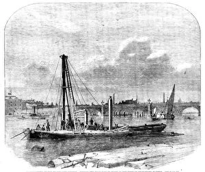
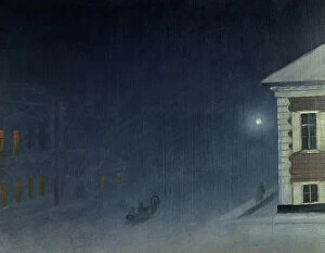
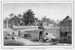
"Journey through Time and Space: Exploring the Thoroughfares of History" Step into a world where maps unveil tales of bygone eras, as we embark on a captivating exploration of thoroughfares that have shaped history. Our first stop takes us to Worcestershire, England, where the Map of Malvern Hills reveals an enchanting landscape dotted with Victorian charm. Transported back to Bristol's yesteryears, we find ourselves ascending the Christmas Steps - a picturesque pathway adorned with timeless elegance. As we wander further into Victorian London, shadows dance upon cobblestone streets, whispering secrets from another era. Across the Irish Sea lies Dublin's O'Connell Street, bustling with life and echoing stories of resilience and rebellion. Yet our journey doesn't end there; a retro-style desert scene beckons us towards an old gas station amidst towering saguaro cacti – a nostalgic reminder of American highways past. Returning to England's embrace, the Map of Durham unveils architectural wonders frozen in time. Meanwhile, Hull's map invites us to uncover hidden gems within its vibrant urban tapestry. Venturing eastward brings us to Kuwait City's Main Street – a testament to modernity intertwined with rich cultural heritage. And just when you think our voyage is complete, Maidstone Road in Lenham captivates with its quaint beauty and idyllic countryside vistas. Immerse yourself in artistry as "Flower Power" transports us to Parisian streets alive with color and fragrance. Prague enchants visitors through winding alleys that hold centuries-old secrets waiting patiently for discovery. Finally, aboard South Devon Railway's Leopard class Saddle Tank Engine, let nostalgia whisk you away on scenic routes reminiscent of simpler times. Join us on this extraordinary journey through diverse landscapes and historical narratives woven together by these remarkable thoroughfares. Let their whispers guide your imagination as you traverse continents and epochs alike – for in each street, road, or path lies a story waiting to be heard.