Fraud Blocker Skip to main content

Plan Collection (page 3)

"Unveiling the Blueprint of Success: The Power of a Well-Crafted Plan" In every era, plans have shaped destinies and transformed history

Background imagePlan Collection: Aubreys Plan of Avebury

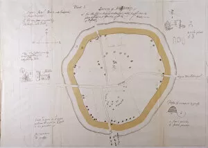
Aubreys Plan of Avebury
John Aubreys plan of Avebury. Aubrey was an English antiquary, who suplimented his writings on sites with detailed plans and sketches

Background imagePlan Collection: Regents Park Plan C1830

Regents Park Plan C1830
A plan of Regents Park including Regents Canal and Marylebone Church Date: c1830

Background imagePlan Collection: ST. BARTS / 1721 / PLAN

ST. BARTS / 1721 / PLAN
A general external view of the buildings which make up Saint Bartholomews Hospital in Smithfield, London

Background imagePlan Collection: Old Sarum Plan

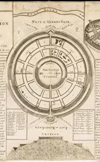
Old Sarum Plan
An exact plan and section of the castle of Old Sarum, above Salisbury Plain, showing the East or Kings Gate, the West, or Queens Gate and its proximity to the River Avon

Background imagePlan Collection: Hensons Aerial Steam Carriage

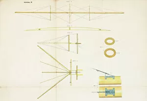
Hensons Aerial Steam Carriage
The Aerial Steam Carriage -- side view of the main frame, and plan of the controlling tail. This flying machine was patented by William Samuel Henson (1812-1888) and John Stringfellow (1799-1883)

Background imagePlan Collection: Map of the World

Map of the World
The World, showing Captain James Cooks voyages from 1768 - 1775, based on Mercators Projection, published by William Faden 1778 Date: 1778

Background imagePlan Collection: Poster advertising the British Empire Exhibition

Poster advertising the British Empire Exhibition at Wembley Park, running from April to October 1924. Travel routes are shown, together with a plan of the exhibition space itself

Background imagePlan Collection: Amsterdam Plan

Amsterdam Plan
A pre-railway plan showing how the streets and canals have been built concentrically round the city centre. Date: mid-19th century

Background imagePlan Collection: Extension of the British Museum, London

Extension of the British Museum, London
Extension of the British Museum in London: the new King Edward VII Galleries. A birds eye view showing the new section of the building. Date: 1914

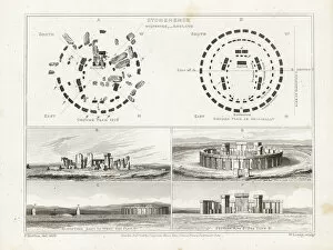
Background imagePlan Collection: Plan and elevation of Stonehenge, Wiltshire

Plan and elevation of Stonehenge, Wiltshire.. Ancient stone circle at Stonehenge, Wiltshire, with original plan and elevation, and ruins as of 1816. Copperplate engraving by W

Background imagePlan Collection: LCC-LFB Dockhead fire station, Bermondsey

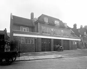
LCC-LFB Dockhead fire station, Bermondsey
Dockhead fire station, Bermondsey, SE London, built in 1928. This fire station was the location for the early seasons of the ITV series Londons Burning

Background imagePlan Collection: Layout of Fort Sumter at the outset of the Civil War

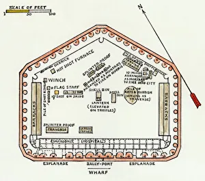
Layout of Fort Sumter at the outset of the Civil War
Fort Sumter ground plan, situated in the harbor of Charleston, SC, 1860. Hand-colored woodcut of a 19th-century illustration

Background imagePlan Collection: Ground plan, Carmarthen County Lunatic Asylum, Wales

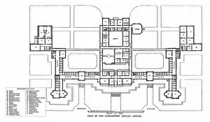
Ground plan, Carmarthen County Lunatic Asylum, Wales
Architects ground-floor plan of the Carmarthen Lunatic Asylum erected near Carmarthen, South Wales, in 1865 and designed by David Brandon

Background imagePlan Collection: Plan Pentonville Prison

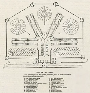
Plan Pentonville Prison
A plan of the floor layout of Pentonville, a model prison built in London in 1843, with corridors of cells radiating out from a central point & exercise yards

Background imagePlan Collection: Plan of Castle Howard (litho)

Plan of Castle Howard (litho)
6005188 Plan of Castle Howard (litho) by English School, (19th century); Private Collection; (add.info.: Plan of Castle Howard)

Background imagePlan Collection: WW1 - Trench map from a soldiers war diary showing the Somme Battlefield with

WW1 - Trench map from a soldiers war diary showing the Somme Battlefield with information gleaned from captured German Prisoners

Background imagePlan Collection: Solar eclipse August 21 Wisconsin

Solar eclipse August 21 Wisconsin
Solar eclipse August 21, 2017 at 1:15pm from Wisconsin, USA 85% Coverage

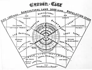
Background imagePlan Collection: Ebenezer Howard - plan of garden city

Ebenezer Howard - plan of garden city
Ebenezer Howards plan of a garden city. Date: 1898

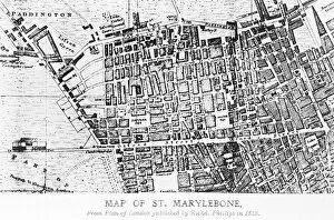
Background imagePlan Collection: Map of St Marylebone, London

Map of St Marylebone, London
Map of St Marylebone, from a plan of London published by Richard Phillips. Date: 1813

Background imagePlan Collection: Glasgow Municipal Tenement Plan

Glasgow Municipal Tenement Plan
Layout plan of a Glasgow Municipal Tenement. Date: 1896

Background imagePlan Collection: Cartoon, Kitcheners All, WW1

Cartoon, Kitcheners All, WW1
Cartoon, Kitcheners All, First World War. A scene in a London club, where nearly all of the members look just like Lord Kitchener, each one with his own ideas of how the war should be run. Date: 1914

Background imagePlan Collection: All-Red Route at the Festival of Empire, 1911

All-Red Route at the Festival of Empire, 1911
A diagram of the All-Red Route at the Festival of Empire, opened on 12th May 1911 by King George V and Queen Mary. The route was essentially an electric railway line laid down at a cost of 90

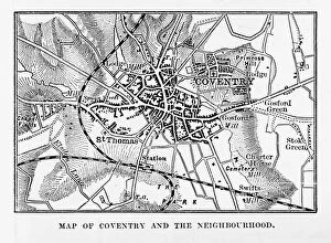
Background imagePlan Collection: Map of Coventry in Warwickshire, England Victorian Engraving, 1840

Map of Coventry in Warwickshire, England Victorian Engraving, 1840
Very Rare, Beautifully Illustrated Antique Engraving of Map of Coventry in Warwickshire, England Victorian Engraving, 1840. Source: Original edition from my own archives

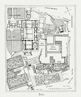
Background imagePlan Collection: Floor plan of Palatine Hill in Rome, published in 1878

Floor plan of Palatine Hill in Rome, published in 1878
Floor plan of the archaeological remains of the Palatine Hill in Rome. The Palatine Hill (Latin: Mons Palatinus, Italian: Monte Palatino)

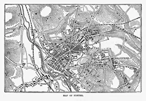
Background imagePlan Collection: Map of Exeter in Devon, England Victorian Engraving, 1840

Map of Exeter in Devon, England Victorian Engraving, 1840
Very Rare, Beautifully Illustrated Antique Engraving of Map of Exeter in Devon, England Victorian Engraving, 1840. Source: Original edition from my own archives

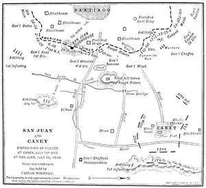
Background imagePlan Collection: Contemporary map showing the advances of Colonel Theodore Roosevelts Rough Riders at the Battle of

Contemporary map showing the advances of Colonel Theodore Roosevelts Rough Riders at the Battle of San Juan Hill, Cuba
CUBA: SAN JUAN HILL. Contemporary map showing the advances of Colonel Theodore Roosevelts Rough Riders at the Battle of San Juan Hill, Cuba, and of other American forces at El Caney, 1 July 1898

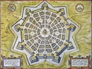
Background imagePlan Collection: Engraved map, 1598, of the heavily-fortified city of Palmanova, Italy

Engraved map, 1598, of the heavily-fortified city of Palmanova, Italy, built by the Venetians near the Adriatic to
ITALY: PALMANOVA MAP, 1598. Engraved map, 1598, of the heavily-fortified city of Palmanova, Italy, built by the Venetians near the Adriatic to prevent Turkish invasions

Background imagePlan Collection: Plan by Eugene Viollet-le-Duc, who restored the cathdedral in the mid-19th century

Plan by Eugene Viollet-le-Duc, who restored the cathdedral in the mid-19th century
PARIS: NOTRE DAME. Plan by Eugene Viollet-le-Duc, who restored the cathdedral in the mid-19th century, showing how the church might have looked with the spires originally intended to crown the towers

Background imagePlan Collection: Didus ineptus, dodo design

Didus ineptus, dodo design
Drawing 51 Vol 2 by Alfred Waterhouse for the ornamentation of the panel over doorway in the South East gallery, first floor of the Natural History Museum, London, 1875

Background imagePlan Collection: Great Zimbabwe / Artefacts

Great Zimbabwe / Artefacts
A plan of the site of the incredible ancient buildings at Great Zimbabwe, and a few of the many objects found at the site. Everything is of ancient African origin

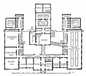
Background imagePlan Collection: Bisley Farm School No. 2 Ground-floor Plan

Bisley Farm School No. 2 Ground-floor Plan
Ground-floor plan of the new building added to the Bisley Farm School, Surrey, in 1873, and later known as the Shaftesbury School block. Date: circa 1888

Background imagePlan Collection: Neo-Sumerian. Statue of Gudea. Girsu, Iraq. 2120 BC. Cuneifo
Neo-Sumerian. Statue of Gudea. Girsu, Iraq. 2120 BC. Cuneifo
Mesopotamia. Neo-Sumerian. Ruler Gudea of state of Lagash. Diorita statue. From Girsu (modern Telloh). Iraq. 2120 BC. Cuneiform inscription. Detail. Museum of Louvre. Paris. France

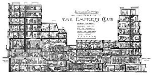
Background imagePlan Collection: A Sectional Drawing of The Empress Club, 13 Berkeley Street

A Sectional Drawing of The Empress Club, 13 Berkeley Street
A Sectional Drawing through the extensive premises of The Empress Club, sitting between Dover Street and 13 Berkeley Street, W1, London

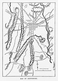
Background imagePlan Collection: Battle of Gettysburg Map, July 3, 1863 Civil War Engraving

Battle of Gettysburg Map, July 3, 1863 Civil War Engraving
Engraving of the Map of the Battle of Gettysburgs, Pennsylvania, July 3, 1863 Civil War Engraving from Famous Leaders and Battle Scenes of the Civil War, Published in 1864

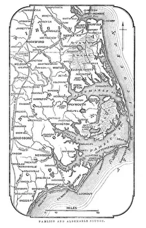
Background imagePlan Collection: Map of Pamlico and Albemarle Sounds

Map of Pamlico and Albemarle Sounds
Vintage engraving from 1863 of a map of Map of Pamlico and Albemarle Sounds at the time of the American Civil War

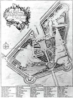
Background imagePlan Collection: A Plan of the House and Gardens at Stowe, Buckinghamshire (engraving)

A Plan of the House and Gardens at Stowe, Buckinghamshire (engraving)
XJF477689 A Plan of the House and Gardens at Stowe, Buckinghamshire (engraving) by Muller, Johann Sebastien (1715-c.1785); Private Collection; (add.info.: House and park of Richard Temple)

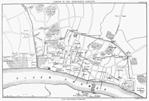
Background imagePlan Collection: Reconstructed map of 13th century London, England

Reconstructed map of 13th century London, England
MAP: LONDON, 13th CENTURY. Reconstructed map of 13th century London, England

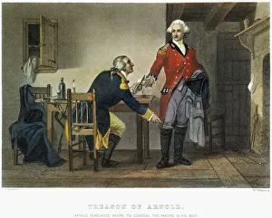
Background imagePlan Collection: Benedict Arnold persuading Major John Andre to conceal the plans of West Point in his boot at

Benedict Arnold persuading Major John Andre to conceal the plans of West Point in his boot at their meeting on 21
ARNOLD AND ANDRE, 1780. Benedict Arnold persuading Major John Andre to conceal the plans of West Point in his boot at their meeting on 21 September 1780. Steel engraving, American, 19th century

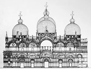
Background imagePlan Collection: Cross-section of Saint Marks Basilica in Venice, Italy

Cross-section of Saint Marks Basilica in Venice, Italy
VENICE: SAINT MARK S. Cross-section of Saint Marks Basilica in Venice, Italy

Background imagePlan Collection: CIVIL WAR: ANACONDA PLAN. Scotts Great Snake or the Anaconda Plan

CIVIL WAR: ANACONDA PLAN. Scotts Great Snake or the Anaconda Plan: General Winfield Scotts plan to blockade the Confederacy and conduct a major offensive down the Mississippi River

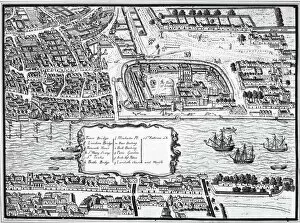
Background imagePlan Collection: TOWER OF LONDON, 1560. Detail from the Agas map of 1560 showing the Tower of London on the Thames

TOWER OF LONDON, 1560. Detail from the Agas map of 1560 showing the Tower of London on the Thames River

Background imagePlan Collection: Map of Rome

Map of Rome

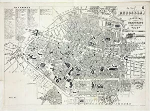
Background imagePlan Collection: Map of Brussels

Map of Brussels
Map of the city of Brussels, Belgium Date: 19th century

Background imagePlan Collection: Map of Paris

Map of Paris
Bradshaws Plan of Paris, France and map of the environs Date: 19th century

Background imagePlan Collection: Ground plan of Millbank Prison

Ground plan of Millbank Prison, London. Date: 1862

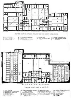
Background imagePlan Collection: Ground plan of Newgate Prison

Ground plan of Newgate Prison, London. Date: 1862

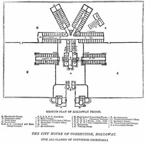
Background imagePlan Collection: Ground plan of Holloway Prison

Ground plan of Holloway Prison
Ground plan of London City Prison and House of Correction, Holloway. Date: 1862

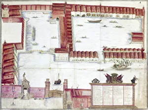
Background imagePlan Collection: VENICE: ARSENALE. The Arsenale of Venice, Italy. Drawing by Antonio di Natale, 18th century

VENICE: ARSENALE. The Arsenale of Venice, Italy. Drawing by Antonio di Natale, 18th century


All Professionally Made to Order for Quick Shipping

"Unveiling the Blueprint of Success: The Power of a Well-Crafted Plan" In every era, plans have shaped destinies and transformed history. From the meticulously detailed Swindon Works Map in the 1940s to the strategic D-Day Map of 1944, maps have guided armies towards victory and nations towards liberation. The grandeur of empires is etched on maps like the British Empire's expansive territories, reminding us that meticulous planning can forge vast dominions. Even legendary figures like Admiral Nelson relied on precise battle plans to secure triumph at Trafalgar in 1805. Beyond military conquests, plans have given rise to architectural marvels. Filippo Brunelleschi's ingenious design for Santa Maria del Fiore Cathedral in Florence showcased his visionary plan through Lodovico Cardi da Cigoli's contemporary drawing. This cross-section blueprint exemplifies how careful planning can manifest breathtaking beauty. Yet not all plans come to fruition unscathed. The Titanic blueprint serves as a haunting reminder that even with meticulous preparations, unforeseen circumstances may arise. Nevertheless, it underscores the importance of thorough planning and risk assessment. From historic battles such as Waterloo or Chancellorsville during the US Civil War where General Lee and General Jackson strategized their moves before engaging in combat, we witness how well-executed they can turn tides amidst chaos and uncertainty. Even ancient times bear testament to strategic brilliance; Hannibal's Battle of Cannae plan from 216 BC showcases his tactical genius by encircling enemy forces—an enduring lesson in outmaneuvering adversaries. Plans extend beyond warfare; they shape our world at large. Whether it be mapping zoological wonders like London Zoo in 1929 or charting geographical landscapes like an old map detailing the majestic Alps—plans enable exploration and understanding of our surroundings while fostering conservation efforts for future generations. In essence, these diverse examples remind us that behind every triumph, there lies a well-crafted plan.