
New England Usa Collection
"Discover the Rich History and Natural Beauty of New England, USA" Step back in time with a glimpse at the USA New England states map from 1875


All Professionally Made to Order for Quick Shipping
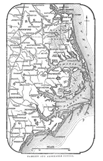
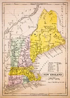
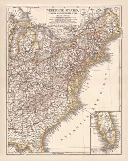
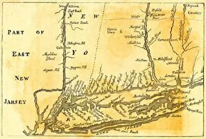
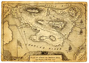
"Discover the Rich History and Natural Beauty of New England, USA" Step back in time with a glimpse at the USA New England states map from 1875, tracing the roots of this enchanting region. Explore the Map of Pamlico and Albemarle Sounds, immersing yourself in its serene coastal allure. Relive one of America's defining moments as you learn about the Boston Tea Party of 1773, a pivotal event that shaped the nation's destiny. Marvel at Portland Head Light standing tall against crashing waves on Cape Elizabeth's rocky shores—a true symbol of resilience and strength. Journey through time with Explorer John Smith's circa 1624 Map of New England, capturing an era when adventure was boundless. Delve into an Antique Map of Eastern USA to witness how these lands evolved over centuries. Immerse yourself in Maine and Vermont's charm through maps dating back to 1883—an invitation to explore their picturesque landscapes. Uncover hidden gems within New England as you navigate through a vintage map showcasing its diverse beauty. The United States' Atlantic coast lithograph published in 1878 offers a glimpse into bustling cities like Boston or Providence—where history intertwines with modernity seamlessly. Admire an Antiquie Map of the United States for a broader perspective on this vast country's intricate tapestry. As your journey concludes, let your imagination wander across Vintage Maps depicting New York or other neighboring states—each telling stories waiting to be discovered. Embark on an unforgettable adventure filled with captivating tales and breathtaking scenery throughout charming New England—the heartland where past meets present harmoniously.