Fraud Blocker Skip to main content

Navigation Collection (page 8)

"Embarking on a Journey: Navigating through Time and Space" Step into the world as we explore its rich history and diverse forms

Background imageNavigation Collection: A/ Brazil Frog; B/ Its Eyes; C/ Hind Leg; D/ Makako Lemur; E/Anteater with Motley Tail, 1813

A/ Brazil Frog; B/ Its Eyes; C/ Hind Leg; D/ Makako Lemur; E/Anteater with Motley Tail, 1813. Creator: Unknown
A/ Brazil Frog; B/ Its Eyes; C/ Hind Leg; D/ Makako Lemur; E/Anteater with Motley Tail, 1813. In 1803-06, Captain I. F. Kruzenshtern became the first Russian to circumnavigate the globe

Background imageNavigation Collection: Sir Martin Frobisher, late 16th century, (1946). Creator: Cornelius Ketel

Sir Martin Frobisher, late 16th century, (1946). Creator: Cornelius Ketel
Sir Martin Frobisher, late 16th century, (1946). Portrait of Martin Frobisher (c1535-1594), English navigator, explorer and privateer who made three voyages to the New World in search of

Background imageNavigation Collection: Eddystone Lighthouse, c1870

Eddystone Lighthouse, c1870. Smeatons lighthouse at Eddystone Rocks on the English Channel remained in use until 1877 when erosion of the rocks under the lighthouse caused it to shake whenever large

Background imageNavigation Collection: Portrait of Henry Hudson, English navigator in ruff, 1609, (1937). Creator: Unknown

Portrait of Henry Hudson, English navigator in ruff, 1609, (1937). Creator: Unknown
Portrait of Henry Hudson, the English navigator, showing the ruff, reign of James I, 1609, (1937). Henry Hudson (c1565-1611) English sea explorer and navigator

Background imageNavigation Collection: Polpeor Cove, The Lizard, Landewednack, Cornwall. 1908

Polpeor Cove, The Lizard, Landewednack, Cornwall. 1908
A view of the rocks on the beach at Polpeor Cove looking seaward with a passing full square rigged ship on the horizon. Photographer: Herbert Hughes

Background imageNavigation Collection: Lloyds signal station, Bass Point, The Lizard, Landewednack, Cornwall. Around 1900

Lloyds signal station, Bass Point, The Lizard, Landewednack, Cornwall. Around 1900
Hand coloured slide by William Charles Hughes of Lloyds signal station on the top of the cliff with flags flying. Photographer: Unknown

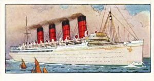
Background imageNavigation Collection: R. M. S. Mauretania, 1937

R. M. S. Mauretania, 1937
R.M.S. Mauretania, 1937. From The Story of Navigation. [The Imperial Tobacco Co. (Of Great Britain & Ireland), Ltd. 1937]

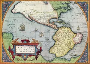
Background imageNavigation Collection: America, or the New World: From the Theatrum Orbis Terrarum by Abraham Ortelius, 1570, 1570

America, or the New World: From the Theatrum Orbis Terrarum by Abraham Ortelius, 1570, 1570
America, or the New World: From the Theatrum Orbis Terrarum by Abraham Ortelius, 1570, (1936). From The Connoisseur, Vol. 98, edited by H. Granville Fell. [International Studio, London, 1936]

Background imageNavigation Collection: 1899 Bacon Pocket Plan Or Map Of London Topography

1899 Bacon Pocket Plan Or Map Of London Topography
1899, Bacon Pocket Plan or Map of London

Background imageNavigation Collection: 1899 View Map Of Boston Harbor From Boston To Cape Cod And Provincetown

1899 View Map Of Boston Harbor From Boston To Cape Cod And Provincetown
1899, View Map of Boston Harbor from Boston to Cape Cod and Provincetown

Background imageNavigation Collection: 1898 Brockhaus Map Of The Moon Topography Cartography

1898 Brockhaus Map Of The Moon Topography Cartography
1898, Brockhaus Map of the Moon

Background imageNavigation Collection: 1895 U.S. Coast Survey Map Of The Chesapeake Bay Around Annapolis

1895 U.S. Coast Survey Map Of The Chesapeake Bay Around Annapolis
1895, U.S. Coast Survey Map of the Chesapeake Bay around Annapolis

Background imageNavigation Collection: 1895 Meiji 28 Japanese Map Of Imperial Japan With Taiwan

1895 Meiji 28 Japanese Map Of Imperial Japan With Taiwan
1895, Meiji 28 Japanese Map of Imperial Japan with Taiwan

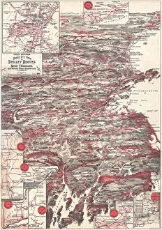
Background imageNavigation Collection: 1898 Walker Trolley Map And View Of New England Centered On Boston

1898 Walker Trolley Map And View Of New England Centered On Boston
1898, Walker Trolley Map and View of New England centered on Boston

Background imageNavigation Collection: 1893 U.S. Coast Survey Nautical Chart Or Map Of The Chesapeake Bay And Delaware Bay

1893 U.S. Coast Survey Nautical Chart Or Map Of The Chesapeake Bay And Delaware Bay
1893, U.S. Coast Survey Nautical Chart or Map of the Chesapeake Bay and Delaware Bay

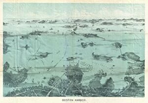
Background imageNavigation Collection: 1897 Walker View Of Boston Harbor Topography

1897 Walker View Of Boston Harbor Topography
1897, Walker View of Boston Harbor

Background imageNavigation Collection: 1892 Scientific American Map And View Of New York City

1892 Scientific American Map And View Of New York City
1892, Scientific American Map and View of New York City

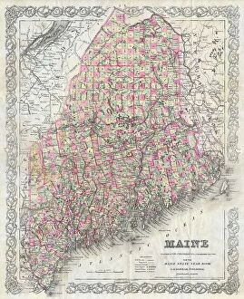
Background imageNavigation Collection: 1894 Colton Map Of Maine Topography Cartography

1894 Colton Map Of Maine Topography Cartography
1894, Colton Map of Maine

Background imageNavigation Collection: 1892 Colton Pocket Map Of Vermont And New Hampshire

1892 Colton Pocket Map Of Vermont And New Hampshire
1892, Colton Pocket Map of Vermont and New Hampshire

Background imageNavigation Collection: 1890 Hachette Map Of Antarctica Topography Cartography

1890 Hachette Map Of Antarctica Topography Cartography
1890, Hachette Map of Antarctica

Background imageNavigation Collection: 1890 View Map Of Boston Habor From Boston To Cape Cod And Provincetown

1890 View Map Of Boston Habor From Boston To Cape Cod And Provincetown
1890, View Map of Boston Habor from Boston to Cape Cod and Provincetown

Background imageNavigation Collection: 1886 Telescopic View And Map Of The Moon Topography

1886 Telescopic View And Map Of The Moon Topography
1886, Telescopic View and Map of the Moon

Background imageNavigation Collection: 1888 Topographic Survey Map Of The United States

1888 Topographic Survey Map Of The United States
1888, Topographic Survey Map of the United States

Background imageNavigation Collection: 1886 Depot De La Guerre Pocket Map Of Paris And Environs

1886 Depot De La Guerre Pocket Map Of Paris And Environs
1886, Depot de la Guerre Pocket Map of Paris and Environs

Background imageNavigation Collection: 1883 U.S.G.S. Map Of The Island Of Hawaii Topography

1883 U.S.G.S. Map Of The Island Of Hawaii Topography
1883, U.S.G.S. Map of the Island of Hawaii

Background imageNavigation Collection: 1884 Drew Pocket Map Of Florida Topography Cartography

1884 Drew Pocket Map Of Florida Topography Cartography
1884, Drew Pocket Map of Florida

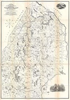
Background imageNavigation Collection: 1881 Thomas Sedgwick Steele Map Of Maine Topography

1881 Thomas Sedgwick Steele Map Of Maine Topography
1881, Thomas Sedgwick Steele Map of Maine

Background imageNavigation Collection: 1883 U.S.G.S. Map Of The Hawaiian Islands Topography

1883 U.S.G.S. Map Of The Hawaiian Islands Topography
1883, U.S.G.S. Map of the Hawaiian Islands

Background imageNavigation Collection: 1891 Long Island Railroad Real Estate Map Of Long Island

1891 Long Island Railroad Real Estate Map Of Long Island
1891, Long Island Railroad Real Estate Map of Long Island

Background imageNavigation Collection: Guilmin Map Of Paris France Monuments Topography

Guilmin Map Of Paris France Monuments Topography
Guilmin Map of Paris, France, Monuments

Background imageNavigation Collection: 1910 U.S. Coast Survey Nautical Chart Or Map Of New York City And Harbor

1910 U.S. Coast Survey Nautical Chart Or Map Of New York City And Harbor
1910, U.S. Coast Survey Nautical Chart or Map of New York City and Harbor

Background imageNavigation Collection: 1907 Geological Survey Map Of San Francisco Peninsula After 1906 Earthquake

1907 Geological Survey Map Of San Francisco Peninsula After 1906 Earthquake
1907, Geological Survey Map of San Francisco Peninsula after 1906 Earthquake

Background imageNavigation Collection: 1907 Geological Survey Map Of San Francisco After 1906 Earthquake

1907 Geological Survey Map Of San Francisco After 1906 Earthquake
1907, Geological Survey Map of San Francisco after 1906 Earthquake

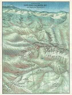
Background imageNavigation Collection: 1904 Clason Map Or View Of The Gilpin Colorado Gold And Mineral Belt

1904 Clason Map Or View Of The Gilpin Colorado Gold And Mineral Belt
1904, Clason Map or View of the Gilpin Colorado Gold and Mineral Belt

Background imageNavigation Collection: 1758 Bellin Map Of Saint Lucia Sainte Lucie West Indies

1758 Bellin Map Of Saint Lucia Sainte Lucie West Indies
1758, Bellin Map of Saint Lucia, Sainte Lucie, West Indies

Background imageNavigation Collection: Norbegia And Gottia Topography Cartography Geography

Norbegia And Gottia Topography Cartography Geography
Norbegia and Gottia

Background imageNavigation Collection: 1874 Mitchell Map Of Pennsylvania Topography

1874 Mitchell Map Of Pennsylvania Topography
1874, Mitchell Map of Pennsylvania

Background imageNavigation Collection: 1874 Ludlow And Custer Map Of The Black Hills

1874 Ludlow And Custer Map Of The Black Hills
1874, Ludlow and Custer Map of The Black Hills

Background imageNavigation Collection: 1874 Gray Map Of North Carolina Topography Cartography

1874 Gray Map Of North Carolina Topography Cartography
1874, Gray Map of North Carolina

Background imageNavigation Collection: 1873 U.S. Coast Survey Map Of The Delta Of The Mississippi River

1873 U.S. Coast Survey Map Of The Delta Of The Mississippi River
1873, U.S. Coast Survey Map of the Delta of the Mississippi River

Background imageNavigation Collection: 1873 U.S. Coast Survey Chart Or Map Of The Chesapeake Bay And Delaware Bay

1873 U.S. Coast Survey Chart Or Map Of The Chesapeake Bay And Delaware Bay
1873, U.S. Coast Survey Chart or Map of the Chesapeake Bay and Delaware Bay

Background imageNavigation Collection: 1873 U.S. Coast Survey Chart Or Map Of The Carolina Coast

1873 U.S. Coast Survey Chart Or Map Of The Carolina Coast
1873, U.S. Coast Survey Chart or Map of the Carolina Coast

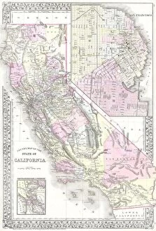
Background imageNavigation Collection: 1881 Mitchell Map Of California W- San Francisco Inset

1881 Mitchell Map Of California W- San Francisco Inset
1881, Mitchell Map of California w- San Francisco Inset

Background imageNavigation Collection: 1873 Gray Railroad Map Of Minnesota And Iowa

1873 Gray Railroad Map Of Minnesota And Iowa
1873, Gray Railroad Map of Minnesota and Iowa

Background imageNavigation Collection: 1873 U.S. Coast Survey Chart Or Map Of New Jersey And The Delaware Bay

1873 U.S. Coast Survey Chart Or Map Of New Jersey And The Delaware Bay
1873, U.S. Coast Survey Chart or Map of New Jersey and the Delaware Bay

Background imageNavigation Collection: 1873 Colton Map Of The Arctic Or North Pole Topography

1873 Colton Map Of The Arctic Or North Pole Topography
1873, Colton Map of the Arctic or North Pole

Background imageNavigation Collection: 1873 Beers Map Of New York State Topography Cartography

1873 Beers Map Of New York State Topography Cartography
1873, Beers Map of New York State

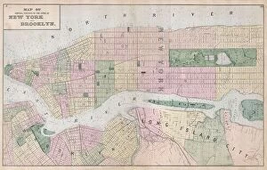
Background imageNavigation Collection: 1873 Beers Map Of New York City Topography Cartography

1873 Beers Map Of New York City Topography Cartography
1873, Beers Map of New York City


All Professionally Made to Order for Quick Shipping

"Embarking on a Journey: Navigating through Time and Space" Step into the world as we explore its rich history and diverse forms. From ancient maps to modern technology, join us on this captivating voyage. Delve into the past with the 1815 plan of the Sheffield to Tinsley canal by W. And J. Fairbank, showcasing their vision for an intricate waterway system. Witness how British India Steam Navigation Company Ltd revolutionized travel across vast oceans, connecting distant lands. Experience the art training aboard the Training Ship Arethusa in Greenhithe, Kent, where young sailors honed their compass drill skills against breathtaking sunsets. Marvel at James Craig's 1768 map of New Town in Edinburgh, Scotland—a testament to meticulous planning and topographical precision. Immerse yourself in adventure as a Viking ship emerges from a fiery sunset silhouette through stunning 3D graphics—an ode to seafaring conquests that shaped history. Explore ancient Greece with Delisle's 1794 map depicting Southern Ancient Greece, Greek Isles, and Crete—unraveling tales of exploration and discovery. Travel across continents to Rhode Island, USA, where Point Judith Lighthouse stands tall amidst dusk's embrace—a guiding light for mariners navigating treacherous waters. Uncover Darwin's compass—J970126—a tool that unlocked nature's secrets during his groundbreaking scientific expeditions. Finally, witness racing pigeons taking flight—a symbol of precision navigation ingrained in our culture for centuries. Navigation is more than just finding your way—it represents human ingenuity and our unyielding desire to explore new horizons. Join us as we celebrate this timeless art that has guided civilizations throughout time.