
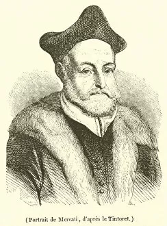
Mercator Collection
"Exploring the World through Mercator's Timeless Maps" Step back in time to the 17th century and embark on a journey of discovery with Gerardus Mercator


All Professionally Made to Order for Quick Shipping
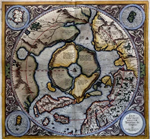
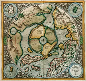
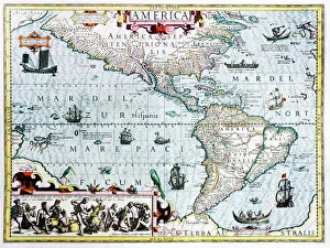
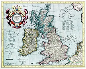
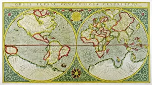
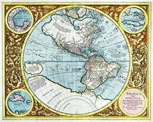
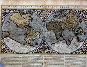
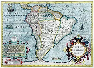
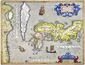
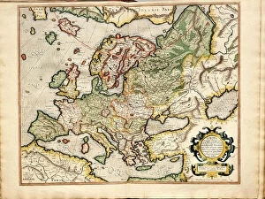
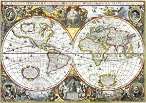
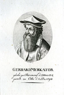
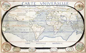
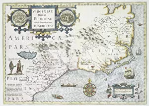
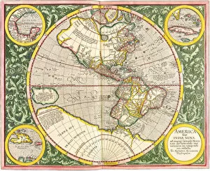
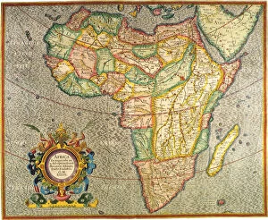
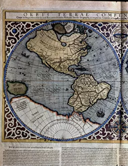
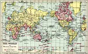
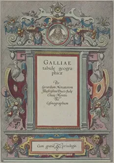
"Exploring the World through Mercator's Timeless Maps" Step back in time to the 17th century and embark on a journey of discovery with Gerardus Mercator, one of history's most renowned cartographers. His maps have left an indelible mark on our understanding of the world, offering glimpses into different continents and eras. One such masterpiece is "Septentrionalium Terrarum descriptio, " a 1595 map that vividly depicts Europe during this era. With intricate details and precise accuracy, it transports us to a time when borders were shifting and empires were rising. Mercator's influence extended far beyond Europe; his "World Map" from 1587 showcased the New World as it was being explored by intrepid adventurers. This map captured not only geographical features but also sparked imaginations about distant lands waiting to be discovered. The British Isles also found their place in Mercator's work, as seen in his captivating 16th-century map. It offers a glimpse into Britain's rich history while showcasing its diverse landscapes and coastal beauty. Venturing further westward, we encounter another remarkable creation: Mercator's Atlas from 1595 unveils an Arctic region that had yet to be fully explored. The map reveals his meticulous attention to detail as he charts uncharted territories leading up to the North Pole—a testament to his unwavering dedication as a cartographer. Traveling eastward takes us across oceans towards Asia, where Japan comes alive through Jodocus Hondius' engraving for Mercator's Atlas edition of 1606. Notably, Korea is depicted as an island—an intriguing reflection of historical perceptions at that time. But perhaps one of the most fascinating aspects lies within Mercator's depiction of the Arctic and North Pole regions—areas shrouded in mystery even today. His maps offer glimpses into these icy realms, fueling curiosity about what lies beyond.