Fraud Blocker Skip to main content

Isles Collection (page 5)

"Exploring the Isles: A Journey through History, Nature, and Resilience" Unfolding history on a WW2 poster: Map of the British Army's strategic isles

Background imageIsles Collection: Map containing the island and kingdom of Sicily, with a part of Naples

Map containing the island and kingdom of Sicily, with a part of Naples, and other adjacent coasts including
7339456 Map containing the island and kingdom of Sicily, with a part of Naples, and other adjacent coasts including the Tyrrhenean Sea, 1676 (coloured engraving) by Seller

Background imageIsles Collection: The Buccaneer was a Picturesque Fellow, early 20th century (book illustration)

The Buccaneer was a Picturesque Fellow, early 20th century (book illustration)
7339191 The Buccaneer was a Picturesque Fellow, early 20th century (book illustration) by Pyle, Howard (1853-1911); National Maritime Museum, London, UK; (add.info.: Creator: Howard Pyle A pirate)

Background imageIsles Collection: West Indies Mosquito Coast Utilla Island surveyed by Commander R. Owen 1835, 1843 (print)

West Indies Mosquito Coast Utilla Island surveyed by Commander R. Owen 1835, 1843 (print)
7340635 West Indies Mosquito Coast Utilla Island surveyed by Commander R. Owen 1835, 1843 (print) by Walker, J. & C. (19th century); 63x45.3 cm; National Maritime Museum, London

Background imageIsles Collection: Plan of Tortola from survey by George King, 1798 (coloured engraving)

Plan of Tortola from survey by George King, 1798 (coloured engraving)
7340496 Plan of Tortola from survey by George King, 1798 (coloured engraving) by King, George (18th century); 48x63 cm; National Maritime Museum, London

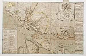
Background imageIsles Collection: Plan of the seige of St. Philips Castle, on the Island of Minorca, 1782 (engraving)

Plan of the seige of St. Philips Castle, on the Island of Minorca, 1782 (engraving)
7340495 Plan of the seige of St. Philips Castle, on the Island of Minorca, 1782 (engraving) by Assiotti, Francis Aegidius (fl.1759-82); 39.5x60 cm; National Maritime Museum, London

Background imageIsles Collection: Chart of Oyster Bay and Huntington Bay, Long Island Sound, 1778 (technical drawing)

Chart of Oyster Bay and Huntington Bay, Long Island Sound, 1778 (technical drawing)
7340416 Chart of Oyster Bay and Huntington Bay, Long Island Sound, 1778 (technical drawing) by DesBarres, Joseph Frederick Wallet (1721-1824); 80x54.5 cm; National Maritime Museum, London

Background imageIsles Collection: A chart of the easternmost part of the East Indies with all the adjacent islands from Cape Comorin

A chart of the easternmost part of the East Indies with all the adjacent islands from Cape Comorin to Japan
7340050 A chart of the easternmost part of the East Indies with all the adjacent islands from Cape Comorin to Japan, 1675 (coloured engraving) by Seller

Background imageIsles Collection: Chart of the Seychelle Islands by the officers of H.M. ships Leven

Chart of the Seychelle Islands by the officers of H.M. ships Leven and Barracouta under the direction of Capt. W.F.W
7342594 Chart of the Seychelle Islands by the officers of H.M. ships Leven and Barracouta under the direction of Capt. W.F.W. Owen R.N. 1825, 1828 (print) by Walker, J. & C

Background imageIsles Collection: Photograph of Captain Thomson with people from the Admiralty Islands

Photograph of Captain Thomson with people from the Admiralty Islands. Scientific discovery expedition of HMS Challenger
7342587 Photograph of Captain Thomson with people from the Admiralty Islands. Scientific discovery expedition of HMS Challenger (1858) 1872-76

Background imageIsles Collection: Island of Mauritius, 1804 (paper)

Island of Mauritius, 1804 (paper)
7340499 Island of Mauritius, 1804 (paper) by Campbell, James (19th century); 53.5x41 cm; National Maritime Museum, London, UK; (add.info.: Creator: James Campbell Scale: 1:500 000)

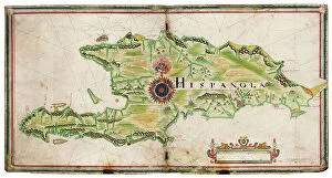
Background imageIsles Collection: Map of Hispaniola, 1653 (manuscript)

Map of Hispaniola, 1653 (manuscript)
7340470 Map of Hispaniola, 1653 (manuscript) by Comberford, Nicholas (d.1673); 47x45 cm; National Maritime Museum, London

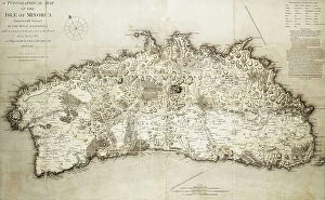
Background imageIsles Collection: Map of Minorca, 1780 (coloured engraving)

Map of Minorca, 1780 (coloured engraving)
7340457 Map of Minorca, 1780 (coloured engraving) by Rochette, L. S. de la (18th century); 61x98 cm; National Maritime Museum, London, UK; (add.info.: Creator: L. S)

Background imageIsles Collection: A new and exact map of the island of Antigua in America, according to a survey made in the years

A new and exact map of the island of Antigua in America, according to a survey made in the years 1746-1748
7340453 A new and exact map of the island of Antigua in America, according to a survey made in the years 1746-1748, c.1749 (coloured engraving) by Baker

Background imageIsles Collection: Osaro, 1590 (Manuscript)

Osaro, 1590 (Manuscript)
7339638 Osaro, 1590 (Manuscript) by Millo, Antonio (fl.c.1590); 31x205 cm; National Maritime Museum, London, UK; (add.info.: Creator: Millo, Antonio Bound sheet. Ms. Additional Places: Osor)

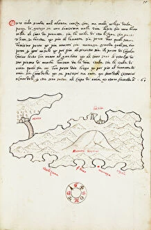
Background imageIsles Collection: los map, c.1480 (vellum)

los map, c.1480 (vellum)
7339634 los map, c.1480 (vellum) by Sonetti, Bartolomeo da li (fl.1485); 60x42.3 cm; National Maritime Museum, London, UK; (add.info.: Creator: Bartolommeo dalli Sonetti Bound sheet. Col. ms)

Background imageIsles Collection: Chart of Antikithira, Ionian Sea, 1420 (vellum)

Chart of Antikithira, Ionian Sea, 1420 (vellum)
7339624 Chart of Antikithira, Ionian Sea, 1420 (vellum) by Buondelmonti, Cristoforo (1385-1430); 25x18 cm; National Maritime Museum, London

Background imageIsles Collection: Chart of Ithaki, c.1420 (vellum)

Chart of Ithaki, c.1420 (vellum)
7339622 Chart of Ithaki, c.1420 (vellum) by Buondelmonti, Cristoforo (1385-1430); 25x18 cm; National Maritime Museum, London

Background imageIsles Collection: Chart of Paxos, c.1420 (vellum)

Chart of Paxos, c.1420 (vellum)
7339621 Chart of Paxos, c.1420 (vellum) by Buondelmonti, Cristoforo (1385-1430); 25x18 cm; National Maritime Museum, London

Background imageIsles Collection: Chart of Paxos, c.1420 (vellum)

Chart of Paxos, c.1420 (vellum)
7339620 Chart of Paxos, c.1420 (vellum) by Buondelmonti, Cristoforo (1385-1430); 25x18 cm; National Maritime Museum, London

Background imageIsles Collection: A plan of Iuan Fernandes Island in the South Sea, lying in the latitude of 33d. 40m

A plan of Iuan Fernandes Island in the South Sea, lying in the latitude of 33d. 40m
7339523 A plan of Iuan Fernandes Island in the South Sea, lying in the latitude of 33d. 40m. south, and west from the continent of Chili 110 leagues, c.1750 (engraving) by Anson

Background imageIsles Collection: Isle of Dogs as seen from the docks at Rotherhithe, 1821 (aquatint, coloured)

Isle of Dogs as seen from the docks at Rotherhithe, 1821 (aquatint, coloured)
7341611 Isle of Dogs as seen from the docks at Rotherhithe, 1821 (aquatint, coloured) by Timms, W. (19th century); 18.3x25 cm; National Maritime Museum, London, UK; (add.info.: Creator: W. H)

Background imageIsles Collection: Roughly sketched chart of Wreck Reef 1803 from a collection of technical memoranda

Roughly sketched chart of Wreck Reef 1803 from a collection of technical memoranda
7340789 Roughly sketched chart of Wreck Reef 1803 from a collection of technical memoranda and correspondence from the Admiralty, 1812-1814 FLI/7/22 (drawing) by Flinders

Background imageIsles Collection: This geographical plan of the Island of Saint Helena is dedicated by permission to Field Marshal

This geographical plan of the Island of Saint Helena is dedicated by permission to Field Marshal His Royal Highness
7339435 This geographical plan of the Island of Saint Helena is dedicated by permission to Field Marshal His Royal Highness the Duke of Kent and Strathearn

Background imageIsles Collection: St. George's Bay surveyed by Edward Bransfield, Master of HMS Andromache, 1821 (print)

St. George's Bay surveyed by Edward Bransfield, Master of HMS Andromache, 1821 (print)
7339419 St. George's Bay surveyed by Edward Bransfield, Master of HMS Andromache, 1821 (print) by Bransfield, Edward (19th century); 41x85.5 cm; National Maritime Museum, London

Background imageIsles Collection: Chart of South Shetland including Coronation Island, from the exploration of the sloop Dove in

Chart of South Shetland including Coronation Island, from the exploration of the sloop Dove in the years 1821
7339411 Chart of South Shetland including Coronation Island, from the exploration of the sloop Dove in the years 1821 and 1822 by George Powell Commander of the same, 1822 (engraving) by Powell

Background imageIsles Collection: Chart of the Island Otaheite (Tahiti) by James Cook, 1769, 1773 (engraving)

Chart of the Island Otaheite (Tahiti) by James Cook, 1769, 1773 (engraving)
7339404 Chart of the Island Otaheite (Tahiti) by James Cook, 1769, 1773 (engraving) by Cook, James (1728-79); 24x41 cm; National Maritime Museum, London

Background imageIsles Collection: Map of Spain with Portugal and Andorra, c.1900 (engraving)

Map of Spain with Portugal and Andorra, c.1900 (engraving)
532952 Map of Spain with Portugal and Andorra, c.1900 (engraving); (add.info.: Map of Spain with Portugal and Andorra, with insets of the Azores Islands, Canary Islands, and Madeira Island)

Background imageIsles Collection: Ostseebad Sellin a Rugen, Strand (b/w photo)

Ostseebad Sellin a Rugen, Strand (b/w photo)
8675101 Ostseebad Sellin a Rugen, Strand (b/w photo) by German Photographer, (19th century); Private Collection; (add.info.: Ostseebad Sellin a Rugen, Strand)

Background imageIsles Collection: Wissower Klinke a Rugen (b/w photo)

Wissower Klinke a Rugen (b/w photo)
8675100 Wissower Klinke a Rugen (b/w photo) by German Photographer, (19th century); Private Collection; (add.info.: Wissower Klinke a Rugen)

Background imageIsles Collection: Volcanic eruption on the island of Reunion (engraving)

Volcanic eruption on the island of Reunion (engraving)
8676716 Volcanic eruption on the island of Reunion (engraving) by English School, (19th century); Private Collection; (add.info.: Volcanic eruption on the island of Reunion)

Background imageIsles Collection: General view of Corfu (engraving)

General view of Corfu (engraving)
8676601 General view of Corfu (engraving) by English School, (19th century); Private Collection; (add.info.: General view of Corfu)

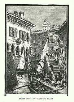
Background imageIsles Collection: Landing place, Ponta Delgade, Azores (engraving)

Landing place, Ponta Delgade, Azores (engraving)
8676233 Landing place, Ponta Delgade, Azores (engraving) by Pritchett, Robert (1828-1907); Private Collection; (add.info.: Landing place, Ponta Delgade, Azores)

Background imageIsles Collection: Castle of Almourol, Portugal (colour litho)

Castle of Almourol, Portugal (colour litho)
8672875 Castle of Almourol, Portugal (colour litho) by Gameiro, Alfredo Roque (1864-1935); Private Collection; (add.info.: Castle of Almourol on an island in the River Tagus, Portugal)

Background imageIsles Collection: Kingston, Jamaica: Roaring River Falls, St Ann's (colour photo)

Kingston, Jamaica: Roaring River Falls, St Ann's (colour photo)
8644411 Kingston, Jamaica: Roaring River Falls, St Ann's (colour photo) by English Photographer, (20th century); Private Collection; (add.info.: Roaring River Falls, St Ann's)

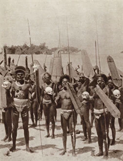
Background imageIsles Collection: Head Hunters of the Solomon Islands (b/w photo)

Head Hunters of the Solomon Islands (b/w photo)
8641457 Head Hunters of the Solomon Islands (b/w photo) by English Photographer, (20th century); Private Collection; (add.info.: Head Hunters of the Solomon Islands)

Background imageIsles Collection: Martha's Vineyard: The Gay Head Bluffs (b/w photo)

Martha's Vineyard: The Gay Head Bluffs (b/w photo)
8640644 Martha's Vineyard: The Gay Head Bluffs (b/w photo) by American Photographer, (19th century); Private Collection; (add.info.: The Gay Head Bluffs)

Background imageIsles Collection: Martha's Vineyard: The Monohansett, The Martha's Vineyard, The Nantucket, The Island Home

Martha's Vineyard: The Monohansett, The Martha's Vineyard, The Nantucket, The Island Home
8640633 Martha's Vineyard: The Monohansett, The Martha's Vineyard, The Nantucket, The Island Home, The River Queen (b/w photo) by American Photographer

Background imageIsles Collection: Martha's Vineyard: View Northwest from the Observatory, Samoset Avenue (b/w photo)

Martha's Vineyard: View Northwest from the Observatory, Samoset Avenue (b/w photo)
8640629 Martha's Vineyard: View Northwest from the Observatory, Samoset Avenue (b/w photo) by American Photographer, (19th century); Private Collection; (add.info)

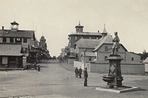
Background imageIsles Collection: Martha's Vineyard: Circuit Avenue and Soldiers Fountain, Island House (b/w photo)

Martha's Vineyard: Circuit Avenue and Soldiers Fountain, Island House (b/w photo)
8640625 Martha's Vineyard: Circuit Avenue and Soldiers Fountain, Island House (b/w photo) by American Photographer, (19th century); Private Collection; (add.info)

Background imageIsles Collection: Jersey, Chanel Islands: St Brelade's Church, erected in 1111 AD (litho)

Jersey, Chanel Islands: St Brelade's Church, erected in 1111 AD (litho)
8640421 Jersey, Chanel Islands: St Brelade's Church, erected in 1111 AD (litho) by English School, (19th century); Private Collection; (add.info.: St Brelade's Church, erected in 1111 AD)

Background imageIsles Collection: Jersey, Chanel Islands: The Market, St Heliers (litho)

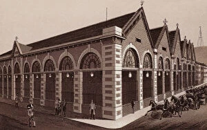
Jersey, Chanel Islands: The Market, St Heliers (litho)
8640418 Jersey, Chanel Islands: The Market, St Heliers (litho) by English School, (19th century); Private Collection; (add.info.: The Market, St Heliers)

Background imageIsles Collection: Martha's Vineyard: Sea View Avenue and View South, from the Observatory (b/w photo)

Martha's Vineyard: Sea View Avenue and View South, from the Observatory (b/w photo)
8640621 Martha's Vineyard: Sea View Avenue and View South, from the Observatory (b/w photo) by American Photographer, (19th century); Private Collection; (add.info)

Background imageIsles Collection: Martha's Vineyard: Cottage City, Ocean Park and the Highlands, from the Observatory (b/w photo)

Martha's Vineyard: Cottage City, Ocean Park and the Highlands, from the Observatory (b/w photo)
8640617 Martha's Vineyard: Cottage City, Ocean Park and the Highlands, from the Observatory (b/w photo) by American Photographer, (19th century); Private Collection; (add.info.: Cottage City)

Background imageIsles Collection: Hobart, from M'Gregor's Gardens (engraving)

Hobart, from M'Gregor's Gardens (engraving)
8648034 Hobart, from M'Gregor's Gardens (engraving) by Australian School, (19th century); Private Collection; (add.info.: Hobart, from M'Gregor's Gardens)

Background imageIsles Collection: Titchfield Hotel (coloured photo)

Titchfield Hotel (coloured photo)
8649156 Titchfield Hotel (coloured photo) by English Photographer, (20th century); Private Collection; (add.info.: Titchfield Hotel)

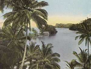
Background imageIsles Collection: Blue Hole, Port Antonio (coloured photo)

Blue Hole, Port Antonio (coloured photo)
8649155 Blue Hole, Port Antonio (coloured photo) by English Photographer, (20th century); Private Collection; (add.info.: Blue Hole, Port Antonio)

Background imageIsles Collection: John Adams Prayer-Book (engraving)

John Adams Prayer-Book (engraving)
8648114 John Adams Prayer-Book (engraving) by Australian School, (19th century); Private Collection; (add.info.: John Adams Prayer-Book. New Hebrides)

Background imageIsles Collection: A Tongan Belle (engraving)

A Tongan Belle (engraving)
8648111 A Tongan Belle (engraving) by Australian School, (19th century); Private Collection; (add.info.: A Tongan Belle. New Hebrides)


All Professionally Made to Order for Quick Shipping

"Exploring the Isles: A Journey through History, Nature, and Resilience" Unfolding history on a WW2 poster: Map of the British Army's strategic isles. Tracing our roots back to Viking Britain with an ancient map of their conquests. Battling against nature's fury at Bishop Rock Lighthouse during a relentless gale. Discovering tranquility amidst the Scilly Isles' breathtaking landscapes and seascapes. Unlocking Earth's secrets with a geological map showcasing the diverse British Islands. Navigating through time with an 18th-century Channel Islands map as our guide. Marveling at the majestic Wolf Rock Lighthouse from above, guarding Cornwall's coast. Immersing in Clan Macdonald's rich heritage that echoes across these storied isles. Reflecting on sacrifice and duty through a poignant WWI poster - "Is your home here? Defend it. " Stepping into Tresco Abbey's old arches, where whispers of Cornwall's past still linger. Witnessing resilience personified at Bishop Rock Lighthouse amidst the Isles of Scilly. Embracing coastal serenity as domestic cattle graze peacefully on Isle of Man’s Bride. Embark on this captivating journey through these remarkable isles; each holds its own tale waiting to be discovered – tales etched by war, shaped by Vikings, guarded by lighthouses, and nurtured by nature’s beauty.