Fraud Blocker Skip to main content

Isles Collection (page 2)

"Exploring the Isles: A Journey through History, Nature, and Resilience" Unfolding history on a WW2 poster: Map of the British Army's strategic isles

Background imageIsles Collection: DDE-90036269

DDE-90036269
Tombolo connecting St Ninian's Isle with Shetland mainland, Scotland, Great Britain (Large format sizes available). Date: 15/04/2010

Background imageIsles Collection: DDE-90036072

DDE-90036072
Two climbers on top of the old man Hoy, backlighted, Orkney islands, Scotland. (Large format sizes available) Date: 15/10/2009

Background imageIsles Collection: Gloster Meteor T. 7 WA669 27

Gloster Meteor T. 7 WA669 27
Royal Air Force - Gloster Meteor T.7 WA669 27, of the Central flying School, at RAF Little Rissington, on 1 August 1970. (RAF Little Rissington is the highest active airfield in the British Isles)

Background imageIsles Collection: View of Ponta Delgada, Sao Miguel Island, Azores

View of Ponta Delgada, Sao Miguel Island, Azores
Embankment and view of the city of Ponta Delgada, Sao Miguel Island, Azores, Atlantic Ocean. Date: circa 1908

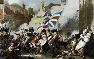
Background imageIsles Collection: The Battle Of Jersey (colour litho)

The Battle Of Jersey (colour litho)
3093499 The Battle Of Jersey (colour litho) by English School, (20th century); Private Collection; (add.info.: The Battle Of Jersey. Postcard, early 20th century.); © Look and Learn

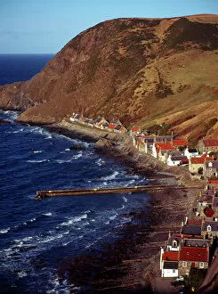
Background imageIsles Collection: Eye_Ubiquitous_20104951

Eye_Ubiquitous_20104951
Scotland, Aberdeenshire, Crovie, One time fishing village seen from cliff top. Row of cottages at foot of steep hillside overlooking coast and stone jetty

Background imageIsles Collection: Charles and Diana, St Marys, Isles of Scilly

Charles and Diana, St Marys, Isles of Scilly
Charles and Diana, Prince and Princess of Wales, on a visit to St Mary s, Isles of Scilly, with a crowd of spectators lining the street

Background imageIsles Collection: Timber Shipwreck, Scilly Isles, Cornwall

Timber Shipwreck, Scilly Isles, Cornwall, England. Date: 1910s

Background imageIsles Collection: Peel Castle, West Quay, Isle of Man

Peel Castle, West Quay, Isle of Man
Peel Castle, West Quay, Peel, Isle of Man, British Isles. Date: 1910s

Background imageIsles Collection: Bonne Nuit Bay, Jersey, Channel Islands

Bonne Nuit Bay, Jersey, Channel Islands, British Isles. Date: 1920s

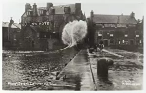
Background imageIsles Collection: Rough Sea in Lerwick Harbour

Rough Sea in Lerwick Harbour, Shetland Islands, Scotland. Date: circa 1910s

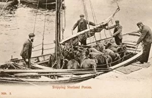
Background imageIsles Collection: Shipping Shetland Ponies

Shipping Shetland Ponies
Transporting a small herd of Shetland Ponies in a modest-sized sailing boat. Date: circa 1906

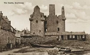
Background imageIsles Collection: Scotland, Shetland Isles - Castle at Scalloway

Scotland, Shetland Isles - Castle at Scalloway
The ruins of the Castle at Scalloway, Scotland - Shetland Isles

Background imageIsles Collection: GRH031414

GRH031414
A view of South Stack lighthouse

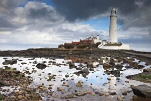
Background imageIsles Collection: St. Marys Island, Northumberland, England; St. Marys Lighthouse

St. Marys Island, Northumberland, England; St. Marys Lighthouse
The Lighthouse, completed in 1898 on a hazardous coast for shipping, remained operational until 1984 when it was superseded by modern navigational techniques

Background imageIsles Collection: Unloading sheep in harbour, Shetland, Scotland

Unloading sheep in harbour, Shetland, Scotland
Unloading sheep in the harbour, Shetland, Scotland. Date: 1960s

Background imageIsles Collection: Factors governing an invasion by G. H. Davis

Factors governing an invasion by G. H. Davis
The situation of Britain face to face with a German north-west Europe: factors governing an invasion during the Second World War

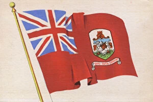
Background imageIsles Collection: The Flag of Bermuda

The Flag of Bermuda Date: circa 1930s

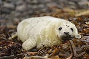
Background imageIsles Collection: Grey Seal (Halichoerus grypus) whitecoat pup, resting on wrack covered beach, Orkney, Scotland

Grey Seal (Halichoerus grypus) whitecoat pup, resting on wrack covered beach, Orkney, Scotland, November

Background imageIsles Collection: Bay of small Isles on the Isle of Jura, looking north, with rainbow arcing from the mainland

Bay of small Isles on the Isle of Jura, looking north, with rainbow arcing from the mainland on the left over Knockrome.low tide

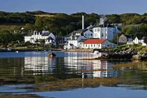
Background imageIsles Collection: View of coastal village, Jura Hotel, Jura Distillery, Lodge, Cooperage, Jura Stores and Jura Hall

View of coastal village, Jura Hotel, Jura Distillery, Lodge, Cooperage, Jura Stores and Jura Hall, Craighouse, Isle of Jura, Inner Hebrides, Scotland

Background imageIsles Collection: View of coastline with whirlpools in narrow strait, looking towards Isle of Scarba

View of coastline with whirlpools in narrow strait, looking towards Isle of Scarba, Gulf of Corryvreckan, Isle of Jura, Inner Hebrides, Scotland

Background imageIsles Collection: Red-throated Diver (Gavia stellata) adult, summer plumage, swimming on loch, Shetland Islands

Red-throated Diver (Gavia stellata) adult, summer plumage, swimming on loch, Shetland Islands, Scotland, June

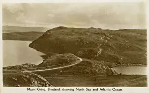
Background imageIsles Collection: Mavis Grind, Shetland Islands

Mavis Grind, Shetland Islands - both the North Sea and the Atlantic Ocean are visible in one hot! Date: circa 1910s

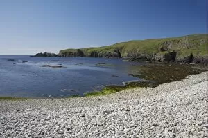
Background imageIsles Collection: View of pebble beach and sea cliffs, Funzie Bay, Fetlar, Shetland Islands, Scotland

View of pebble beach and sea cliffs, Funzie Bay, Fetlar, Shetland Islands, Scotland

Background imageIsles Collection: Atlantic Puffin (Fratercula arctica) adult, with sandeels and seaweed in beak, standing on rock

Atlantic Puffin (Fratercula arctica) adult, with sandeels and seaweed in beak, standing on rock, Inner Farne, Farne Islands, Northumberland, England, july

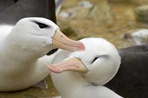
Background imageIsles Collection: Black-browed Albatross (Diomedea melanophoris) adult pair, courtship preening, close-up of heads

Black-browed Albatross (Diomedea melanophoris) adult pair, courtship preening, close-up of heads, Falkland Islands

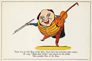
Background imageIsles Collection: Lear / Nonsense / Isles

Lear / Nonsense / Isles
There was on Old Man of the Isles, whose face was pervaded with smiles; He sung high dum diddle, and played on the fiddle, that amiable Man of the Isles

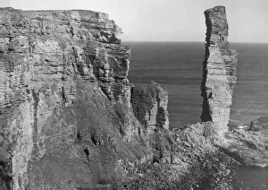
Background imageIsles Collection: The Old Man of Hoy

The Old Man of Hoy, a curious cliff formation on the west coast of the Island of Hoy in the Orkney Isles, Scotland

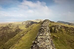
Background imageIsles Collection: Northumberland, England; Hadrians Wall

Northumberland, England; Hadrians Wall

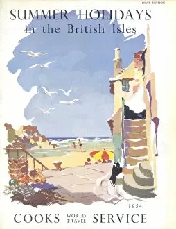
Background imageIsles Collection: Summer Holidays in the British Isles, with Cooks

Summer Holidays in the British Isles, with Cooks
Cover illustration for Summer Holidays in the British Isles, with Cooks World Travel Service, showing a West Country scene with people playing on a sandy beach, fishing nets and seagulls

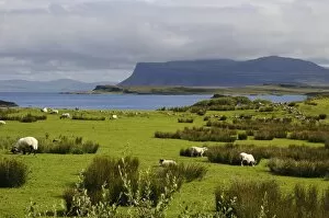
Background imageIsles Collection: View of sea loch with sheep grazing near shore, Loch Scridain, Isle of Mull, Inner Hebrides

View of sea loch with sheep grazing near shore, Loch Scridain, Isle of Mull, Inner Hebrides, Scotland, August

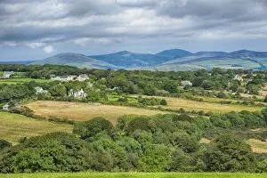
Background imageIsles Collection: View across farmland towards mountain, viewed from Port Soderick towards Snaefell, Isle of Man

View across farmland towards mountain, viewed from Port Soderick towards Snaefell, Isle of Man, August

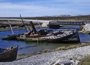
Background imageIsles Collection: Falklands Shipwrecks on Falkland beach

Falklands Shipwrecks on Falkland beach

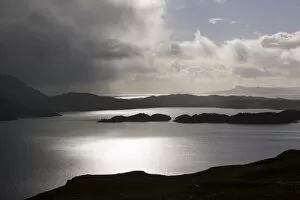
Background imageIsles Collection: A shower passing over Loch Morar in Scotland looking towards Rhum

A shower passing over Loch Morar in Scotland looking towards Rhum
Ashley Cooper / SpecialistStock

Background imageIsles Collection: Colour map of Dominica with detailed geographical observations, c.1760 (hand coloured engraving)

Colour map of Dominica with detailed geographical observations, c.1760 (hand coloured engraving)
7339471 Colour map of Dominica with detailed geographical observations, c.1760 (hand coloured engraving) by Jefferys, Thomas (c.1719-71); 63.5x48 cm; National Maritime Museum, London

Background imageIsles Collection: Sketch of part of the Island of Corsica, 1794 (pen, ink, wash)

Sketch of part of the Island of Corsica, 1794 (pen, ink, wash)
7339462 Sketch of part of the Island of Corsica, 1794 (pen, ink, wash) by Dundas, H. (18th century); 59x47 cm; National Maritime Museum, London, UK; (add.info.: Creator: H. Dundas Scale: 1:45 000)

Background imageIsles Collection: A chart of the Island of Bourbon in the Indian Ocean, 1780 (paper)

A chart of the Island of Bourbon in the Indian Ocean, 1780 (paper)
7339415 A chart of the Island of Bourbon in the Indian Ocean, 1780 (paper) by Gilbert, William (18th century); 61x93 cm; National Maritime Museum, London

Background imageIsles Collection: A chart of Lord Howe Island, 1788, 1789 (engraving)

A chart of Lord Howe Island, 1788, 1789 (engraving)
7339400 A chart of Lord Howe Island, 1788, 1789 (engraving) by Stockdale, J. (18th century); 24x33 cm; National Maritime Museum, London, UK; (add.info.: Creator: J)

Background imageIsles Collection: Plan of Eagle Island and Bird Island, late 18th to early 19th century (paper)

Plan of Eagle Island and Bird Island, late 18th to early 19th century (paper)
7340731 Plan of Eagle Island and Bird Island, late 18th to early 19th century (paper) by Dalrymple, Alexander (18th-19th century); National Maritime Museum, London

Background imageIsles Collection: Plate from Edward Barlow's journal of his life at sea in king's ships

Plate from Edward Barlow's journal of his life at sea in king's ships
7340651 Plate from Edward Barlow's journal of his life at sea in king's ships, East & West Indiamen & other merchantmen from 1659 to 1703. 1814 (print) by Heather, W

Background imageIsles Collection: Piazzetta and San Georgio by moonlight, Venice, Italy, c.1890-1900 (photochrom)

Piazzetta and San Georgio by moonlight, Venice, Italy, c.1890-1900 (photochrom)
8735747 Piazzetta and San Georgio by moonlight, Venice, Italy, c.1890-1900 (photochrom) by Detroit Publishing Co. (1880-1920); Private Collection; (add.info)

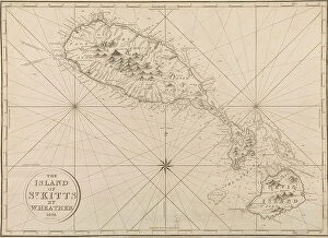
Background imageIsles Collection: A complete map of the West Indies containing the coasts of Florida, Louisiana

A complete map of the West Indies containing the coasts of Florida, Louisiana
7339476 A complete map of the West Indies containing the coasts of Florida, Louisiana, New Spain and Terra Firma with all the islands, 1794 (print) by Dunn

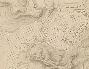
Background imageIsles Collection: Greece, the Peiraeus or Port Drako surveyed by Commander Thomas Graves, H.M.S

Greece, the Peiraeus or Port Drako surveyed by Commander Thomas Graves, H.M.S. Beacon 1840, [Detail], 1843 (print)
7342579 Greece, the Peiraeus or Port Drako surveyed by Commander Thomas Graves, H.M.S. Beacon 1840, [Detail], 1843 (print) by Walker, J. & C

Background imageIsles Collection: Greece, the Peiraeus or Port Drako surveyed by Commander Thomas Graves, H.M.S

Greece, the Peiraeus or Port Drako surveyed by Commander Thomas Graves, H.M.S. Beacon 1840, 1843 (print)
7342578 Greece, the Peiraeus or Port Drako surveyed by Commander Thomas Graves, H.M.S. Beacon 1840, 1843 (print) by Walker, J. & C

Background imageIsles Collection: Archipeligo, Rhodes Island, town and ports of Rhodes surveyed by Commander Thomas Graves

Archipeligo, Rhodes Island, town and ports of Rhodes surveyed by Commander Thomas Graves, HMS Beacon 1838, 1844 (print)
7342500 Archipeligo, Rhodes Island, town and ports of Rhodes surveyed by Commander Thomas Graves, HMS Beacon 1838, 1844 (print) by Walker, J. & C

Background imageIsles Collection: Plan of the Island of Dominica laid down by actual survey under the direction of the Honorable

Plan of the Island of Dominica laid down by actual survey under the direction of the Honorable the Commissioners for
7340451 Plan of the Island of Dominica laid down by actual survey under the direction of the Honorable the Commissioners for the Sale of Lands in the Ceded Islands by John Byres Chief Surveyor 1776

Background imageIsles Collection: Plan of the Island of Bequia laid down by actual survey under the direction of the Honorable

Plan of the Island of Bequia laid down by actual survey under the direction of the Honorable the Commissioners for
7340450 Plan of the Island of Bequia laid down by actual survey under the direction of the Honorable the Commissioners for the Sale of Lands in the Ceded Islands by John Byres Chief Surveyor 1776


All Professionally Made to Order for Quick Shipping

"Exploring the Isles: A Journey through History, Nature, and Resilience" Unfolding history on a WW2 poster: Map of the British Army's strategic isles. Tracing our roots back to Viking Britain with an ancient map of their conquests. Battling against nature's fury at Bishop Rock Lighthouse during a relentless gale. Discovering tranquility amidst the Scilly Isles' breathtaking landscapes and seascapes. Unlocking Earth's secrets with a geological map showcasing the diverse British Islands. Navigating through time with an 18th-century Channel Islands map as our guide. Marveling at the majestic Wolf Rock Lighthouse from above, guarding Cornwall's coast. Immersing in Clan Macdonald's rich heritage that echoes across these storied isles. Reflecting on sacrifice and duty through a poignant WWI poster - "Is your home here? Defend it. " Stepping into Tresco Abbey's old arches, where whispers of Cornwall's past still linger. Witnessing resilience personified at Bishop Rock Lighthouse amidst the Isles of Scilly. Embracing coastal serenity as domestic cattle graze peacefully on Isle of Man’s Bride. Embark on this captivating journey through these remarkable isles; each holds its own tale waiting to be discovered – tales etched by war, shaped by Vikings, guarded by lighthouses, and nurtured by nature’s beauty.