Fraud Blocker Skip to main content

Great Lakes Collection (page 9)

"Discover the Majestic Beauty of the Great Lakes

Background imageGreat Lakes Collection: Postcard of Airplane Flying over Beach at Cedar Point. ca. 1916

Postcard of Airplane Flying over Beach at Cedar Point. ca. 1916, FINEST FRESH WATER BEACH IN THE WORLD, CEDAR POINT, OHIO

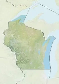
Background imageGreat Lakes Collection: State of Wisconsin, United States, Relief Map

State of Wisconsin, United States, Relief Map
Relief map of the State of Wisconsin, United States. This image was compiled from data acquired by LANDSAT 5 & 7 satellites combined with elevation data

Background imageGreat Lakes Collection: State of Illinois, United States, True Colour Satellite Image

State of Illinois, United States, True Colour Satellite Image
Satellite view of the State of Illinois, United States. This image was compiled from data acquired by LANDSAT 5 & 7 satellites

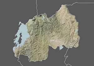
Background imageGreat Lakes Collection: Rwanda, Relief Map with Border and Mask

Rwanda, Relief Map with Border and Mask
Relief map of Rwanda (with border and mask). This image was compiled from data acquired by landsat 5 & 7 satellites combined with elevation data

Background imageGreat Lakes Collection: United States, Relief Map with Border and Mask

United States, Relief Map with Border and Mask
Relief map of the United States (with border and mask). This image was compiled from data acquired by landsat 5 & 7 satellites combined with elevation data

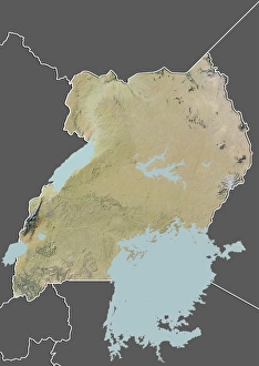
Background imageGreat Lakes Collection: Uganda, Relief Map with Border and Mask

Uganda, Relief Map with Border and Mask
Relief map of Uganda (with border and mask). This image was compiled from data acquired by landsat 5 & 7 satellites combined with elevation data

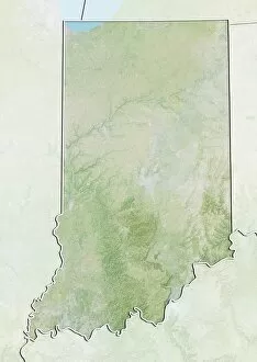
Background imageGreat Lakes Collection: State of Indiana, United States, Relief Map

State of Indiana, United States, Relief Map
Relief map of the State of Indiana, United States. This image was compiled from data acquired by LANDSAT 5 & 7 satellites combined with elevation data

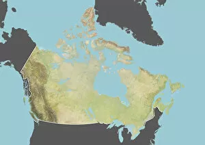
Background imageGreat Lakes Collection: Canada, Relief Map With Border and Mask

Canada, Relief Map With Border and Mask
Relief map of Canada (with border and mask). This image was compiled from data acquired by landsat 5 & 7 satellites combined with elevation data

Background imageGreat Lakes Collection: United States and Canada, Relief Map with Border

United States and Canada, Relief Map with Border
Relief map of the United States and Canada (with border). This image was compiled from data acquired by LANDSAT 5 & 7 satellites combined with elevation data

Background imageGreat Lakes Collection: Province of Ontario, Canada, True Colour Satellite Image

Province of Ontario, Canada, True Colour Satellite Image
Satellite view of Ontario, Canada. This image was compiled from data acquired by LANDSAT 5 & 7 satellites

Background imageGreat Lakes Collection: Province of Ontario, Canada, Relief Map

Province of Ontario, Canada, Relief Map
Relief map of Ontario, Canada. This image was compiled from data acquired by LANDSAT 5 & 7 satellites combined with elevation data

Background imageGreat Lakes Collection: State of Indiana, United States, True Colour Satellite Image

State of Indiana, United States, True Colour Satellite Image
Satellite view of the State of Indiana, United States. This image was compiled from data acquired by LANDSAT 5 & 7 satellites

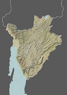
Background imageGreat Lakes Collection: Burundi, Relief Map With Border and Mask

Burundi, Relief Map With Border and Mask
Relief map of Burundi (with border and mask). This image was compiled from data acquired by landsat 5 & 7 satellites combined with elevation data

Background imageGreat Lakes Collection: State of Wisconsin, United States, True Colour Satellite Image

State of Wisconsin, United States, True Colour Satellite Image
Satellite view of the State of Wisconsin, United States. This image was compiled from data acquired by LANDSAT 5 & 7 satellites

Background imageGreat Lakes Collection: State of Pennsylvania, United States, True Colour Satellite Image

State of Pennsylvania, United States, True Colour Satellite Image
Satellite view of the State of Pennsylvania, United States. This image was compiled from data acquired by LANDSAT 5 & 7 satellites

Background imageGreat Lakes Collection: State of Pennsylvania, United States, Relief Map

State of Pennsylvania, United States, Relief Map
Relief map of the State of Pennsylvania, United States. This image was compiled from data acquired by LANDSAT 5 & 7 satellites combined with elevation data

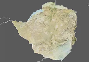
Background imageGreat Lakes Collection: Zimbabwe, Relief Map with Border and Mask

Zimbabwe, Relief Map with Border and Mask
Relief map of Zimbabwe (with border and mask). This image was compiled from data acquired by landsat 5 & 7 satellites combined with elevation data

Background imageGreat Lakes Collection: United States and Canada, True Colour Satellite Image With Border

United States and Canada, True Colour Satellite Image With Border
Satellite view of the United States and Canada (with border). This image was compiled from data acquired by LANDSAT 5 & 7 satellites

Background imageGreat Lakes Collection: State of Illinois, United States, Relief Map

State of Illinois, United States, Relief Map
Relief map of the State of Illinois, United States. This image was compiled from data acquired by LANDSAT 5 & 7 satellites combined with elevation data

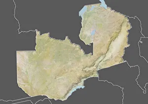
Background imageGreat Lakes Collection: Zambia, Relief Map With Border and Mask

Zambia, Relief Map With Border and Mask
Relief map of Zambia (with border and mask). This image was compiled from data acquired by landsat 5 & 7 satellites combined with elevation data

Background imageGreat Lakes Collection: State of Ohio, United States, True Colour Satellite Image

State of Ohio, United States, True Colour Satellite Image
Satellite view of the State of Ohio, United States. This image was compiled from data acquired by LANDSAT 5 & 7 satellites

Background imageGreat Lakes Collection: State of Ohio, United States, Relief Map

State of Ohio, United States, Relief Map
Relief map of the State of Ohio, United States. This image was compiled from data acquired by LANDSAT 5 & 7 satellites combined with elevation data

Background imageGreat Lakes Collection: State of New York, United States, True Colour Satellite Image

State of New York, United States, True Colour Satellite Image
Satellite view of the State of New York, United States. This image was compiled from data acquired by LANDSAT 5 & 7 satellites

Background imageGreat Lakes Collection: State of New York, United States, Relief Map

State of New York, United States, Relief Map
Relief map of the State of New York, United States. This image was compiled from data acquired by LANDSAT 5 & 7 satellites combined with elevation data

Background imageGreat Lakes Collection: State of Minnesota, United States, True Colour Satellite Image

State of Minnesota, United States, True Colour Satellite Image
Satellite view of the State of Minnesota, United States. This image was compiled from data acquired by LANDSAT 5 & 7 satellites

Background imageGreat Lakes Collection: State of Minnesota, United States, Relief Map

State of Minnesota, United States, Relief Map
Relief map of the State of Minnesota, United States. This image was compiled from data acquired by LANDSAT 5 & 7 satellites combined with elevation data

Background imageGreat Lakes Collection: State of Michigan, United States, True Colour Satellite Image

State of Michigan, United States, True Colour Satellite Image
Satellite view of the State of Michigan, United States. This image was compiled from data acquired by LANDSAT 5 & 7 satellites

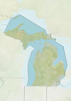
Background imageGreat Lakes Collection: State of Michigan, United States, Relief Map

State of Michigan, United States, Relief Map
Relief map of the State of Michigan, United States. This image was compiled from data acquired by LANDSAT 5 & 7 satellites combined with elevation data

Background imageGreat Lakes Collection: Usa, indiana dunes national lakeshore, deer (cervus elaphus) at side of road, blurred motion

Usa, indiana dunes national lakeshore, deer (cervus elaphus) at side of road, blurred motion

Background imageGreat Lakes Collection: Usa, minnesota, voyageurs national park, gray wolf (canis lupus) in wired-in enclosure in sanctuary

Usa, minnesota, voyageurs national park, gray wolf (canis lupus) in wired-in enclosure in sanctuary

Background imageGreat Lakes Collection: Michigan, USA, satellite image

Michigan, USA, satellite image
Michigan, USA. North is at top. Natural colour satellite image of the USA, showing the state of Michigan with the surrounding states shaded out. The USA consists of 50 states

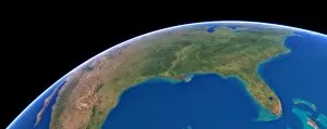
Background imageGreat Lakes Collection: US Southern States, satellite artwork C015 / 6577

US Southern States, satellite artwork C015 / 6577
US Southern States. Simulated panoramic satellite image of the southern United States taken from low Earth orbit over the Gulf of Mexico

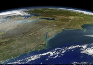
Background imageGreat Lakes Collection: East coast of the USA, satellite image C013 / 5162

East coast of the USA, satellite image C013 / 5162
East coast of the USA, satellite image. North is towards top. Clouds are white. The land area consists of eastern Canada across top and the north-eastern USA across centre and lower left

Background imageGreat Lakes Collection: The Huron Lightship Museum at Pine Grove Park in Port Huron, Michigan

The Huron Lightship Museum at Pine Grove Park in Port Huron, Michigan

Background imageGreat Lakes Collection: The Vantage Point Great Lakes Maritime Center located on the St. Clair River where

The Vantage Point Great Lakes Maritime Center located on the St. Clair River where it meets the Black River at Port Huron, Michigan

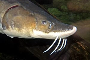
Background imageGreat Lakes Collection: Lake Sturgeon. Great Lakes, Hudson's Bay and Mississippi

Lake Sturgeon. Great Lakes, Hudson's Bay and Mississippi
PM-10811 Lake Sturgeon Great Lakes Acipenser fulvescens Hudson's Bay and Mississippi. freshwater fish Pat Morris contact details: prints@ardea.com tel: +44 (0) 20 8318 1401

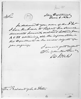
Background imageGreat Lakes Collection: War of 1812: Letter

War of 1812: Letter
WAR OF 1812: LETTER. Letter to President James Madison from Mr. Jones of the Navy Department, 6 June 1814, regarding the U.S. Naval force on Lakes Erie, Champlain and Ontario
Background imageGreat Lakes Collection: TRADE SILVER GORGETS. Silver gorgets made by white artisans for trade with Native Americans of

TRADE SILVER GORGETS. Silver gorgets made by white artisans for trade with Native Americans of the Great Lakes region, 1780-1820

Background imageGreat Lakes Collection: COLONIAL AMERICA: MAP, c1770. The British Dominions in America. Map showing the British colonies

COLONIAL AMERICA: MAP, c1770. The British Dominions in America. Map showing the British colonies and provinces in America, by Thomas Kitchin, c1770

Background imageGreat Lakes Collection: FORT MACKINAC, c1814. Fort Mackinac on an island off Michigan in the strait between Lake Huron

FORT MACKINAC, c1814. Fort Mackinac on an island off Michigan in the strait between Lake Huron and Lake Michigan, as it looked during the War of 1812. Wood engraving, American, 1865

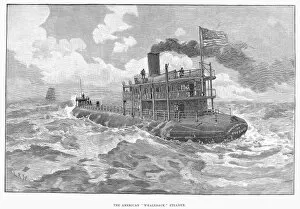
Background imageGreat Lakes Collection: WHALESBACK STEAMER, 1891. An American whaleback freighter, built for transporting cargo

WHALESBACK STEAMER, 1891. An American whaleback freighter, built for transporting cargo on the Great Lakes. Wood engraving, English, 1891

Background imageGreat Lakes Collection: MAP: COLONIAL AMERICA. A map of the thirteen original American colonies and neighboring French

MAP: COLONIAL AMERICA. A map of the thirteen original American colonies and neighboring French and Spanish colonial possessions, mid-18th century. Line engraving, late 19th century

Background imageGreat Lakes Collection: NORTHWEST TERRITORY, 1787. Map of the Northwest Territory as it appeared after the promulgation of

NORTHWEST TERRITORY, 1787. Map of the Northwest Territory as it appeared after the promulgation of the Northwest Ordinance of 1787

Background imageGreat Lakes Collection: GREAT LAKES STEAMBOAT. Walk-in-the-Water, the first steamboat in service on the Great Lakes

GREAT LAKES STEAMBOAT. Walk-in-the-Water, the first steamboat in service on the Great Lakes (from 1818 to 1821). Line engraving, 19th century

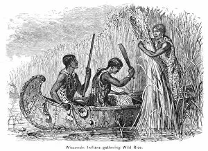
Background imageGreat Lakes Collection: NATIVE AMERICANS: GATHERING RICE. Wisconsin Native Americans gathering wild rice

NATIVE AMERICANS: GATHERING RICE. Wisconsin Native Americans gathering wild rice. Wood engraving, 19th century

Background imageGreat Lakes Collection: GREAT LAKES: CANOE, 19th C. Wisconsin Native Americans gathering wild rice

GREAT LAKES: CANOE, 19th C. Wisconsin Native Americans gathering wild rice. Wood engraving, American, 19th century

Background imageGreat Lakes Collection: GREAT LAKES STEAMER. Walk-in-the-Water, the first steamboat in service on the Great Lakes

GREAT LAKES STEAMER. Walk-in-the-Water, the first steamboat in service on the Great Lakes (from 1818 to 1821). Color engraving, 19th century

Background imageGreat Lakes Collection: Waterfall flowing into freshwater lake, Lake Superior, Picture Rocks N. P

Waterfall flowing into freshwater lake, Lake Superior, Picture Rocks N. P. Upper Peninsula, Michigan, U. S. A. october
Waterfall flowing into freshwater lake, Lake Superior, Picture Rocks N.P. Upper Peninsula, Michigan, U.S.A. october


All Professionally Made to Order for Quick Shipping

"Discover the Majestic Beauty of the Great Lakes: A Journey through History and Nature" Embark on a captivating journey as we explore the enchanting wonders of the Great Lakes region. Nestled within this picturesque landscape lies Sturgeon Bay Lighthouse, an iconic symbol of Door County, Wisconsin. Its towering presence serves as a beacon for sailors navigating these vast waters. Delve into history's depths and witness the echoes of the Battle of Lake Erie during the War of 1812. Feel a surge of patriotism as you imagine US Navy ships sailing bravely amidst turbulent waves near Sackets Harbor, New York in 1814. Experience tranquility under moonlit skies at Whitefish Point Lighthouse, casting its ethereal glow upon Lake Superior's shores. Marvel at EVNT2A-00196—a long exposure photograph capturing nature's raw beauty along Grand Marais' coastline—where time stands still in harmony with crashing waves. Gaze up to behold a celestial spectacle—the Milky Way Over Hollow Rock—illuminating Lake Michigan's night sky like an artist's brushstroke across canvas. Transport yourself back to centuries past with GREAT LAKES MAP, 1755—an exquisite French engraved map that unveils early explorations and settlements around these magnificent lakes. Prepare to be awe-struck by Niagara Falls' majestic cascade—a breathtaking sight where Waterfall Niagara Falls meets vibrant rainbows in Canada, Ontario. Immerse yourself in TRAN2A-00040—an immersive experience that transports you deep beneath these cascading waters. Witness resilience amidst adversity as a grain boat braves treacherous snowstorms on Lake Erie—a testament to human determination against nature's fury captured forever in EXPL2A-00128. The Great Lakes region is more than just water—it is an embodiment of history, natural splendor, and boundless adventures waiting to be discovered. So come forth and let your senses be captivated by this extraordinary tapestry of land and water.