
Geometric Collection (page 6)
"Exploring the Geometric Wonders: From Ancient Maps to Modern Art" Step back in time to 1768 with James Craig's Map of New Town, Edinburgh, Scotland


All Professionally Made to Order for Quick Shipping
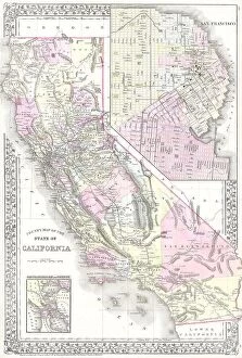
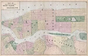
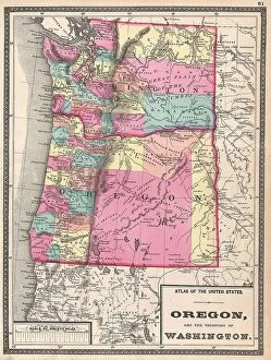
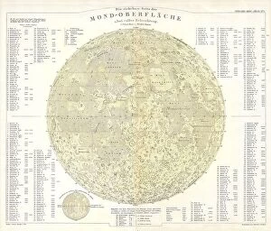
"Exploring the Geometric Wonders: From Ancient Maps to Modern Art" Step back in time to 1768 with James Craig's Map of New Town, Edinburgh, Scotland. This intricate creation showcases the geometric layout of this historic city, offering a glimpse into its urban planning genius. Travel further through history to 1794 and marvel at the Delisle Map of Southern Ancient Greece. With its detailed topography and depiction of Greek Isles and Crete, this map unveils the geometric beauty of these ancient lands. Fast forward to modern times and discover Choi Hung Estate in Hong Kong. As one of the oldest public housing estates, it boasts an impressive display architecture that harmoniously blends tradition with contemporary design. Venture beyond Earth's boundaries with an 1886 Telescopic View and Map of the Moon. Through cartography and geography, this mesmerizing piece reveals the intricate topography that dots our celestial neighbor. Dive into abstract art with Kazimir Malevich's iconic Black Square (oil on canvas). Its simplicity may deceive you as it challenges traditional notions by embracing geometry as a form of expression. Immerse yourself in Islamic culture at Alhambra in Spain where stunning carvings showcase intricate geometric patterns. These masterpieces demonstrate how mathematics intertwines seamlessly with artistry. Witness Southwest Indian craftsmanship through GEUR2D-00047 - a captivating artwork that highlights indigenous geometrical motifs passed down through generations. Journey to Cornwall, England, where Men-an-Tol stands tall as a cromlech monument. Its circular shape embodies ancient symbolism while showcasing geometrical precision within nature's embrace. Admire Mosaic with Arab and Kufic Calligraphy adorning walls across various regions. These exquisite designs fuse Arabic script intricately woven into mesmerizing geometric patterns – true works of art. Step inside Seville's Alcazar Interior in Spain for an architectural feast for your eyes.