Fraud Blocker Skip to main content

Geographical Collection (page 20)

"Journey through Time and Space: Exploring the Geographical Evolution" Al-Idrisi's World Map, 1154: Unveiling ancient cartographic wisdom

Background imageGeographical Collection: 1818 Pinkerton Map Of North America John Pinkerton

1818 Pinkerton Map Of North America John Pinkerton
1818, Pinkerton Map of North America, John Pinkerton, 1758 - 1826, Scottish antiquarian, cartographer, UK

Background imageGeographical Collection: 1818 Pinkerton Map Of Northern Scotland John Pinkerton

1818 Pinkerton Map Of Northern Scotland John Pinkerton
1818, Pinkerton Map of Northern Scotland, John Pinkerton, 1758 - 1826, Scottish antiquarian, cartographer, UK

Background imageGeographical Collection: 1818 Pinkerton Map Of Northern England John Pinkerton

1818 Pinkerton Map Of Northern England John Pinkerton
1818, Pinkerton Map of Northern England, John Pinkerton, 1758 - 1826, Scottish antiquarian, cartographer, UK

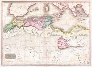
Background imageGeographical Collection: 1818 Pinkerton Map Of Northern Africa And The Mediterranean

1818 Pinkerton Map Of Northern Africa And The Mediterranean
1818, Pinkerton Map of Northern Africa and the Mediterranean, John Pinkerton, 1758 - 1826, Scottish antiquarian, cartographer, UK

Background imageGeographical Collection: 1818 Pinkerton Map Of Korea And Japan John Pinkerton

1818 Pinkerton Map Of Korea And Japan John Pinkerton
1818, Pinkerton Map of Korea and Japan, John Pinkerton, 1758 - 1826, Scottish antiquarian, cartographer, UK

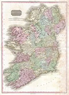
Background imageGeographical Collection: 1818 Pinkerton Map Of Ireland John Pinkerton

1818 Pinkerton Map Of Ireland John Pinkerton
1818, Pinkerton Map of Ireland, John Pinkerton, 1758 - 1826, Scottish antiquarian, cartographer, UK

Background imageGeographical Collection: 1818 Pinkerton Map Of Holland Or The Netherlands

1818 Pinkerton Map Of Holland Or The Netherlands
1818, Pinkerton Map of Holland or the Netherlands, John Pinkerton, 1758 - 1826, Scottish antiquarian, cartographer, UK

Background imageGeographical Collection: 1818 Pinkerton Map Of France John Pinkerton 1758 – 1826

1818 Pinkerton Map Of France John Pinkerton 1758 – 1826
1818, Pinkerton Map of France, John Pinkerton, 1758 - 1826, Scottish antiquarian, cartographer, UK

Background imageGeographical Collection: 1818 Pinkerton Map Of Egypt John Pinkerton 1758 – 1826

1818 Pinkerton Map Of Egypt John Pinkerton 1758 – 1826
1818, Pinkerton Map of Egypt, John Pinkerton, 1758 - 1826, Scottish antiquarian, cartographer, UK

Background imageGeographical Collection: 1818 Pinkerton Map Of Beligum John Pinkerton

1818 Pinkerton Map Of Beligum John Pinkerton
1818, Pinkerton Map of Beligum, John Pinkerton, 1758 - 1826, Scottish antiquarian, cartographer, UK

Background imageGeographical Collection: 1818 Pinkerton Map Of Asia John Pinkerton 1758 – 1826

1818 Pinkerton Map Of Asia John Pinkerton 1758 – 1826
1818, Pinkerton Map of Asia, John Pinkerton, 1758 - 1826, Scottish antiquarian, cartographer, UK

Background imageGeographical Collection: 1818 Pinkerton Map Of Africa John Pinkerton 1758 – 1826

1818 Pinkerton Map Of Africa John Pinkerton 1758 – 1826
1818, Pinkerton Map of Africa, John Pinkerton, 1758 - 1826, Scottish antiquarian, cartographer, UK

Background imageGeographical Collection: 1818 Pinkerton Map Of British North America Or Canada

1818 Pinkerton Map Of British North America Or Canada
1818, Pinkerton Map of British North America or Canada, John Pinkerton, 1758 - 1826, Scottish antiquarian, cartographer, UK

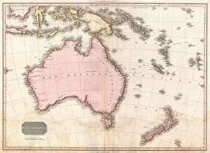
Background imageGeographical Collection: 1818 Pinkerton Map Of Australia And New Zealand

1818 Pinkerton Map Of Australia And New Zealand
1818, Pinkerton Map of Australia and New Zealand, John Pinkerton, 1758 - 1826, Scottish antiquarian, cartographer, UK

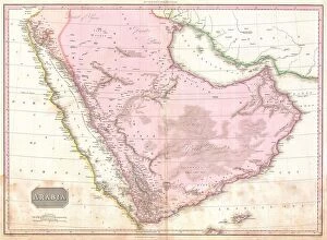
Background imageGeographical Collection: 1818 Pinkerton Map Of Arabia And The Persian Gulf

1818 Pinkerton Map Of Arabia And The Persian Gulf
1818, Pinkerton Map of Arabia and the Persian Gulf, John Pinkerton, 1758 - 1826, Scottish antiquarian, cartographer, UK

Background imageGeographical Collection: 1818 Pinkerton Map Of Chile John Pinkerton 1758 – 1826

1818 Pinkerton Map Of Chile John Pinkerton 1758 – 1826
1818, Pinkerton Map of Chile, John Pinkerton, 1758 - 1826, Scottish antiquarian, cartographer, UK

Background imageGeographical Collection: 1801 Cary Map Of China And Korea John Cary 1754 – 1835

1801 Cary Map Of China And Korea John Cary 1754 – 1835
1801, Cary Map of China and Korea, John Cary, 1754 - 1835, English cartographer

Background imageGeographical Collection: 1814 Thomson Map Of The English Channel John Thomson

1814 Thomson Map Of The English Channel John Thomson
1814, Thomson Map of the English Channel, John Thomson, 1777 - 1840, was a Scottish cartographer from Edinburgh, UK

Background imageGeographical Collection: 1814 Thomson Map Of Southern Ireland John Thomson

1814 Thomson Map Of Southern Ireland John Thomson
1814, Thomson Map of Southern Ireland, John Thomson, 1777 - 1840, was a Scottish cartographer from Edinburgh, UK

Background imageGeographical Collection: 1814 Thomson Map Of Northern India And Nepal

1814 Thomson Map Of Northern India And Nepal
1814, Thomson Map of Northern India and Nepal, John Thomson, 1777 - 1840, was a Scottish cartographer from Edinburgh, UK

Background imageGeographical Collection: 1814 Thomson Map Of India W-Ganges John Thomson

1814 Thomson Map Of India W-Ganges John Thomson
1814, Thomson Map of India w-Ganges, John Thomson, 1777 - 1840, was a Scottish cartographer from Edinburgh, UK

Background imageGeographical Collection: 1814 Thomson Map Of India John Thomson 1777 - 1840

1814 Thomson Map Of India John Thomson 1777 - 1840
1814, Thomson Map of India, John Thomson, 1777 - 1840, was a Scottish cartographer from Edinburgh, UK

Background imageGeographical Collection: 1808 Smith Map Of India Topography Cartography

1808 Smith Map Of India Topography Cartography
1808, Smith Map of India

Background imageGeographical Collection: 1806 Cary Map Of The United States East Of The Mississippi River

1806 Cary Map Of The United States East Of The Mississippi River
1806, Cary Map of the United States east of the Mississippi River, John Cary, 1754 - 1835, English cartographer

Background imageGeographical Collection: 1806 Cary Map Of Tartary Or Central Asia John Cary

1806 Cary Map Of Tartary Or Central Asia John Cary
1806, Cary Map of Tartary or Central Asia, John Cary, 1754 - 1835, English cartographer

Background imageGeographical Collection: 1805 Cary Map Of Egypt John Cary 1754 – 1835

1805 Cary Map Of Egypt John Cary 1754 – 1835
1805, Cary Map of Egypt, John Cary, 1754 - 1835, English cartographer

Background imageGeographical Collection: 1804 Jeffreys And Kitchin Map Of Ireland Topography

1804 Jeffreys And Kitchin Map Of Ireland Topography
1804, Jeffreys and Kitchin Map of Ireland

Background imageGeographical Collection: 1804 Cary Map Of Belgium And Luxembourg John Cary

1804 Cary Map Of Belgium And Luxembourg John Cary
1804, Cary Map of Belgium and Luxembourg, John Cary, 1754 - 1835, English cartographer

Background imageGeographical Collection: 1801 Cary Map Of The World On Mercator Projection

1801 Cary Map Of The World On Mercator Projection
1801, Cary Map of the World on Mercator Projection, John Cary, 1754 - 1835, English cartographer

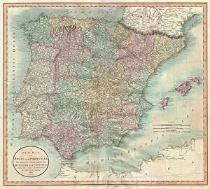
Background imageGeographical Collection: 1801 Cary Map Of Spain And Portugal John Cary

1801 Cary Map Of Spain And Portugal John Cary
1801, Cary Map of Spain and Portugal, John Cary, 1754 - 1835, English cartographer

Background imageGeographical Collection: 1801 Cary Map Of Portugal John Cary 1754 – 1835

1801 Cary Map Of Portugal John Cary 1754 – 1835
1801, Cary Map of Portugal, John Cary, 1754 - 1835, English cartographer

Background imageGeographical Collection: 1801 Cary Map Of Denmark John Cary 1754 – 1835

1801 Cary Map Of Denmark John Cary 1754 – 1835
1801, Cary Map of Denmark, John Cary, 1754 - 1835, English cartographer

Background imageGeographical Collection: 1814 Thomson Map Of France John Thomson 1777 - 1840

1814 Thomson Map Of France John Thomson 1777 - 1840
1814, Thomson Map of France, John Thomson, 1777 - 1840, was a Scottish cartographer from Edinburgh, UK

Background imageGeographical Collection: 1809 Pinkerton Map Of Southern Africa John Pinkerton

1809 Pinkerton Map Of Southern Africa John Pinkerton
1809, Pinkerton Map of Southern Africa, John Pinkerton, 1758 - 1826, Scottish antiquarian, cartographer, UK

Background imageGeographical Collection: 1815 Thomson Map Of Spain And Portugal John Thomson

1815 Thomson Map Of Spain And Portugal John Thomson
1815, Thomson Map of Spain and Portugal, John Thomson, 1777 - 1840, was a Scottish cartographer from Edinburgh, UK

Background imageGeographical Collection: 1814 Rizzi-Zannoni Map Of Italy Topography Cartography

1814 Rizzi-Zannoni Map Of Italy Topography Cartography
1814, Rizzi-Zannoni Map of Italy

Background imageGeographical Collection: 1807 Cary Map Of South America John Cary 1754 – 1835

1807 Cary Map Of South America John Cary 1754 – 1835
1807, Cary Map of South America, John Cary, 1754 - 1835, English cartographer

Background imageGeographical Collection: 1815 Thomson Map Of Southern Scotland John Thomson

1815 Thomson Map Of Southern Scotland John Thomson
1815, Thomson Map of Southern Scotland, John Thomson, 1777 - 1840, was a Scottish cartographer from Edinburgh, UK

Background imageGeographical Collection: 1814 Thomson Map Of North America John Thomson

1814 Thomson Map Of North America John Thomson
1814, Thomson Map of North America, John Thomson, 1777 - 1840, was a Scottish cartographer from Edinburgh, UK

Background imageGeographical Collection: 1814 Thomson Map Of Mexico And Texas John Thomson

1814 Thomson Map Of Mexico And Texas John Thomson
1814, Thomson Map of Mexico and Texas, John Thomson, 1777 - 1840, was a Scottish cartographer from Edinburgh, UK

Background imageGeographical Collection: 1814 Thomson Map Of North And South America John Thomson

1814 Thomson Map Of North And South America John Thomson
1814, Thomson Map of North and South America, John Thomson, 1777 - 1840, was a Scottish cartographer from Edinburgh, UK

Background imageGeographical Collection: 1811 Cary Map Of The Kingdom Of Portugal John Cary

1811 Cary Map Of The Kingdom Of Portugal John Cary
1811, Cary Map of the Kingdom of Portugal, John Cary, 1754 - 1835, English cartographer

Background imageGeographical Collection: 1806 Cary Map Of India Or Hindoostan John Cary

1806 Cary Map Of India Or Hindoostan John Cary
1806, Cary Map of India or Hindoostan, John Cary, 1754 - 1835, English cartographer

Background imageGeographical Collection: 1813 Thomson Map Of Africa John Thomson 1777 - 1840

1813 Thomson Map Of Africa John Thomson 1777 - 1840
1813, Thomson Map of Africa, John Thomson, 1777 - 1840, was a Scottish cartographer from Edinburgh, UK

Background imageGeographical Collection: 1809 Tardieu Map Of North America Topography

1809 Tardieu Map Of North America Topography
1809, Tardieu Map of North America

Background imageGeographical Collection: 1804 German Edition Of The Rennel Map Of India

1804 German Edition Of The Rennel Map Of India
1804, German Edition of the Rennel Map of India

Background imageGeographical Collection: 1814 Thomson Map Of The Atlantic Ocean John Thomson

1814 Thomson Map Of The Atlantic Ocean John Thomson
1814, Thomson Map of the Atlantic Ocean, John Thomson, 1777 - 1840, was a Scottish cartographer from Edinburgh, UK

Background imageGeographical Collection: 1799 Clement Cruttwell Map Of Europe Topography

1799 Clement Cruttwell Map Of Europe Topography
1799, Clement Cruttwell Map of Europe


All Professionally Made to Order for Quick Shipping

"Journey through Time and Space: Exploring the Geographical Evolution" Al-Idrisi's World Map, 1154: Unveiling ancient cartographic wisdom, this map showcases the Islamic scholar's remarkable understanding of global geography. Continental Drift after 250 Million Years: Witnessing Earth's transformative power, this concept reveals how tectonic plates shaped our continents over millions of years. Malham Cove, Yorkshire Dales: A geological marvel standing tall in the picturesque Yorkshire Dales, showcasing nature's artistic prowess carved by ice and water. British Empire World Map, 19th Century: Tracing the vast expanse of an empire on which the sun never set; a testament to Britain's once-global dominance. James Craig Map of New Town, Edinburgh, Scotland (1768): The birth of urban planning captured in ink; explore Edinburgh’s meticulously designed New Town with its unique topography. Anglo-Saxon 10th Century World Map: Delving into medieval perceptions of our planet; discover how early societies envisioned their place within a world still shrouded in mystery. Catalan Atlas, 14th Century: Marvel at one of history’s most exquisite maps as it unveils Europe’s expanding knowledge during the Middle Ages – a true masterpiece. UK at Night from Space: Behold Britain illuminated like never before. This awe-inspiring view from space captures the vibrant tapestry that is modern-day United Kingdom after sundown. Orteliuss Map of Ottoman Empire (1570): Step back into time and witness one man’s meticulous depiction of an empire that spanned three continents - revealing cultural diversity and grandeur. Europe at Night - Satellite Image & Europe at Night - Illuminating Boundaries : Gaze upon two contrasting images capturing Europe under different lights – highlighting both unity and division across nations 17th Century World Map.