Fraud Blocker Skip to main content

Geographical Collection (page 100)

"Journey through Time and Space: Exploring the Geographical Evolution" Al-Idrisi's World Map, 1154: Unveiling ancient cartographic wisdom

Background imageGeographical Collection: SPAIN. MALLORCA. Palma de Mallorca. Statue of
SPAIN. MALLORCA. Palma de Mallorca. Statue of Ramon Llull

Background imageGeographical Collection: Ceramics depicting the stages of life (3rd c

Ceramics depicting the stages of life (3rd c. AD). Engendering. Moche or Mochica Art. PERU. Sipᮮ Royal Tombs of Sipᮠ Museum

Background imageGeographical Collection: SPAIN. M鲩da. Roman Bridge on river Guadiana

SPAIN. M鲩da. Roman Bridge on river Guadiana
SPAIN. M鲩 da. Roman Bridge on river Guadiana

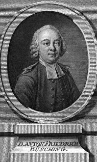
Background imageGeographical Collection: Anton F Busching

Anton F Busching
ANTON FRIEDRICH BUSCHING German geographical writer. Date: 1724 - 1793

Background imageGeographical Collection: Aranui Cave, Waitomo, King Country, North Island, New Zealand

Aranui Cave, Waitomo, King Country, North Island, New Zealand

Background imageGeographical Collection: Ruakuri Caves, Waitomo, King Country, North Island, New Zealand

Ruakuri Caves, Waitomo, King Country, North Island, New Zealand

Background imageGeographical Collection: Stalactite, Ruakuri Caves, Waitomo, King Country, North Island, New Zealand

Stalactite, Ruakuri Caves, Waitomo, King Country, North Island, New Zealand

Background imageGeographical Collection: Blue Lights, Ruakuri Caves, Waitomo, King Country, North Island, New Zealand

Blue Lights, Ruakuri Caves, Waitomo, King Country, North Island, New Zealand

Background imageGeographical Collection: Stalactites, Ruakuri Caves, Waitomo, King Country, North Island, New Zealand

Stalactites, Ruakuri Caves, Waitomo, King Country, North Island, New Zealand

Background imageGeographical Collection: Spiral Ramp into Ruakuri Caves, Waitomo, King Country, North Island, New Zealand

Spiral Ramp into Ruakuri Caves, Waitomo, King Country, North Island, New Zealand

Background imageGeographical Collection: Page of prospectus, Aeronautic Association

Page of prospectus, Aeronautic Association
Page of a prospectus promoting the purchase of shares in the balloon company, Aeronautic Association - For promoting geographical surveys of some of the remaining undiscovered tracts of the globe To

Background imageGeographical Collection: Large balloon image on a prospectus

Large balloon image on a prospectus
Large balloon image, part of a prospectus promoting the purchase of shares in the balloon company. Aeronautic Association - For promoting geographical surveys of some of the remaining undiscovered

Background imageGeographical Collection: Rambles through our country - an instructive geographical ga

Rambles through our country - an instructive geographical game for the young. Print showing a map of the United States as it appeared in 1890. Date c1890

Background imageGeographical Collection: Coltons geographical cards

Coltons geographical cards

Background imageGeographical Collection: Monument marking equator, Uganda

Monument marking equator, Uganda

Background imageGeographical Collection: Global wind patterns

Global wind patterns. Historical illustration of global air circulation, 1855. This model was designed by Matthew Fonataine Maury (1806-1873), a US naval lieutenant who was also an oceanographer

Background imageGeographical Collection: Marsh light

Marsh light, historical artwork. Also known as a will o the wisp, ignis fatuus, and corpse candle, a marsh light is a pale light seen in marshes and bogs

Background imageGeographical Collection: California Gold Rush, 19th century

California Gold Rush, 19th century
California Gold Rush. Picture of Sutters Mill, taken in 1850, with James Wilson Marshall (1810-1885) in the foreground. Sutters Mill was located on the South Fork of the American River in Coloma

Background imageGeographical Collection: Swarm of locusts

Swarm of locusts. Coloured historical artwork of a farmer attempting to ward a large swarm of locusts away from his crops

Background imageGeographical Collection: Early weather satellite images

Early weather satellite images of Europe. These images are from the TIROS (Television and Infrared Observation Satellite) programme (1960-1966), and the Nimbus satellites (1964-1978)

Background imageGeographical Collection: Global thought, conceptual artwork

Global thought, conceptual artwork
Global thought. Conceptual computer artwork of a man sitting on a human brain in front of a globe of the Earth. This could represent humans thinking about global issues such as global warming

Background imageGeographical Collection: Sea kayaking, Hawaii

Sea kayaking, Hawaii
MODEL RELEASED. Sea kayaking. The steam rising in the distance was caused by the lava flow from Kilauea volcano pouring into the sea. Photographed off Hawaii Volcanoes National Park, Hawaii, USA

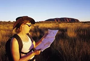
Background imageGeographical Collection: Tourist at Uluru

Tourist at Uluru
MODEL RELEASED. Tourist at Uluru (Ayers Rock), Australia. Female tourist using a map in the Australian outback. The large outcrop of rock on the horizon (upper right)

Background imageGeographical Collection: Drinking from a stream

Drinking from a stream
MODEL RELEASED. Drinking from a stream. Man using a cup to drink water from a glacial stream. There are many diseases that can be transmitted through contaminated water

Background imageGeographical Collection: Sandown Park racecourse, Surrey, UK

Sandown Park racecourse, Surrey, UK
Sandown Park racecourse. Aerial photograph of Sandown Park (centre left), racecourse and leisure venue, Surrey, UK. As well as holding races most weekends, this course hosts the Eclipse Stakes

Background imageGeographical Collection: Sunset, South Africa

Sunset, South Africa
Sunset over a small island in the middle of a inland water body (vlei). The island provides shelter and protection for waterbirds. Photographed at De Hoop Nature Reserve, South Africa

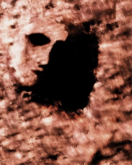
Background imageGeographical Collection: Face on Mars

Face on Mars. Computer artwork of the Face on Mars feature. This eroded mesa-like land formation, located in the Cydonia region of Mars, is 1.5 kilometres across

Background imageGeographical Collection: Tropical sunset

Tropical sunset. Sun setting through clouds over the sea and tropical islands. Two people are seen in the rays of the setting sun on a narrow spit of land rising out of the sea

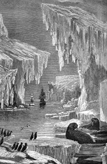
Background imageGeographical Collection: Arctic exploration, 19th century

Arctic exploration, 19th century
Arctic exploration. 19th century artwork of two ships exploring the Arctic. The most famous 19th century expedition to the Arctic was led in 1845 by the British naval captain Sir John Franklin on HMS

Background imageGeographical Collection: Chelyuskin steamship, Arkhangelsk, 1933

Chelyuskin steamship, Arkhangelsk, 1933
Chelyuskin steamship leaving Arkhangelsk port in Russia, in 1933. This Soviet exploration ship later got stuck in Arctic ice

Background imageGeographical Collection: Aeroplane contrail against the Moon

Aeroplane contrail against the Moon. Aeroplane, at a height of 10 kilometres, producing a contrail. Contrails are artificial clouds formed from frozen water droplets from the exhaust of the engines

Background imageGeographical Collection: Ecofriendly shopping, artwork

Ecofriendly shopping, artwork
Ecofriendly shopping. Conceptual computer artwork of green shopping trollies, depicting shopping methods that have a reduced impact on the environment

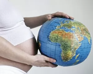
Background imageGeographical Collection: Population growth

Population growth
MODEL RELEASED. Population growth. Pregnant woman holding an inflated globe

Background imageGeographical Collection: Rescue of Soviet Arctic expedition, 1938

Rescue of Soviet Arctic expedition, 1938
Rescue of Soviet Arctic expedition. Members of the first Soviet drifting station " North Pole-1", in 1938, being rescued from their ice floe in the Arctic, which had started to break up

Background imageGeographical Collection: The Geographer, 17th century artwork

The Geographer, 17th century artwork by the Dutch painter Johannes Vermeer (1632-1675). This artwork was finished in 1669, and forms a pair with The Astronomer (V700/157), also by Vermeer

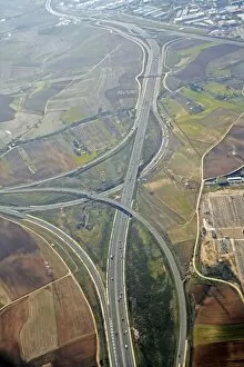
Background imageGeographical Collection: N1 Motorway, Madrid, Spain

N1 Motorway, Madrid, Spain. This motorway is situated outside Madrid and connects Madrid to northern Spain

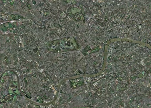
Background imageGeographical Collection: Enlarged congestion charging zone, London

Enlarged congestion charging zone, London
Enlarged congestion charging zone, central London, England. The congestion charge zone was introduced on 17th February 2003 as a way to raise funds for improvements in Londons public transport

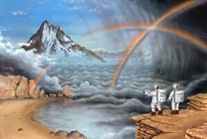
Background imageGeographical Collection: Alien planet exploration, artwork

Alien planet exploration, artwork
Alien planet exploration. Artwork of astronauts on a cliff edge observing two rainbows formed during a storm on an alien planet

Background imageGeographical Collection: Martian dunes, Endurance Crater

Martian dunes, Endurance Crater
Martian dunes. Sand dunes in Endurance Crater on Mars, coloured image. Dunes such as these cover much of the surface of Mars, so information gained about this one set may be applicable elsewhere

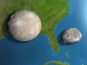
Background imageGeographical Collection: Asteroids Ceres and Vesta, scale artwork

Asteroids Ceres and Vesta, scale artwork
Asteroids Ceres and Vesta, computer scale artwork. The asteroids (Ceres is the larger one) are seen against the south-eastern USA for scale. Florida is between them

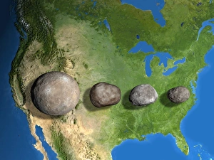
Background imageGeographical Collection: Four largest asteroids, scale artwork

Four largest asteroids, scale artwork
Four largest asteroids, computer scale artwork. The asteroids are seen against North America for scale. From left, from largest to smallest, they are: Ceres, Vesta, Pallas, and Hygiea

Background imageGeographical Collection: Moon internal structure

Moon internal structure, computer artwork. The Moon has a diameter of 3476 kilometres. It has a crust overlying a thick mantle layer, and a small solid core. The Moon is geologically dead

Background imageGeographical Collection: Search for extraterrestrial intelligence

Search for extraterrestrial intelligence. Message in a bottle, washed up on a beach, beneath a nebula and stars. The message asks whether there is " Anyone there

Background imageGeographical Collection: Otto Schmidt, Soviet geophysicist

Otto Schmidt, Soviet geophysicist
Otto Yulievich Schmidt (1891-1956), Soviet geophysicist and polar explorer. Schmidt is famous for his explorations of the Arctic

Background imageGeographical Collection: Aleksei Treshnikov, Arctic explorer

Aleksei Treshnikov, Arctic explorer
Aleksei Treshnikov (right, 1914-1991), Soviet Arctic explorer, with a companion in the Arctic. In his youth, Treshnikov participated in a Soviet expedition to the North Pole (1948)

Background imageGeographical Collection: Globe

Globe in a school classroom

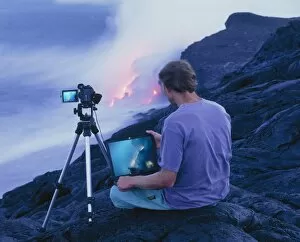
Background imageGeographical Collection: Man taking photographs of a lava flow

Man taking photographs of a lava flow
MODEL RELEASED. Man taking photographs of a lava flow from Kilauea volcano as it enters the sea. He has the camera connected to a laptop to get a more detailed view of the lava flow

Background imageGeographical Collection: Paolo Savi, Italian geologist

Paolo Savi, Italian geologist
Paolo Savi (1798-1871), Italian geologist and ornithologist. Paolo Savi, who was born in Pisa, was regarded as the father of Italian geology


All Professionally Made to Order for Quick Shipping

"Journey through Time and Space: Exploring the Geographical Evolution" Al-Idrisi's World Map, 1154: Unveiling ancient cartographic wisdom, this map showcases the Islamic scholar's remarkable understanding of global geography. Continental Drift after 250 Million Years: Witnessing Earth's transformative power, this concept reveals how tectonic plates shaped our continents over millions of years. Malham Cove, Yorkshire Dales: A geological marvel standing tall in the picturesque Yorkshire Dales, showcasing nature's artistic prowess carved by ice and water. British Empire World Map, 19th Century: Tracing the vast expanse of an empire on which the sun never set; a testament to Britain's once-global dominance. James Craig Map of New Town, Edinburgh, Scotland (1768): The birth of urban planning captured in ink; explore Edinburgh’s meticulously designed New Town with its unique topography. Anglo-Saxon 10th Century World Map: Delving into medieval perceptions of our planet; discover how early societies envisioned their place within a world still shrouded in mystery. Catalan Atlas, 14th Century: Marvel at one of history’s most exquisite maps as it unveils Europe’s expanding knowledge during the Middle Ages – a true masterpiece. UK at Night from Space: Behold Britain illuminated like never before. This awe-inspiring view from space captures the vibrant tapestry that is modern-day United Kingdom after sundown. Orteliuss Map of Ottoman Empire (1570): Step back into time and witness one man’s meticulous depiction of an empire that spanned three continents - revealing cultural diversity and grandeur. Europe at Night - Satellite Image & Europe at Night - Illuminating Boundaries : Gaze upon two contrasting images capturing Europe under different lights – highlighting both unity and division across nations 17th Century World Map.