Fraud Blocker Skip to main content

Frontiers Collection

"Exploring Frontiers: From Scotland to the Middle East, a Journey Through Time" Embarking on a captivating journey through history and geography

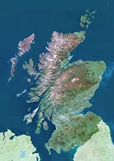
Background imageFrontiers Collection: Scotland, UK, satellite image

Scotland, UK, satellite image
Scotland, UK. North is at top. Natural colour satellite image showing Scotland in the United Kingdom, with the surrounding territories shaded out

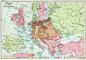
Background imageFrontiers Collection: Map of Europe after the Peace of Tilsit in 1807, from A Short History of the

Map of Europe after the Peace of Tilsit in 1807, from A Short History of the
KW392529 Map of Europe after the Peace of Tilsit in 1807, from A Short History of the English People by J. R. Green, published 1893 (colour litho) by English School

Background imageFrontiers Collection: Middle East, satellite image

Middle East, satellite image
Middle East. North is at top. Satellite image of the Middle East, showing the borders (white lines) of the countries. The Middle East is a Eurocentric term used to describe a region that roughly

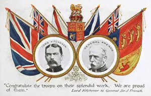
Background imageFrontiers Collection: Congratulations from Lord Kitchener to Sir John French

Congratulations from Lord Kitchener to Sir John French
Postcard detailing the congratulations sent from Lord Kitchener to General Sir John French on August 25th 1914, at the very start of the First World War

Background imageFrontiers Collection: The War Map of Western Europe showings the entire zone of military operations in the Western

The War Map of Western Europe showings the entire zone of military operations in the Western campaign (litho)
3252857 The War Map of Western Europe showings the entire zone of military operations in the Western campaign (litho); Private Collection; (add.info.: The War Map of Western Europe)

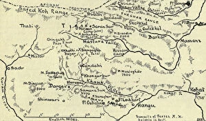
Background imageFrontiers Collection: Map of the Tirah Campaign, c1900. Creator: Unknown

Map of the Tirah Campaign, c1900. Creator: Unknown
Map of the Tirah Campaign, c1900. The Tirah expedition was an Indian frontier campaign from September 1897 to April 1898. Tirah is a mountainous tract of country in what was formally known as

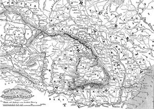
Background imageFrontiers Collection: Map of the Frontiers of Austria & Russia, 1856. Creator: Unknown

Map of the Frontiers of Austria & Russia, 1856. Creator: Unknown. Map of the Frontiers of Austria & Russia, 1856
Map of the Frontiers of Austria & Russia, 1856. Map showing the area involved in the Crimean War: Black Sea, Transylvania, Hungary, Poland, Turkey, Odessa, Kiev, Bessarabia, Galicia

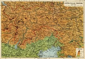
Background imageFrontiers Collection: Map of the Austro-Italian frontier, First World War, (c1920). Creator: John Bartholomew & Son

Map of the Austro-Italian frontier, First World War, (c1920). Creator: John Bartholomew & Son
Map of the Austro-Italian frontier, First World War, (c1920). Mountainous area between Salzburg, Trieste and Cremona, showing the Tyrol

Background imageFrontiers Collection: In Majorca

In Majorca
Critics write books about nationality in art. But art itself knows no frontiers. here we have a Swedish artist painting in Majorca and his work speaks its full message to English eyes

Background imageFrontiers Collection: The National Peoples Army guarantees the inviolability of the German Democratic Republics

The National Peoples Army guarantees the inviolability of the German Democratic Republics territory... (colour photo)
3638422 The National Peoples Army guarantees the inviolability of the German Democratic Republics territory.... (colour photo) by German Photographer (20th Century); Private Collection; (add.info)

Background imageFrontiers Collection: PanGermanic and AntiGermanic plans for the division of Europe after the Great War of 1914

PanGermanic and AntiGermanic plans for the division of Europe after the Great War of 1914
CHT411553 PanGermanic and AntiGermanic plans for the division of Europe after the Great War of 1914, c.1917 (colour litho) by Czech School

Background imageFrontiers Collection: The Buffalora Bridge across the Ticino, on the Frontiers of Piedmont and Lombardy (engraving)

The Buffalora Bridge across the Ticino, on the Frontiers of Piedmont and Lombardy (engraving)
2771911 The Buffalora Bridge across the Ticino, on the Frontiers of Piedmont and Lombardy (engraving) by English School, (19th century); Private Collection; (add.info)

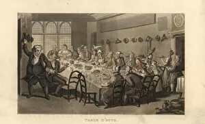
Background imageFrontiers Collection: Travellers dining at a restaurant in a French inn, 18thC

Travellers dining at a restaurant in a French inn, 18thC
Travellers dining at a restaurant in a French inn, late 18th century. Table d hote. Handcoloured copperplate engraving after an illustration by Thomas Rowlandson from Journal of Sentimental Travels

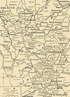
Background imageFrontiers Collection: Map of Luxemburg and the Frontiers of France and Germany (engraving)

Map of Luxemburg and the Frontiers of France and Germany (engraving)
1611062 Map of Luxemburg and the Frontiers of France and Germany (engraving) by English School, (19th century); Private Collection; (add.info)

Background imageFrontiers Collection: Map of the Frontiers of Austria and Russia (engraving)

Map of the Frontiers of Austria and Russia (engraving)
1608523 Map of the Frontiers of Austria and Russia (engraving) by English School, (19th century); Private Collection; (add.info.: Map of the Frontiers of Austria and Russia)

Background imageFrontiers Collection: The Serallo, and Boundary-Stone dividing the Spanish Territory from Morocco (engraving)

The Serallo, and Boundary-Stone dividing the Spanish Territory from Morocco (engraving)
2772805 The Serallo, and Boundary-Stone dividing the Spanish Territory from Morocco (engraving) by English School, (19th century); Private Collection; (add.info.: The Serallo)

Background imageFrontiers Collection: Protected by secure frontiers, the construction of the GDR capital is going on (b / w photo)

Protected by secure frontiers, the construction of the GDR capital is going on (b / w photo)
3638393 Protected by secure frontiers, the construction of the GDR capital is going on (b/w photo) by German Photographer (20th Century); Private Collection; (add.info)

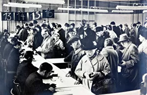
Background imageFrontiers Collection: East German citizens queuing to obtain permits to visit relatives in the West (b / w photo)

East German citizens queuing to obtain permits to visit relatives in the West (b / w photo)
6029800 East German citizens queuing to obtain permits to visit relatives in the West (b/w photo) by German Photographer (20th Century); Private Collection; (add.info)

Background imageFrontiers Collection: Afghanistan and its Surroundings, showing the Frontiers of Russia and British India (engraving)

Afghanistan and its Surroundings, showing the Frontiers of Russia and British India (engraving)
1059908 Afghanistan and its Surroundings, showing the Frontiers of Russia and British India (engraving) by English School

Background imageFrontiers Collection: Together with the Baltic Red Banner Fleet and the Polish Navy the Peoples Navy of the National

Together with the Baltic Red Banner Fleet and the Polish Navy the Peoples Navy of the National Peoples Army
3638424 Together with the Baltic Red Banner Fleet and the Polish Navy the Peoples Navy of the National Peoples Army.... (colour photo) by German Photographer (20th Century)

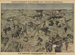
Background imageFrontiers Collection: Grand Couronne of Nancy (colour litho)

Grand Couronne of Nancy (colour litho)
729496 Grand Couronne of Nancy (colour litho) by Bombled, Louis Charles (1862-1927) (after); Private Collection; (add.info.: Grand Couronne of Nancy - panoramic view. Illustration by Louis Blombled)

Background imageFrontiers Collection: Monte Bianco from the Italian side of the Mont Blanc Tunnel on the France Italy Border in

Monte Bianco from the Italian side of the Mont Blanc Tunnel on the France Italy Border in the Alps August 1998

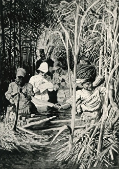
Background imageFrontiers Collection: AFRICA / EXPLORATION / CONGO

AFRICA / EXPLORATION / CONGO
Cutting through the jungle with a machete in the swamps of the Lobaye, the French and Germans establish frontiers in the Congo. Date: 1913

Background imageFrontiers Collection: German & Austrian Frontiers with Russia, First World War, (c1920). Creator: Unknown

German & Austrian Frontiers with Russia, First World War, (c1920). Creator: Unknown
German & Austrian Frontiers with Russia, First World War, (c1920). Map of eastern Europe and the Baltic coast. From "The Great World War: A History", Volume VII, edited by Frank A Mumby

Background imageFrontiers Collection: Map showing the border between France and Germany, First World War, c1915, (c1920)

Map showing the border between France and Germany, First World War, c1915, (c1920). The Franco-German Frontier, disputed territory

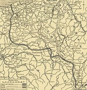
Background imageFrontiers Collection: Belgian, British and French positions, First World War, 1915, (c1920). Creator: Unknown

Belgian, British and French positions, First World War, 1915, (c1920). Creator: Unknown
Belgian, British and French positions, First World War, 1915, (c1920). " Joffres Wall" : the Allies line in France and Belgium at the beginning of February

Background imageFrontiers Collection: East-European Theatre of War, 1914-1918, (c1920). Creator: John Bartholomew & Son

East-European Theatre of War, 1914-1918, (c1920). Creator: John Bartholomew & Son
East-European Theatre of War, 1914-1918, (c1920). Map of Eastern Europe during the First World War, showing parts of Germany, Russia and Austria-Hungary

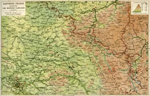
Background imageFrontiers Collection: Northern France Illustrating the Western Campaign, 1914, (c1920)

Northern France Illustrating the Western Campaign, 1914, (c1920). Map of northern France, Belgium and Luxembourg, at the start of the First World War

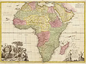
Background imageFrontiers Collection: Africa circa 1725 from Modern Geography

Africa circa 1725 from Modern Geography. Drawn and engraved by John Senex. The map shows boundaries of kingdoms and tribal areas on the continent as they were assumed to be in the early 18th century

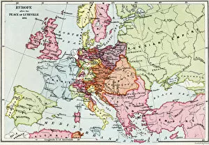
Background imageFrontiers Collection: Map of Europe after the Peace of Luneville, 1801, from A Short History of the

Map of Europe after the Peace of Luneville, 1801, from A Short History of the
KW392528 Map of Europe after the Peace of Luneville, 1801, from A Short History of the English People by J. R. Green, published 1893 (colour litho) by English School

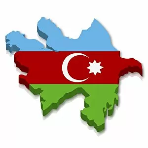
Background imageFrontiers Collection: Shape and national flag of Azerbaijan, 3D computer graphics

Shape and national flag of Azerbaijan, 3D computer graphics

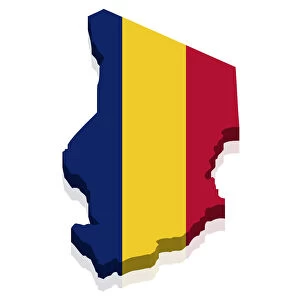
Background imageFrontiers Collection: Shape and national flag of the Republic of Chad, 3D computer graphics

Shape and national flag of the Republic of Chad, 3D computer graphics

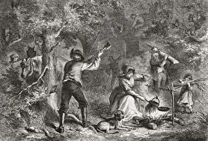
Background imageFrontiers Collection: Border settlers in Ohio. Settlers on the American frontier in the 19th century

Border settlers in Ohio. Settlers on the American frontier in the 19th century. After an 1876 work by Felix Darley

Background imageFrontiers Collection: Colonial Africa. Delimitation of the new Franco-German

Colonial Africa. Delimitation of the new Franco-German borders in Congo. Commissioners of both countries in the swampy jungle of the Lobaye Valley, actual Central African Republic

Background imageFrontiers Collection: Times War Atlas - WWI maps

Times War Atlas - WWI maps
The Times War Atlas. The atlas contains the following loose maps - 1) Map of the North Sea. 2) Map of the frontiers of France. 3) Map of the North Eastern Theatre of War. 4) Map of the Balkans

Background imageFrontiers Collection: Shape and national flag of Croatia, 3D computer graphics

Shape and national flag of Croatia, 3D computer graphics

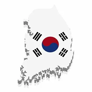
Background imageFrontiers Collection: Shape and national flag of South Korea, 3D computer graphics

Shape and national flag of South Korea, 3D computer graphics

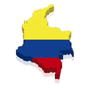
Background imageFrontiers Collection: Shape and national flag of Colombia, 3D computer graphics

Shape and national flag of Colombia, 3D computer graphics

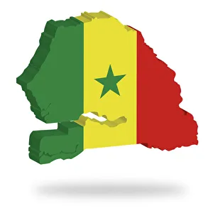
Background imageFrontiers Collection: Shape and national flag of Senegal, levitating, 3D computer graphics

Shape and national flag of Senegal, levitating, 3D computer graphics

Background imageFrontiers Collection: DR Congo, satellite image

DR Congo, satellite image
DR Congo. North is at top. Satellite image of the Democratic Republic of the Congo (DRC) in Central Africa, with the surrounding countries shaded out

Background imageFrontiers Collection: George Rogers Clark

George Rogers Clark
GEORGE ROGERS CLARK American military, active on the frontiers of civilisation against the Native Americans, British and suchlike lesser breeds. Date: 1752 - 1818

Background imageFrontiers Collection: Austrians V Russians

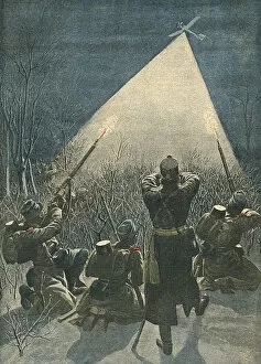
Austrians V Russians
On the frontiers of Galicia, Austrians fire on Russian reconnaissance flights - an early example of anti-aircraft defences in action ! Date: January 1913

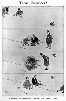
Background imageFrontiers Collection: Those Frontiers by William Heath Robinson, post WW1

Those Frontiers by William Heath Robinson, post WW1
A little disagreement as to the exact line. Two men bicker over a line of territory, have a scrap and then see that while they have been fighting

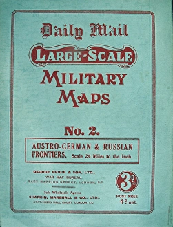
Background imageFrontiers Collection: Two foldout Daily Mail Military Maps Numbers - WWI era

Two foldout Daily Mail Military Maps Numbers - WWI era
Two foldout Daily Mail Military Maps Numbers 1 and 2. No. 1 - The Franco-Belgian & German Frontiers, Scale 12 Miles to the Inch. No. 2 - Austro-German & Russian Frontiers, Scale 24 Miles to the Inch

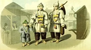
Background imageFrontiers Collection: Narrative of a Pedestrian Journey through Russia and Siberian Tartary, from the frontiers

Narrative of a Pedestrian Journey through Russia and Siberian Tartary, from the frontiers of China to the Frozen Sea and Kamtchatka, performed during the years 1820, 1821, 1822, and 1823

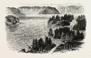
Background imageFrontiers Collection: St. Johns River, Frontiers of New Brunswick and Maine, North America, Us, USA

St. Johns River, Frontiers of New Brunswick and Maine, North America, Us, USA
St. Johns River, Frontiers of New Brunswick and Maine, North America, Us, Usa, 1870S Engraving

Background imageFrontiers Collection: Fort Chambly, Frontiers of Canada and the United States, Us, Usa, 1870S Engraving

Fort Chambly, Frontiers of Canada and the United States, Us, Usa, 1870S Engraving

Background imageFrontiers Collection: VIEW ON THE FRONTIERS OF CANADA, 1870s engraving

VIEW ON THE FRONTIERS OF CANADA, 1870s engraving


All Professionally Made to Order for Quick Shipping

"Exploring Frontiers: From Scotland to the Middle East, a Journey Through Time" Embarking on a captivating journey through history and geography, we delve into the concept of frontiers. Starting in Scotland, UK, our satellite image reveals breathtaking landscapes that have witnessed countless tales of exploration and conquest. Tracing back to 1807, we uncover a map depicting Europe after the Peace of Tilsit. This pivotal moment shaped new frontiers and reshaped nations across the continent. Moving further eastward, another satellite image showcases the ever-evolving landscape of the Middle East – an intricate web of cultural diversity and historical significance. Amidst these frontiers lie moments worth celebrating. Lord Kitchener's congratulations to Sir John French symbolize triumphs achieved amidst challenging circumstances. Meanwhile, Majorca offers a serene escape where frontiers blur as travelers immerse themselves in its beauty. The First World War brought about significant changes along Austro-Italian frontier lines. A map from around 1920 illustrates this transformation - borders redrawn as consequences unfolded. Colonial Africa also experienced frontier delimitation between France and Germany; boundaries that left lasting imprints on African nations' destinies. In post-war Europe, PanGermanic and AntiGermanic plans for division emerged – visions that would shape future frontiers yet again. The Buffalora Bridge spanning Ticino River stands as both a physical connection between Piedmont and Lombardy but also as a metaphorical bridge connecting diverse cultures across their respective frontiers. Stepping back in time to 18th century France brings us to an inn where travelers dine together at a restaurant - transcending language barriers while embracing shared experiences across national frontiers. Lastly, Luxemburg's engraving presents us with an intriguing perspective on how France and Germany's intertwined histories influenced their respective territories' delicate balance along their common frontier lines. Frontier exploration is not merely about geographical boundaries; it encompasses the human spirit's relentless pursuit of knowledge, connection, and understanding.