Home > Maps and Charts > World
Two foldout Daily Mail Military Maps Numbers - WWI era

![]()
Wall Art and Photo Gifts from Mary Evans Picture Library
Two foldout Daily Mail Military Maps Numbers - WWI era
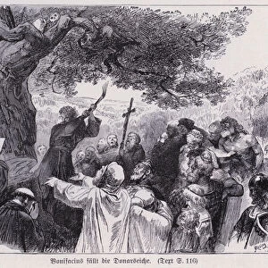
Two foldout Daily Mail Military Maps Numbers 1 and 2. No. 1 - The Franco-Belgian & German Frontiers, Scale 12 Miles to the Inch. No. 2 - Austro-German & Russian Frontiers, Scale 24 Miles to the Inch. Book
Mary Evans Picture Library makes available wonderful images created for people to enjoy over the centuries
Media ID 14154156
© David Cohen Fine Art/Mary Evans Picture Library
Austro Belgian Daily Foldout Franco Frontiers Inch Mail Maps Miles Numbers Scale
FEATURES IN THESE COLLECTIONS
> Maps and Charts
> Early Maps
> Maps and Charts
> World
EDITORS COMMENTS
This pair of vintage foldout military maps, hailing from the tumultuous era of World War I, showcases the intricate details of the Franco-Belgian and German frontiers on Map No. 1 (left), and the Austro-German and Russian frontiers on Map No. 2 (right). These meticulously crafted maps, published by the Daily Mail, were essential tools for understanding the complex geopolitical landscape of Europe during the First World War. Measuring 12 miles to the inch on Map No. 1 and 24 miles to the inch on Map No. 2, these detailed illustrations offer an unprecedented glimpse into the intricacies of the battlefields and territories involved in the conflict. The Franco-Belgian and German frontiers map highlights the strategic locations of key military installations, towns, and rivers that marked the border between the opposing forces. Meanwhile, the Austro-German and Russian frontiers map reveals the vast expanses of Eastern Europe, where the Central Powers and the Allied forces clashed. These historical maps not only provide valuable insights into the military strategies and territorial disputes that fueled the Great War but also serve as a poignant reminder of the human cost of conflict. The intricate lines and labels, carefully etched onto the paper, stand as a testament to the meticulous planning and dedication that went into creating these invaluable resources during a time of uncertainty and change. As you unfold these beautifully preserved maps, you are transported back to a time when the world was on the brink of transformation. The intricate details and historical significance of these maps make them an essential addition to any collection focused on World War I, military history, or cartography.
MADE IN THE UK
Safe Shipping with 30 Day Money Back Guarantee
FREE PERSONALISATION*
We are proud to offer a range of customisation features including Personalised Captions, Color Filters and Picture Zoom Tools
SECURE PAYMENTS
We happily accept a wide range of payment options so you can pay for the things you need in the way that is most convenient for you
* Options may vary by product and licensing agreement. Zoomed Pictures can be adjusted in the Basket.