Fraud Blocker Skip to main content

Exploration Collection (page 3)

"Unveiling the Unknown: A Journey through Time and Terrain" Embarking on a voyage of discovery, the HMS Erebus and HMS Terror set sail in 1845

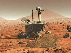
Background imageExploration Collection: Mars Spirit rover

Mars Spirit rover. Computer illustration of the Spirit rover on the surface of Mars. This is one of two identical rovers sent to Mars in 2003

Background imageExploration Collection: Curiosity rover on Mars, artwork

Curiosity rover on Mars, artwork

Background imageExploration Collection: 16th century world map

16th century world map made by Pierre Desceliers in 1546 on a commission by King Francis I for Henri II of France. Most noticeable is that the Northern hemisphere is upside-down

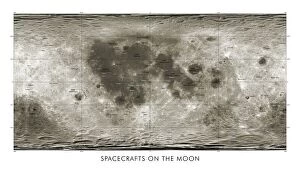
Background imageExploration Collection: Spacecraft on the Moon, lunar map

Spacecraft on the Moon, lunar map
Spacecraft on the Moon. Map showing coloured markers for 34 spacecraft that impacted or landed on the Moon from the 1960s onwards

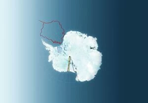
Background imageExploration Collection: Antarctic exploration, route maps

Antarctic exploration, route maps
Antarctic exploration. Map of Antarctica showing the routes taken by Ernest Shackleton (1914 to 1916, red), Roald Amundsen (1911 to 1912, brown), Robert Scott (1911 to 1912)

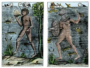
Background imageExploration Collection: Undersea exploration in 16th-century Europe

Undersea exploration in 16th-century Europe
Underwater diver and man-at-arms, France, 1532. Hand-colored woodcut of a 19th century illustration

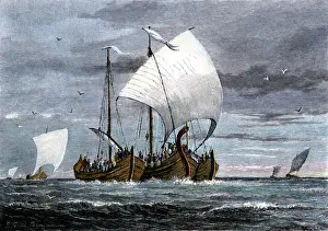
Background imageExploration Collection: Fleet of Viking raiders in the Middle Ages

Fleet of Viking raiders in the Middle Ages
Viking ships at sea with warriors on board. Hand-colored woodcut of a 19th-century illustration

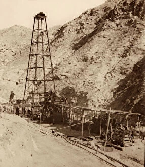
Background imageExploration Collection: Oil Well at Chillingar

Oil Well at Chillingar, Iran. One of Irans largest oil fields, Chilingar was named after George V. Chilingar, one of the best-known petroleum geologists in the world

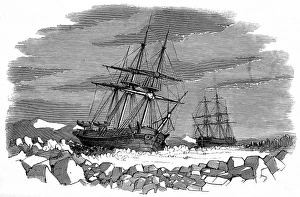
Background imageExploration Collection: The Enterprise and Investigator surrounded by ice, Barro

The Enterprise and Investigator surrounded by ice, Barro
Engraving showing the Enterprise and Investigator surrounded by pack ice in Barrows Straits, September 1849. These two ships were used by Sir James Clark Rosss Expedition of 1848-1849 to search

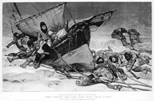
Background imageExploration Collection: The End of Sir John Franklins Arctic Expedition, 1845

The End of Sir John Franklins Arctic Expedition, 1845
Engraving showing the end of Sir John Franklins ill-fated Arctic expedition of 1845, entitled They Forged the last link with their lives. This engraving was taken from a painting by W

Background imageExploration Collection: Franklins expedition seeking Northwest Passage

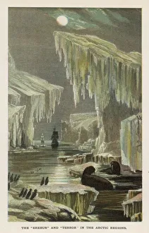
Franklins expedition seeking Northwest Passage
Seals and sea-birds watch as Sir John Franklins Erebus and Terror sail cautiously between Arctic icebergs

Background imageExploration Collection: Canoeing on the Louse River, Boundary Waters Canoe Area Wilderness, Superior National Forest

Canoeing on the Louse River, Boundary Waters Canoe Area Wilderness, Superior National Forest, Minnesota, United States of America, North America

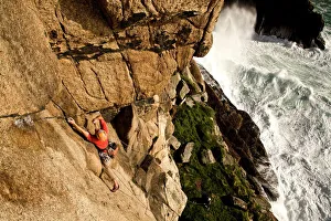
Background imageExploration Collection: A climber on the classic extreme route Raven Wall on the cliffs at Bosigran, near St

A climber on the classic extreme route Raven Wall on the cliffs at Bosigran, near St. Just, West Penwith, Cornwall, England, United Kingdom, Europe

Background imageExploration Collection: Map of Europe, 1700

Map of Europe, 1700
17th century map of Europe. Published in 1700, this map by the Dutch cartographer Frederick de Witt (1630-1706) shows the latest knowledge of the geography of Europe

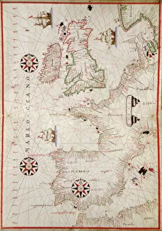
Background imageExploration Collection: Map of Western Europe, 1590

Map of Western Europe, 1590
16th century map of Western Europe. Published around 1590, this map shows the coasts of Western Europe and the Mediterranean

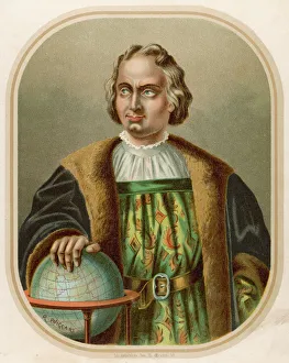
Background imageExploration Collection: Christopher Columbus, Italian navigator and explorer

Christopher Columbus, Italian navigator and explorer
Christopher Columbus, Italian navigator, coloniser and explorer on behalf of Spain. He undertook four voyages of exploration, first reaching the American continent in 1492

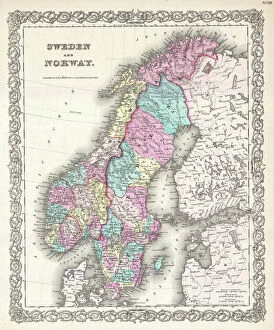
Background imageExploration Collection: 1855, Colton Map of Scandinavia, Norway, Sweden, Finland, topography, cartography

1855, Colton Map of Scandinavia, Norway, Sweden, Finland, topography, cartography
1855, Colton Map of Scandinavia, Norway, Sweden, Finland

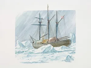
Background imageExploration Collection: Fridtjof Nansens 1893 ship the Fram frozen into ice

Fridtjof Nansens 1893 ship the Fram frozen into ice

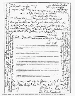
Background imageExploration Collection: Last record, dated 1847 and 1848, of Sir John Franklins expedition in search of the Northwest

Last record, dated 1847 and 1848, of Sir John Franklins expedition in search of the Northwest passage, found in 1859
FRANKLIN EXPEDITION, 1848. Last record, dated 1847 and 1848, of Sir John Franklins expedition in search of the Northwest passage, found in 1859

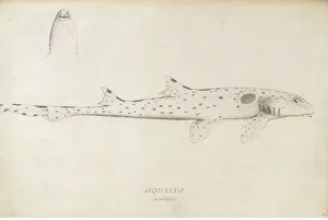
Background imageExploration Collection: Hemiscyllium ocellatum, epaulette shark

Hemiscyllium ocellatum, epaulette shark
Ff. 56. Pencil sketch by Herman Dietrich Sporing made during Captain James Cooks first voyage to explore the southern continent 1768-1771

Background imageExploration Collection: Nimrod in the Ice

Nimrod in the Ice
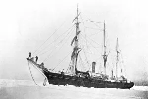
Shackletons ship Nimrod held up in the pack ice. Date: circa 1907

Background imageExploration Collection: 17th century map of the New World

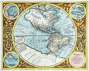
17th century map of the New World

Background imageExploration Collection: Buran space shuttle landing

Buran space shuttle landing
The Buran orbiter landing at the Baikonur space center

Background imageExploration Collection: Darwins Beagle Voyage Map South America

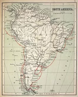
Darwins Beagle Voyage Map South America
Map of South America with Voyage of the Beagle coloured in red. Appendix from " The Voyage of HMS Beagle" (Cover Title) by Charles Darwin, New Edition 1890 John Murray publishers

Background imageExploration Collection: Scott of the Antarctic and his predecessors

Scott of the Antarctic and his predecessors
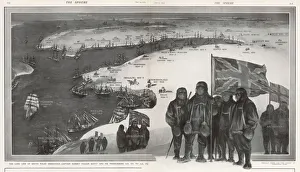
Illustration showing Captain Scott with his team flying the Union Jack flag, along with the names of previous polar explorers with the chronology traced back over a map of Antarctica

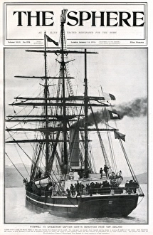
Background imageExploration Collection: Terra Nova on front cover of The Sphere

Terra Nova on front cover of The Sphere
Farewell to civilisation - Captain Scott and his team pictured departing New Zealand in the Terra Nova, bound for Antarctica in December 1910 in their bid to become the first to reach the South Pole

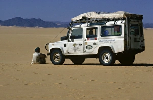
Background imageExploration Collection: Expedition vehicle in the Tenere region of the central Sahara

Expedition vehicle in the Tenere region of the central Sahara

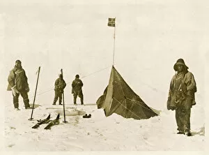
Background imageExploration Collection: Scott at Amundsens Tent

Scott at Amundsens Tent
Scotts team arrive at the South Pole to find that Amundsens crew have beaten them to it; frozen and demoralised, they perished weeks later

Background imageExploration Collection: Captain Oates 1912

Captain Oates 1912
LAWRENCE EDWARD GRACE OATES Member of Captain Scotts expedition which reached the South Pole in January 1912; lost his life in a blizzard on the return trip

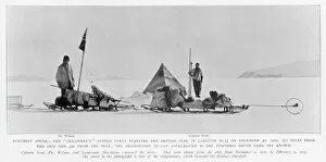
Background imageExploration Collection: Events / Exploration / Polar

Events / Exploration / Polar
Sledge party planting British flag. Shackleton, Scott and Wilson Discovery exploration of the Antarctic

Background imageExploration Collection: U-2 spy plane with fictitious NASA markings, USA, 1960. Creator: NASA

U-2 spy plane with fictitious NASA markings, USA, 1960. Creator: NASA
U-2 spy plane with fictitious NASA markings, USA, 1960. After Francis Gary Powers was shot down over the Soviet Union during a CIA spy flight on May 1, 1960

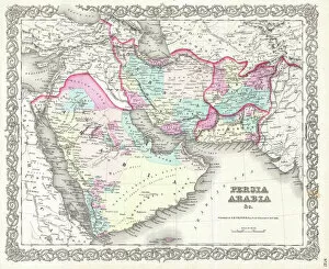
Background imageExploration Collection: 1855, Colton Map of Persia, Afghanistan, and Arabia, topography, cartography, geography

1855, Colton Map of Persia, Afghanistan, and Arabia, topography, cartography, geography
1855, Colton Map of Persia, Afghanistan, and Arabia

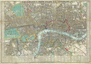
Background imageExploration Collection: 1848, Crutchley Pocket Map or Plan of London, England, topography, cartography, geography

1848, Crutchley Pocket Map or Plan of London, England, topography, cartography, geography
1848, Crutchley Pocket Map or Plan of London, England

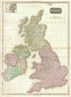
Background imageExploration Collection: 1818, Pinkerton Map of the British Isles, England, Scotland, Ireland, John Pinkerton

1818, Pinkerton Map of the British Isles, England, Scotland, Ireland, John Pinkerton, 1758 - 1826, Scottish antiquarian, cartographer, UK

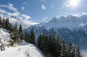
Background imageExploration Collection: Brevant ski area, Aiguilles de Chamonix, Chamonix, Haute-Savoie, French Alps, France, Europe

Brevant ski area, Aiguilles de Chamonix, Chamonix, Haute-Savoie, French Alps, France, Europe

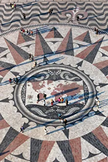
Background imageExploration Collection: Pavement map showing routes of Portugese explorers below Monument to the Discoveries, Belem

Pavement map showing routes of Portugese explorers below Monument to the Discoveries, Belem, Lisbon, Portugal, Europe

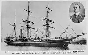
Background imageExploration Collection: Captain Scott and his exploration ship, Terra Nova

Captain Scott and his exploration ship, Terra Nova
The south polar expedition: Captain Scott and his exploration ship " Terra Nova"

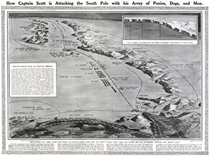
Background imageExploration Collection: How Captain Scott is attacking the South Pole

How Captain Scott is attacking the South Pole
Double page spread from The Sphere, showing a map of Antarctica along with the route of Captain Scott and his team of ponies, dogs and men in their attempt to be the first to reach the South Pole

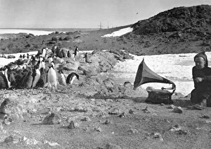
Background imageExploration Collection: Penguins & Gramophone

Penguins & Gramophone
Penguins listening to the gramophone, during the summer. Date: 1908-1909

Background imageExploration Collection: Scott Polar Expedition 1910 - 1912 - Mount Erebus

Scott Polar Expedition 1910 - 1912 - Mount Erebus
The slopes of Mount Erebus, the active volcano on Ross Island in the Antarctic, shrouded in smoke and cloud, seen during the ill-fated Scott polar expedition to the South Pole, 1910 - 1912

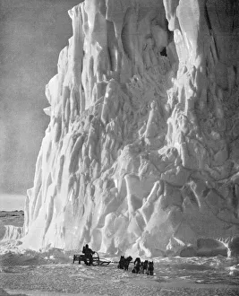
Background imageExploration Collection: Scott Polar Expedition - point of the Barne Glacier

Scott Polar Expedition - point of the Barne Glacier
A huge cliff of ice passed by the Terra Nova when she arrived at McMurdo Sound during the Scott Polar Expedition, 1910 - 1912. Date: 1913

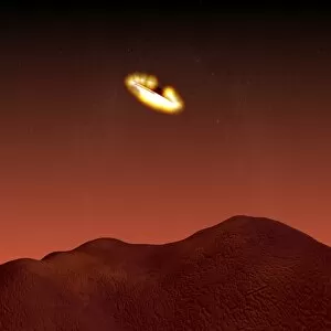
Background imageExploration Collection: Beagle 2 landing on Mars

Beagle 2 landing on Mars
Beagle 2 probe landing on Mars, computer artwork. Its heat shield is glowing as it falls through the Martian atmosphere. This British probe was carried to Mars by the European Space Agencys Mars

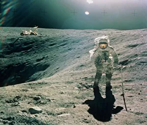
Background imageExploration Collection: Astronaut Duke next to Plum Crater, Apollo 16

Astronaut Duke next to Plum Crater, Apollo 16
Exploring the Moon: astronaut Duke stands next to Crater Plum during the first excursion of the Apollo 16 mission. Duke is seen holding a bore sampling implement
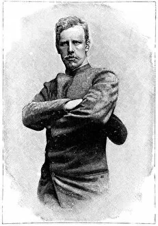
Background imageExploration Collection: Fridtjof Nansen, Norwegian explorer

Fridtjof Nansen, Norwegian explorer
Fridtjof Nansen (1861-1930), Norwegian explorer, biologist and humanitarian. In 1888 he was the first to cross the Greenland ice sheet and showed that it covered the entire island

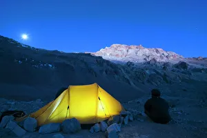
Background imageExploration Collection: Illuminated tent at Plaza de Mulas base camp, Aconcagua 6962m, highest peak in South America

Illuminated tent at Plaza de Mulas base camp, Aconcagua 6962m, highest peak in South America, Aconcagua Provincial Park, Andes mountains, Argentina, South America

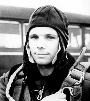
Background imageExploration Collection: Yuri Gagarin, Soviet cosmonaut

Yuri Gagarin, Soviet cosmonaut
Yuri Gagarin (1934-1968), soviet cosmonaut and first man in space. Gagarin made the first manned space flight on 12 April 1961

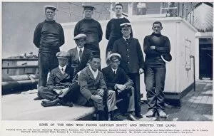
Background imageExploration Collection: Some of the men who found Captain Scott

Some of the men who found Captain Scott
Some of the Men who found the bodies of Captain Scott and his companions and erected a cairn, pictured on their return to New Zealand

Background imageExploration Collection: BP employee opening the flow valves

BP employee opening the flow valves
A British Petroleum employee opens the flow valves of an oil plant in the Middle East (likely to have been in Iraq or Iran)


All Professionally Made to Order for Quick Shipping

"Unveiling the Unknown: A Journey through Time and Terrain" Embarking on a voyage of discovery, the HMS Erebus and HMS Terror set sail in 1845, their mission shrouded in mystery. As they ventured into uncharted waters, these vessels became symbols of exploration's relentless pursuit. Across distant lands, explorers like Sir Edmund Hillary left indelible marks on history. Scaling the majestic Mount Everest alongside Tenzing Norgay in 1953, they reached new heights both literally and metaphorically. Their triumph echoed throughout time as a testament to human resilience. Yet not all expeditions ended with glory. The ill-fated journey of Erebus and Terror marked Franklin's last endeavor, forever etched in maritime lore. These ships vanished into icy depths, leaving behind tales of bravery amidst treacherous conditions. In a single snapshot captured from space, the Earthrise photograph revealed our planet's fragility against the vastness of space—a reminder that exploration extends beyond earthly boundaries. Heroes emerged from adversity; Shackleton, Wild, and Adams defied nature's wrath during their Antarctic expedition—an epic tale of survival against all odds. The HMS Beagle Ship laid up after Darwin's transformative voyage—its significance imprinted upon scientific progress forevermore. This vessel carried ideas that challenged conventions and reshaped our understanding of life itself. Maps unfolded before us like portals to unknown territories—the British Empire world map depicted an era when exploration expanded horizons far beyond imagination. From ancient Viking ships sailing turbulent seas to Captain Francis Crozier leading his crew aboard HMS Terror—exploration coursed through veins filled with courage and determination. Even within city limits lay untrodden paths waiting to be discovered—the James Craig Map showcased Edinburgh's New Town emerging from topographical dreams into reality—an urban landscape born out of innovation and vision.