Fraud Blocker Skip to main content

Bartholomew Collection (page 2)

Bartholomew, a name that resonates through time and geography, leaving its mark on maps and hospitals alike

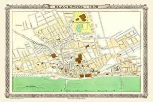
Background imageBartholomew Collection: Old Map of Blackpool 1898 from the Royal Atlas by Bartholomew

Old Map of Blackpool 1898 from the Royal Atlas by Bartholomew
A fine very detailed plan of the Town of Blackpool remastered from an original contained within " The Royal Atlas of England and Wales" ; edited by J.G

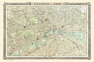
Background imageBartholomew Collection: Old Map of London 1898 from the Royal Atlas by Bartholomew

Old Map of London 1898 from the Royal Atlas by Bartholomew
A fine very detailed plan of the City of London remastered from an original contained within " The Royal Atlas of England and Wales" ; edited by J.G

Background imageBartholomew Collection: Old Map of Bournemouth 1898 from the Royal Atlas by Bartholomew

Old Map of Bournemouth 1898 from the Royal Atlas by Bartholomew
A fine very detailed plan of the Seaside Town of Bournemouth from 1898 remastered from an original contained within " The Royal Atlas of England and Wales" ; edited by J.G

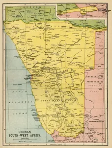
Background imageBartholomew Collection: Map of German South West Africa, First World War, (c1920). Creator: John Bartholomew & Son

Map of German South West Africa, First World War, (c1920). Creator: John Bartholomew & Son
Map of German South West Africa, First World War, (c1920). The German annexation of South West Africa took place in the 1880s

Background imageBartholomew Collection: Austria-Hungary and Neighbouring Lands - Map, 1920. Creator: John Bartholomew & Son

Austria-Hungary and Neighbouring Lands - Map, 1920. Creator: John Bartholomew & Son
Austria-Hungary and Neighbouring Lands, c1914, (c1920). Map of the Austro-Hungarian Empire and surrounding countries at start of the First World War

Background imageBartholomew Collection: Political Map of Africa, 1914, (1920). Creator: John Bartholomew & Son

Political Map of Africa, 1914, (1920). Creator: John Bartholomew & Son
Political Map of Africa, 1914, (1920). Colonial possessions in Africa at the start of the First World War. British colonies are pink, French - green, German - orange, Portuguese - purple

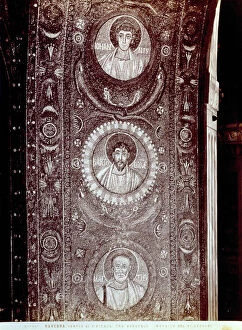
Background imageBartholomew Collection: Mosaic portraying three Apostles, in the church of San Vitale in Ravenna

Mosaic portraying three Apostles, in the church of San Vitale in Ravenna. Ravenna Mosaic Early Christian Art, Europe, First and Second Millennium A.D.. Date of Photograph:1870-1890

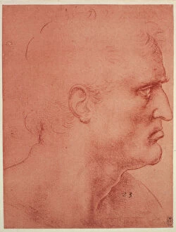
Background imageBartholomew Collection: Head of St. Bartholomew for the Last Supper by Leonardo da Vinci

Head of St. Bartholomew for the Last Supper by Leonardo da Vinci, sanguine drawing on red paper preserved at the Royal Library of Windsor

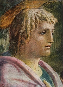
Background imageBartholomew Collection: Tribute Money, detail with the face of St. John the Evangelist. Fresco by Masaccio

Tribute Money, detail with the face of St. John the Evangelist. Fresco by Masaccio. Brancacci Chapel, Church of Sta. Maria del Carmine, Florence Mural Painting Early Renaissance, Renaissance

Background imageBartholomew Collection: The Last Supper; tapestry by the Gobelins Company, designed by Jean Audran, Palazzo del Quirinale

The Last Supper; tapestry by the Gobelins Company, designed by Jean Audran, Palazzo del Quirinale, Rome Rome Palazzo del Quirinale Tapestry Eighteenth Century, Renaissance-Baroque styles and periods

Background imageBartholomew Collection: The martyring of St. Bartholomew: miniature of the Rovere Missal

The martyring of St. Bartholomew: miniature of the Rovere Missal. Work by Francesco Marmitta preserved in the Turin Civic Museum of Ancient Art Turin Civic Museum of Ancient Art Illumination Early

Background imageBartholomew Collection: Shrine of St. Potentino, work by Trves, preserved in the Louvre Museum, Paris

Shrine of St. Potentino, work by Trves, preserved in the Louvre Museum, Paris. The shrine is in wrought iron with precious stones, fretworks and statuettes under arcades

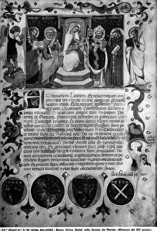
Background imageBartholomew Collection: An illuminated page with a Madonna with Child and Saints, of the Statute of the Society

An illuminated page with a Madonna with Child and Saints, of the Statute of the Society and Register of the Haberdashers, preserved in the National Civic Museum, Bologna

Background imageBartholomew Collection: Saint Bartholomew, high-relief fragment of the monument of Pope Callistus III, 15th century art

Saint Bartholomew, high-relief fragment of the monument of Pope Callistus III, 15th century art, Vatican Grottoes, St. Peter's Basilica, Vatican City State of the Vatican City St

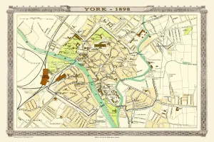
Background imageBartholomew Collection: Old Map of York 1898 from the Royal Atlas by Bartholomew

Old Map of York 1898 from the Royal Atlas by Bartholomew
A fine very detailed plan of the City of York remastered from an original contained within " The Royal Atlas of England and Wales" ; edited by J.G

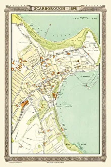
Background imageBartholomew Collection: Old Map of Scarborough 1898 from the Royal Atlas by Bartholomew

Old Map of Scarborough 1898 from the Royal Atlas by Bartholomew
A fine very detailed plan of the Seaside Town of Scarborough from 1898 remastered from an original contained within " The Royal Atlas of England and Wales" ; edited by J.G

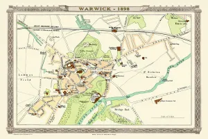
Background imageBartholomew Collection: Old Map of Warwick 1898 from the Royal Atlas by Bartholomew

Old Map of Warwick 1898 from the Royal Atlas by Bartholomew
A fine very detailed plan of the City of Warwick remastered from an original contained within " The Royal Atlas of England and Wales" ; edited by J.G

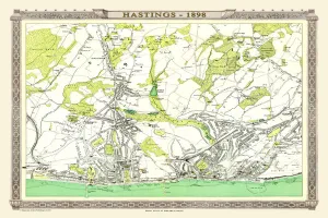
Background imageBartholomew Collection: Old Map of Hastings 1898 from the Royal Atlas by Bartholomew

Old Map of Hastings 1898 from the Royal Atlas by Bartholomew
A fine very detailed town plan of Hastings from 1898 remastered from an original contained within " The Royal Atlas of England and Wales" ; edited by J.G

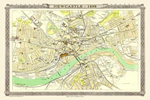
Background imageBartholomew Collection: Old Map of Newcastle 1898 from the Royal Atlas by Bartholomew

Old Map of Newcastle 1898 from the Royal Atlas by Bartholomew
A fine very detailed plan of the City of Newcastle remastered from an original contained within " The Royal Atlas of England and Wales" ; edited by J.G

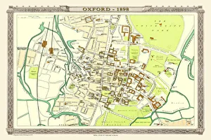
Background imageBartholomew Collection: Old Map of Oxford 1898 from the Royal Atlas by Bartholomew

Old Map of Oxford 1898 from the Royal Atlas by Bartholomew
A fine very detailed plan of the City of Oxford remastered from an original contained within " The Royal Atlas of England and Wales" ; edited by J.G

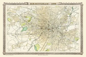
Background imageBartholomew Collection: Old Map of Birmingham 1898 from the Royal Atlas by Bartholomew

Old Map of Birmingham 1898 from the Royal Atlas by Bartholomew
A fine very detailed plan of the City of Birmingham remastered from an original contained within " The Royal Atlas of England and Wales" ; edited by J.G

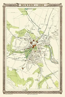
Background imageBartholomew Collection: Old Map of Buxton 1898 from the Royal Atlas by Bartholomew

Old Map of Buxton 1898 from the Royal Atlas by Bartholomew
A fine very detailed plan of the Spa Town of Buxton from 1898 remastered from an original contained within " The Royal Atlas of England and Wales" ; edited by J.G

Background imageBartholomew Collection: India and the Campaigns of the Middle East, First World War, 1914-1918, (c1920)

India and the Campaigns of the Middle East, First World War, 1914-1918, (c1920). Map showing British India coloured pink as part of the British Empire, Afghanistan, Persia, Asia Minor, Arabia

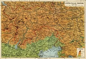
Background imageBartholomew Collection: Map of the Austro-Italian frontier, First World War, (c1920). Creator: John Bartholomew & Son

Map of the Austro-Italian frontier, First World War, (c1920). Creator: John Bartholomew & Son
Map of the Austro-Italian frontier, First World War, (c1920). Mountainous area between Salzburg, Trieste and Cremona, showing the Tyrol

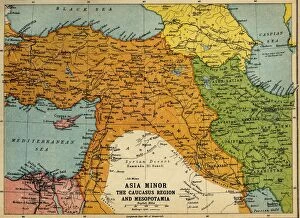
Background imageBartholomew Collection: Asia Minor, the Caucasus Region and Mesopotamia, First World War, c1915, (c1920)

Asia Minor, the Caucasus Region and Mesopotamia, First World War, c1915, (c1920). Map of part of the Middle East, showing eastern Turkey, Cyprus, Syria, Lebanon, Palestine

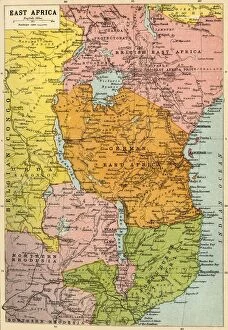
Background imageBartholomew Collection: Map of East Africa, First World War, (c1920). Creator: John Bartholomew & Son

Map of East Africa, First World War, (c1920). Creator: John Bartholomew & Son
Map of East Africa, First World War, (c1920). Map showing colonial possessions including the Belgian Congo, British East Africa, German East Africa, Northern Rhodesia and Portuguese East Africa

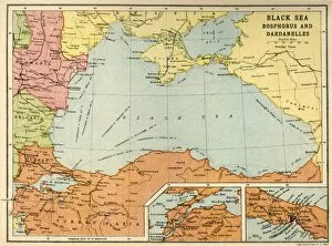
Background imageBartholomew Collection: Black Sea: Bosphorus and Dardanelles, c1914, (c1920). Creator: John Bartholomew & Son

Black Sea: Bosphorus and Dardanelles, c1914, (c1920). Creator: John Bartholomew & Son
Black Sea: Bosphorus and Dardanelles, c1914, (c1920). Map of the Black Sea and parts of surrounding countries at the start of the First World War, showing Russia and the Crimea, Romania

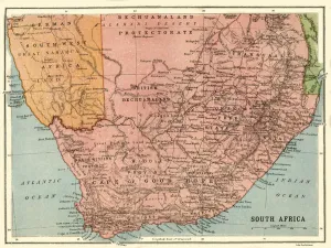
Background imageBartholomew Collection: Map of South Africa, c1914, (c1920). Creator: John Bartholomew & Son

Map of South Africa, c1914, (c1920). Creator: John Bartholomew & Son
Map of South Africa, c1914, (c1920). Map of the southern tip of Africa at the start of the First World War, showing German South-West Africa (later Namibia)

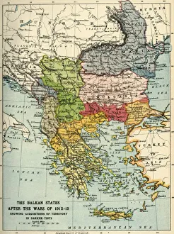
Background imageBartholomew Collection: The Balkan States After the Wars of 1912-13, (c1920). Creator: John Bartholomew & Son

The Balkan States After the Wars of 1912-13, (c1920). Creator: John Bartholomew & Son
The Balkan States After the Wars of 1912-13, (c1920). Showing Acquisitions of Territory in Darker Tints. Map of the Balkans: Bosnia, Montenegro, Servia (Serbia), Albania, Roumania (Romania)

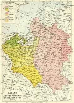
Background imageBartholomew Collection: Poland and the Partitions of 1772, 1793 & 1795, (c1920). Creator: John Bartholomew & Son

Poland and the Partitions of 1772, 1793 & 1795, (c1920). Creator: John Bartholomew & Son
Poland and the Partitions of 1772, 1793 & 1795, (c1920). Map showing how territory in Europe was divided between the empires of Russia, Prussia and Austria in the 18th century

Background imageBartholomew Collection: Map of Central Europe, c1914. Creator: John Bartholomew & Son

Map of Central Europe, c1914. Creator: John Bartholomew & Son
Map of Central Europe, c1914. Europe as it looked at the beginning of the First World War. From " The Great World War - A History" Volume I, edited by Frank A Mumby

Background imageBartholomew Collection: Map of Belgium and Northern France, c1914, (c1920). Creator: John Bartholomew & Son

Map of Belgium and Northern France, c1914, (c1920). Creator: John Bartholomew & Son
Map of Belgium and Northern France, c1914, (c1920). How the area looked at the start of the First World War. From " The Great World War - A History" Volume I, edited by Frank A Mumby

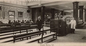
Background imageBartholomew Collection: St Bartholomews Hospital, London - Surgery Waiting Hall

St Bartholomews Hospital, London - Surgery Waiting Hall
St Bartholomews Hospital, Farringdon, City of London - Surgery Waiting Hall. Date: circa 1907

Background imageBartholomew Collection: St Bartholomews Hospital, London - Mary Ward

St Bartholomews Hospital, London - Mary Ward
St Bartholomews Hospital, Farringdon, City of London - Mary Ward. Date: circa 1907

Background imageBartholomew Collection: St Bartholomews Hospital, London - Staircase

St Bartholomews Hospital, London - Staircase
St Bartholomews Hospital, Farringdon, City of London - Staircase with wall painting by Hogarth - now extensively restored to its former glory. Date: circa 1907

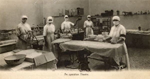
Background imageBartholomew Collection: St Bartholomews Hospital, London - An operating Theatre

St Bartholomews Hospital, London - An operating Theatre
St Bartholomews Hospital, Farringdon, City of London - An operating Theatre. Date: circa 1907

Background imageBartholomew Collection: St Bartholomews Hospital, London - The Dispensary

St Bartholomews Hospital, London - The Dispensary
St Bartholomews Hospital, Farringdon, City of London - The Dispensary Date: circa 1907

Background imageBartholomew Collection: Newbury Bartholomew Street Edwardian period

Newbury Bartholomew Street Edwardian period

Background imageBartholomew Collection: St Bartholomew's Church, Churchdown, Gloucestershire

St Bartholomew's Church, Churchdown, Gloucestershire
Interior of St Bartholomew's Church, looking east, in the village of Churchdown, Gloucestershire Date: 1930s

Background imageBartholomew Collection: View through the south door, St Bartholomew's Church, in the village of Churchdown

View through the south door, St Bartholomew's Church, in the village of Churchdown, Gloucestershire Date: 1930s

Background imageBartholomew Collection: John Hunter

John Hunter (1728 - 1893), Scottish surgeon, one of the most distinguished scientists and surgeons of his day. He assisted his brother

Background imageBartholomew Collection: St. Bartholomew Hospital

St. Bartholomew Hospital
The west entrance of St. Bartholomew Hospital, London, showing the gatehouse which was built in 17002 with a statue of Henry VIII. Date: late 1890s

Background imageBartholomew Collection: View of St. Bartholomew's Hospital in the City of London. Date: 1750

View of St. Bartholomew's Hospital in the City of London. Date: 1750

Background imageBartholomew Collection: Virgin and child with saint John the Baptist, Peter, Paul, Anthony the abbot, Michael, Bartholomew

Virgin and child with saint John the Baptist, Peter, Paul, Anthony the abbot, Michael, Bartholomew
5309711 Virgin and child with saint John the Baptist, Peter, Paul, Anthony the abbot, Michael, Bartholomew, Onophrius and Lawrence, 1420-30 (tempera on wood) by Mariotto di Cristofano

Background imageBartholomew Collection: Bartholeme de Las Casas (1474-1566) (oil on panel) (see also 129762)

Bartholeme de Las Casas (1474-1566) (oil on panel) (see also 129762)
IND116891 Bartholeme de Las Casas (1474-1566) (oil on panel) (see also 129762) by Spanish School, (16th century); Archivo de Indias, Seville, Spain; Mithra-Index

Background imageBartholomew Collection: The Flaying of St. Bartholomew (fresco)

The Flaying of St. Bartholomew (fresco)
875223 The Flaying of St. Bartholomew (fresco) by Ponte, Giovanni dal (c.1385-1437/42); Santa Trinita, Florence, Italy; © Giuliano Valsecchi

Background imageBartholomew Collection: Dossal of an altar with central ciborium, from the left, St. Francis, St. Bartholomew

Dossal of an altar with central ciborium, from the left, St. Francis, St. Bartholomew
6366121 Dossal of an altar with central ciborium, from the left, St. Francis, St. Bartholomew, the Archangel Raphael and Tobiolo, c.1475 (bas-relief polychrome glazed terracotta) by Della Robbia

Background imageBartholomew Collection: Dossal of an altar with central ciborium, detail of St. Francis and St. Bartholomew, c

Dossal of an altar with central ciborium, detail of St. Francis and St. Bartholomew, c
6366122 Dossal of an altar with central ciborium, detail of St. Francis and St. Bartholomew, c.1475 (bas-relief polychrome glazed terracotta) by Della Robbia, Andrea (1435-1525/28); Santa Croce


All Professionally Made to Order for Quick Shipping

Bartholomew, a name that resonates through time and geography, leaving its mark on maps and hospitals alike. From the bustling streets of London to the tranquil landscapes of Devonport and Stonehouse, Bartholomew's legacy is etched into history. In the early 20th century, J. Bartholomew & Co. Crafted a masterpiece - a map of the Trans-Siberian Railway. This intricate engraving showcased their expertise in cartography, guiding travelers along this iconic route with precision and accuracy. Meanwhile, St. Bartholomews Hospital stood as a beacon of healing in 18th-century London. Its courtyard witnessed countless tales of resilience and recovery, offering solace to those seeking medical aid amidst bustling city life. The Royal Atlas by Bartholomew transported us back to Victorian times with an old map of Plymouth, Devonport, and Stonehouse from 1898. It captured the essence of these coastal towns with meticulous detail - every street corner immortalized for generations to come. Venturing further north on another page from the Royal Atlas was Durham's old map from 1898 by none other than Bartholomew himself. The winding rivers and ancient landmarks painted a vivid picture of this historic city nestled in England's northeast countryside. Back in London again at St. Bartholomews Hospital - The Quadrangle revealed itself as an architectural marvel designed to inspire hope within its walls. Henry VIII Gate stood tall since 1886; it bore witness to centuries' worth of stories unfolding within its grand entrance. But beyond maps and hospitals lies artistry too - John Bartholomew captured the beauty of Isle of Wight in his c20th-century artwork. His brushstrokes brought life to serene landscapes that whispered tales only nature could tell. Dublin's Rotunda Hospital found itself intertwined with our narrative as well – reminding us that even across borders, Bartholomew's influence reached far and wide.