Framed Print > Animals > Mammals > Cricetidae > California Mouse
Framed Print : California under Mexican rule, 1800s


![]()
Framed Photos from North Wind
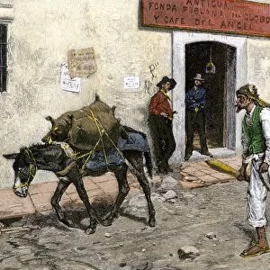
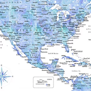
California under Mexican rule, 1800s
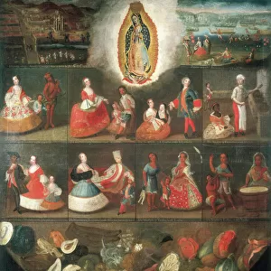
Map of Alta California under Mexican government, early 1800s.
Hand-colored woodcut of a 19th-century illustration
North Wind Picture Archives brings history to life with stock images and hand-colored illustrations
Media ID 5882707
© North Wind Picture Archives
California Colonial Colonist Colony Mexican Mexico West Western Alta California Hispanic
14"x12" (38x32cm) Modern Frame
Step back in time with our exquisite Framed Print from Media Storehouse, featuring a captivating image of California under Mexican rule in the early 1800s. This antique map, sourced from North Wind Picture Archives, showcases the rich history of Alta California with intricate hand-coloring and meticulous detail. Perfectly preserved in a high-quality frame, this unique piece is a must-have for history enthusiasts and those who appreciate the beauty of historical cartography. Add this stunning conversation starter to your home or office decor and let the stories of the past come alive.
Wood effect frame, card mounted, 10x8 archival quality photo print. Overall outside dimensions 14x12 inches (38x32cm). Environmentally and ozone friendly, 40mm wide x 15mm Polycore® moulding has the look of real wood, is durable and light and easy to hang. Biodegradable and made with non-chlorinated gases (no toxic fumes) it is efficient; producing 100 tons of polystyrene can save 300 tons of trees! Prints are glazed with lightweight, shatterproof, optical clarity acrylic (providing the same general protection from the environment as glass). The back is stapled hardboard with a sawtooth hanger attached. Note: To minimise original artwork cropping, for optimum layout, and to ensure print is secure, the visible print may be marginally smaller
Contemporary Framed and Mounted Prints - Professionally Made and Ready to Hang
Estimated Image Size (if not cropped) is 17.2cm x 24.4cm (6.8" x 9.6")
Estimated Product Size is 32.5cm x 37.6cm (12.8" x 14.8")
These are individually made so all sizes are approximate
Artwork printed orientated as per the preview above, with portrait (vertical) orientation to match the source image.
FEATURES IN THESE COLLECTIONS
> Animals
> Mammals
> Cricetidae
> California Mouse
> Animals
> Mammals
> Muridae
> Western Mouse
> Historic
> Colonial America illustrations
> Colonial America
> Historic
> Colonial America illustrations
> Historic
> Colonial history
> Colonial art and artists
> Maps and Charts
> Early Maps
> North America
> Mexico
> Maps
> North America
> Mexico
> Related Images
> North Wind Picture Archives
> Maps
EDITORS COMMENTS
This beautifully hand-colored woodcut print showcases a historic map of Alta California during the early 1800s, when it was under Mexican rule. The intricate details and vibrant colors bring to life this significant period in American history. The map depicts the vast expanse of California as a Mexican colony, highlighting its importance as a strategic territory for both Mexico and the United States. It serves as a visual representation of the colonial era, reminding us of the complex dynamics between nations during this time. The illustration captures the essence of traditional art from that era, with its meticulous craftsmanship and attention to detail. It transports us back to an age where cartography played a crucial role in understanding and exploring new territories. As we delve into this vintage piece, we are reminded of California's rich Hispanic heritage and its deep-rooted connection to Mexico. This snapshot from history sheds light on how different cultures have shaped North America over centuries. This image is not just an artistic masterpiece but also an educational tool that allows us to appreciate our shared past. It invites us to reflect on the historical significance of colonization while celebrating the diverse tapestry that makes up modern-day California.
MADE IN THE UK
Safe Shipping with 30 Day Money Back Guarantee
FREE PERSONALISATION*
We are proud to offer a range of customisation features including Personalised Captions, Color Filters and Picture Zoom Tools
SECURE PAYMENTS
We happily accept a wide range of payment options so you can pay for the things you need in the way that is most convenient for you
* Options may vary by product and licensing agreement. Zoomed Pictures can be adjusted in the Basket.