Framed Print > Arts > Artists > M > Mexican School Mexican School
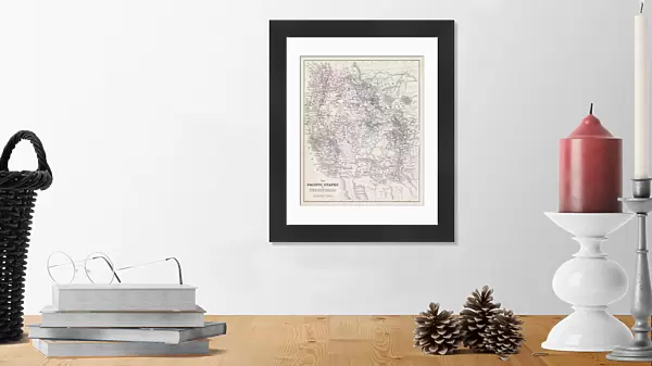
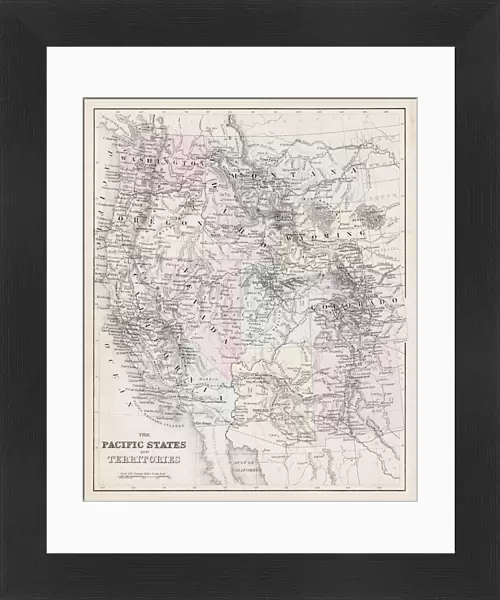
Framed Print : Map of Pacific States USA 1877


![]()
Framed Photos from Fine Art Storehouse
Map of Pacific States USA 1877
Warrens Common School Geography 1877
Unleash your creativity and transform your space into a visual masterpiece!
THEPALMER
Media ID 14824575
© This content is subject to copyright
Arizona California Colorado Montana New Mexico Oregon Pacific Washington Wyoming
14"x12" (38x32cm) Modern Frame
Step back in time with our exquisite 'Map of Pacific States USA 1877' Framed Print from ThePalmer at Media Storehouse. This stunning piece, originally from Warren's Common School Geography of 1877, showcases historical cartography at its finest. The intricate details of this antique map are beautifully preserved in this high-quality print, making it a captivating addition to any home or office. Transport yourself to a bygone era with this unique and educational piece of art.
Wood effect frame, card mounted, 10x8 archival quality photo print. Overall outside dimensions 14x12 inches (38x32cm). Environmentally and ozone friendly, 40mm wide x 15mm Polycore® moulding has the look of real wood, is durable and light and easy to hang. Biodegradable and made with non-chlorinated gases (no toxic fumes) it is efficient; producing 100 tons of polystyrene can save 300 tons of trees! Prints are glazed with lightweight, shatterproof, optical clarity acrylic (providing the same general protection from the environment as glass). The back is stapled hardboard with a sawtooth hanger attached. Note: To minimise original artwork cropping, for optimum layout, and to ensure print is secure, the visible print may be marginally smaller
Contemporary Framed and Mounted Prints - Professionally Made and Ready to Hang
Estimated Image Size (if not cropped) is 20.1cm x 24.4cm (7.9" x 9.6")
Estimated Product Size is 32.5cm x 37.6cm (12.8" x 14.8")
These are individually made so all sizes are approximate
Artwork printed orientated as per the preview above, with portrait (vertical) orientation to match the source image.
FEATURES IN THESE COLLECTIONS
> Fine Art Storehouse
> Map
> Historical Maps
> Fine Art Storehouse
> Map
> USA Maps
> Animals
> Mammals
> Cricetidae
> California Mouse
> Arts
> Artists
> M
> Mexican School Mexican School
> Maps and Charts
> Related Images
> North America
> Mexico
> Related Images
> North America
> United States of America
> Arizona
> Related Images
> North America
> United States of America
> California
> Related Images
> North America
> United States of America
> Colorado
> Related Images
> North America
> United States of America
> Maps
> North America
> United States of America
> Montana
> Related Images
> North America
> United States of America
> New Mexico
> Related Images
EDITORS COMMENTS
In this print titled "Map of Pacific States USA 1877" we are transported back in time to the late 19th century, where cartography was both an art form and a means of education. This particular map, sourced from Warrens Common School Geography in 1877, offers us a glimpse into the vast expanse of the Pacific States region. The intricate details on this vintage map allow us to explore the territories that make up present-day Arizona, California, Colorado, Montana, New Mexico, Oregon, Washington state and Wyoming. It is fascinating to see how these states were depicted over a century ago when their landscapes were still largely untamed and unexplored. The craftsmanship evident in this print by THEPALMER showcases not only historical accuracy but also artistic flair. The delicate lines and vibrant colors bring life to each state's boundaries while highlighting major cities and geographical features. As we study this piece closely, it becomes apparent that maps served as more than just navigational tools; they were windows into the world for students eager to learn about their surroundings. This photograph captures not only a moment frozen in time but also represents an important milestone in American history – an era marked by westward expansion and exploration. Whether you are a history enthusiast or simply appreciate fine art prints like this one from Fine Art Storehouse, "Map of Pacific States USA 1877" serves as a reminder of our ever-evolving understanding of geography and its impact on society throughout the ages.
MADE IN THE UK
Safe Shipping with 30 Day Money Back Guarantee
FREE PERSONALISATION*
We are proud to offer a range of customisation features including Personalised Captions, Color Filters and Picture Zoom Tools
SECURE PAYMENTS
We happily accept a wide range of payment options so you can pay for the things you need in the way that is most convenient for you
* Options may vary by product and licensing agreement. Zoomed Pictures can be adjusted in the Basket.