Framed Print > Asia > Palestine > Maps
Framed Print : Antique Map of Ancient Palestine


![]()
Framed Photos from Fine Art Storehouse
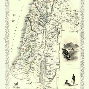
Antique Map of Ancient Palestine
Antique Map from 1862 of Ancient Palestine. Showing Palestine before exile; Palestine and Lower Egypt; Jerusalem; and the Kingdom of David and Solomon. Maps text is written in Latin
Unleash your creativity and transform your space into a visual masterpiece!
duncan1890
Media ID 18062903
© Duncan Walker
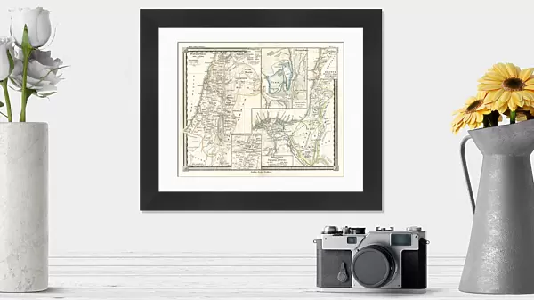
14"x12" (38x32cm) Modern Frame
Step back in time with our Antique Map of Ancient Palestine from the Media Storehouse Framed Prints collection. This exquisite piece, created by duncan1890 in 1862, offers a fascinating glimpse into the historical landscape of the region before the exile. With intricate detail, the map showcases Palestine, Lower Egypt, Jerusalem, and the Kingdom of David and Solomon. The text is beautifully written in Latin, adding to the vintage charm. Elevate your home or office decor with this captivating and educational piece of art.
Wood effect frame, card mounted, 10x8 archival quality photo print. Overall outside dimensions 14x12 inches (38x32cm). Environmentally and ozone friendly, 40mm wide x 15mm Polycore® moulding has the look of real wood, is durable and light and easy to hang. Biodegradable and made with non-chlorinated gases (no toxic fumes) it is efficient; producing 100 tons of polystyrene can save 300 tons of trees! Prints are glazed with lightweight, shatterproof, optical clarity acrylic (providing the same general protection from the environment as glass). The back is stapled hardboard with a sawtooth hanger attached. Note: To minimise original artwork cropping, for optimum layout, and to ensure print is secure, the visible print may be marginally smaller
Contemporary Framed and Mounted Prints - Professionally Made and Ready to Hang
Estimated Image Size (if not cropped) is 24.4cm x 19.7cm (9.6" x 7.8")
Estimated Product Size is 37.6cm x 32.5cm (14.8" x 12.8")
These are individually made so all sizes are approximate
Artwork printed orientated as per the preview above, with landscape (horizontal) orientation to match the source image.
FEATURES IN THESE COLLECTIONS
> Fine Art Storehouse
> Map
> Historical Maps
> Africa
> Egypt
> Related Images
> Asia
> Palestine
> Jerusalem
> Asia
> Palestine
> Related Images
> Historic
> Ancient civilizations
> Ancient Egypt
> Historic
> Ancient civilizations
> Maps and Charts
> Early Maps
> Maps and Charts
> Related Images
EDITORS COMMENTS
This print takes us back in time to the ancient land of Palestine, offering a glimpse into its rich history and civilization. Dating all the way back to 1862, this antique map showcases Palestine before exile, presenting an invaluable resource for historians and enthusiasts alike. The intricate details on this map are truly remarkable. From the borders of Palestine and Lower Egypt to the majestic city of Jerusalem, every line tells a story of ancient civilizations that once thrived in these lands. The Kingdom of David and Solomon is prominently featured, reminding us of their legendary reigns and contributions. What makes this piece even more intriguing is that it is written entirely in Latin. This adds an air of mystery as we delve deeper into deciphering the text and uncovering hidden meanings within its pages. It serves as a testament to the scholarly pursuits during that era when Latin was widely used as a language for academia. As we gaze upon this mesmerizing artwork, we are transported through time, immersing ourselves in the wonders of ancient cartography. It invites us to explore not only geographical boundaries but also cultural exchanges between neighboring regions. Duncan1890's masterful capture ensures that this antique map remains preserved for generations to come – a window into our past where history comes alive with each glance.
MADE IN THE UK
Safe Shipping with 30 Day Money Back Guarantee
FREE PERSONALISATION*
We are proud to offer a range of customisation features including Personalised Captions, Color Filters and Picture Zoom Tools
SECURE PAYMENTS
We happily accept a wide range of payment options so you can pay for the things you need in the way that is most convenient for you
* Options may vary by product and licensing agreement. Zoomed Pictures can be adjusted in the Basket.