Fine Art Print > Fine Art Storehouse > Map > Reference Maps
Fine Art Print : Chad country map


Please select a smaller print size for this image
![]()
Fine Art Prints from Fine Art Storehouse
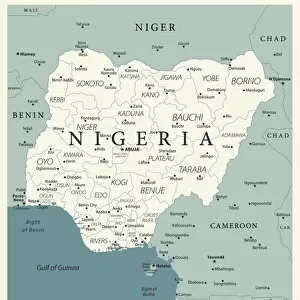
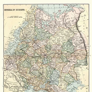
Chad country map
2011 edition
Unleash your creativity and transform your space into a visual masterpiece!
Media ID 14432095
A4 (21x29cm) Fine Art Print
Our Fine Art Prints are printed on 100% acid free, PH neutral paper with archival properties. This printing method is used by museums and art collections to exhibit photographs and art reproductions. Hahnemühle certified studio for digital fine art printing. Printed on 308gsm Photo Rag Paper.
Our fine art prints are high-quality prints made using a paper called Photo Rag. This 100% cotton rag fibre paper is known for its exceptional image sharpness, rich colors, and high level of detail, making it a popular choice for professional photographers and artists. Photo rag paper is our clear recommendation for a fine art paper print. If you can afford to spend more on a higher quality paper, then Photo Rag is our clear recommendation for a fine art paper print.
Estimated Product Size is 21cm x 29.7cm (8.3" x 11.7")
These are individually made so all sizes are approximate
Artwork printed orientated as per the preview above, with portrait (vertical) orientation to match the source image.
EDITORS COMMENTS
This print showcases the Chad country map, specifically the 2011 edition. With intricate details and vibrant colors, this artwork from Fine Art Storehouse is a visual delight for geography enthusiasts and art lovers alike. The map depicts the vast expanse of Chad, a landlocked country located in Central Africa. From its northern Saharan region to its southern savannahs and fertile valleys, every contour of Chad's diverse landscape is beautifully portrayed in this print. The borders demarcating neighboring countries such as Libya, Sudan, Cameroon, Nigeria, Niger, and Central African Republic are clearly defined. As you explore this stunning piece of art further, your eyes will be drawn to the various cities and towns marked on the map. Each dot represents a thriving community with its unique culture and history waiting to be discovered. Rivers like Lake Chad Basin or Chari River meander through the terrain like lifelines providing sustenance to both nature and humanity. Beyond being an aesthetic masterpiece that would enhance any space it adorns; this print serves as an educational tool too. It invites viewers to delve into Chad's rich heritage while igniting curiosity about its people's way of life.
MADE IN THE UK
Safe Shipping with 30 Day Money Back Guarantee
FREE PERSONALISATION*
We are proud to offer a range of customisation features including Personalised Captions, Color Filters and Picture Zoom Tools
SECURE PAYMENTS
We happily accept a wide range of payment options so you can pay for the things you need in the way that is most convenient for you
* Options may vary by product and licensing agreement. Zoomed Pictures can be adjusted in the Basket.