
Maps Fine Art Print Collection
Discover the rich cultural heritage and breathtaking landscapes of Turkey and Asia with our exquisite collection of Fine Art Prints of Maps from Media Storehouse. Each map is meticulously crafted, showcasing intricate details and vibrant colors that bring the regions to life. Explore ancient cities, vast deserts, and crystal-clear waters with these stunning works of art. Perfect for adding a touch of worldly charm to your home or office, these maps make for an unforgettable addition to any decor.
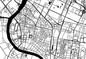
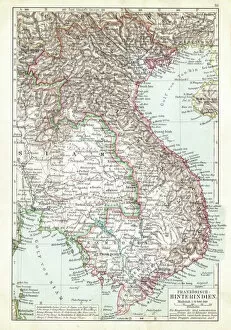
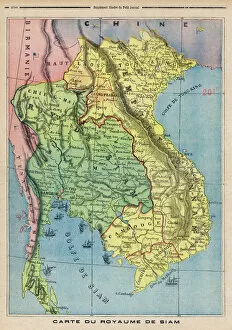
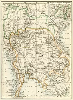
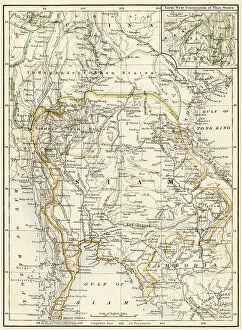
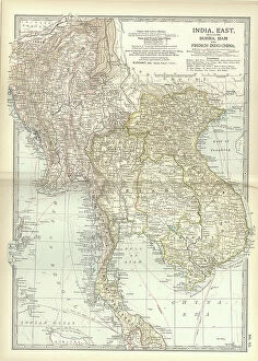
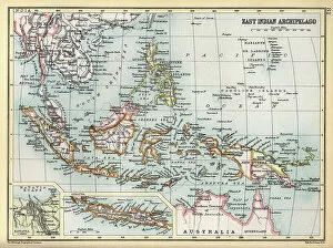
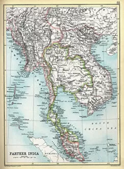
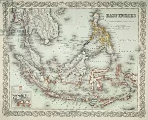
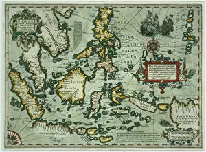
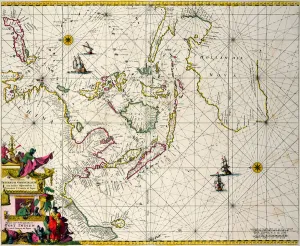
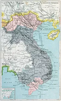
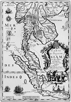
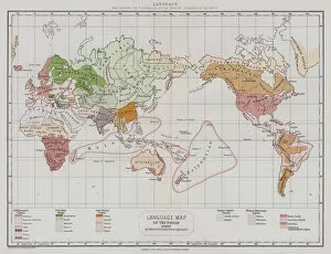
Maps of Turkey Asia are maps that show the physical features, cities, and other geographical information about the country
Choose a picture from our Maps Fine Art Print Collection for your Wall Art and Photo Gifts
72 Fine Art Prints


All Professionally Made to Order for Quick Shipping
-
Maps Fine Art Print Collection
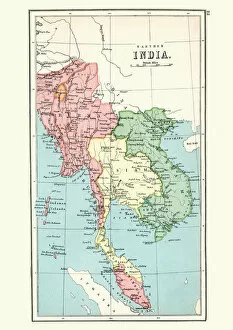
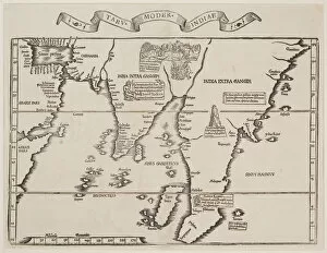
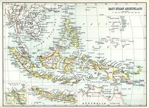
Maps of Turkey Asia are maps that show the physical features, cities, and other geographical information about the country. They include detailed topographical information such as mountains, rivers, lakes and valleys. They also show political boundaries between provinces and countries. Additionally, they provide important transportation routes such as highways and railways. Maps of Turkey Asia can be used for a variety of purposes including planning trips or finding specific locations within the country, and are often used by businesses to identify potential markets or areas for expansion. Furthermore, they can be used to study history or culture in order to gain a better understanding of the region’s past and present development. Maps of Turkey Asia are an invaluable tool for anyone looking to explore this fascinating region of the world.
+
Our beautiful Wall Art and Photo Gifts include Framed Prints, Photo Prints, Poster Prints, Canvas Prints, Jigsaw Puzzles, Metal Prints and so much more
Media Storehouse offers a stunning collection of Maps of Turkey Asia, which is perfect for those who love to explore the world's geography. Our collection features an extensive range of maps that showcase the intricate details and topography of Turkey Asia. These maps are available in various sizes and formats, including wall art and framed prints. The Maps of Turkey Asia collection includes antique maps dating back to the 16th century as well as contemporary ones that highlight modern-day landmarks such as cities, highways, and airports. Each map is carefully crafted with precision and accuracy to provide an immersive experience for anyone interested in learning about this region's history or planning a trip there. Whether you're looking to decorate your home or office space with unique wall art or want to gift someone who loves traveling, our Maps of Turkey Asia collection has something for everyone. With its vast selection and high-quality printing techniques, these maps are sure to impress any geography enthusiast.
+
What are Maps of Turkey Asia art prints?
Maps of Turkey Asia art prints are high-quality reproductions of antique and modern maps depicting the geography, topography, and political boundaries of Turkey and its surrounding regions in Asia. These prints showcase intricate details such as cities, rivers, mountains, forests, deserts, and landmarks that have been carefully drawn by skilled cartographers over the centuries. These art prints serve not only as decorative pieces but also as educational tools for those interested in history or geography. They can be used to trace the evolution of borders or to understand how different civilizations interacted with each other throughout history. Maps of Turkey Asia art prints come in a variety of sizes and styles to suit any taste or decor. Whether you prefer vintage maps with an aged patina or colorful contemporary designs that pop off the wall, there is something for everyone. These prints make great gifts for travelers, students, historians or anyone who appreciates beautiful artwork that tells a story about our world's past and present.
+
What Maps of Turkey Asia art prints can I buy from Media Storehouse?
We offer a wide range of Maps of Turkey Asia art prints that are perfect for those who love to explore and learn about the geography of this region. These maps come in various styles, sizes, and designs, ranging from vintage to modern, colorful to monochromatic. You can choose from detailed topographical maps that show elevation changes and terrain features or political maps that highlight borders between countries and cities. Some popular options include antique Turkish city plans dating back to the 19th century or Ottoman Empire-era maps showing the extent of their territories across Asia Minor. Additionally, there are also contemporary satellite images showcasing Turkey's diverse landscapes such as its mountain ranges, coastal regions or arid deserts. Whether you're looking for an educational tool for your classroom or simply want a beautiful piece of wall decor for your home or office space, we have something suitable for everyone with their vast collection of Maps of Turkey Asia art prints.
+
How do I buy Maps of Turkey Asia art prints?
To buy Maps of Turkey Asia art prints from Media Storehouse, you can browse our extensive collection online. We offer a wide range of maps and artwork depicting various regions in Turkey and Asia, which you can search for using keywords or by browsing through categories. Once you have found the print that you want to purchase, simply add it to your cart and proceed to checkout. You will be prompted to enter your shipping information and payment details before completing your order. We offer high-quality prints on a variety of materials, including canvas, paper, and metal. We also offer framing options if you prefer a ready-to-hang piece. Buying Maps of Turkey Asia art prints from Media Storehouse is an easy process that allows you to bring beautiful artwork into your home or office with just a few clicks.
+
How much do Maps of Turkey Asia art prints cost?
We offer a wide range of Maps of Turkey Asia art prints that are available at varying prices. Our collection includes high-quality prints featuring detailed maps of the region, showcasing its diverse geography and rich cultural heritage. The cost of these prints depends on several factors such as the size, framing options, and materials used in printing. We understand that every customer has unique preferences when it comes to purchasing art prints. Therefore, we strive to provide an extensive selection of Maps of Turkey Asia art prints that cater to different tastes and budgets. Whether you're looking for a small print to decorate your home or a large one for your office space, we have something for everyone. Our team is dedicated to providing exceptional customer service and ensuring that our customers receive their orders promptly and securely. We take pride in offering affordable yet high-quality Maps of Turkey Asia art prints that are sure to add value and beauty to any space they adorn.
+
How will my Maps of Turkey Asia art prints be delivered to me?
We take great care in delivering your Maps of Turkey Asia art prints to you. We use a reliable and trusted courier service that ensures your order is delivered safely and securely. Your prints will be carefully packaged to prevent any damage during transit. We offer different delivery options depending on your location and the size of your order. For smaller orders, we use standard delivery services which typically take 3-5 working days for UK deliveries and up to 10 working days for international deliveries. For larger or more valuable orders, we may use a tracked or signed-for service to ensure secure delivery. You will receive an email confirmation once your order has been dispatched with tracking information if applicable. Rest assured that at Media Storehouse, we strive to provide the best possible customer experience from start to finish when it comes to delivering our high-quality art prints straight to your door.