Fraud Blocker Skip to main content

Home > Fine Art Finder > Maps (celestial & Terrestrial)

Maps (celestial & Terrestrial) Collection (page 5)

1,542 items

Background imageMaps (celestial & Terrestrial) Collection: Connecticut (litho)

Connecticut (litho)
PNP329794 Connecticut (litho) by American School, (18th century); Private Collection; (add.info.: from the Mapp of New England, by John Seller; ); Peter Newark Pictures; American, out of copyright

Background imageMaps (celestial & Terrestrial) Collection: Map of Illinois Central Railroad Companys depot grounds and buildings in Chicago

Map of Illinois Central Railroad Companys depot grounds and buildings in Chicago
NBY332294 Map of Illinois Central Railroad Companys depot grounds and buildings in Chicago, 1855 (litho) by Mendel, Edward (1827-84); Newberry Library, Chicago, Illinois

Background imageMaps (celestial & Terrestrial) Collection: A Map of the Countries Thirty Degrees round the North Pole

A Map of the Countries Thirty Degrees round the North Pole
NBY332292 A Map of the Countries Thirty Degrees round the North Pole, from Atlas to Crutwells Gazetteer by Clement Crutwell (1743-1808) published London, 1799 (coloured engraving) by Neele

Background imageMaps (celestial & Terrestrial) Collection: Atlas du Plan General de la Ville de Paris, 1796 (engraving)

Atlas du Plan General de la Ville de Paris, 1796 (engraving)
CHT341948 Atlas du Plan General de la Ville de Paris, 1796 (engraving) by Verniquet, Edme (1727-1804); Bibliotheque de L Arsenal, Paris, France; (add.info.: Verniquet, by training an architect)

Background imageMaps (celestial & Terrestrial) Collection: View of Venice, illustration from the Liber Chronicarum

View of Venice, illustration from the Liber Chronicarum
REV345838 View of Venice, illustration from the Liber Chronicarum by Hartmann Schedel (1440-1514) published in Nuremberg, 1493 (woodcut) by German School

Background imageMaps (celestial & Terrestrial) Collection: Map of Serravalle, from Les Villes de Venetie, 1704

Map of Serravalle, from Les Villes de Venetie, 1704
REV345813 Map of Serravalle, from Les Villes de Venetie, 1704, published by Pierre Mortier in Amsterdam (engraving) by Mortier

Background imageMaps (celestial & Terrestrial) Collection: Map of Africa, published in 1700, Paris (colour engraving)

Map of Africa, published in 1700, Paris (colour engraving)
REV345805 Map of Africa, published in 1700, Paris (colour engraving) by Delisle, Guillaume (1675-1726) (after); Private Collection; (add.info.: Guillaume de L Isle)

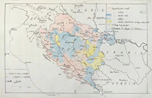
Background imageMaps (celestial & Terrestrial) Collection: Map of Bosnia with details of the areas occupied by minority ethnic groups, 1910 (pen

Map of Bosnia with details of the areas occupied by minority ethnic groups, 1910 (pen
CHT344067 Map of Bosnia with details of the areas occupied by minority ethnic groups, 1910 (pen, ink & w/c) by French School, (20th century); Archives du Ministere des Affaires Etrangeres, Paris

Background imageMaps (celestial & Terrestrial) Collection: Map of Berlin, printed by Koenigl. Lithogr. Institut, Berlin, 1857 (colour litho)

Map of Berlin, printed by Koenigl. Lithogr. Institut, Berlin, 1857 (colour litho)
AGD355563 Map of Berlin, printed by Koenigl. Lithogr. Institut, Berlin, 1857 (colour litho) by German School, (19th century); 85.1x119 cm; Private Collection; (add.info.: Koenigl. Preuss)

Background imageMaps (celestial & Terrestrial) Collection: Map of Berlin, published by Carl Glueck Verlag, Berlin, 1860 (colour litho)

Map of Berlin, published by Carl Glueck Verlag, Berlin, 1860 (colour litho)
AGD355555 Map of Berlin, published by Carl Glueck Verlag, Berlin, 1860 (colour litho) by German School, (19th century); 49.6x37 cm; Private Collection; (add.info)

Background imageMaps (celestial & Terrestrial) Collection: Chart showing the exact localities in England and Scotland that suffered from hostile air

Chart showing the exact localities in England and Scotland that suffered from hostile air
STC359795 Chart showing the exact localities in England and Scotland that suffered from hostile air raids and bombardments from December 16th, 1914 to June 17th, 1918

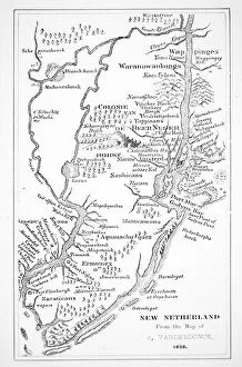
Background imageMaps (celestial & Terrestrial) Collection: Colonial America: the Dutch Colony of New Netherland (litho)

Colonial America: the Dutch Colony of New Netherland (litho)
PNP351122 Colonial America: the Dutch Colony of New Netherland (litho) by Vanderbank, John (1694-1739) (after); Private Collection; (add.info)

Background imageMaps (celestial & Terrestrial) Collection: Colony of Georgia, America, 1733 (litho)

Colony of Georgia, America, 1733 (litho)
PNP351109 Colony of Georgia, America, 1733 (litho) by American School, (18th century); Private Collection; (add.info.: the earliest map of Georgia; ); Peter Newark American Pictures; American

Background imageMaps (celestial & Terrestrial) Collection: Map of Boston and Charlestown, 1775 (pen, ink & w / c on paper)

Map of Boston and Charlestown, 1775 (pen, ink & w / c on paper)
PNP351105 Map of Boston and Charlestown, 1775 (pen, ink & w/c on paper) by Montresor, John (1736-99); Private Collection; Peter Newark American Pictures; English, out of copyright

Background imageMaps (celestial & Terrestrial) Collection: Map of the Western Hemisphere in 1626 (colour litho)

Map of the Western Hemisphere in 1626 (colour litho)
PNP351107 Map of the Western Hemisphere in 1626 (colour litho) by Speed, John (1552-1629); Private Collection; Peter Newark American Pictures; English, out of copyright

Background imageMaps (celestial & Terrestrial) Collection: Map of Vicenza, illustration from Civitates Orbis Terrarum, c. 1580 (engraving)

Map of Vicenza, illustration from Civitates Orbis Terrarum, c. 1580 (engraving)
REV345839 Map of Vicenza, illustration from Civitates Orbis Terrarum, c.1580 (engraving) by Braun, Georg (1541-1622) and Hogenberg

Background imageMaps (celestial & Terrestrial) Collection: Map showing the world trade shipping routes, cartography by Pierre Duval (1619-83

Map showing the world trade shipping routes, cartography by Pierre Duval (1619-83
REV345800 Map showing the world trade shipping routes, cartography by Pierre Duval (1619-83) published in 1686, Paris (colour engraving) by French School

Background imageMaps (celestial & Terrestrial) Collection: Gotha during the siege of Grimmenstein, 1567 (oil on panel)

Gotha during the siege of Grimmenstein, 1567 (oil on panel)
BFM286623 Gotha during the siege of Grimmenstein, 1567 (oil on panel) by German School, (16th century); Schlossmuseum, Schloss Friedenstein, Gotha

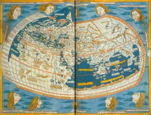
Background imageMaps (celestial & Terrestrial) Collection: Map of the world, based on descriptions and co-ordinates given in Geographia

Map of the world, based on descriptions and co-ordinates given in Geographia
NBY259407 Map of the world, based on descriptions and co-ordinates given in Geographia first published in Ulm, Germany, 1482 (colour litho) by Ptolemy (Claudius Ptolemaeus of Alexandria)(c.90-168)

Background imageMaps (celestial & Terrestrial) Collection: Map of Sixteenth Century Italy, from the Sala delle Carte Geografiche

Map of Sixteenth Century Italy, from the Sala delle Carte Geografiche
BEN90579 Map of Sixteenth Century Italy, from the Sala delle Carte Geografiche (Hall of Geographical Maps) 1575 (oil on panel) by Bonsignori, Stefano and Danti

Background imageMaps (celestial & Terrestrial) Collection: Map of Sixteenth Century Turkey, from the Sala delle Carte Geografiche

Map of Sixteenth Century Turkey, from the Sala delle Carte Geografiche
BEN90577 Map of Sixteenth Century Turkey, from the Sala delle Carte Geografiche (Hall of Geographical Maps) 1575 (oil on panel) by Bonsignori, Stefano and Danti

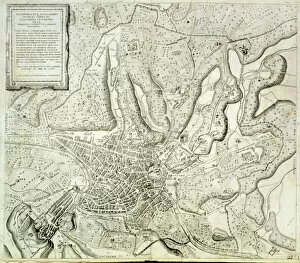
Background imageMaps (celestial & Terrestrial) Collection: Map of the city of Rome, engraved by the artist, 1557 (engraving)

Map of the city of Rome, engraved by the artist, 1557 (engraving)
STC84896 Map of the city of Rome, engraved by the artist, 1557 (engraving) by Lafreri, Antonio (1512-77); Private Collection; The Stapleton Collection; French, out of copyright

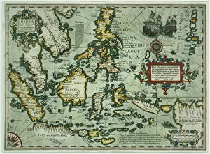
Background imageMaps (celestial & Terrestrial) Collection: Map of the East Indies, pub. 1635 in Amsterdam (hand-coloured engraving)

Map of the East Indies, pub. 1635 in Amsterdam (hand-coloured engraving)
STC79290 Map of the East Indies, pub. 1635 in Amsterdam (hand-coloured engraving) by Dutch School, (17th century); Private Collection; The Stapleton Collection; Dutch, out of copyright

Background imageMaps (celestial & Terrestrial) Collection: Plan of Regents Park, printed by Boosey & Co. 1822 (engraving)

Plan of Regents Park, printed by Boosey & Co. 1822 (engraving)
CWA93314 Plan of Regents Park, printed by Boosey & Co. 1822 (engraving) by Briggs, J. (19th century) (after); City of Westminster Archive Centre, London, UK; eWestminister Archives; English

Background imageMaps (celestial & Terrestrial) Collection: Map of Tunis, from Civitates Orbis Terrarum by Georg Braun (1541-1622

Map of Tunis, from Civitates Orbis Terrarum by Georg Braun (1541-1622
STC121078 Map of Tunis, from Civitates Orbis Terrarum by Georg Braun (1541-1622) and Frans Hogenberg (1535-90), 1574 (coloured engraving) by Hoefnagel

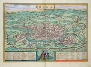
Background imageMaps (celestial & Terrestrial) Collection: Map of Rome, from Civitates Orbis Terrarum by Georg Braun (1541-1622

Map of Rome, from Civitates Orbis Terrarum by Georg Braun (1541-1622
STC121069 Map of Rome, from Civitates Orbis Terrarum by Georg Braun (1541-1622) and Frans Hogenberg (1535-90), c.1572 (coloured engraving) by Hoefnagel

Background imageMaps (celestial & Terrestrial) Collection: Map of Poitiers, from Civitates Orbis Terrarum

Map of Poitiers, from Civitates Orbis Terrarum
STC121039 Map of Poitiers, from Civitates Orbis Terrarum by Georg Braun (1541-1622) and Frans Hogenberg (1535-90), 1561 (coloured engraving) by Hoefnagel

Background imageMaps (celestial & Terrestrial) Collection: Map of Parma, Siena, Palermo, and Drepanum, from Civitates Orbis Terrarum

Map of Parma, Siena, Palermo, and Drepanum, from Civitates Orbis Terrarum
STC121068 Map of Parma, Siena, Palermo, and Drepanum, from Civitates Orbis Terrarum by Georg Braun (1541-1622) and Frans Hogenberg (1535-90), c.1572 (coloured engraving) by Hoefnagel

Background imageMaps (celestial & Terrestrial) Collection: Map of Naples, from Civitates Orbis Terrarum by Georg Braun (1541-1622

Map of Naples, from Civitates Orbis Terrarum by Georg Braun (1541-1622
STC121067 Map of Naples, from Civitates Orbis Terrarum by Georg Braun (1541-1622) and Frans Hogenberg (1535-90), c.1572 (coloured engraving) by Hoefnagel

Background imageMaps (celestial & Terrestrial) Collection: Map of Milan, from Civitates Orbis Terrarum by Georg Braun (1541-1622

Map of Milan, from Civitates Orbis Terrarum by Georg Braun (1541-1622
STC121066 Map of Milan, from Civitates Orbis Terrarum by Georg Braun (1541-1622) and Frans Hogenburg (1535-90), c.1572 (coloured engraving) by Hoefnagel

Background imageMaps (celestial & Terrestrial) Collection: Map of Catania, from Civitates Orbis Terrarum by Georg Braun (1541-1622

Map of Catania, from Civitates Orbis Terrarum by Georg Braun (1541-1622
STC121059 Map of Catania, from Civitates Orbis Terrarum by Georg Braun (1541-1622) and Frans Hogenberg (1535-90), c.1572 (coloured engraving) by Hoefnagel

Background imageMaps (celestial & Terrestrial) Collection: Map of Seville, Cadiz, and Malaga, from Civitates Orbis Terrarum

Map of Seville, Cadiz, and Malaga, from Civitates Orbis Terrarum
STC121052 Map of Seville, Cadiz, and Malaga, from Civitates Orbis Terrarum by Georg Braun (1541-1622) and Frans Hogenberg (1535-90), c.1572 (coloured engraving) by Hoefnagel

Background imageMaps (celestial & Terrestrial) Collection: Map of Avignon, from Civitates Orbis Terrarum by Georg Braun (1541-1622

Map of Avignon, from Civitates Orbis Terrarum by Georg Braun (1541-1622
STC121029 Map of Avignon, from Civitates Orbis Terrarum by Georg Braun (1541-1622) and Frans Hogenberg, c.1572 (colour engraving) by Hoefnagel

Background imageMaps (celestial & Terrestrial) Collection: Map of Nuremberg, Ulm, and Saltzburg, from Civitates Orbis Terrarum

Map of Nuremberg, Ulm, and Saltzburg, from Civitates Orbis Terrarum
STC121026 Map of Nuremberg, Ulm, and Saltzburg, from Civitates Orbis Terrarum by Georg Braun (1541-1622) and Frans Hogenberg (1535-90), c.1572 (colour engraving) by Hoefnagel

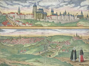
Background imageMaps (celestial & Terrestrial) Collection: Map of Prague, from Civitates Orbis Terrarum by Georg Braun (1541-1622

Map of Prague, from Civitates Orbis Terrarum by Georg Braun (1541-1622
STC121014 Map of Prague, from Civitates Orbis Terrarum by Georg Braun (1541-1622) and Frans Hogenberg (1535-90), c.1572 (coloured engraving) by Hoefnagel

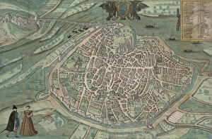
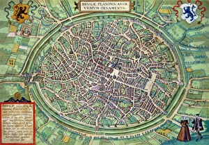
Background imageMaps (celestial & Terrestrial) Collection: Town Plan of Bruges, from Civitates Orbis Terrarum

Town Plan of Bruges, from Civitates Orbis Terrarum
STC121001 Town Plan of Bruges, from Civitates Orbis Terrarum by Georg Braun (1541-1622) and Frans Hogenburg (1535-90), c.1572 (coloured engraving) by Hoefnagel

Background imageMaps (celestial & Terrestrial) Collection: Map of Florence with a Perspectival View, 1750 (engraving)

Map of Florence with a Perspectival View, 1750 (engraving)
BAT100317 Map of Florence with a Perspectival View, 1750 (engraving) by Seutter, Georg MatthAaus (1678-1757); Museo di Firenze Com era, Florence, Italy; Photo eNicol Orsi Battaglini; German

Background imageMaps (celestial & Terrestrial) Collection: Map of Florence, 1730 (engraving)

Map of Florence, 1730 (engraving)
BAT100307 Map of Florence, 1730 (engraving) by Papini (18th century); Museo di Firenze Com era, Florence, Italy; Photo eNicol Orsi Battaglini; Italian, out of copyright

Background imageMaps (celestial & Terrestrial) Collection: Typus Orbis Terrarum, world map, 1577 (engraving) (b&w photo)

Typus Orbis Terrarum, world map, 1577 (engraving) (b&w photo)
XJF100257 Typus Orbis Terrarum, world map, 1577 (engraving) (b&w photo) by Ortelius, Abraham (1527-98); Private Collection; Flemish, out of copyright

Background imageMaps (celestial & Terrestrial) Collection: Map of Lake Garda and Surrounding Areas (oil on panel)

Map of Lake Garda and Surrounding Areas (oil on panel)
FTB97031 Map of Lake Garda and Surrounding Areas (oil on panel) by Sorte, Cristoforo (fl.1510-95); Museo Correr, Venice, Italy; Italian, out of copyright

Background imageMaps (celestial & Terrestrial) Collection: Paris at the outbreak of the French Revolution in 1789 (coloured litho)

Paris at the outbreak of the French Revolution in 1789 (coloured litho)
STC101885 Paris at the outbreak of the French Revolution in 1789 (coloured litho) by English School; Private Collection; The Stapleton Collection; English, out of copyright

Background imageMaps (celestial & Terrestrial) Collection: Map Charting the Movement of the Earth and Planets, from The Celestial Atlas

Map Charting the Movement of the Earth and Planets, from The Celestial Atlas
STC129821 Map Charting the Movement of the Earth and Planets, from The Celestial Atlas, or The Harmony of the Universe (Atlas coelestis seu harmonia macrocosmica) pub

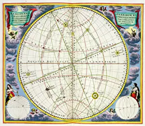
Background imageMaps (celestial & Terrestrial) Collection: Map Charting the Orbit of the Moon around the Earth, from A Celestial Atlas

Map Charting the Orbit of the Moon around the Earth, from A Celestial Atlas
STC129820 Map Charting the Orbit of the Moon around the Earth, from A Celestial Atlas, or The Harmony of the Universe (Atlas coelestis seu harmonia macrocosmica) pub

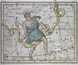
Background imageMaps (celestial & Terrestrial) Collection: Ophiuchus or Serpentarius, from A Celestial Atlas, pub

Ophiuchus or Serpentarius, from A Celestial Atlas, pub
STC129811 Ophiuchus or Serpentarius, from A Celestial Atlas, pub. in 1822 (coloured engraving) by Jamieson, Alexander (fl.1820); Private Collection; (add.info)

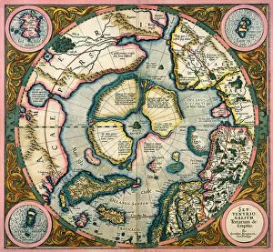
Background imageMaps (celestial & Terrestrial) Collection: Septentrionalium terrarum descriptio, map of the Arctic, 1595 (engraving)

Septentrionalium terrarum descriptio, map of the Arctic, 1595 (engraving)
STC126924 Septentrionalium terrarum descriptio, map of the Arctic, 1595 (engraving) by Mercator, Gerardus (1512-94); Private Collection; (add.info)

Background imageMaps (celestial & Terrestrial) Collection: A map of Constantinople in 1422 (engraving)

A map of Constantinople in 1422 (engraving)
aP168413 A map of Constantinople in 1422 (engraving) by Buondelmonti, Cristoforo (c, 1385-c.1430) (after); Private Collection; (add.info)

Background imageMaps (celestial & Terrestrial) Collection: The Empire of Charlemagne (742-814) from Le Nouveau Theatre du Monde

The Empire of Charlemagne (742-814) from Le Nouveau Theatre du Monde
CHT165851 The Empire of Charlemagne (742-814) from Le Nouveau Theatre du Monde, 1639 (coloured engraving) by Hondius, Hendrik I (1573-p.1649); Archives du Ministere des Affaires Etrangeres, Paris

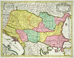
Background imageMaps (celestial & Terrestrial) Collection: Map of the Kingdom of Hungary and the States which are United to its Crown, pub

Map of the Kingdom of Hungary and the States which are United to its Crown, pub
STC101845 Map of the Kingdom of Hungary and the States which are United to its Crown, pub. by Jan Barend Elwe, Amsterdam, 1742 (engraving) by Dutch School


All Professionally Made to Order for Quick Shipping


-

Why Choose Us?

We are a leading provider of Art Prints and Photo Gifts since 2003, working in partnership with a range of Sporting Clubs, Charities, Museums and Picture Libraries. A large share of profits from any of their images will go directly towards supporting that charity or club. Our archive of images is carefully curated to bring you a wide range of subjects, including landscapes, wildlife, architecture, and more. We ship from our partner labs in the UK, USA, EU (Netherlands) and Australia.
+

How do I place an order?

Ordering is quick & easy - Just follow 5 Simple Steps:
  1. Find your image: Use our search box or browse our online photo Collections to find the image you want.

  2. Choose your print format: Select your desired product and add it to your cart.

  3. Enter your details: If you're a returning customer, simply enter your email address and password, and we'll fill in your billing and shipping address details. All personal details are held securely and are fully GDPR compliant. As standard, we remove all Personally Identifiable Information after 12 months.

  4. Pay for your purchase: We use state-of-the-art security for online shopping and do not have access to your card details.

  5. Sit back and relax: We'll email you confirmation of your order and when it's dispatched. Registered customers can also track orders in the 'My Account' area.

+

How do I pay for an order?

You can pay for your order with most of the major credit and debit cards, or PayPal. For added security, major financial institutions process payment details separately and securely on our behalf. We do not have access to your online payment card details. Online payments are preferred however we do take phone orders. For UK customers only we accept cheques issued against a UK bank.
+

Is my data safe?

We take data security very seriously. We do not have access to your full card details and all payments are requested over a fully secure connection. Additionally, we fully comply with current European and GDPR legislation, and automatically remove all personal data after at most 12 months (unless you have an account with us and have signed in recently). We also have a strict opt-in policy and would never sell your personal details. Your data is only used to fulfill your order promptly and efficiently.
+

Is wall art ready to hang?

For quick and easy installation all wall art, including framed prints, canvas prints and metal prints are supplied with a ready to hang solution on the back. Generally, saw tooth hangers are applied as they allow wall art to hang flush against the wall. The serrated edge of the hanger prevents the frame from shifting or tilting when hung.
+

Are the photo prints fade resistant?

Yes, we use archival quality photo paper photographic paper for vivid reproduction Prints are an accurate representations of the original artwork, which is preserved for artistic character and authenticity. We guarantee they match previews shown on our web site