Fraud Blocker Skip to main content

Home > Fine Art Finder > Maps (celestial & Terrestrial)

Maps (celestial & Terrestrial) Collection (page 32)

1,542 items

Background imageMaps (celestial & Terrestrial) Collection: Road from Whitby to Durham, from John Ogilbys Britannia, published London

Road from Whitby to Durham, from John Ogilbys Britannia, published London
BAL16022 Road from Whitby to Durham, from John Ogilbys Britannia, published London, 1675 by Ogilby, John (1600-1676); Map House, London, UK; English, out of copyright

Background imageMaps (celestial & Terrestrial) Collection: Map of Northampton and adjacent counties, from Atlas of England and Wales

Map of Northampton and adjacent counties, from Atlas of England and Wales
BAL16021 Map of Northampton and adjacent counties, from Atlas of England and Wales, 1576 (copper plate engraving) by Saxton, Christopher (c.1542-c.1610); Map House, London, UK; English

Background imageMaps (celestial & Terrestrial) Collection: F. 52v Map of Florida and the Antilles, from Cosmographia Universelle, 1555

F. 52v Map of Florida and the Antilles, from Cosmographia Universelle, 1555
XIR159080 F.52v Map of Florida and the Antilles, from Cosmographia Universelle, 1555 (w/c on paper) by Le Testu, Guillaume (c.1509-73); Min

Background imageMaps (celestial & Terrestrial) Collection: Plan of Moscow, 1628 (engraving) (b / w photo)

Plan of Moscow, 1628 (engraving) (b / w photo)
XIR159030 Plan of Moscow, 1628 (engraving) (b/w photo) by French School, (17th century); Private Collection; French, out of copyright

Background imageMaps (celestial & Terrestrial) Collection: Map illustrating La Rochelle occupied by the Huguenots (engraving) (b / w photo)

Map illustrating La Rochelle occupied by the Huguenots (engraving) (b / w photo)
XIR158889 Map illustrating La Rochelle occupied by the Huguenots (engraving) (b/w photo) by Lafreri, Antonio (1512-77); 30x47 cm; Bibliotheque Municipale, La Rochelle

Background imageMaps (celestial & Terrestrial) Collection: Terrestrial Globe, showing the Indian Ocean, made in Nuremberg, 1492 (see also 158163

Terrestrial Globe, showing the Indian Ocean, made in Nuremberg, 1492 (see also 158163
XIR158167 Terrestrial Globe, showing the Indian Ocean, made in Nuremberg, 1492 (see also 158163 and 158166) by Behaim, Martin (1459-1507); Bibliotheque Nationale, Paris

Background imageMaps (celestial & Terrestrial) Collection: Terrestrial Globe, showing the Indian Ocean, made in Nuremberg, 1492 (see also 158163

Terrestrial Globe, showing the Indian Ocean, made in Nuremberg, 1492 (see also 158163
XIR158166 Terrestrial Globe, showing the Indian Ocean, made in Nuremberg, 1492 (see also 158163, 158167) by Behaim, Martin (1459-1507); Bibliotheque Nationale, Paris

Background imageMaps (celestial & Terrestrial) Collection: Birds Eye Plan of Paris, 1615 (engraving)

Birds Eye Plan of Paris, 1615 (engraving)
XIR158159 Birds Eye Plan of Paris, 1615 (engraving) by Merian, Matthaus, the Elder (1593-1650); Bibliotheque Nationale, Paris, France; (add.info.: at time of Louis XIII; vue d oiseau); Swiss

Background imageMaps (celestial & Terrestrial) Collection: Plan of Paris, known as the Plan de Turgot, engraved by Claude Lucas, 1734-39

Plan of Paris, known as the Plan de Turgot, engraved by Claude Lucas, 1734-39
XIR158158 Plan of Paris, known as the Plan de Turgot, engraved by Claude Lucas, 1734-39 (engraving) (b/w photo) (detail) by Bretez, Louis (18th century) (after); Bibliotheque Nationale, Paris

Background imageMaps (celestial & Terrestrial) Collection: Plan of Paris, known as the Plan de Turgot, engraved by Claude Lucas, 1734-39

Plan of Paris, known as the Plan de Turgot, engraved by Claude Lucas, 1734-39
XIR158155 Plan of Paris, known as the Plan de Turgot, engraved by Claude Lucas, 1734-39 (engraving) (b/w photo) (detail) by Bretez, Louis (18th century) (after); Bibliotheque de L Arsenal, Paris

Background imageMaps (celestial & Terrestrial) Collection: Plan of Paris, known as the Plan de Turgot, engraved by Claude Lucas, 1734-39

Plan of Paris, known as the Plan de Turgot, engraved by Claude Lucas, 1734-39
XIR158154 Plan of Paris, known as the Plan de Turgot, engraved by Claude Lucas, 1734-39 (engraving) (b/w photo) (detail) by Bretez, Louis (18th century) (after); Private Collection; French

Background imageMaps (celestial & Terrestrial) Collection: Plan of Paris, known as the Plan de Turgot, engraved by Claude Lucas, 1734-39

Plan of Paris, known as the Plan de Turgot, engraved by Claude Lucas, 1734-39
XIR158153 Plan of Paris, known as the Plan de Turgot, engraved by Claude Lucas, 1734-39 (engraving) (b/w photo) (detail) by Bretez, Louis (18th century) (after); Private Collection; French

Background imageMaps (celestial & Terrestrial) Collection: Lutetia or the first plan of Paris, taken from Caesar, Strabo, Emperor Julian

Lutetia or the first plan of Paris, taken from Caesar, Strabo, Emperor Julian
XIR158152 Lutetia or the first plan of Paris, taken from Caesar, Strabo, Emperor Julian and Ammianus Marcellinus, 1705 (engraving) (b/w photo) by French School

Background imageMaps (celestial & Terrestrial) Collection: Map of Paris and its Surroundings, from Oisivetes (colour engraving)

Map of Paris and its Surroundings, from Oisivetes (colour engraving)
XIR156747 Map of Paris and its Surroundings, from Oisivetes (colour engraving) by Vauban, Sebastien Le Prestre de (1633-1707); Service Historique de L Armee et de L Air, Vincennes

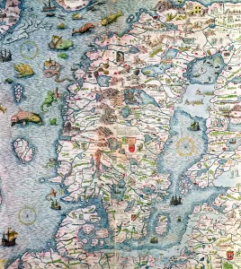
Background imageMaps (celestial & Terrestrial) Collection: Scandinavia, detail from the Carta Marina da Olaus Magnus, 1572 (coloured engraving)

Scandinavia, detail from the Carta Marina da Olaus Magnus, 1572 (coloured engraving)
XIR155549 Scandinavia, detail from the Carta Marina da Olaus Magnus, 1572 (coloured engraving) by Lafreri, Antonio (1512-77); Institut Tessin, Hotel de Marle, Paris, France; French, out of copyright

Background imageMaps (celestial & Terrestrial) Collection: Map of Corsica (coloured engraving)

Map of Corsica (coloured engraving)
XIR227256 Map of Corsica (coloured engraving) by Seutter, Georg MatthAÔé¼us (1678-1757); Bibliotheque Nationale, Paris, France; (add.info.: carte geographique de l Ile de Corse; ); German

Background imageMaps (celestial & Terrestrial) Collection: Planisphere, from Atlas Coelestis, engraved by Pieter Schenk (1660-1719) and Gerard Valk

Planisphere, from Atlas Coelestis, engraved by Pieter Schenk (1660-1719) and Gerard Valk
XIR154166 Planisphere, from Atlas Coelestis, engraved by Pieter Schenk (1660-1719) and Gerard Valk (1651-1726) (colour engraving) by Cellarius

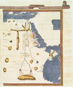
Background imageMaps (celestial & Terrestrial) Collection: Map showing Egypt to Ethiopia, from the Ptolemy manuscript, c

Map showing Egypt to Ethiopia, from the Ptolemy manuscript, c
XZL151832 Map showing Egypt to Ethiopia, from the Ptolemy manuscript, c.1470, illustration from Memoires de la Societe Royale de Geographie d Egypte (litho) by D Angiolo

Background imageMaps (celestial & Terrestrial) Collection: Map tracing Magellans world voyage, once owned by Charles V, 1545 (vellum)

Map tracing Magellans world voyage, once owned by Charles V, 1545 (vellum)
XZL151822 Map tracing Magellans world voyage, once owned by Charles V, 1545 (vellum) (see also 63417) by Agnese, Battista (1514-64); John Carter Brown Library, Brown University, RI, USA; Italian

Background imageMaps (celestial & Terrestrial) Collection: Ms 988 Tome 3 fol. 14 Map of Rocroi, from Atlas de Louis XIV, 1683-88 (gouache

Ms 988 Tome 3 fol. 14 Map of Rocroi, from Atlas de Louis XIV, 1683-88 (gouache
XIR226020 Ms 988 Tome 3 fol.14 Map of Rocroi, from Atlas de Louis XIV, 1683-88 (gouache on paper) by Vauban, Sebastien Le Prestre de (1633-1707); Min

Background imageMaps (celestial & Terrestrial) Collection: Constellations of the Southern Hemisphere, from the Synopsis of Comets

Constellations of the Southern Hemisphere, from the Synopsis of Comets
XJF149100 Constellations of the Southern Hemisphere, from the Synopsis of Comets by Sir Edmund Halley (1656-1742) 1705 (engraving) (b/w photo) by English School

Background imageMaps (celestial & Terrestrial) Collection: A True Description of the Naval Expedition of Francis Drake, who with Five Ships

A True Description of the Naval Expedition of Francis Drake, who with Five Ships
XYC148716 A True Description of the Naval Expedition of Francis Drake, who with Five Ships Departed from the Western Part of England on 13th December 1577

Background imageMaps (celestial & Terrestrial) Collection: Map showing the route of the Armada fleet, engraved by Augustine Ryther, 1588 (engraving)

Map showing the route of the Armada fleet, engraved by Augustine Ryther, 1588 (engraving)
XZL148106 Map showing the route of the Armada fleet, engraved by Augustine Ryther, 1588 (engraving) (see 133339 for b/w) by Adams, Robert (1540-95) (after); Private Collection; English

Background imageMaps (celestial & Terrestrial) Collection: Map charting Sir Francis Drakes (c. 1540-96) circumnavigation of the globe, engraved

Map charting Sir Francis Drakes (c. 1540-96) circumnavigation of the globe, engraved
XCF137074 Map charting Sir Francis Drakes (c.1540-96) circumnavigation of the globe, engraved by Frans Hogenburg (1535-90) (coloured engraving) by English School

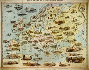
Background imageMaps (celestial & Terrestrial) Collection: The Travellers, or A Tour Through Europe, engraved by W. Clerk, published by William Spooner

The Travellers, or A Tour Through Europe, engraved by W. Clerk, published by William Spooner
BAL135467 The Travellers, or A Tour Through Europe, engraved by W. Clerk, published by William Spooner, London, 1842 (hand-coloured litho) by English School

Background imageMaps (celestial & Terrestrial) Collection: Map of the Various Proposed Isthmian Canal Routes (litho) (b / w photo)

Map of the Various Proposed Isthmian Canal Routes (litho) (b / w photo)
XJF135244 Map of the Various Proposed Isthmian Canal Routes (litho) (b/w photo) by English School, (19th century); Private Collection; English, out of copyright

Background imageMaps (celestial & Terrestrial) Collection: Map of Great Britain, France and Spain, 1473 (engraving)

Map of Great Britain, France and Spain, 1473 (engraving)
XJF134226 Map of Great Britain, France and Spain, 1473 (engraving) by Benincasa, Grazioso (fl.1468); Private Collection; Italian, out of copyright

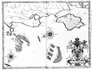
Background imageMaps (celestial & Terrestrial) Collection: Map No. 10 showing the route of the Armada fleet, engraved by Augustine Ryther, 1588

Map No. 10 showing the route of the Armada fleet, engraved by Augustine Ryther, 1588
XJF133940 Map No.10 showing the route of the Armada fleet, engraved by Augustine Ryther, 1588 (engraving) (b/w photo) by Adams, Robert (1540-95) (after); Private Collection; English, out of copyright

Background imageMaps (celestial & Terrestrial) Collection: Map No. 7 showing the route of the Armada fleet, engraved by Augustine Ryther, 1588

Map No. 7 showing the route of the Armada fleet, engraved by Augustine Ryther, 1588
XJF133938 Map No.7 showing the route of the Armada fleet, engraved by Augustine Ryther, 1588 (engraving) (b/w photo) by Adams, Robert (1540-95) (after); Private Collection; English, out of copyright

Background imageMaps (celestial & Terrestrial) Collection: Map No. 8 showing the route of the Armada fleet, engraved by Augustine Ryther, 1588

Map No. 8 showing the route of the Armada fleet, engraved by Augustine Ryther, 1588
XJF133937 Map No.8 showing the route of the Armada fleet, engraved by Augustine Ryther, 1588 (engraving) (b/w photo) by Adams, Robert (1540-95) (after); Private Collection; English, out of copyright

Background imageMaps (celestial & Terrestrial) Collection: Map No. 6 showing the route of the Armada fleet, engraved by Augustine Ryther, 1588

Map No. 6 showing the route of the Armada fleet, engraved by Augustine Ryther, 1588
XJF133936 Map No.6 showing the route of the Armada fleet, engraved by Augustine Ryther, 1588 (engraving) (b/w photo) by Adams, Robert (1540-95) (after); Private Collection; English, out of copyright

Background imageMaps (celestial & Terrestrial) Collection: Map No. 4 Showing the route of the Armada fleet, engraved by Augustine Ryther; 1588

Map No. 4 Showing the route of the Armada fleet, engraved by Augustine Ryther; 1588
XJF133934 Map No.4 Showing the route of the Armada fleet, engraved by Augustine Ryther; 1588 (engraving) (b/w photo) by Adams, Robert (1540-95) (after); Private Collection; English, out of copyright

Background imageMaps (celestial & Terrestrial) Collection: Map No. 2 Showing the route of the Armada fleet, engraved by Augustine Ryther, 1588

Map No. 2 Showing the route of the Armada fleet, engraved by Augustine Ryther, 1588
XJF133932 Map No.2 Showing the route of the Armada fleet, engraved by Augustine Ryther, 1588 (engraving) (b/w photo) by Adams, Robert (1540-95) (after); Private Collection; English, out of copyright

Background imageMaps (celestial & Terrestrial) Collection: Mirror of Nature as a Whole, A Likeness of Art (engraving) (b / w photo)

Mirror of Nature as a Whole, A Likeness of Art (engraving) (b / w photo)
XJF133925 Mirror of Nature as a Whole, A Likeness of Art (engraving) (b/w photo) by English School, (18th century); Private Collection; English, out of copyright

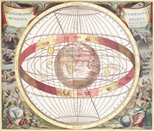
Background imageMaps (celestial & Terrestrial) Collection: Map Depicting the Ptolemaic and Tycho Brahe (1546-1601) Systems of Planetary Orbit

Map Depicting the Ptolemaic and Tycho Brahe (1546-1601) Systems of Planetary Orbit
XJF133924 Map Depicting the Ptolemaic and Tycho Brahe (1546-1601) Systems of Planetary Orbit, 1701 (engraving) (b/w photo) by English School

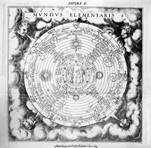
Background imageMaps (celestial & Terrestrial) Collection: The Elemental Composition of the World (engraving) (b / w photo)

The Elemental Composition of the World (engraving) (b / w photo)
XJF133399 The Elemental Composition of the World (engraving) (b/w photo) by English School, (17th century); Private Collection; English, out of copyright

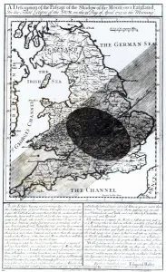
Background imageMaps (celestial & Terrestrial) Collection: A Map Showing the Passage of the Shadow of the Moon Over England on 22 April 1715

A Map Showing the Passage of the Shadow of the Moon Over England on 22 April 1715
XJF133397 A Map Showing the Passage of the Shadow of the Moon Over England on 22 April 1715, engraved by John Senex, 1715 (engraving) (b/w photo) by English School

Background imageMaps (celestial & Terrestrial) Collection: The Essential Harmony from which any Human Spirit is Made Up, 1619 (engraving) (b / w

The Essential Harmony from which any Human Spirit is Made Up, 1619 (engraving) (b / w
XJF133388 The Essential Harmony from which any Human Spirit is Made Up, 1619 (engraving) (b/w photo) by English School, (17th century); Private Collection; English, out of copyright

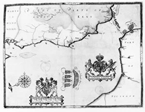
Background imageMaps (celestial & Terrestrial) Collection: Map showing the route of the Armada fleet, engraved by Augustine Ryther, 1588 (engraving)

Map showing the route of the Armada fleet, engraved by Augustine Ryther, 1588 (engraving)
XJF133339 Map showing the route of the Armada fleet, engraved by Augustine Ryther, 1588 (engraving) (b/w photo) by Adams, Robert (1540-95) (after); Private Collection; English, out of copyright

Background imageMaps (celestial & Terrestrial) Collection: Map No. 1 showing the route of the Armada fleet, engraved by Augustine Ryther, 1588

Map No. 1 showing the route of the Armada fleet, engraved by Augustine Ryther, 1588
XCF133338 Map No. 1 showing the route of the Armada fleet, engraved by Augustine Ryther, 1588 (engraving) (b/w photo) by Adams, Robert (1540-95) (after); Private Collection; English, out of copyright

Background imageMaps (celestial & Terrestrial) Collection: Map of the Island of Utopia and its Alphabet (engraving) (b / w photo)

Map of the Island of Utopia and its Alphabet (engraving) (b / w photo)
XJF131244 Map of the Island of Utopia and its Alphabet (engraving) (b/w photo) by English School, (16th century); Private Collection; English, out of copyright

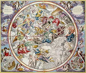
Background imageMaps (celestial & Terrestrial) Collection: Map of the Christian Constellations as depicted by Julius Schiller, from The Celestial Atlas

Map of the Christian Constellations as depicted by Julius Schiller, from The Celestial Atlas
XCF129833 Map of the Christian Constellations as depicted by Julius Schiller, from The Celestial Atlas, or The Harmony of the Universe (Atlas coelestis seu harmonia macrocosmica) pub

Background imageMaps (celestial & Terrestrial) Collection: The Islands of Samoa and Maouna, from the itinerary of La Perouse, 1787 (engraving)

The Islands of Samoa and Maouna, from the itinerary of La Perouse, 1787 (engraving)
XIR1272880 The Islands of Samoa and Maouna, from the itinerary of La Perouse, 1787 (engraving) by French School, (18th century); Private Collection; French, out of copyright

Background imageMaps (celestial & Terrestrial) Collection: Map of the South China Sea, from the itinerary of La Perouse, 1787 (engraving)

Map of the South China Sea, from the itinerary of La Perouse, 1787 (engraving)
XIR1272877 Map of the South China Sea, from the itinerary of La Perouse, 1787 (engraving) by French School, (18th century); Private Collection; (add.info.: Jean FranAzois de Galaup)

Background imageMaps (celestial & Terrestrial) Collection: The Bay of Concepcion, Chile (engraving)

The Bay of Concepcion, Chile (engraving)
XIR1272875 The Bay of Concepcion, Chile (engraving) by French School, (18th century); Private Collection; (add.info.: On the itinerary of Jean FranAzois de Galaup, comte de Laperouse)

Background imageMaps (celestial & Terrestrial) Collection: Map of Connecticut, from Connecticut Historical Collections by John Warner Barber

Map of Connecticut, from Connecticut Historical Collections by John Warner Barber
BAL124946 Map of Connecticut, from Connecticut Historical Collections by John Warner Barber, 1856 (engraving) by American School, (19th century); Private Collection; American, out of copyright

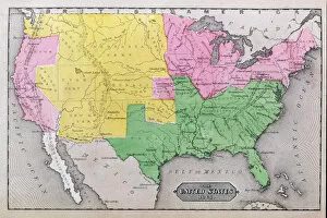
Background imageMaps (celestial & Terrestrial) Collection: Map of the United States in 1861, from Our Whole Country: The Past and Present

Map of the United States in 1861, from Our Whole Country: The Past and Present
BAL124928 Map of the United States in 1861, from Our Whole Country: The Past and Present of the United States, Historical and Descriptive, by John Warner Barber and Henry Hare

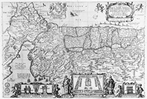
Background imageMaps (celestial & Terrestrial) Collection: Forty Years Travels of the Children of Israel (engraving) (b / w photo)

Forty Years Travels of the Children of Israel (engraving) (b / w photo)
XJF115889 Forty Years Travels of the Children of Israel (engraving) (b/w photo) by English School, (17th century); Private Collection; (add.info.: dedicated to James Butler)


All Professionally Made to Order for Quick Shipping


-

Why Choose Us?

We are a leading provider of Art Prints and Photo Gifts since 2003, working in partnership with a range of Sporting Clubs, Charities, Museums and Picture Libraries. A large share of profits from any of their images will go directly towards supporting that charity or club. Our archive of images is carefully curated to bring you a wide range of subjects, including landscapes, wildlife, architecture, and more. We ship from our partner labs in the UK, USA, EU (Netherlands) and Australia.
+

How do I place an order?

Ordering is quick & easy - Just follow 5 Simple Steps:
  1. Find your image: Use our search box or browse our online photo Collections to find the image you want.

  2. Choose your print format: Select your desired product and add it to your cart.

  3. Enter your details: If you're a returning customer, simply enter your email address and password, and we'll fill in your billing and shipping address details. All personal details are held securely and are fully GDPR compliant. As standard, we remove all Personally Identifiable Information after 12 months.

  4. Pay for your purchase: We use state-of-the-art security for online shopping and do not have access to your card details.

  5. Sit back and relax: We'll email you confirmation of your order and when it's dispatched. Registered customers can also track orders in the 'My Account' area.

+

How do I pay for an order?

You can pay for your order with most of the major credit and debit cards, or PayPal. For added security, major financial institutions process payment details separately and securely on our behalf. We do not have access to your online payment card details. Online payments are preferred however we do take phone orders. For UK customers only we accept cheques issued against a UK bank.
+

Is my data safe?

We take data security very seriously. We do not have access to your full card details and all payments are requested over a fully secure connection. Additionally, we fully comply with current European and GDPR legislation, and automatically remove all personal data after at most 12 months (unless you have an account with us and have signed in recently). We also have a strict opt-in policy and would never sell your personal details. Your data is only used to fulfill your order promptly and efficiently.
+

Is wall art ready to hang?

For quick and easy installation all wall art, including framed prints, canvas prints and metal prints are supplied with a ready to hang solution on the back. Generally, saw tooth hangers are applied as they allow wall art to hang flush against the wall. The serrated edge of the hanger prevents the frame from shifting or tilting when hung.
+

Are the photo prints fade resistant?

Yes, we use archival quality photo paper photographic paper for vivid reproduction Prints are an accurate representations of the original artwork, which is preserved for artistic character and authenticity. We guarantee they match previews shown on our web site