Fraud Blocker Skip to main content

Home > Fine Art Finder > Maps (celestial & Terrestrial)

Maps (celestial & Terrestrial) Collection (page 31)

1,542 items

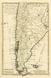
Background imageMaps (celestial & Terrestrial) Collection: Chile, from the south of Peru to Cape Horn, from Atlas de Toutes les Parties

Chile, from the south of Peru to Cape Horn, from Atlas de Toutes les Parties
KW205856 Chile, from the south of Peru to Cape Horn, from Atlas de Toutes les Parties Connues du Globe Terrestre by Guillaume Raynal (1713-96) published Geneva, 1780 (coloured engraving) by Bonne

Background imageMaps (celestial & Terrestrial) Collection: Southern India and Ceylon, from Atlas de Toutes les Parties Connues du Globe

Southern India and Ceylon, from Atlas de Toutes les Parties Connues du Globe
KW205854 Southern India and Ceylon, from Atlas de Toutes les Parties Connues du Globe Terrestre by Guillaume Raynal (1713-96), published J L Pellet, Geneva, 1780 (coloured engraving) by Bonne

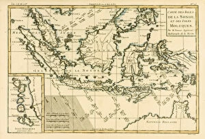
Background imageMaps (celestial & Terrestrial) Collection: Indonesia and the Philippines, from Atlas de Toutes les Parties Connues du Globe

Indonesia and the Philippines, from Atlas de Toutes les Parties Connues du Globe
KW205853 Indonesia and the Philippines, from Atlas de Toutes les Parties Connues du Globe Terrestre by Guillaume Raynal (1713-96) published Geneva, 1780 (coloured engraving) by Bonne

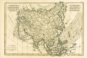
Background imageMaps (celestial & Terrestrial) Collection: Asia, from Atlas de Toutes les Parties Connues du Globe Terrestre by Guillaume Raynal

Asia, from Atlas de Toutes les Parties Connues du Globe Terrestre by Guillaume Raynal
KW205845 Asia, from Atlas de Toutes les Parties Connues du Globe Terrestre by Guillaume Raynal (1713-96) published Geneva, 1780 (coloured engraving) by Bonne

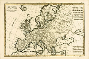
Background imageMaps (celestial & Terrestrial) Collection: Europe, from Atlas de Toutes les Parties Connues du Globe Terrestre by Guillaume Raynal

Europe, from Atlas de Toutes les Parties Connues du Globe Terrestre by Guillaume Raynal
KW205842 Europe, from Atlas de Toutes les Parties Connues du Globe Terrestre by Guillaume Raynal (1713-96) published Geneva, 1780 (coloured engraving) by Bonne

Background imageMaps (celestial & Terrestrial) Collection: Map of the World using the Mercator Projection, from Atlas de Toutes les Parties

Map of the World using the Mercator Projection, from Atlas de Toutes les Parties
KW205839 Map of the World using the Mercator Projection, from Atlas de Toutes les Parties Connues du Globe Terrestre by Guillaume Raynal (1713-96) published Geneva

Background imageMaps (celestial & Terrestrial) Collection: The Antilles and the Gulf of Mexico, from Atlas de Toutes les Parties Connues

The Antilles and the Gulf of Mexico, from Atlas de Toutes les Parties Connues
KW205836 The Antilles and the Gulf of Mexico, from Atlas de Toutes les Parties Connues du Globe Terrestre by Guillaume Raynal (1713-96) published Geneva, 1780 (coloured engraving) by Bonne

Background imageMaps (celestial & Terrestrial) Collection: Northern Europe, including Denmark, Norway, Sweden and Lapland, with most of Western Russia

Northern Europe, including Denmark, Norway, Sweden and Lapland, with most of Western Russia
KW205833 Northern Europe, including Denmark, Norway, Sweden and Lapland, with most of Western Russia, from Atlas de Toutes les Parties Connues du Globe Terrestre by Guillaume Raynal (1713-96)

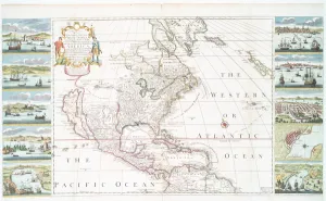
Background imageMaps (celestial & Terrestrial) Collection: North America, from Atlas de Toutes les Parties Connues du Globe Terrestre

North America, from Atlas de Toutes les Parties Connues du Globe Terrestre
KW205832 North America, from Atlas de Toutes les Parties Connues du Globe Terrestre by Guillaume Raynal (1713-96), published J L Pellet, Geneva, 1780 (coloured engraving) by Bonne

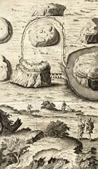
Background imageMaps (celestial & Terrestrial) Collection: The First Plan of Rome as it was at the Beginning of the Reign of Romulus (engraving)

The First Plan of Rome as it was at the Beginning of the Reign of Romulus (engraving)
KW205659 The First Plan of Rome as it was at the Beginning of the Reign of Romulus (engraving) by English School; Private Collection; Ken Welsh; English, out of copyright

Background imageMaps (celestial & Terrestrial) Collection: A Second Plan of Rome Representing its Situation after the Union Between Romulus and Tatius

A Second Plan of Rome Representing its Situation after the Union Between Romulus and Tatius
KW205653 A Second Plan of Rome Representing its Situation after the Union Between Romulus and Tatius (engraving) by English School; Private Collection; Ken Welsh; English, out of copyright

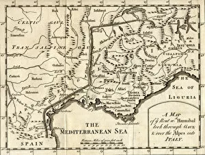
Background imageMaps (celestial & Terrestrial) Collection: A Map of the Route Hannibal took through Gaul and over the Alps into Italy (engraving)

A Map of the Route Hannibal took through Gaul and over the Alps into Italy (engraving)
KW205652 A Map of the Route Hannibal took through Gaul and over the Alps into Italy (engraving) by English School; Private Collection; Ken Welsh; English, out of copyright

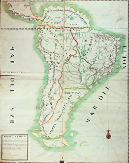
Background imageMaps (celestial & Terrestrial) Collection: Map of South America, 1777 (w / c, gouache and pen & ink on paper)

Map of South America, 1777 (w / c, gouache and pen & ink on paper)
XIR201598 Map of South America, 1777 (w/c, gouache and pen & ink on paper) by Spanish School, (18th century); Museo Naval, Madrid, Spain; (add.info.: Carte de l Amerique du Sud; ); Spanish

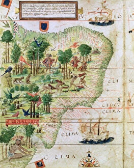
Background imageMaps (celestial & Terrestrial) Collection: Brazil from the Miller Atlas by Pedro Reinel, c. 1519 (detail of 75615)

Brazil from the Miller Atlas by Pedro Reinel, c. 1519 (detail of 75615)
BAL199955 Brazil from the Miller Atlas by Pedro Reinel, c.1519 (detail of 75615) by Portuguese School, (16th century); Bibliotheque Nationale, Paris, France; Portuguese, out of copyright

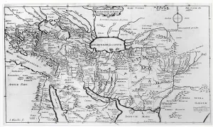
Background imageMaps (celestial & Terrestrial) Collection: Map of the Travels and the Expeditions of Alexander the Great (356-323 BC) in Asia

Map of the Travels and the Expeditions of Alexander the Great (356-323 BC) in Asia
XIR196729 Map of the Travels and the Expeditions of Alexander the Great (356-323 BC) in Asia (engraving) (b/w photo) by Blanchin, Jean (b.1597); Bibliotheque Nationale, Paris

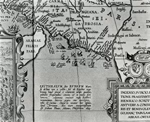
Background imageMaps (celestial & Terrestrial) Collection: Map of Alexander the Greats empire, from Abrahami Ortelli theatri orbis

Map of Alexander the Greats empire, from Abrahami Ortelli theatri orbis
XIR196728 Map of Alexander the Greats empire, from Abrahami Ortelli theatri orbis terrarum parergon, published in Antwerp in 1674 (engraving) (b/w photo) (detail) by Ortelius

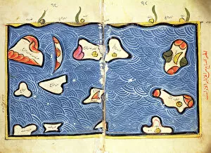
Background imageMaps (celestial & Terrestrial) Collection: The Indian Ocean, from an atlas (vellum)

The Indian Ocean, from an atlas (vellum)
XIR192402 The Indian Ocean, from an atlas (vellum) by Al-Idrisi or Edrisi, Abu Muhammad (c.1100-64) (after); Egyptian National Library, Cairo

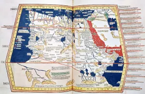
Background imageMaps (celestial & Terrestrial) Collection: Map of Africa, plate 18 from an Atlas of the World, 1486 (coloured engraving)

Map of Africa, plate 18 from an Atlas of the World, 1486 (coloured engraving)
XIR192401 Map of Africa, plate 18 from an Atlas of the World, 1486 (coloured engraving) by Ptolemy (Claudius Ptolemaeus of Alexandria)(c.90-168)(after); Bibliotheque Nationale, Paris, France; Greek

Background imageMaps (celestial & Terrestrial) Collection: Map of Spain and Portugal, 1731 (engraving)

Map of Spain and Portugal, 1731 (engraving)
KW188578 Map of Spain and Portugal, 1731 (engraving) by Moll, Hermann (fl.1678-1732); Private Collection; (add.info.: divided into Kingdoms and Principalities; ); Ken Welsh; German, out of copyright

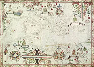
Background imageMaps (celestial & Terrestrial) Collection: Map of the Mediterranean, 1625 (gouache on paper)

Map of the Mediterranean, 1625 (gouache on paper)
XIR187095 Map of the Mediterranean, 1625 (gouache on paper) by Oliva, Johannes (fl.1625) (attr. to); Bibliotheque Nationale, Paris, France; Spanish, out of copyright

Background imageMaps (celestial & Terrestrial) Collection: Fol. 32v The Spice Trade in the Moloccas, from Cosmographie Universelle

Fol. 32v The Spice Trade in the Moloccas, from Cosmographie Universelle
XIR187075 Fol.32v The Spice Trade in the Moloccas, from Cosmographie Universelle, 1555 (w/c on paper) by Le Testu, Guillaume (c.1509-73); Min

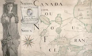
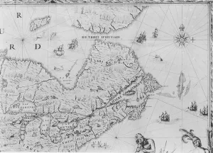
Background imageMaps (celestial & Terrestrial) Collection: Map of Nouvelle-France (Canada) 1699 (engraving) (see also 159120)

Map of Nouvelle-France (Canada) 1699 (engraving) (see also 159120)
XIR187069 Map of Nouvelle-France (Canada) 1699 (engraving) (see also 159120) by Fonville (fl.1699); Service Historique de la Marine, Vincennes, France; French, out of copyright

Background imageMaps (celestial & Terrestrial) Collection: Fol. 7v Map of the North Pole, from Cosmographie Universelle, 1555 (w / c

Fol. 7v Map of the North Pole, from Cosmographie Universelle, 1555 (w / c
XIR238653 Fol.7v Map of the North Pole, from Cosmographie Universelle, 1555 (w/c on paper) by Le Testu, Guillaume (c.1509-73); Min

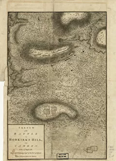
Background imageMaps (celestial & Terrestrial) Collection: Sketch of the Battle of Hobkirks Hill, near Camden, on the 25th April, 1781, published in London

Sketch of the Battle of Hobkirks Hill, near Camden, on the 25th April, 1781, published in London
XOS1765875 Sketch of the Battle of Hobkirks Hill, near Camden, on the 25th April, 1781, published in London, 1794 (engraving) by Vallancey, Charles (1721-1812); Private Collection; British

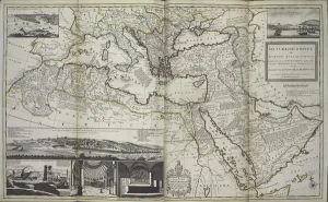
Background imageMaps (celestial & Terrestrial) Collection: The Turkish Empire in Europe, Asia and Africa, 1736 (hand coloured print)

The Turkish Empire in Europe, Asia and Africa, 1736 (hand coloured print)
XOS1765727 The Turkish Empire in Europe, Asia and Africa, 1736 (hand coloured print) by Moll, Hermann (fl.1678-1732); 64x101 cm; New York Public Library

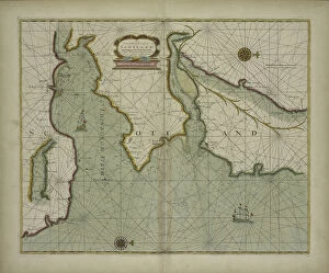
Background imageMaps (celestial & Terrestrial) Collection: A chart of the East coast of Scotland from a sea-atlas containing an hydrographical

A chart of the East coast of Scotland from a sea-atlas containing an hydrographical
XOS1765726 A chart of the East coast of Scotland from a sea-atlas containing an hydrographical description of most of the sea-coasts of the known parts of the world by Samuel Thornton

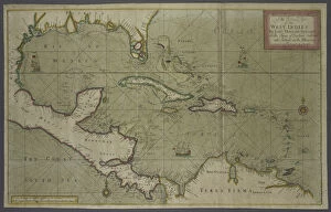
Background imageMaps (celestial & Terrestrial) Collection: Trading map of the West Indies, 1707 (hand coloured print)

Trading map of the West Indies, 1707 (hand coloured print)
XOS1765725 Trading map of the West Indies, 1707 (hand coloured print) by English School, (18th century); New York Public Library

Background imageMaps (celestial & Terrestrial) Collection: A new and correct map of the world from an atlas of the sea, 1707 (hand coloured print)

A new and correct map of the world from an atlas of the sea, 1707 (hand coloured print)
XOS1765724 A new and correct map of the world from an atlas of the sea, 1707 (hand coloured print) by English School, (18th century); New York Public Library

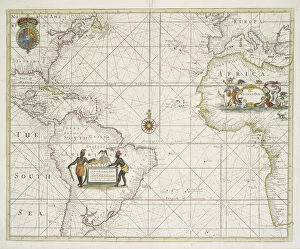
Background imageMaps (celestial & Terrestrial) Collection: Chart of the Western (now Atlantic) Ocean with rhumb lines by Jeremiah Seller, 1705

Chart of the Western (now Atlantic) Ocean with rhumb lines by Jeremiah Seller, 1705
XOS1765721 Chart of the Western (now Atlantic) Ocean with rhumb lines by Jeremiah Seller, 1705 (hand coloured print) by English School, (18th century); 42x53 cm; New York Public Library

Background imageMaps (celestial & Terrestrial) Collection: Territorial holdings of the Dutch West India Company, 1710 (hand coloured print

Territorial holdings of the Dutch West India Company, 1710 (hand coloured print
XOS1765720 Territorial holdings of the Dutch West India Company, 1710 (hand coloured print on vellum) by Bleau, Guillaume & Jean (17th century); 77.3x95.2 cm; New York Public Library

Background imageMaps (celestial & Terrestrial) Collection: A new and correct map of the trading part of the West Indies, 1741 (hand coloured print)

A new and correct map of the trading part of the West Indies, 1741 (hand coloured print)
XOS1765715 A new and correct map of the trading part of the West Indies, 1741 (hand coloured print) by Overton, Henry (18th century); 54x68 cm; New York Public Library

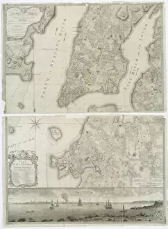
Background imageMaps (celestial & Terrestrial) Collection: Plan of the city of New York in North America surveyed in the years 1766 & 1767 published

Plan of the city of New York in North America surveyed in the years 1766 & 1767 published
XOS1765714 Plan of the city of New York in North America surveyed in the years 1766 & 1767 published in Fadens Atlas, 1776 (engraving) by Bry, Theodore de (1528-98), after White

Background imageMaps (celestial & Terrestrial) Collection: Newly discovered Virginia, 1590 (hand coloured engraving)

Newly discovered Virginia, 1590 (hand coloured engraving)
XOS1765713 Newly discovered Virginia, 1590 (hand coloured engraving) by Bry, Theodore de (1528-98), after White, John (d.1593); 29x40 cm; New York Public Library, USA; (add.info.: Americae pars)

Background imageMaps (celestial & Terrestrial) Collection: A new and accurate map of the world, 1676 (hand coloured print)

A new and accurate map of the world, 1676 (hand coloured print)
XOS1765712 A new and accurate map of the world, 1676 (hand coloured print) by Speed, John (1552-1629) (after); 41x54 cm; New York Public Library

Background imageMaps (celestial & Terrestrial) Collection: A general map of the world or terraqueous globe by Samuel Dunn, 1787 (engraving)

A general map of the world or terraqueous globe by Samuel Dunn, 1787 (engraving)
XOS1765709 A general map of the world or terraqueous globe by Samuel Dunn, 1787 (engraving) by English School, (18th century); 106x128 cm; New York Public Library

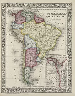
Background imageMaps (celestial & Terrestrial) Collection: Map of South America showing its political divisions from Mitchells new general atlas

Map of South America showing its political divisions from Mitchells new general atlas
XOS1765707 Map of South America showing its political divisions from Mitchells new general atlas, 1863 (coloured engraving) by Mitchell, Samuel Augustus (1792-1868); New York Public Library

Background imageMaps (celestial & Terrestrial) Collection: Double-hemisphere world map from Gooss Sea Atlas of the Water World, 1672 (hand

Double-hemisphere world map from Gooss Sea Atlas of the Water World, 1672 (hand
XOS1765706 Double-hemisphere world map from Gooss Sea Atlas of the Water World, 1672 (hand coloured engraving) by Goos, Pieter (fl.1670s); New York Public Library

Background imageMaps (celestial & Terrestrial) Collection: America Pars Meridionalis, page 93 of Atlas Minor Sive Geographia Compendiosa

America Pars Meridionalis, page 93 of Atlas Minor Sive Geographia Compendiosa
XYC176335 America Pars Meridionalis, page 93 of Atlas Minor Sive Geographia Compendiosa, qua Orbis Terrarum compiled by Nicolaes Visscher (1618-1709) 1655 (hand coloured engraving) by Jansson

Background imageMaps (celestial & Terrestrial) Collection: Map of Antwerp (engraving) (b / w photo)

Map of Antwerp (engraving) (b / w photo)
XJF105844 Map of Antwerp (engraving) (b/w photo) by Dutch School, (18th century); Private Collection; Dutch, out of copyright

Background imageMaps (celestial & Terrestrial) Collection: Map illustrating the Naval Attack on England by Napoleon Bonaparte (1769-1821) c

Map illustrating the Naval Attack on England by Napoleon Bonaparte (1769-1821) c
XIR168320 Map illustrating the Naval Attack on England by Napoleon Bonaparte (1769-1821) c.1803-04 (coloured engraving) by French School, (19th century); Bibliotheque Nationale, Paris

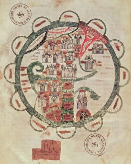
Background imageMaps (celestial & Terrestrial) Collection: Ms 782 f. 374v World map with Jerusalem in the centre, from Chroniques de St

Ms 782 f. 374v World map with Jerusalem in the centre, from Chroniques de St
XIR167558 Ms 782 f.374v World map with Jerusalem in the centre, from Chroniques de St. Denis, c.1275 (vellum) by French School, (13th century); Bibliotheque Sainte-Genevieve, Paris

Background imageMaps (celestial & Terrestrial) Collection: Fol. 47v Map of Peru, from Cosmographie Universelle, 1555 (w / c on paper)

Fol. 47v Map of Peru, from Cosmographie Universelle, 1555 (w / c on paper)
XIR165901 Fol.47v Map of Peru, from Cosmographie Universelle, 1555 (w/c on paper) by Le Testu, Guillaume (c.1509-73); Min

Background imageMaps (celestial & Terrestrial) Collection: Map of the Siege of Malta in 1565 (engraving) (b / w photo)

Map of the Siege of Malta in 1565 (engraving) (b / w photo)
XIR165123 Map of the Siege of Malta in 1565 (engraving) (b/w photo) by Italian School, (16th century); Bibliotheque Nationale, Paris

Background imageMaps (celestial & Terrestrial) Collection: Map of New France dedicated to Colbert by Duchesneau, Intendant, 1681 (engraving)

Map of New France dedicated to Colbert by Duchesneau, Intendant, 1681 (engraving)
XIR164769 Map of New France dedicated to Colbert by Duchesneau, Intendant, 1681 (engraving) (b/w photo) (detail) (see also 164768) by Franquelin

Background imageMaps (celestial & Terrestrial) Collection: Map of New France dedicated to Colbert by Duchesneau, Intendant, 1681 (engraving)

Map of New France dedicated to Colbert by Duchesneau, Intendant, 1681 (engraving)
XIR164768 Map of New France dedicated to Colbert by Duchesneau, Intendant, 1681 (engraving) (b/w photo) (see 164769 for detail) by Franquelin

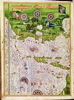
Background imageMaps (celestial & Terrestrial) Collection: Fol. 40v Map of the Magellan Straits, from Cosmographie Universelle, 1555

Fol. 40v Map of the Magellan Straits, from Cosmographie Universelle, 1555
XIR229320 Fol.40v Map of the Magellan Straits, from Cosmographie Universelle, 1555 (w/c on paper) by Le Testu, Guillaume (c.1509-73); Min

Background imageMaps (celestial & Terrestrial) Collection: IUK T. 5964 View of Istanbul (gouache on paper)

IUK T. 5964 View of Istanbul (gouache on paper)
XYL161187 IUK T.5964 View of Istanbul (gouache on paper) by Al-Silahi, Nasuh (Matraki) (16th Century); Topkapi Palace Museum, Istanbul

Background imageMaps (celestial & Terrestrial) Collection: Fol. 39v Map of the Magellan Straits, from Cosmographie Universelle, 1555

Fol. 39v Map of the Magellan Straits, from Cosmographie Universelle, 1555
XIR161170 Fol.39v Map of the Magellan Straits, from Cosmographie Universelle, 1555 (w/c on paper) by Le Testu, Guillaume (c.1509-73); Min


All Professionally Made to Order for Quick Shipping


-

Why Choose Us?

We are a leading provider of Art Prints and Photo Gifts since 2003, working in partnership with a range of Sporting Clubs, Charities, Museums and Picture Libraries. A large share of profits from any of their images will go directly towards supporting that charity or club. Our archive of images is carefully curated to bring you a wide range of subjects, including landscapes, wildlife, architecture, and more. We ship from our partner labs in the UK, USA, EU (Netherlands) and Australia.
+

How do I place an order?

Ordering is quick & easy - Just follow 5 Simple Steps:
  1. Find your image: Use our search box or browse our online photo Collections to find the image you want.

  2. Choose your print format: Select your desired product and add it to your cart.

  3. Enter your details: If you're a returning customer, simply enter your email address and password, and we'll fill in your billing and shipping address details. All personal details are held securely and are fully GDPR compliant. As standard, we remove all Personally Identifiable Information after 12 months.

  4. Pay for your purchase: We use state-of-the-art security for online shopping and do not have access to your card details.

  5. Sit back and relax: We'll email you confirmation of your order and when it's dispatched. Registered customers can also track orders in the 'My Account' area.

+

How do I pay for an order?

You can pay for your order with most of the major credit and debit cards, or PayPal. For added security, major financial institutions process payment details separately and securely on our behalf. We do not have access to your online payment card details. Online payments are preferred however we do take phone orders. For UK customers only we accept cheques issued against a UK bank.
+

Is my data safe?

We take data security very seriously. We do not have access to your full card details and all payments are requested over a fully secure connection. Additionally, we fully comply with current European and GDPR legislation, and automatically remove all personal data after at most 12 months (unless you have an account with us and have signed in recently). We also have a strict opt-in policy and would never sell your personal details. Your data is only used to fulfill your order promptly and efficiently.
+

Is wall art ready to hang?

For quick and easy installation all wall art, including framed prints, canvas prints and metal prints are supplied with a ready to hang solution on the back. Generally, saw tooth hangers are applied as they allow wall art to hang flush against the wall. The serrated edge of the hanger prevents the frame from shifting or tilting when hung.
+

Are the photo prints fade resistant?

Yes, we use archival quality photo paper photographic paper for vivid reproduction Prints are an accurate representations of the original artwork, which is preserved for artistic character and authenticity. We guarantee they match previews shown on our web site