Home > North America > United States of America > New York > New York > Maps
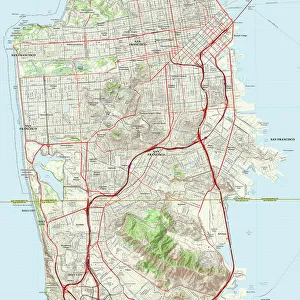
Plan of New York Island with Part of Long Island, Staten Island and East New Jersey

![]()
Wall Art and Photo Gifts from Fine Art Finder
Plan of New York Island with Part of Long Island, Staten Island and East New Jersey
985783 Plan of New York Island with Part of Long Island, Staten Island and East New Jersey and the Engagement on the Woody Heights of Long Island between the British Forces, under the command of General Sir William Howe (1729-1814), and the Americans, August 27, 1776, 1777 (coloured engraving) by Faden, William (1750-1836); Private Collection; (add.info.: Plan of New York Island with Part of Long Island, Staten Island and East New Jersey and the Engagement on the Woody Heights of Long Island between the British Forces, under the command of General Sir William Howe (1729-1814), and the Americans, August 27, 1776. From The North American Atlas. William Faden (1750-1836). Coloured engraving. Published 1777.); Photo eChristies Images; British, out of copyright
Media ID 23676078
© Christie's Images / Bridgeman Images
1770s 1777 Atlas English Text Engraved Geographic Isle Jersey Language Late 18th Century Late Eighteenth Century Lettering Long Island Military Position Military Rank Navigational Equipment New Jersey New York State Part Of Prints Staten Island Word Artist British British Artist Faden
FEATURES IN THESE COLLECTIONS
> Arts
> Artists
> F
> William Faden
> Fine Art Finder
> Artists
> Edward (after) Donovan
> Fine Art Finder
> Artists
> William Faden
> Fine Art Finder
> Temp Classification
> Maps and Charts
> Related Images
> North America
> United States of America
> Maps
> North America
> United States of America
> New Jersey
> Related Images
> North America
> United States of America
> New York
> New York
> Maps
> North America
> United States of America
> New York
> New York
> Staten Island
> Related Images
> North America
> United States of America
> New York
> Related Images
> Popular Themes
> North Island
EDITORS COMMENTS
This print showcases the intricate "Plan of New York Island with Part of Long Island, Staten Island and East New Jersey" created by William Faden in 1777. The colored engraving depicts a crucial engagement that took place on August 27,1776, between the British forces led by General Sir William Howe and the American troops. The detailed map provides a fascinating glimpse into the military tactics employed during this historic battle. It highlights strategic locations such as Woody Heights on Long Island where intense fighting occurred. With its precise lettering and navigational equipment illustrations, this artwork serves as both an informative historical document and a stunning piece of art. Faden's expertise as an illustrator is evident in his meticulous depiction of the landscape, capturing every contour of New York Island along with parts of Long Island, Staten Island, and East New Jersey. The vibrant colors bring life to the scene while emphasizing key geographical features. As we delve into this late eighteenth-century masterpiece, it becomes apparent that Faden's work transcends mere cartography; it tells a story of bravery and sacrifice from one pivotal moment in American history. This print allows us to appreciate not only Faden's artistic talent but also the significance of this battle in shaping the future course of our nation.
MADE IN THE UK
Safe Shipping with 30 Day Money Back Guarantee
FREE PERSONALISATION*
We are proud to offer a range of customisation features including Personalised Captions, Color Filters and Picture Zoom Tools
SECURE PAYMENTS
We happily accept a wide range of payment options so you can pay for the things you need in the way that is most convenient for you
* Options may vary by product and licensing agreement. Zoomed Pictures can be adjusted in the Basket.