
Maps Collection
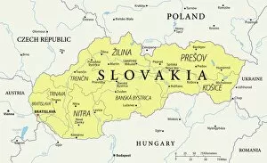
Maps of Slovakia Europe are detailed maps that show the country's borders, cities, rivers, mountains and other geographical features
Choose a picture from our Maps Collection for your Wall Art and Photo Gifts
11 items


All Professionally Made to Order for Quick Shipping
-
Maps Collection
Maps of Slovakia Europe are detailed maps that show the country's borders, cities, rivers, mountains and other geographical features. They also show the various regions and provinces within Slovakia. The maps provide an overview of the country's topography and its major roads and highways, and are useful for planning trips or understanding the geography of Slovakia. Maps of Slovakia can be found in print form or online from a variety of sources including government websites, travel websites, bookstores and libraries. These they are help travelers plan their trips to explore this beautiful country in Central Europe with its stunning mountain ranges, rolling hillsides and picturesque towns.
+
Our beautiful pictures are available as Framed Prints, Photos, Wall Art and Photo Gifts
The Maps of Slovakia Europe collection from Media Storehouse offers a range of wall art and framed prints showcasing the geography, history, and culture of Slovakia. Our collection features a variety of maps that highlight different aspects of the country, including its cities, regions, topography, and landmarks. These maps are available in various sizes and formats to suit different preferences and decor styles. The Maps of Slovakia Europe collection is an excellent choice for anyone interested in Slovakian history or culture or those who want to add a unique touch to their home or office decor. The high-quality printing ensures that each map is detailed and vibrant while the framing options allow for easy display without any additional work required. Whether you're looking for a gift for someone special or want to treat yourself to something new, the Maps of Slovakia Europe collection has something for everyone. With its stunning visuals and rich cultural significance, our collection is sure to be a conversation starter wherever it's displayed.
+
What are Maps of Slovakia Europe art prints?
Maps of Slovakia Europe art prints are high-quality reproductions of maps that depict the geography and topography of Slovakia, a landlocked country in Central Europe. These prints are created using advanced printing techniques that ensure the accuracy and clarity of every detail on the map. These art prints are not just functional tools for navigation or education but also serve as beautiful decorative pieces for homes, offices, or public spaces. They can be framed and hung on walls to add a touch of elegance and sophistication to any room. Maps of Slovakia Europe art prints come in various sizes and styles to suit different preferences. Some feature vintage designs with an antique look while others have modern graphics with vibrant colors. Regardless of the style chosen, these art prints offer a unique way to showcase one's love for geography, history, or travel. Maps of Slovakia Europe art prints from Media Storehouse provide an excellent opportunity to own a piece of Slovakian culture while adding beauty and interest to any space.
+
What Maps of Slovakia Europe art prints can I buy from Media Storehouse?
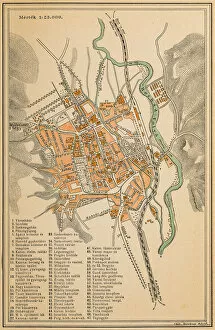
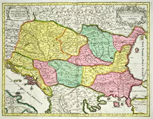
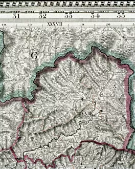
We offer a wide range of Maps of Slovakia Europe art prints that you can purchase. These maps are created by skilled artists and designers who have captured the essence of Slovakia's geography, culture, and history in their artwork. You can choose from vintage-style maps that showcase the country's topography, cities, and landmarks or modern designs that feature colorful illustrations with detailed information about its regions. Some popular options include antique maps dating back to the 19th century which display intricate details such as mountain ranges, rivers, forests and towns. Other styles include contemporary cityscape prints featuring famous Slovakian landmarks like Bratislava Castle or St Martin’s Cathedral. All these map art prints come in various sizes to suit your needs whether it is for home decor or office space decoration. They make great gifts for anyone interested in cartography or travel enthusiasts looking to add some unique wall art to their collection.
+
How do I buy Maps of Slovakia Europe art prints?
To buy Maps of Slovakia Europe art prints from Media Storehouse, you can browse our extensive collection of artwork online. Once you have found the print that you would like to purchase, simply add it to your cart and proceed to checkout. You will be prompted to enter your shipping and payment information before finalizing your order. We offer a variety of sizes and framing options for their art prints, so be sure to select the one that best suits your needs. We also offer a range of other products such as canvas prints and posters if you prefer those instead. If you have any questions about purchasing Maps of Slovakia Europe art prints or any other artwork from Media Storehouse, our customer service team is available to assist you via phone or email. With high-quality printing techniques and a vast selection of beautiful artwork, buying Maps of Slovakia Europe art prints from Media Storehouse is easy and convenient.
+
How much do Maps of Slovakia Europe art prints cost?
We offer a wide range of art prints featuring maps of Slovakia and Europe. The cost of these prints varies depending on the size and type of print you choose. We have a variety of options available, including canvas prints, framed prints, and poster prints. Our map art prints are created using high-quality materials to ensure that they look great for years to come. Whether you're looking for a large statement piece or something smaller to add to your collection, we have something for everyone. We take pride in offering affordable prices without sacrificing quality. Our goal is to make it easy for anyone to enjoy beautiful artwork in their home or office. If you're interested in purchasing one of our map art prints, please visit our website or contact us directly for more information.
+
How will my Maps of Slovakia Europe art prints be delivered to me?
We offer a range of delivery options for our Maps of Slovakia Europe art prints. We understand that receiving your order in perfect condition is important to you, which is why we take great care in packaging and shipping your artwork. All of our art prints are carefully rolled and placed into sturdy cardboard tubes to ensure they arrive safely. Our standard delivery service typically takes between 3-5 working days from dispatch, although this may vary depending on your location. For customers who require their orders sooner, we also offer expedited delivery services such as express or next day delivery at an additional cost. These options can be selected during the checkout process. We pride ourselves on providing excellent customer service and aim to make the ordering process as smooth and hassle-free as possible. If you have any questions about our delivery options or need further assistance with placing an order, please don't hesitate to contact us.