
Maps Collection (page 2)
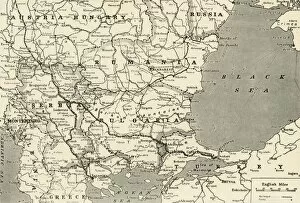
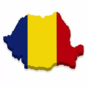
Romania is a country located in southeastern Europe, bordered by Bulgaria, Ukraine, Hungary and Serbia
92 items


All Professionally Made to Order for Quick Shipping
-
Maps Collection
Romania is a country located in southeastern Europe, bordered by Bulgaria, Ukraine, Hungary and Serbia, and is a member of the European Union and has a population of approximately 19 million people. Romania has an area of 238,391 square kilometers and its capital city is Bucharest. The terrain of Romania consists mostly of mountains and hills with some plains along the Black Sea coast. The Carpathian Mountains run through the center of the country from north to south. Romania also has several rivers including the Danube River which forms part of its border with Bulgaria and can an important tool for understanding Romania's geography as they provide detailed information about its landforms, cities, roads and other features, and are be found online or in print form from various sources such as libraries or bookstores.
+
Our beautiful pictures are available as Framed Prints, Photos, Wall Art and Photo Gifts
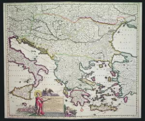
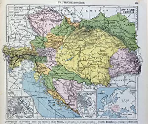
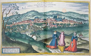
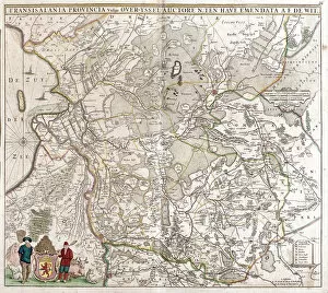
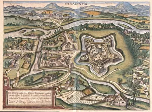
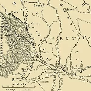
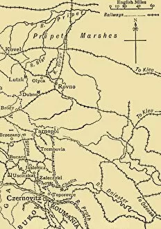
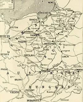
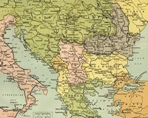
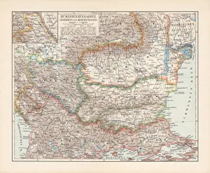
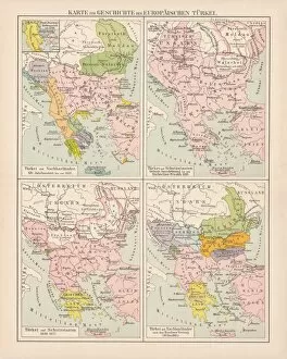
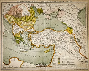
The Maps of Romania Europe collection from Media Storehouse offers a stunning array of wall art and framed prints that showcase the beauty and diversity of Romania. Our collection includes a range of maps, both old and new, that depict various regions, cities, and landmarks throughout the country. These maps are not only visually striking but also provide valuable historical context for those interested in exploring Romania's rich cultural heritage. Whether you're looking to decorate your home or office with unique artwork or simply want to learn more about this fascinating country, the Maps of Romania Europe collection has something for everyone. From intricate topographical maps to colorful political charts, these prints offer a wealth of information about Romania's geography, history, and culture. If you're looking for high-quality wall art that celebrates the beauty and complexity of Romania, look no further than our Maps of Romania Europe collection.
+
What are Maps of Romania Europe art prints?
Maps of Romania Europe art prints are high-quality reproductions of maps depicting the country of Romania and its surrounding regions. These prints are created using state-of-the-art printing technology, ensuring that every detail is captured with precision and accuracy. These maps can be used for a variety of purposes, from educational to decorative. They make excellent additions to classrooms, offices, or homes as they provide an interesting visual representation of geography and history. Maps of Romania Europe art prints come in a range of sizes and styles, including vintage-inspired designs and modern interpretations. Some feature intricate details such as topography or city names while others focus on broader geographic features like rivers or mountain ranges. Maps of Romania Europe art prints offer a unique way to explore the beauty and complexity of this fascinating region. Whether you're looking for something practical or simply aesthetically pleasing, these prints are sure to impress.
+
What Maps of Romania Europe art prints can I buy from Media Storehouse?
We offer a wide range of Maps of Romania Europe art prints that you can buy. These maps are available in various sizes and formats, including canvas prints, framed prints, and photographic prints. You can choose from different styles of maps such as antique maps, topographical maps or political maps. The antique map collection includes historical depictions of Romania dating back to the 16th century while the topographical map collection features detailed terrain information about the country's landscape. The political map collection provides an overview of Romania's administrative divisions and major cities. These Maps of Romania Europe art prints are perfect for decorating your home or office space with a touch of history and culture. They also make great gifts for anyone interested in geography or Romanian heritage. Media Storehouse has a vast selection of high-quality Maps of Romania Europe art prints that cater to all tastes and preferences.
+
How do I buy Maps of Romania Europe art prints?
To buy Maps of Romania Europe art prints from Media Storehouse, you can browse our extensive collection of maps and select the one that catches your eye. Once you've found the perfect print, simply add it to your cart and proceed to checkout. You'll be prompted to enter your shipping information and payment details before finalizing your purchase. We offer a variety of sizes for their art prints, so make sure to choose the size that best fits your needs. Additionally, we offer framing options if you want to have your print ready-to-hang upon arrival. If you're looking for something specific or can't find what you're looking for on their website, Media Storehouse also offers a custom printing service where they can create bespoke maps tailored specifically to your preferences. Buying Maps of Romania Europe art prints from Media Storehouse is an easy and straightforward process with plenty of options available to suit any taste or budget.
+
How much do Maps of Romania Europe art prints cost?
We offer a wide range of Maps of Romania Europe art prints that vary in price depending on the size and type of print. Our collection includes vintage maps, modern maps, and artistic interpretations of Romania and Europe's geography. We understand that everyone has different tastes and preferences when it comes to artwork, which is why we have curated a diverse selection to cater to all our customers' needs. Our Maps of Romania Europe art prints are printed using high-quality materials to ensure that they last for years without fading or losing their vibrancy. Whether you're looking for a small print to add some character to your home office or a large statement piece for your living room wall, we have something for everyone. We pride ourselves on offering affordable prices without compromising on quality so that our you can enjoy beautiful artwork without breaking the bank. So if you're looking for Maps of Romania Europe art prints, look no further than Media Storehouse.
+
How will my Maps of Romania Europe art prints be delivered to me?
Your Maps of Romania Europe art prints will be delivered to you in a safe and secure manner. We take great care in packaging your artwork so that it arrives at your doorstep in pristine condition. Our standard delivery method is through a trusted courier service, who will ensure that your package is handled with the utmost care during transit. We offer various shipping options depending on your location and preferences. You can choose from standard or express delivery services, which may have different delivery times and costs associated with them. Once your order has been dispatched, we will provide you with tracking information so that you can monitor its progress until it reaches you. If there are any issues or concerns regarding the delivery of your artwork, please do not hesitate to contact us for assistance. We pride ourselves on providing our customers with high-quality products and exceptional customer service. We look forward to delivering your Maps of Romania Europe art prints soon.