Fraud Blocker Skip to main content

Home > Europe > Italy > Maps

Maps Collection (page 4)

Maps of Italy Europe are invaluable resources for anyone looking to explore the country

3,130 items

Background imageMaps Collection: Portrait of Amerigo Vespucci (1454-1512) from The Narrative and Critical History

Portrait of Amerigo Vespucci (1454-1512) from The Narrative and Critical History
BAL111015 Portrait of Amerigo Vespucci (1454-1512) from The Narrative and Critical History of America, edited by Justin Winsor, London, 1886 (engraving) by English School

Background imageMaps Collection: Columbus Voyages

Columbus Voyages
1889: A map of the four voyages of the Italian navigator, Christopher Columbus (1451 - 1506), from The Worlds Great Explorers, by J Scott Keltic, (London 1889). (Photo by Hulton Archive/Getty Images)
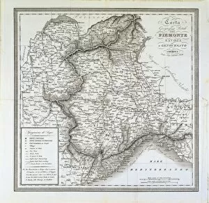
Background imageMaps Collection: Map of Piedmont, of the Savoy and Genovas. Cremona, engraving on copper, 1832

Map of Piedmont, of the Savoy and Genovas. Cremona, engraving on copper, 1832
Cartography, Italy, 19th century. Map of Piedmont, of the Savoy and Genovas. Cremona, 1832. Engraving on copper

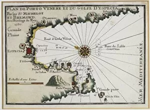
Background imageMaps Collection: Portovenere and the Gulf of La Spezia, Map by Henry Michelot

Portovenere and the Gulf of La Spezia, Map by Henry Michelot and Laurens Bremond from the Portolan Charts of
Cartography, Italy, 18th century. Portovenere and the Gulf of La Spezia. Map by Henry Michelot and Laurens Bremond from the Portolan Charts of the Mediterranean Sea, Amsterdam 1709. Copper engraving

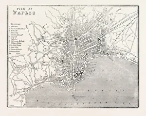
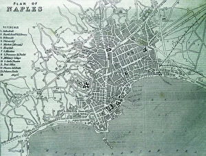
Background imageMaps Collection: MAP OF NAPLES, ITALY, 1860 engraving

MAP OF NAPLES, ITALY, 1860 engraving

Background imageMaps Collection: Map of the Horn of Africa, oil painting by Stefano Buonsignori 1575-1584

Map of the Horn of Africa, oil painting by Stefano Buonsignori 1575-1584
Italy - Tuscany region - Florence. Palazzo Vecchio, Hall of the Geographical Maps. Map of the Horn of Africa, oil painting by Stefano Buonsignori 1575-1584

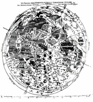
Background imageMaps Collection: A 17th century map of the Moon

A 17th century map of the Moon
5312009 A 17th century map of the Moon; (add.info.: Engraving depicting a 17th century map of the Moon based on observations by Giovanni Battista Riccioli)

Background imageMaps Collection: Map of the City of Pisa in 1649 crossed by the Arno River

Map of the City of Pisa in 1649 crossed by the Arno River
FGL5463273 Map of the City of Pisa in 1649 crossed by the Arno River.; Fototeca Gilardi

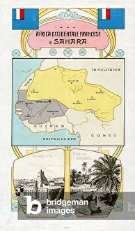
Background imageMaps Collection: CARTOGRAPHY 'French West Africa and Sahara'

CARTOGRAPHY "French West Africa and Sahara"
6202965 CARTOGRAPHY "French West Africa and Sahara"; (add.info.: CARTOGRAPHY "French West Africa and Sahara". Flag, cartography and view of Tombuctu and an Oasis in the desert)

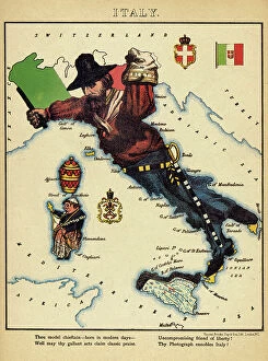
Background imageMaps Collection: Allegorical cartoon depicting the map of Italy formed by the figure of Giuseppe Garibaldi

Allegorical cartoon depicting the map of Italy formed by the figure of Giuseppe Garibaldi (1807-1882)
FGL5482129 Allegorical cartoon depicting the map of Italy formed by the figure of Giuseppe Garibaldi (1807-1882) chasing Pope Pius IX from Italy

Background imageMaps Collection: Isolario, in verse, with coloured drawings and a chart of the eastern Mediterranean on vellum

Isolario, in verse, with coloured drawings and a chart of the eastern Mediterranean on vellum
7339139 Isolario, in verse, with coloured drawings and a chart of the eastern Mediterranean on vellum. c.1480 (drawing on vellum) by Sonetti

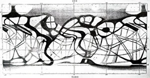
Background imageMaps Collection: Map of Martian canals

Map of Martian canals
5307584 Map of Martian canals'.; (add.info.: Map of Martian canals by Giovanni Schiaparell. Giovanni Schiaparelli (1835-1910) an Italian astronomer and science historian. Dated 19th century

Background imageMaps Collection: Map of Ancient Sicily and southern Italy, c.278 BC

Map of Ancient Sicily and southern Italy, c.278 BC
7177138 Map of Ancient Sicily and southern Italy, c.278 BC.; Private Collection; (add.info.: Map of Ancient Sicily and southern Italy, c.278 BC)

Background imageMaps Collection: Intensity of Suicide in Italy, Period 1864-76 (colour litho)

Intensity of Suicide in Italy, Period 1864-76 (colour litho)
8634281 Intensity of Suicide in Italy, Period 1864-76 (colour litho) by English School, (19th century); Private Collection; (add.info.: Intensity of Suicide in Italy, Period 1864-76)

Background imageMaps Collection: Italy, North (colour litho)

Italy, North (colour litho)
8653603 Italy, North (colour litho) by English School, (19th century); Private Collection; (add.info.: Italy, North. Illustration for "The Times" Atlas (Office of "The Times")

Background imageMaps Collection: Map of the Wanderings of Aeneas and flight of Icarus (litho)

Map of the Wanderings of Aeneas and flight of Icarus (litho)
8634520 Map of the Wanderings of Aeneas and flight of Icarus (litho) by English School, (20th century); Private Collection; (add.info.: Map of the Wanderings of Aeneas and flight of Icarus)

Background imageMaps Collection: Geography map: representation of the island of Hispaniola (Santo Domingo and Haiti)

Geography map: representation of the island of Hispaniola (Santo Domingo and Haiti) (Greater Antilles)
VEN5030472 Geography map: representation of the island of Hispaniola (Santo Domingo and Haiti) (Greater Antilles), of the Virgin Islands (Lesser Antilles)

Background imageMaps Collection: Geography map: representation of Peru's South American coast from an Atlas made by Italian

Geography map: representation of Peru's South American coast from an Atlas made by Italian cartographer Antonio
VEN5030459 Geography map: representation of Peru's South American coast from an Atlas made by Italian cartographer Antonio Francesco Lucini (born 1605), 1661 approximately Biblioteca Angelica

Background imageMaps Collection: Michelangelo Buonarroti dit Michel Ange (Michelangelo or Michelangelo, 1475-1564)

Michelangelo Buonarroti dit Michel Ange (Michelangelo or Michelangelo, 1475-1564)
GIM5037968 Michelangelo Buonarroti dit Michel Ange (Michelangelo or Michelangelo, 1475-1564): Studies for the staircase project of the Medica Laurenziana Library in Florence.; (add.info)

Background imageMaps Collection: Portulan representing the Adriatic Sea, the coasts of Italy and Croatia

Portulan representing the Adriatic Sea, the coasts of Italy and Croatia. Watercolour by Augustin Roussin 1630 Municipal
JEB4878504 Portulan representing the Adriatic Sea, the coasts of Italy and Croatia. Watercolour by Augustin Roussin 1630 Municipal Library of Marseille; (add.info)

Background imageMaps Collection: Map of Italy, from the time of Augustus (Octavian or Octavian, 63 BC-14 AD)

Map of Italy, from the time of Augustus (Octavian or Octavian, 63 BC-14 AD)
NWI4863040 Map of Italy, from the time of Augustus (Octavian or Octavian, 63 BC-14 AD. BC) first Roman emperor until the Constantine Empire

Background imageMaps Collection: Ancient Rome: map of Mount Palatine. Map of Palatine Hill, city center of ancient Rome

Ancient Rome: map of Mount Palatine. Map of Palatine Hill, city center of ancient Rome
NWI4863003 Ancient Rome: map of Mount Palatine. Map of Palatine Hill, city center of ancient Rome. Hand-colored woodcut of a 19th century illustration; (add.info.: Ancient Rome)

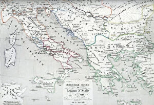
Background imageMaps Collection: Map of Italy and Greece around 774 - 900 (MAP of Italy and Greece, 8th-9th century)

Map of Italy and Greece around 774 - 900 (MAP of Italy and Greece, 8th-9th century)
ELD4928040 Map of Italy and Greece around 774 - 900 (MAP of Italy and Greece, 8th-9th century) Engraving from " Atlas Universel" by Houze

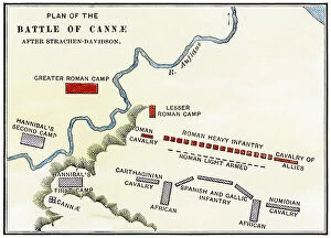
Background imageMaps Collection: Ancient History: Map of the Battle of Cannes (Italy, Canne della Battaglia)

Ancient History: Map of the Battle of Cannes (Italy, Canne della Battaglia)
NWI4860053 Ancient History: Map of the Battle of Cannes (Italy, Canne della Battaglia) between Hannibal and the Romans during the Second Punic War, 216 BC

Background imageMaps Collection: Plan of Milan with the churches, 1700

Plan of Milan with the churches, 1700
QUA5033530 Plan of Milan with the churches, 1700; (add.info.: Plan of Milan with the churches, 1700); Photo © Mauro Ranzani

Background imageMaps Collection: Siege of Cazal in 1630 - City map and citadel of Cazal (Casale) - Engraving of the 17th century

Siege of Cazal in 1630 - City map and citadel of Cazal (Casale) - Engraving of the 17th century
XEE5027215 Siege of Cazal in 1630 - City map and citadel of Cazal (Casale) - Engraving of the 17th century; (add.info.: Siege of Cazal in 1630 - City map and citadel of Cazal (Casale)

Background imageMaps Collection: First World War: France, Patriotic Map showing a child with a flag

First World War: France, Patriotic Map showing a child with a flag and lead soldiers doing salvation and saying
LUX4739020 First World War: France, Patriotic Map showing a child with a flag and lead soldiers doing salvation and saying: Like Dad I do military salvation

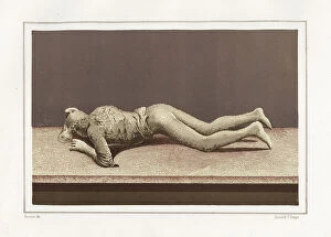
Background imageMaps Collection: Plaster cast of a woman's body from the Via Stabiana now in the Museum of Pompeii

Plaster cast of a woman's body from the Via Stabiana now in the Museum of Pompeii
FLO4687112 Plaster cast of a woman's body from the Via Stabiana now in the Museum of Pompeii. Chromolithograph by Victor Steeger after an illustration by Geremia Discanno from Emile Presuhn

Background imageMaps Collection: Cast of a dead dog from the House of Vesonius Primus, a fuller

Cast of a dead dog from the House of Vesonius Primus, a fuller. Chromolithograph by Victor Steeger after an
FLO4687111 Cast of a dead dog from the House of Vesonius Primus, a fuller. Chromolithograph by Victor Steeger after an illustration by Geremia Discanno from Emile Presuhn (1844-1878)

Background imageMaps Collection: Crocodile and pygmies from the House of the Pygmies (Casa dei Pygmeii) 9, Regio IX, Insula V

Crocodile and pygmies from the House of the Pygmies (Casa dei Pygmeii) 9, Regio IX, Insula V. Chromolithograph by J.G
FLO4687070 Crocodile and pygmies from the House of the Pygmies (Casa dei Pygmeii) 9, Regio IX, Insula V. Chromolithograph by J.G

Background imageMaps Collection: Elevation of the Mausoleum of Hadrian in its perfect state in Parco Adriano, Rome

Elevation of the Mausoleum of Hadrian in its perfect state in Parco Adriano, Rome
FLO4679377 Elevation of the Mausoleum of Hadrian in its perfect state in Parco Adriano, Rome. Copperplate engraving by Henry Moses from A Collection of Antique Vases, Altars, etc

Background imageMaps Collection: Statue of Amerigo Vespucci (1454-1512), merchant, Italian navigator

Statue of Amerigo Vespucci (1454-1512), merchant, Italian navigator, he was the first to consider the coasts of
YOU4419652 Statue of Amerigo Vespucci (1454-1512), merchant, Italian navigator, he was the first to consider the coasts of present-day South America as a new continent, distinct from Asia

Background imageMaps Collection: Map of the city of Vicovaro, Italy (engraving)

Map of the city of Vicovaro, Italy (engraving)
3600001 Map of the city of Vicovaro, Italy (engraving); (add.info.: Map of the city of Vicovaro (Italy). Italian engraving of the 16th century.); PHAS/UIG

Background imageMaps Collection: Map of Italy, c.1900 (engraving)

Map of Italy, c.1900 (engraving)
532986 Map of Italy, c.1900 (engraving); (add.info.: Map of northern Italy, circa 1902, from the 10th edition of Encyclopaedia Britannica.); Encyclopaedia Britannica/UIG

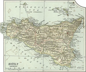
Background imageMaps Collection: Map of Sicily, c.1900 (engraving)

Map of Sicily, c.1900 (engraving)
533317 Map of Sicily, c.1900 (engraving); (add.info.: Map of Sicily, Italy, circa 1902, from the 10th edition of Encyclopaedia Britannica.); Encyclopaedia Britannica/UIG

Background imageMaps Collection: Map showing the Gulf of Paria or De La Ballena as Christopher Columbus named it on his third

Map showing the Gulf of Paria or De La Ballena as Christopher Columbus named it on his third voyage, 1892 (print)
2915323 Map showing the Gulf of Paria or De La Ballena as Christopher Columbus named it on his third voyage, 1892 (print); (add.info.: From the book Life of Christopher Columbus by Clements R)

Background imageMaps Collection: Turin or Torino - Its Envisons, 1700

Turin or Torino - Its Envisons, 1700
2900906 Turin or Torino - Its Envisons, 1700; (add.info.: Turin or Torino - Its Envisons, 1700.); Buyenlarge Archive/UIG

Background imageMaps Collection: Plan of Naples, 1860

Plan of Naples, 1860
1577558 Plan of Naples, 1860; (add.info.: Plan of Naples.); Universal History Archive/UIG

Background imageMaps Collection: Map of European odds on the Atlantic Ocean, including Gibraltar, Portugal, Spain, England

Map of European odds on the Atlantic Ocean, including Gibraltar, Portugal, Spain, England, Ireland and Iceland
AIS5350370 Map of European odds on the Atlantic Ocean, including Gibraltar, Portugal, Spain, England, Ireland and Iceland, as well as North Africa

Background imageMaps Collection: Map of Oceania and the southern Pacific by Bartolomeo Borghi, Florence, 1836

Map of Oceania and the southern Pacific by Bartolomeo Borghi, Florence, 1836
FLO4624218 Map of Oceania and the southern Pacific by Bartolomeo Borghi, Florence, 1836. Handcoloured copperplate engraving from Giulio Ferrario's Ancient

Background imageMaps Collection: First World War 1914-1918 (War 14-18). Map of the western front between December 1914

First World War 1914-1918 (War 14-18). Map of the western front between December 1914 and October 1916
PCT4297712 First World War 1914-1918 (War 14-18). Map of the western front between December 1914 and October 1916, German advance - Italian front between June 1915

Background imageMaps Collection: A map of the Moon

A map of the Moon
5312011 A map of the Moon; (add.info.: Engraving depicting a map of the Moon based on observations by Giovanni Battista Riccioli, Giovanni Domenico Cassini, Christian Mayer and others)

Background imageMaps Collection: Map of the northern hemisphere of Mars

Map of the northern hemisphere of Mars
5307581 Map of the northern hemisphere of Mars.; (add.info.: Map of the northern hemisphere of Mars by Giovanni Schiaparelli)

Background imageMaps Collection: Cartography: map of Florence between 1780 and 1845. Firenze Com'era Museum, Florence

Cartography: map of Florence between 1780 and 1845. Firenze Com'era Museum, Florence
BEN5464549 Cartography: map of Florence between 1780 and 1845. Firenze Com'era Museum, Florence; Photo © Raffaello Bencini

Background imageMaps Collection: Geographical map of Italy. Miniature from the 15th century, based on the manuscript Geographia

Geographical map of Italy. Miniature from the 15th century, based on the manuscript Geographia (Geography)
BEN5469694 Geographical map of Italy. Miniature from the 15th century, based on the manuscript Geographia (Geography) by Claudius Ptolemaeus (Claudius Ptolemaeus, 90-168). Greek translation

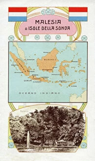
Background imageMaps Collection: CARTOGRAPHY 'Malaysia or Sunda Islands' early 1900s (print)

CARTOGRAPHY "Malaysia or Sunda Islands" early 1900s (print)
6202968 CARTOGRAPHY "Malaysia or Sunda Islands" early 1900s (print); (add.info.: CARTOGRAPHY "Malaysia or Sunda Islands". Flag, cartography and view of the capital Batavia)

Background imageMaps Collection: A map of the moon based on observations

A map of the moon based on observations
5308431 A map of the moon based on observations.; (add.info.: Engraving depicting a map of the moon based on the observations of Giovanni Battista Riccioli and Giovanni Domenico Cassini)

Background imageMaps Collection: Ancient history sites Greece and Italy, 18th century (print)

Ancient history sites Greece and Italy, 18th century (print)
7315194 Ancient history sites Greece and Italy, 18th century (print); Private Collection; (add.info.: 18th century map of Italy and Greece showing major sites of ancient history)


All Professionally Made to Order for Quick Shipping


-

Maps Collection

Maps of Italy Europe are invaluable resources for anyone looking to explore the country. They provide detailed information about the terrain, roads, cities, and other points of interest, and are be found in a variety of formats such as paper maps, online maps, and apps. Paper they can great for planning trips or getting an overview of the area while online maps provide more detailed information such as street names and directions. Apps are also useful for navigating while on-the-go. Maps of Italy Europe can help travelers find their way around unfamiliar places with ease and make sure they don’t miss out on any must-see attractions along their journey.
+

Our beautiful Wall Art and Photo Gifts include Framed Prints, Photo Prints, Poster Prints, Canvas Prints, Jigsaw Puzzles, Metal Prints and so much more

The Maps of Italy Europe collection from Media Storehouse is a stunning range of wall art and framed prints that showcase the beauty and diversity of Italy. Our collection features an extensive selection of maps, ranging from antique maps dating back to the 16th century to modern-day cartography. Each map has been carefully selected for its historical significance or aesthetic appeal, making it a perfect addition to any home or office space. The Maps of Italy Europe collection offers something for everyone, with maps depicting different regions and cities across Italy. From the rolling hills of Tuscany to the bustling streets of Rome, these maps capture the essence of this beautiful country in intricate detail. Whether you are looking for a unique piece of wall art or a thoughtful gift for someone special, the Maps of Italy Europe collection is sure to impress. With high-quality printing and framing options available, these prints are designed to last a lifetime and bring joy to all who view them.
+

What are Maps of Italy Europe art prints?

Maps of Italy Europe art prints are high-quality reproductions of vintage and contemporary maps that showcase the intricate details and beauty of Italy and other European countries. These prints are perfect for those who love to travel, history enthusiasts, or anyone looking to add a touch of sophistication to their home decor. These art prints come in various sizes and styles, from colorful antique maps depicting the regions of Italy to modern minimalist designs highlighting the country's famous landmarks. They are printed on premium paper using archival inks that ensure long-lasting color vibrancy. Maps of Italy Europe art prints make great gifts for friends or family members who have a special connection with Italy or Europe. They can also be used as educational tools in classrooms or offices. Whether you're looking for a unique piece to decorate your living room wall or want to add some character to your workspace, Maps of Italy Europe art prints offer endless possibilities for personalization and creativity.
+

What Maps of Italy Europe art prints can I buy from Media Storehouse?

We offer a wide range of Maps of Italy Europe art prints that you can buy. These maps are available in various sizes and styles to suit your preferences. You can choose from antique, vintage, or contemporary designs that showcase the beauty and history of Italy and Europe. The collection includes detailed maps of Italian cities such as Rome, Florence, Venice, Milan, Naples, and many others. You can also find regional maps that highlight the diverse landscapes and cultures across Italy's 20 regions. In addition to Italian maps, Media Storehouse also offers European continent maps that feature neighboring countries such as France, Spain, Germany, Switzerland among others. These prints come in different formats including canvas prints or framed wall art for easy display on your walls. Whether you're looking for decorative pieces for your home or office space or educational resources for schools or libraries; Media Storehouse has got you covered with their extensive selection of Maps of Italy Europe art prints.
+

How do I buy Maps of Italy Europe art prints?

To buy Maps of Italy Europe art prints from Media Storehouse, you can browse our extensive collection online. We offer a variety of sizes and framing options to suit your preferences. Once you have found the print that you like, simply add it to your cart and proceed to checkout. You will be prompted to enter your shipping information and payment details before completing the purchase. We offer high-quality prints on premium paper using state-of-the-art printing technology. Their maps are sourced from reputable archives and collections around the world, ensuring accuracy and authenticity. Whether you are looking for a vintage map of Italy or a contemporary interpretation of Europe's geography, we have something for everyone. With our easy-to-use website and secure checkout process, buying Maps of Italy Europe art prints has never been easier.
+

How much do Maps of Italy Europe art prints cost?

We offer a wide range of Maps of Italy Europe art prints at various price points to suit different budgets. Our collection includes vintage maps, contemporary designs, and everything in between. The cost of our Maps of Italy Europe art prints depends on several factors such as the size, framing options, and materials used for printing. We use high-quality paper and ink to ensure that every print is vibrant and long-lasting. Our you can choose from a variety of sizes ranging from small to large formats depending on their preferences. Whether you're looking for a simple poster or an intricately framed piece, we have something for everyone. Our selection also includes canvas prints which provide a unique texture and depth to your artwork. The cost of our Maps of Italy Europe art prints varies based on individual choices but we strive to provide affordable options without compromising quality.
+

How will my Maps of Italy Europe art prints be delivered to me?

We take great care in ensuring that your Maps of Italy Europe art prints are delivered to you safely and securely. Our delivery process is designed to be hassle-free and convenient for our customers. Once you have placed your order with us, your Maps of Italy Europe art prints will be carefully packaged and dispatched from our warehouse. We use reliable courier services to ensure that your artwork arrives at its destination in perfect condition. We offer a range of delivery options depending on the size and weight of your order, as well as the destination address. You can choose standard or express delivery options at checkout. Our team is committed to providing excellent customer service throughout the entire ordering process. If you have any questions about shipping or delivery, please don't hesitate to contact us via email or phone. We're always happy to help.