Fraud Blocker Skip to main content

Home > Europe > Greece > Maps

Maps Collection (page 4)

Maps of Greece Europe are essential tools for travelers, historians, and anyone interested in the region

1,416 items

Background imageMaps Collection: Italy, Temple of Hera former called Temple of Poseidon, in Paestum illustration

Italy, Temple of Hera former called Temple of Poseidon, in Paestum illustration
UTD4921792 Italy, Temple of Hera former called Temple of Poseidon, in Paestum illustration from : " Kunsthistorische Bilderbogen " (Art history image gallery), first part, published by E

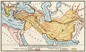
Background imageMaps Collection: Map of the empire of Alexander III of Macedonian, known as the Great (356-323 BC)

Map of the empire of Alexander III of Macedonian, known as the Great (356-323 BC), after the Battle of Ipsos (Turkey)
NWI4912667 Map of the empire of Alexander III of Macedonian, known as the Great (356-323 BC), after the Battle of Ipsos (Turkey), in 301 BC

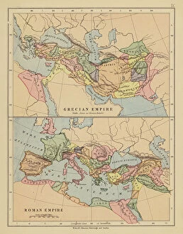
Background imageMaps Collection: Grecian Empire; Roman Empire (colour litho)

Grecian Empire; Roman Empire (colour litho)
8630309 Grecian Empire; Roman Empire (colour litho) by English School, (19th century); Private Collection; (add.info.: Grecian Empire; Roman Empire)

Background imageMaps Collection: Map of the Ottoman Empire (colour litho)

Map of the Ottoman Empire (colour litho)
8664038 Map of the Ottoman Empire (colour litho) by English School, (19th century); Private Collection; (add.info.: Map of the Ottoman Empire)

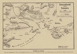
Background imageMaps Collection: Battle of Salamis, 480 BC (engraving)

Battle of Salamis, 480 BC (engraving)
8663911 Battle of Salamis, 480 BC (engraving) by German School, (20th century); Private Collection; (add.info.: Map showing the Greek and Persian fleets at the Battle of Salamis, 480 BC)

Background imageMaps Collection: World map based on the vision of the Greek geographer Eratosthene (276-194 BC)

World map based on the vision of the Greek geographer Eratosthene (276-194 BC). Colouring engraving of the 19th century
NWI4851714 World map based on the vision of the Greek geographer Eratosthene (276-194 BC). Colouring engraving of the 19th century.; (add.info)

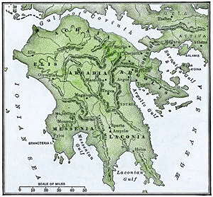
Background imageMaps Collection: Ancient Greece: Map of the Peloponnese. 19th century colour engraving

Ancient Greece: Map of the Peloponnese. 19th century colour engraving
NWI4859950 Ancient Greece: Map of the Peloponnese. 19th century colour engraving.; (add.info.: Ancient Greece: Map of the Peloponnese. 19th century colour engraving.); Photo © North Wind Pictures

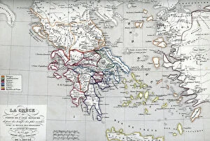
Background imageMaps Collection: Map of Greece at the times of Heraclides (son of Heracles) Plate from ' Atlas Universel' by Houze

Map of Greece at the times of Heraclides (son of Heracles) Plate from " Atlas Universel" by Houze
ELD4924939 Map of Greece at the times of Heraclides (son of Heracles) Plate from " Atlas Universel" by Houze, 1851 Private collection; (add.info)

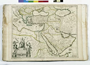
Background imageMaps Collection: The Ottoman Empire: Saudi Arabia, Greece, Egypt, Cyprus, Lebanon, Syria, Anatolia

The Ottoman Empire: Saudi Arabia, Greece, Egypt, Cyprus, Lebanon, Syria, Anatolia
JEB4874587 The Ottoman Empire: Saudi Arabia, Greece, Egypt, Cyprus, Lebanon, Syria, Anatolia... map of Nicolas and William Sanson of Abbevile. Municipal library of Marseille

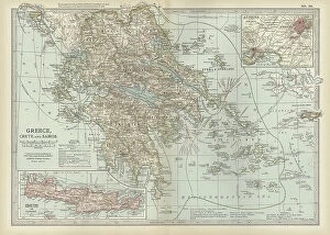
Background imageMaps Collection: Map of Greece with Crete and Samos, c.1900 (engraving)

Map of Greece with Crete and Samos, c.1900 (engraving)
533001 Map of Greece with Crete and Samos, c.1900 (engraving); (add.info.: Map showing detail of Greece with Crete and Samos, with insets of Crete and Athens, circa 1902)

Background imageMaps Collection: CARTOGRAPHY Map of the Mediterranean of the 18th century highlighting the places where 'The Seven

CARTOGRAPHY Map of the Mediterranean of the 18th century highlighting the places where "The Seven Wonders of
6202962 CARTOGRAPHY Map of the Mediterranean of the 18th century highlighting the places where "The Seven Wonders of the World" are located; (add.info)

Background imageMaps Collection: Greece, Athen, Acropolis, the floor plan of the Parthenon, illustration

Greece, Athen, Acropolis, the floor plan of the Parthenon, illustration
UTD4921737 Greece, Athen, Acropolis, the floor plan of the Parthenon, illustration from : " Kunsthistorische Bilderbogen " (Art history image gallery), first part, published by E. A

Background imageMaps Collection: Celestial globe with 270-degree Meridian ring, with magnitude table and astronomical details

Celestial globe with 270-degree Meridian ring, with magnitude table and astronomical details, 1537 (paper mache)
MMM5469006 Celestial globe with 270-degree Meridian ring, with magnitude table and astronomical details, 1537 (paper mache) by Dutch School, (16th century); National Maritime Museum, London

Background imageMaps Collection: Map of the Eastern Roman Empire (Byzantine Empire) and the Kingdom of the Lombards

Map of the Eastern Roman Empire (Byzantine Empire) and the Kingdom of the Lombards
ELD4928045 Map of the Eastern Roman Empire (Byzantine Empire) and the Kingdom of the Lombards, 553-774 (Map of byzantine empire and Kingdom of the Lombards)

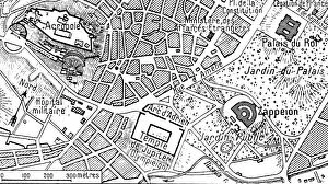
Background imageMaps Collection: Athenes vue en avion; Plan correspondant a la photographie ci-dessous, 1916. Creator: Unknown

Athenes vue en avion; Plan correspondant a la photographie ci-dessous, 1916. Creator: Unknown
Athenes vue en avion; Plan correspondant a la photographie ci-dessous, 1916. From "Collection de la Guerre IV. L'Illustration Tome CXLVIII

Background imageMaps Collection: Athenes vue en avion; Athenes et son port le Piree, 1916. Creator: Unknown

Athenes vue en avion; Athenes et son port le Piree, 1916. Creator: Unknown
Athenes vue en avion; Athenes et son port le Piree, 1916. From "Collection de la Guerre IV. L'Illustration Tome CXLVIII

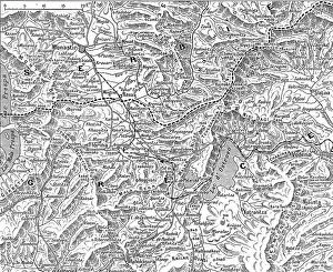
Background imageMaps Collection: Frontiere greco-serbe; terrain ou s'est deployee l'offensive de septembre a la frontiere... 1916

Frontiere greco-serbe; terrain ou s'est deployee l'offensive de septembre a la frontiere... 1916
Frontiere greco-serbe; terrain ou s'est deployee l'offensive de septembre a la frontiere greco-serbe, de part et d'autre du lac d'Ostrovo. 1916. From "Collection de la Guerre IV

Background imageMaps Collection: La Campagne Macedonienne; De Salonique a Monastir, 1916. Creator: Unknown

La Campagne Macedonienne; De Salonique a Monastir, 1916. Creator: Unknown
La Campagne Macedonienne; De Salonique a Monastir. 1916. From "Collection de la Guerre IV. L'Illustration Tome CXLVII. La Guerre Juillet, Aout, Septembre, Octobre, Novembre, Decembre 1916"

Background imageMaps Collection: Panorama du theatre des operations des armees alliees, 1916. Creator: Unknown

Panorama du theatre des operations des armees alliees, 1916. Creator: Unknown
Panorama du theatre des operations des armees alliees (Francais, anglais, serbes, russes et Italiens) de la frontiere d'Albanie au golfe de Cavala, 1916. From "Collection de la Guerre IV

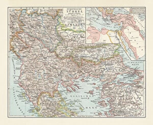
Background imageMaps Collection: Historical map of the Ottoman Empire (Turkey), European part, 1897

Historical map of the Ottoman Empire (Turkey), European part, 1897
Historical map of European part of the Ottoman Empire (Turkey) at the end of the 19th century. Lithograph, published in 1897

Background imageMaps Collection: Old map of Greece, steel engraving, published 1857

Old map of Greece, steel engraving, published 1857
Old map of Greece. Steel engraving with hand coloured borderlines, published in 1857

Background imageMaps Collection: Black Maps Earth Tones 05

Black Maps Earth Tones 05
Emiliano Deificus

Background imageMaps Collection: 1 Maps 45

1 Maps 45
Emiliano Deificus

Background imageMaps Collection: City Love Maps 05

City Love Maps 05
Emiliano Deificus

Background imageMaps Collection: City Heart Maps 05

City Heart Maps 05
Emiliano Deificus

Background imageMaps Collection: Black Maps 05

Black Maps 05
Emiliano Deificus

Background imageMaps Collection: City Heart Maps 05

City Heart Maps 05
Emiliano Deificus

Background imageMaps Collection: Black Skyline 05

Black Skyline 05
Emiliano Deificus

Background imageMaps Collection: Charon transports the souls of the dead to the kingdom of Hades, 2nd half of 19th century

Charon transports the souls of the dead to the kingdom of Hades, 2nd half of 19th century. Creator: Mikhail Znamensky
Charon transports the souls of the dead to the kingdom of Hades, 2nd half of 19th century. From a collection of 239 drawings

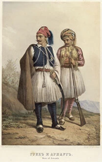
Background imageMaps Collection: Greek and Arnaut, 1862. Creator: Karl Fiale

Greek and Arnaut, 1862. Creator: Karl Fiale
Greek and Arnaut, 1862. Sheet 19 from the album "Description ethnographique des peuples de la Russie", volume 1

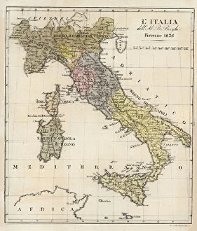
Background imageMaps Collection: Map of Italy in 1836 by Ab. Bartolomeo Borghi

Map of Italy in 1836 by Ab. Bartolomeo Borghi
Map of Italy in 1836. Showing the kingdoms of Sardinia, Lombardy, Venice, Rome, Tuscany, Parma, Naples and Corsica. Map by Ab. Bartolomeo Borghi, Florence. l Italia dell Ab. B. Borghi, Firenze 1836

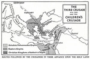
Background imageMaps Collection: Map of Third Crusade and Childrens Crusade

Map of Third Crusade and Childrens Crusade
Map of the Third Crusade and the Childrens Crusade, showing various routes and territories. Date: 1190

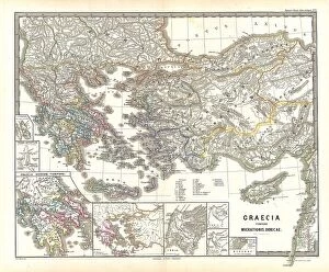
Background imageMaps Collection: 1865 Spruner Map Of Greece During The Dorian Migrations

1865 Spruner Map Of Greece During The Dorian Migrations
1865, Spruner Map of Greece during the Dorian Migrations

Background imageMaps Collection: 1862 Perthes Map Of Greece And The Balkans Topography

1862 Perthes Map Of Greece And The Balkans Topography
1862, Perthes Map of Greece and the Balkans

Background imageMaps Collection: 1855 Colton Map Of Greece Topography Cartography

1855 Colton Map Of Greece Topography Cartography
1855, Colton Map of Greece

Background imageMaps Collection: 1853 Mitchell Map Of Greece Topography Cartography

1853 Mitchell Map Of Greece Topography Cartography
1853, Mitchell Map of Greece

Background imageMaps Collection: 1850 Mitchell Map Of Greece Topography Cartography

1850 Mitchell Map Of Greece Topography Cartography
1850, Mitchell Map of Greece

Background imageMaps Collection: 1832 Delamarche Map Of Greece And The Balkans

1832 Delamarche Map Of Greece And The Balkans
1832, Delamarche Map of Greece and the Balkans

Background imageMaps Collection: 1834 Malte-Brun Map Of Greece Topography Cartography

1834 Malte-Brun Map Of Greece Topography Cartography
1834, Malte-Brun Map of Greece

Background imageMaps Collection: 1836 Cary Map Of Greece And The Balkans John Cary

1836 Cary Map Of Greece And The Balkans John Cary
1836, Cary Map of Greece and the Balkans, John Cary, 1754 - 1835, English cartographer

Background imageMaps Collection: 1827 Finely Map Of Greece Topography Cartography

1827 Finely Map Of Greece Topography Cartography
1827, Finely Map of Greece

Background imageMaps Collection: 1794 Anville Map Of Ancient Greece Topography

1794 Anville Map Of Ancient Greece Topography
1794, Anville Map of Ancient Greece

Background imageMaps Collection: 1784 Bocage Map Of The City Of Athens In Ancient Greece

1784 Bocage Map Of The City Of Athens In Ancient Greece
1784, Bocage Map of the City of Athens in Ancient Greece

Background imageMaps Collection: 1868 British Admiralty Chart Or Map Of The Mediterranean Sea

1868 British Admiralty Chart Or Map Of The Mediterranean Sea
1868, British Admiralty Chart or Map of the Mediterranean Sea, Italy, Corsica, Greece, Tunisia

Background imageMaps Collection: 1865 Spruner Map Of Greece Macedonia And Thrace Before The Peloponnesian War

1865 Spruner Map Of Greece Macedonia And Thrace Before The Peloponnesian War
1865, Spruner Map of Greece, Macedonia and Thrace before the Peloponnesian War

Background imageMaps Collection: 1865 Spruner Map Of Greece Epirus After The Persian War

1865 Spruner Map Of Greece Epirus After The Persian War
1865, Spruner Map of Greece, Epirus after the Persian War

Background imageMaps Collection: 1864 Mitchell Map Of Italy Greece And The Austrian Empire

1864 Mitchell Map Of Italy Greece And The Austrian Empire
1864, Mitchell Map of Italy, Greece and the Austrian Empire

Background imageMaps Collection: 1863 Johnson Map Of Austria Hungary Turkey Italy And Greece

1863 Johnson Map Of Austria Hungary Turkey Italy And Greece
1863, Johnson Map of Austria, Hungary, Turkey, Italy and Greece


All Professionally Made to Order for Quick Shipping


-

Maps Collection

Maps of Greece Europe are essential tools for travelers, historians, and anyone interested in the region. They provide an overview of the country's geography, cities, and regions, and are be used to plan trips, locate points of interest such as archaeological sites or beaches, and to gain a better understanding of the area's cultural heritage. They also show roads and other transportation routes that connect cities and towns throughout Greece. Additionally they can help visitors find their way around unfamiliar areas by providing detailed information about streets and landmarks. By using maps of Greece Europe travelers can make informed decisions about where to go during their visit.
+

Our beautiful pictures are available as Framed Prints, Photos, Wall Art and Photo Gifts

The Maps of Greece Europe collection from Media Storehouse is a stunning compilation of vintage and contemporary maps that showcase the beauty and history of Greece. Our collection includes a wide range of maps, from ancient Greek city-states to modern-day Greece, highlighting the country's rich cultural heritage. Each map in our collection is carefully curated and printed on high-quality paper or canvas, ensuring that every detail is captured with precision. The Maps of Greece Europe collection offers a variety of sizes and framing options to suit any decor style. Whether you're looking for a unique piece to add to your home or office, or you're an avid collector interested in historical cartography, the Maps of Greece Europe collection has something for everyone. With its beautiful designs and exceptional quality, it's no wonder why our collection is so popular among art enthusiasts around the world.
+

What are Maps of Greece Europe art prints?

Maps of Greece Europe art prints are high-quality reproductions of maps that depict the geography, topography and political boundaries of Greece and other European countries. These prints showcase intricate details such as major cities, rivers, mountains, coastlines and islands in a visually appealing manner. They are available in various sizes to suit different spaces and can be framed or mounted for display. These art prints serve multiple purposes including educational use in classrooms or offices, decorative use in homes or hotels, as well as gifting options for history buffs or travel enthusiasts. The Maps of Greece Europe art prints are printed on premium quality paper using advanced printing technology to ensure vibrant colours and sharp images that last long without fading. These art prints offer an excellent way to explore the rich cultural heritage of Greece and other European nations while adding a touch of sophistication to any space they adorn.
+

What Maps of Greece Europe art prints can I buy from Media Storehouse?

We offer a wide range of Maps of Greece Europe art prints that you can purchase. These maps are perfect for those who love history, geography or simply want to decorate their homes with unique and interesting pieces. The collection includes antique maps dating back to the 16th century as well as modern-day maps that showcase the country's topography, cities and landmarks. You can choose from different styles such as vintage, retro or contemporary depending on your preference. Some of the popular options include detailed city maps like Athens, Thessaloniki and Crete while others feature Greece's islands like Santorini, Mykonos and Corfu. The quality of these prints is exceptional with high-resolution images printed on premium paper using state-of-the-art printing technology. You can also select various sizes to fit your space requirements. Whether you're looking for a gift for someone special or just want to add some character to your home decor, we have an extensive selection of Maps of Greece Europe art prints that will suit any taste or budget.
+

How do I buy Maps of Greece Europe art prints?

To buy maps of Greece Europe art prints from Media Storehouse, you can browse our extensive collection online. We offer a wide range of map designs and sizes to choose from, so you can find the perfect print for your needs. Once you have found the artwork that you want to purchase, simply add it to your cart and proceed to checkout. At checkout, you will be prompted to enter your shipping information and payment details. You can pay using a variety of methods including credit card or PayPal. After completing your order, Media Storehouse will process it and ship it out as soon as possible. Buying maps of Greece Europe art prints from Media Storehouse is an easy and convenient way to decorate your home or office with beautiful artwork. With their high-quality printing techniques and attention to detail, these prints are sure to impress anyone who sees them. So why wait? Start browsing today.
+

How much do Maps of Greece Europe art prints cost?

We offer a wide range of Maps of Greece Europe art prints that are available at varying prices. The cost of these prints depends on several factors such as the size, quality, and type of paper used for printing. Our collection includes vintage maps, contemporary designs, and artistic interpretations that cater to different tastes and preferences. We understand the importance of providing affordable options without compromising on quality. Therefore, our pricing is competitive while ensuring that each print meets our high standards. We also offer various framing options to enhance the overall aesthetic appeal of your chosen artwork. Whether you're looking for a unique gift or want to decorate your home or office space with beautiful Maps of Greece Europe art prints, we have something for everyone's budget. You can browse through our extensive collection online and choose from a variety of sizes and styles that suit your needs best.
+

How will my Maps of Greece Europe art prints be delivered to me?

We take great care in ensuring that your Maps of Greece Europe art prints are delivered to you safely and securely. We use high-quality packaging materials to protect your artwork during transit, including sturdy cardboard tubes for rolled prints and flat cardboard boxes for framed prints. Our delivery partners are reliable and experienced couriers who will handle your package with care. They will deliver your artwork directly to the address provided at checkout, so please ensure that it is accurate and up-to-date. Once you receive your Maps of Greece Europe art print, we recommend handling it with care to avoid any damage or creases. If you have ordered a framed print, be sure to hang it in a suitable location away from direct sunlight or moisture. We hope that you enjoy your new artwork and appreciate the effort we put into delivering it safely to you.