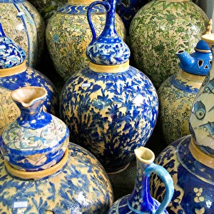
Cushion > Sheffield City Archives > Maps and Plans > Bowen's County Maps, c. 1777
Cushion : County Map of Cheshire, c. 1777


![]()
Home Decor from Sheffield City Archives
County Map of Cheshire, c. 1777
From The Large English Atlas: or, a new set of map of all the counties of England and Wales drawn from the several surveys which have been hitherto been published. With three general maps of England, Scotland and Ireland, from the latest and best authorities, by Emanuel Bowen, Thomas Kitchin and others. London, printed and sold by T. Bowles, [c.1777]
Sheffield City Archives and Local Studies Library has an unrivalled collection of images of Sheffield, England
Media ID 25438314
© Sheffield City Council - All Rights Reserved
Antique Map Bowens Map County Map Emanuel Bowen Old Map Thomas Kitchin Cheshire Chester Congleton Crewe Ellesmere Port Frodsham Knutsford Lymm Macclesfield Nantwich Neston Northwich Poynton Runcorn Sandbach Warrington Widnes Wilmslow Winsford
Medium 18" Cushion (46x46cm)
18"x18" (46x46cm) Fibre filled cushion with a plush soft feel. Your choice of image fills the front, with a stone coloured faux suede back. Flat sewn concealed white zip.
Accessorise your space with decorative, soft cushions
Estimated Image Size (if not cropped) is 45.7cm x 35.2cm (18" x 13.9")
Estimated Product Size is 45.7cm x 45.7cm (18" x 18")
These are individually made so all sizes are approximate
Artwork printed orientated as per the preview above, with landscape (horizontal) orientation to match the source image.
EDITORS COMMENTS
This antique map, titled "County Map of Cheshire, c. 1777" offers a fascinating glimpse into the historical geography of this English county. Crafted by renowned cartographers Emanuel Bowen and Thomas Kitchin, this print is part of The Large English Atlas: or, a new set of maps of all the counties of England and Wales. With intricate details and exquisite craftsmanship, this map showcases the various towns and cities that dotted Cheshire during the late 18th century. From bustling urban centers like Warrington, Chester, Crewe, Runcorn, Widnes to picturesque locales such as Ellesmere Port, Macclesfield, Northwich - every corner is meticulously depicted. The map also highlights lesser-known but equally significant places like Wilmslow, Winsford, Congleton, Sandbach, Nantwich, Poynton, Neston, Middlewich, AIsager, Knutsford, Lymm, Frodsham- each contributing to the rich tapestry that makes up Cheshire's history. As you explore this vintage masterpiece further, you'll notice it not only provides an accurate representation of geographical features but also includes three general maps depicting England Scotland, and Ireland from reputable sources at that time. Preserved with care in Sheffield City Archives, this remarkable piece serves as a testament to the skillful artistry and dedication put forth by Bowen, Kitchin, and others involved in its creation. Whether you're an avid collector, a history enthusiast or simply appreciate fine craftsmanship, this County Map of
MADE IN THE UK
Safe Shipping with 30 Day Money Back Guarantee
FREE PERSONALISATION*
We are proud to offer a range of customisation features including Personalised Captions, Color Filters and Picture Zoom Tools
SECURE PAYMENTS
We happily accept a wide range of payment options so you can pay for the things you need in the way that is most convenient for you
* Options may vary by product and licensing agreement. Zoomed Pictures can be adjusted in the Basket.