Canvas Print > Europe > United Kingdom > Scotland > Highlands > Alness
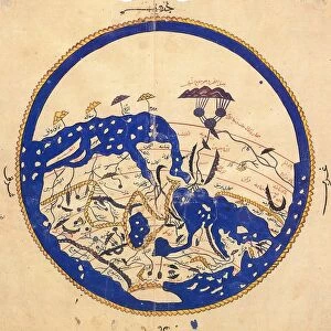
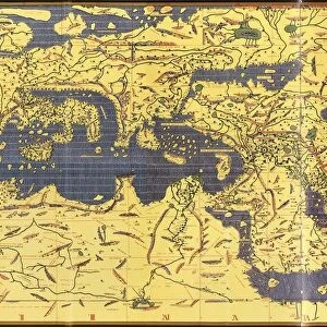
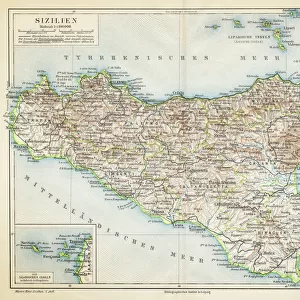
Canvas Print : The Tabula Rogeriana, drawn by al-Idrisi for Roger II of Sicily in 1154, an important


![]()
Canvas Prints from Universal Images Group (UIG)
The Tabula Rogeriana, drawn by al-Idrisi for Roger II of Sicily in 1154, an important
The Tabula Rogeriana, drawn by al-Idrisi for Roger II of Sicily in 1154, an important ancient world map
Universal Images Group (UIG) manages distribution for many leading specialist agencies worldwide
Media ID 9781623
© Universal History Archive/Universal Images Group
Drawn Important Roger Sicily 1154 Al Idrisi Tabula
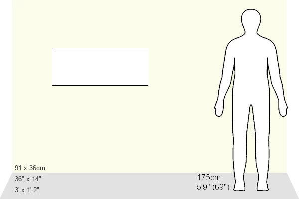
36"x14" (91x35cm) Canvas Print
Introducing the captivating Media Storehouse Canvas Prints featuring the historic Tabula Rogeriana map. Drawn by the renowned cartographer Al-Idrisi for Roger II of Sicily in 1154, this ancient masterpiece is a testament to the rich history of geographical exploration. The intricate details and vibrant colors of this iconic map are beautifully rendered on high-quality canvas, creating a stunning piece of art for your home or office. Transport yourself back in time and embellish your space with a touch of history and culture. Experience the allure of the Media Storehouse Canvas Prints - history, art, and elegance combined. (Please note: Framing is not included in this product.)
Ready to hang Premium Gloss Canvas Print. Our archival quality canvas prints are made from Polyester and Cotton mix and stretched over a 1.25" (32mm) kiln dried knot free wood stretcher bar. Packaged in a plastic bag and secured to a cardboard insert for transit.
Canvas Prints add colour, depth and texture to any space. Professionally Stretched Canvas over a hidden Wooden Box Frame and Ready to Hang
Estimated Product Size is 91.4cm x 35.6cm (36" x 14")
These are individually made so all sizes are approximate
Artwork printed orientated as per the preview above, with landscape (horizontal) orientation to match the source image.
FEATURES IN THESE COLLECTIONS
> Europe
> Italy
> Sicily
> Related Images
> Europe
> United Kingdom
> Scotland
> Highlands
> Alness
> Maps and Charts
> Early Maps
> Maps and Charts
> Popular Maps
> Maps and Charts
> Related Images
> Maps and Charts
> World
> Universal Images Group (UIG)
> History
EDITORS COMMENTS
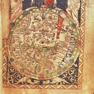
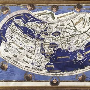
This print showcases the remarkable Tabula Rogeriana, a significant ancient world map drawn by al-Idrisi for Roger II of Sicily in 1154. The intricate details and meticulous craftsmanship of this cartographic masterpiece are truly awe-inspiring. Commissioned by King Roger II, this map holds immense historical importance as it represents a pivotal moment in the development of geographical knowledge during the medieval period. Al-Idrisi, a renowned Arab geographer and cartographer, meticulously crafted this map to provide an accurate depiction of the known world at that time. The Tabula Rogeriana is not only visually stunning but also serves as a testament to the power and influence held by Sicily's Norman kings during this era. It beautifully captures their ambition to gather knowledge from different cultures and create something extraordinary. Every inch of this ancient treasure reveals fascinating insights into how people perceived geography centuries ago. From detailed coastlines to mountain ranges, cities, rivers, and even mythical creatures decorating its borders – each element tells a story about the diverse cultures that inhabited our planet back then. As we gaze upon this exceptional piece of history through Universal Images Group (UIG)'s expertly captured photo print, we can't help but marvel at humanity's thirst for exploration and understanding throughout time. The Tabula Rogeriana remains an enduring symbol of human curiosity and ingenuity in unraveling the mysteries of our vast world.
MADE IN THE UK
Safe Shipping with 30 Day Money Back Guarantee
FREE PERSONALISATION*
We are proud to offer a range of customisation features including Personalised Captions, Color Filters and Picture Zoom Tools
SECURE PAYMENTS
We happily accept a wide range of payment options so you can pay for the things you need in the way that is most convenient for you
* Options may vary by product and licensing agreement. Zoomed Pictures can be adjusted in the Basket.