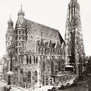
Canvas Print > Arts > Landscape paintings > Waterfall and river artworks > River artworks
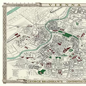
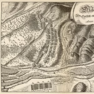
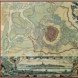
Canvas Print : Austria. Vienna. Plan, 1720


![]()
Canvas Prints from Mary Evans Picture Library
Austria. Vienna. Plan, 1720
Austria. Vienna. Plan of the walled city with Prater and the Danube River. Engraving, 1720
Mary Evans Picture Library makes available wonderful images created for people to enjoy over the centuries
Media ID 14330263
© Thaliastock / Mary Evans
1720 Austria Austrian Capital Cartography Center Channel Danube Overview Panorama Plan Prater Vienna Walled
20"x16" (50x40cm) Canvas Print
"Step into the past with our exquisite Canvas Print of "Austria. Vienna. Plan, 1720" from Media Storehouse. This stunning reproduction, sourced from Mary Evans Prints Online, showcases an intricately detailed engraving of Vienna's historic city plan from 1720. Witness the grandeur of the walled city, with its majestic Prater amusement park and the winding Danube River. Transport yourself back in time with this beautiful and authentic work of art, perfect for adding character and charm to any room in your home or office."
Ready to hang Premium Gloss Canvas Print. Our archival quality canvas prints are made from Polyester and Cotton mix and stretched over a 1.25" (32mm) kiln dried knot free wood stretcher bar. Packaged in a plastic bag and secured to a cardboard insert for transit.
Canvas Prints add colour, depth and texture to any space. Professionally Stretched Canvas over a hidden Wooden Box Frame and Ready to Hang
Estimated Product Size is 50.8cm x 40.6cm (20" x 16")
These are individually made so all sizes are approximate
Artwork printed orientated as per the preview above, with landscape (horizontal) orientation to match the source image.
FEATURES IN THESE COLLECTIONS
> Aerial Photography
> Austria
> Aerial Photography
> Related Images
> Arts
> Landscape paintings
> Waterfall and river artworks
> River artworks
> Europe
> Austria
> Aerial Views
> Europe
> Austria
> Related Images
EDITORS COMMENTS
1. Title: "Austria. Vienna. Plan of the Walled City with Prater and the Danube River, 1720" This engraving, created in the year 1720, offers a fascinating glimpse into the historical layout of Vienna, the magnificent capital city of Austria. The meticulously crafted image transports us back in time, allowing us to explore the city's architectural wonders and urban planning during the 18th century. The intricate detail of this map reveals the walled city's center, with its labyrinthine streets and grand structures nestled within. The Danube River, a vital artery of European trade and commerce, winds its way through the city, connecting it to the rest of Europe. The Prater, an iconic landmark, can be seen in the top right corner, its towering Ferris wheel a testament to the city's rich history and its enduring allure. This panoramic view, a product of the Age of Enlightenment, showcases the city's modernization during the 18th century. The map's creation represents a significant milestone in cartography, offering an aerial perspective that was not common during this era. The image serves as a valuable historical document, providing insights into the urban planning and development of Vienna during a pivotal period in European history. The engraving's antique charm and historical significance make it an essential addition to any collection focusing on European history, urban development, or cartography. This piece of art not only serves as a beautiful decorative element but also as an educational tool, allowing us to learn about the rich history of Austria and its capital city, Vienna.
MADE IN THE UK
Safe Shipping with 30 Day Money Back Guarantee
FREE PERSONALISATION*
We are proud to offer a range of customisation features including Personalised Captions, Color Filters and Picture Zoom Tools
SECURE PAYMENTS
We happily accept a wide range of payment options so you can pay for the things you need in the way that is most convenient for you
* Options may vary by product and licensing agreement. Zoomed Pictures can be adjusted in the Basket.