Canvas Print > Europe > Norway > Maps
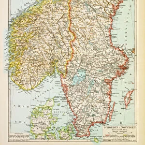
Canvas Print : Map of Norway and Sweden 1894


![]()
Canvas Prints from Fine Art Storehouse
Map of Norway and Sweden 1894
Map of Norway and Sweden
Unleash your creativity and transform your space into a visual masterpiece!
THEPALMER
Media ID 13613551
© Roberto A Sanchez
Dictionary Monoprint Norway Scandinavia Sweden Drawing Art Product Retro Styled
20"x16" (50x40cm) Canvas Print
"Step back in time with our stunning Map of Norway and Sweden 1894 canvas print from THEPALMER's Fine Art Storehouse collection. This captivating vintage map transports you to a bygone era, meticulously detailing the borders and topography of Norway and Sweden during the late 19th century. The high-quality canvas print brings out the rich colors and intricate lines of the map, making it a beautiful addition to any home or office. Hang it in your living room, study, or den to add a touch of history and sophistication to your space."
Ready to hang Premium Gloss Canvas Print. Our archival quality canvas prints are made from Polyester and Cotton mix and stretched over a 1.25" (32mm) kiln dried knot free wood stretcher bar. Packaged in a plastic bag and secured to a cardboard insert for transit.
Canvas Prints add colour, depth and texture to any space. Professionally Stretched Canvas over a hidden Wooden Box Frame and Ready to Hang
Estimated Product Size is 40.6cm x 50.8cm (16" x 20")
These are individually made so all sizes are approximate
Artwork printed orientated as per the preview above, with portrait (vertical) orientation to match the source image.
FEATURES IN THESE COLLECTIONS
> Europe
> Norway
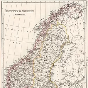
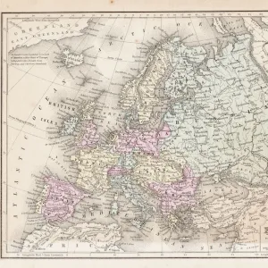
> Related Images
> Europe
> Related Images
> Europe
> Sweden
> Related Images
> Maps and Charts
> Related Images
> Fine Art Storehouse
> The Magical World of Illustration
> Palmer Illustrated Collection
> Fine Art Storehouse
> Map
> Historical Maps
EDITORS COMMENTS
This print takes us back in time to the year 1894, immersing us in the intricate world of cartography. The "Map of Norway and Sweden" is a true testament to the artistry and craftsmanship that went into creating maps during this era. With its retro styling and antique charm, this engraved image transports us to a bygone era. The illustration itself is an etching, showcasing the meticulous attention to detail that was characteristic of mapmaking at the time. Every contour line, river, and mountain range has been delicately etched onto paper using traditional techniques such as lithography and engraving. This monoprint captures not only the physical geography but also the essence of old-world Scandinavia. As we gaze upon this vintage masterpiece, we are reminded of how maps were once treasured possessions used for exploration and navigation. The Map of Norway and Sweden serves as a window into history, allowing us to visualize Europe's northernmost regions as they were over a century ago. Displayed vertically with no people present in the frame, this drawing art product evokes a sense of wonderment about these two neighboring countries' rich cultural heritage. Whether you have Nordic roots or simply appreciate historical artifacts, THEPALMER's creation offers an opportunity to admire both beauty and functionality through one timeless piece.
MADE IN THE UK
Safe Shipping with 30 Day Money Back Guarantee
FREE PERSONALISATION*
We are proud to offer a range of customisation features including Personalised Captions, Color Filters and Picture Zoom Tools
SECURE PAYMENTS
We happily accept a wide range of payment options so you can pay for the things you need in the way that is most convenient for you
* Options may vary by product and licensing agreement. Zoomed Pictures can be adjusted in the Basket.