Fraud Blocker Skip to main content

Home > Asia > Turkmenistan > Maps

Maps Collection

Maps of Turkmenistan Asia are essential for anyone visiting or living in this Central Asian country

Choose a picture from our Maps Collection for your Wall Art and Photo Gifts

91 items

Background imageMaps Collection: Road Map of Bangkok, Thailand

Road Map of Bangkok, Thailand
Geographical/Road map of Bangkok, Thailand

Background imageMaps Collection: Siam and the Malay Archipelago (colour litho)

Siam and the Malay Archipelago (colour litho)
8653606 Siam and the Malay Archipelago (colour litho) by English School, (19th century); Private Collection; (add.info.: Siam and the Malay Archipelago)

Background imageMaps Collection: Map Siam / Thailand 1893

Map Siam / Thailand 1893
Map showing the Kingdom of Siam, now Thailand

Background imageMaps Collection: Flat map of Thailand with flag

Flat map of Thailand with flag
Detailed map of Thailand with surroundings, provinces, capital and flag

Background imageMaps Collection: Map of Farther India, 1902. Creator: Unknown

Map of Farther India, 1902. Creator: Unknown
Map of Farther India, 1902. Southeast Asia, including Burma, Siam, Cambodia, French Indochina and Malaya. From The Century Atlas of the World. [John Walker & Co, Ltd. London, 1902]

Background imageMaps Collection: GASI2A-00067

GASI2A-00067
Map of Siam (now Thailand) and the independent Shan States, 1870s. Printed color lithograph, 19th century

Background imageMaps Collection: Antique map of Vietnam, Laos, Cambodia and Ta'hailand

Antique map of Vietnam, Laos, Cambodia and Ta'hailand
Antique map of Vietnam, Laos, Cambodia and TÔǽhailand

Background imageMaps Collection: Map of Thailand and Vietnam 1900

Map of Thailand and Vietnam 1900
Meyers hand-Atlas Leipzig und Wien Verlag des Bibliographischen Instituts 1900

Background imageMaps Collection: ASIA MAP, 19th CENTURY. Persia, Afghanistan, Turkestan, India, Tibet, Burma, and Siam

ASIA MAP, 19th CENTURY. Persia, Afghanistan, Turkestan, India, Tibet, Burma, and Siam. Detail from a late 19th century map of Asia

Background imageMaps Collection: Map of Malacca peninsula (Burma, Thailand and Malaysia), circa 1870. 19th century lithography

Map of Malacca peninsula (Burma, Thailand and Malaysia), circa 1870. 19th century lithography
NWI4865582 Map of Malacca peninsula (Burma, Thailand and Malaysia), circa 1870. 19th century lithography.; (add.info.: Map of Malacca peninsula (Burma, Thailand and Malaysia), circa 1870

Background imageMaps Collection: Geographic map of Siam (Thailand) and the independent states of Shan, 1870. Lithography

Geographic map of Siam (Thailand) and the independent states of Shan, 1870. Lithography
NWI4865483 Geographic map of Siam (Thailand) and the independent states of Shan, 1870. Lithography.; (add.info.: Geographic map of Siam (Thailand) and the independent states of Shan, 1870

Background imageMaps Collection: Map of Eastern India, c.1900 (engraving)

Map of Eastern India, c.1900 (engraving)
533022 Map of Eastern India, c.1900 (engraving); (add.info.: Map showing historical boundaries of eastern India, Burma, Siam and French Indo-China, circa 1902)

Background imageMaps Collection: BANGKOK

BANGKOK
StudioSix

Background imageMaps Collection: Black Maps Earth Tones 08

Black Maps Earth Tones 08
Emiliano Deificus

Background imageMaps Collection: 1 Maps 41

1 Maps 41
Emiliano Deificus

Background imageMaps Collection: City Love Maps 08

City Love Maps 08
Emiliano Deificus

Background imageMaps Collection: City Heart Maps 08

City Heart Maps 08
Emiliano Deificus

Background imageMaps Collection: 0041 City

0041 City
Emiliano Deificus

Background imageMaps Collection: City Heart Maps 08

City Heart Maps 08
Emiliano Deificus

Background imageMaps Collection: Antique map Burma, Thailand, Vietnam, Malaysia, 1897, late 19th Century

Antique map Burma, Thailand, Vietnam, Malaysia, 1897, late 19th Century
Vintage engraving of a Antique map of Burma, Thailand, Vietnam, Malaysia, 1897, late 19th Century

Background imageMaps Collection: 16th century, antique, archival, bangladesh, banner, bay of bengal, border, cartography

16th century, antique, archival, bangladesh, banner, bay of bengal, border, cartography, ceylon, country, document, geography, historic, historical, india, indian ocean, latitude, legend, map

Background imageMaps Collection: Kingdoms of Arakan, Pegu, Siam, Cambodia and Laos, engraving by G

Kingdoms of Arakan, Pegu, Siam, Cambodia and Laos, engraving by G. Zuliani taken from Tome IV of the "Newest Atlas" published in Venice in 1785 by Antonio Zatta

Background imageMaps Collection: Antique illustration from US navy and army: Philippines, Malaysia, Thailand map

Antique illustration from US navy and army: Philippines, Malaysia, Thailand map

Background imageMaps Collection: antique, archival, border, burma, cambodia, cartography, country, document, geography

antique, archival, border, burma, cambodia, cartography, country, document, geography, historic, historical, india orientalis, indian ocean, indonesia, islands, latitude, legend, longitude, malaysia

Background imageMaps Collection: Antique map of East Indian Archipelago

Antique map of East Indian Archipelago, including, the Phillippines, Papua New Guinea, Borneo and Java from 1891. With Detail of Batavia (Jakarta)

Background imageMaps Collection: Map of southeast Asia's Malay Archipelago 1896

Map of southeast Asia's Malay Archipelago 1896
Andres Allgemeiner Handatlas - Bielefeld und Leipzig 1896

Background imageMaps Collection: South East Asia, Thailand, Samut Prakan province, Erawan Museum, the middle room of

South East Asia, Thailand, Samut Prakan province, Erawan Museum, the middle room of the museum representing the human world with a stained glass world map and zodiac by German artist Jakob Schwarzkopf

Background imageMaps Collection: 13826524

13826524

Background imageMaps Collection: Old Antique map East indian Archipelago, Indonesia, Siam, Java, Batavia, Philippines

Old Antique map East indian Archipelago, Indonesia, Siam, Java, Batavia, Philippines, Papua New Guinea, 1890s
Antique map of East indian Archipelago, Indonesia, SIam, Java, Batavia, Philippines, Papua New Guinea, 1890s, Victorian 19th Century history

Background imageMaps Collection: Old Antique map of Farther India, Burma, Siam, Malay, Vietnam, 1890s, Victorian 19th Century history

Old Antique map of Farther India, Burma, Siam, Malay, Vietnam, 1890s, Victorian 19th Century history
Antique map of Farther India, Burma, Siam, Malay, Vietnam, 1890s, Victorian 19th Century history

Background imageMaps Collection: Kampong or Southeast Asian village depicted at the Exposition Universelle, Paris, France

Kampong or Southeast Asian village depicted at the Exposition Universelle, Paris, France, 1889 (b / w photo)
7200482 Kampong or Southeast Asian village depicted at the Exposition Universelle, Paris, France, 1889 (b/w photo) by Brichaut

Background imageMaps Collection: Giacomo and Giovanni Battista Tocci, Italian conjoined twins (engraving)

Giacomo and Giovanni Battista Tocci, Italian conjoined twins (engraving)
7157332 Giacomo and Giovanni Battista Tocci, Italian conjoined twins (engraving) by German School, (19th century); Private Collection; (add.info.: Giacomo and Giovanni Battista Tocci)

Background imageMaps Collection: The Twin Brothers (engraving)

The Twin Brothers (engraving)
7185525 The Twin Brothers (engraving) by English School, (17th century) (after); Private Collection; (add.info.: The Twin Brothers)

Background imageMaps Collection: Geographic map of the kingdom of Siam - in 'Le petit journal'

Geographic map of the kingdom of Siam - in "Le petit journal"
LSE4109501 Geographic map of the kingdom of Siam - in " Le petit journal", 12/08/1893. by Unknown Artist, (19th century); Private Collection; (add.info)

Background imageMaps Collection: Map of the East Indies (colour engraving)

Map of the East Indies (colour engraving)
XCF286475 Map of the East Indies (colour engraving) by American School; Private Collection; American, out of copyright

Background imageMaps Collection: Map of the East Indies, pub. 1635 in Amsterdam (hand-coloured engraving)

Map of the East Indies, pub. 1635 in Amsterdam (hand-coloured engraving)
STC79290 Map of the East Indies, pub. 1635 in Amsterdam (hand-coloured engraving) by Dutch School, (17th century); Private Collection; The Stapleton Collection; Dutch, out of copyright

Background imageMaps Collection: East Indies: Sea and coastal chart extending from Southern India to Japan by the way of

East Indies: Sea and coastal chart extending from Southern India to Japan by the way of
BON111060 East Indies: Sea and coastal chart extending from Southern India to Japan by the way of the East Indian archipelago (coloured engraving) by Wit

Background imageMaps Collection: French school textbook map of Indochina, 1905 (colour litho)

French school textbook map of Indochina, 1905 (colour litho)
CHT216702 French school textbook map of Indochina, 1905 (colour litho) by French School, (20th century); Private Collection; eArchives Charmet; French, out of copyright

Background imageMaps Collection: Plan of Lopburi, 1751 (litho)

Plan of Lopburi, 1751 (litho)
LIT389801 Plan of Lopburi, 1751 (litho) by French School, (18th century); (add.info.: made in Paris; Plan de la Ville de Louvo, demeure ordinaire des Rois de Siam; ); Photo eLuca Tettoni; French

Background imageMaps Collection: Map of the Kingdom of Siam, Paris, 1686 (engraving) (b / w photo)

Map of the Kingdom of Siam, Paris, 1686 (engraving) (b / w photo)
CHT286981 Map of the Kingdom of Siam, Paris, 1686 (engraving) (b/w photo) by French School, (17th century); Bibliotheque Nationale, Paris

Background imageMaps Collection: Language (colour litho)

Language (colour litho)
3650025 Language (colour litho) by English School, (19th century); Private Collection; (add.info.: Language. Map showing the distribution of the principal languages of the world)

Background imageMaps Collection: Map of the city of Siam, capital of the kingdom of that name after a survey done by a

Map of the city of Siam, capital of the kingdom of that name after a survey done by a
LIT389753 Map of the city of Siam, capital of the kingdom of that name after a survey done by a French engineer in 1687, published in the 1751 edition of Histoire Generale des Voyages by Antoine

Background imageMaps Collection: Map of the Kingdom of Siam (colour litho)

Map of the Kingdom of Siam (colour litho)
2818419 Map of the Kingdom of Siam (colour litho) by French School, (19th century); Private Collection; (add.info.: Map of the Kingdom of Siam)

Background imageMaps Collection: Map of Ayutthaya, 1686 (ink on paper)

Map of Ayutthaya, 1686 (ink on paper)
LIT389803 Map of Ayutthaya, 1686 (ink on paper) by French School, (17th century); (add.info.: Siam ou Iudia, Capitalle du Royaume de Siam; ); Photo eLuca Tettoni; French, out of copyright

Background imageMaps Collection: Map of Laos and the Mekong river showing the route of the voyage of Henri Mouhot

Map of Laos and the Mekong river showing the route of the voyage of Henri Mouhot
423692 Map of Laos and the Mekong river showing the route of the voyage of Henri Mouhot, illustration from Travels in the Central Parts of Indo-China (Siam), Cambodia, and Laos During the Years 1858

Background imageMaps Collection: Map of East India (South and Southeast Asia: Pakistan, India, Nepal, Bangladesh, Burma

Map of East India (South and Southeast Asia: Pakistan, India, Nepal, Bangladesh, Burma
LRI4710618 Map of East India (South and Southeast Asia: Pakistan, India, Nepal, Bangladesh, Burma, Sri Lanka, Thailand, Malaysia, Vietnam, Cambodia, Laos, Philipines)

Background imageMaps Collection: The Crisis in Siam, Map showing the Disputed Territory (engraving)

The Crisis in Siam, Map showing the Disputed Territory (engraving)
1062788 The Crisis in Siam, Map showing the Disputed Territory (engraving) by English School, (19th century); Private Collection; (add.info.: The Crisis in Siam, Map showing the Disputed Territory)

Background imageMaps Collection: 616098852

616098852
Maps, 616098852


All Professionally Made to Order for Quick Shipping


-

Maps Collection

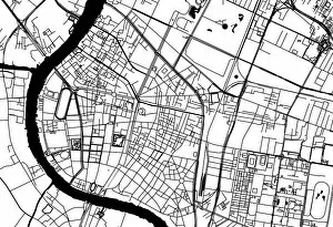
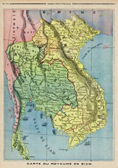
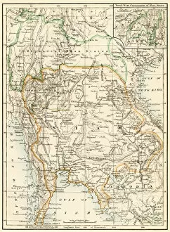
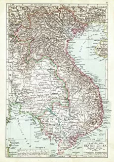
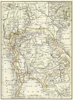
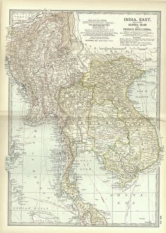
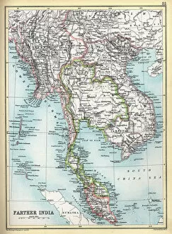
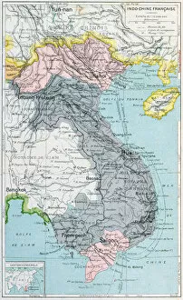
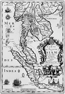
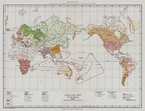
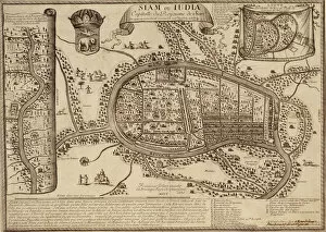
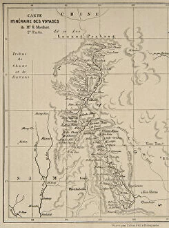
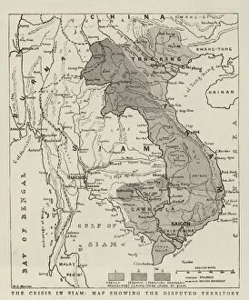
Maps of Turkmenistan Asia are essential for anyone visiting or living in this Central Asian country. The maps provide an overview of the country's geography, including its major cities, rivers, mountains and deserts. They also show the location of important sites such as archaeological ruins and cultural monuments. Additionally, they provide information about roads and transportation networks that can help travelers plan their trips more effectively. Maps of Turkmenistan Asia also include details about the climate, population distribution and other important facts about the region. With these maps in hand, visitors can explore this fascinating land with confidence and ease.
+

Our beautiful pictures are available as Framed Prints, Photos, Wall Art and Photo Gifts

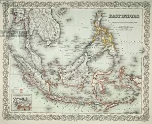
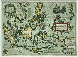
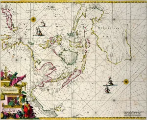
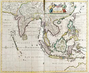
The Maps of Turkmenistan Asia collection from Media Storehouse is a stunning array of wall art and framed prints that showcase the beauty and diversity of this Central Asian country. Our collection features a range of maps, including antique maps dating back to the 18th century, as well as more modern depictions that highlight the country's geography, topography, and political boundaries. Each print in our collection is expertly crafted using high-quality materials and printing techniques to ensure that it captures every detail with precision and clarity. Whether you're looking for a unique piece of artwork to adorn your home or office walls or simply want to learn more about this fascinating region, the Maps of Turkmenistan Asia collection has something for everyone. From intricate city plans to detailed topographical maps, these prints offer an unparalleled glimpse into one of the world's most intriguing countries. So why not explore this captivating corner of Asia today with Media Storehouse?
+

What are Maps of Turkmenistan Asia art prints?

Maps of Turkmenistan Asia art prints are high-quality reproductions of maps that showcase the geography, topography, and landmarks of Turkmenistan. These prints are created by skilled artists who use a combination of traditional techniques and modern technology to produce stunning visual representations of this Central Asian country. These art prints can be used for a variety of purposes, such as educational materials in classrooms or offices, decorative pieces in homes or businesses, or even as gifts for those interested in geography or travel. They come in various sizes and styles to suit different preferences and needs. Maps of Turkmenistan Asia art prints offer an excellent way to appreciate the beauty and complexity of this fascinating country. Whether you're looking for a unique piece to add to your collection or simply want to learn more about Turkmenistan's history and culture, these prints are sure to impress with their intricate details and vibrant colors.
+

What Maps of Turkmenistan Asia art prints can I buy from Media Storehouse?

We offer a wide range of Maps of Turkmenistan Asia art prints that you can purchase. These maps showcase the geography and topography of Turkmenistan, including its major cities, landmarks, and natural features. You can choose from different styles and designs to suit your preferences or needs. Some of the popular Maps of Turkmenistan Asia art prints available at Media Storehouse include vintage maps, satellite imagery, political maps, physical maps, and more. These artworks are printed on high-quality paper using advanced printing technologies to ensure clarity and durability. Whether you're looking for decorative pieces for your home or office or educational resources for schools or libraries, we have something to offer. With their vast collection of Maps of Turkmenistan Asia art prints, you'll surely find something that fits your taste and budget.
+

How do I buy Maps of Turkmenistan Asia art prints?

To buy Maps of Turkmenistan Asia art prints from Media Storehouse, you can browse our extensive collection of maps and select the one that best suits your needs. Once you have found the map you want to purchase, simply add it to your cart and proceed to checkout. At checkout, you will be prompted to enter your billing and shipping information. We offer a range of payment options including credit card, PayPal, and Amazon Pay. You can choose the option that is most convenient for you. Once your order has been processed, Media Storehouse will carefully package your print and ship it directly to your address. Their high-quality printing process ensures that each map is printed with vibrant colors on premium paper stock. Whether you're looking for a decorative piece for your home or office or need a reference tool for geographic research or education purposes, our selection of Maps of Turkmenistan Asia art prints is sure to meet your needs.
+

How much do Maps of Turkmenistan Asia art prints cost?

We offer a wide range of Maps of Turkmenistan Asia art prints that cater to different preferences and budgets. The cost of these prints varies depending on factors such as the size, framing options, and materials used. We have affordable options for those who are looking for budget-friendly prints, as well as high-end pieces for collectors or those who want to make a statement with their wall art. Our Maps of Turkmenistan Asia art prints are created using high-quality printing techniques and materials to ensure that they last for years without fading or losing their vibrancy. They are perfect for adding character and personality to any room in your home or office. We take pride in providing our customers with exceptional service and quality products at competitive prices. If you're interested in purchasing a Maps of Turkmenistan Asia art print from us, please browse our collection online or contact us directly for more information about pricing and availability.
+

How will my Maps of Turkmenistan Asia art prints be delivered to me?

Your Maps of Turkmenistan Asia art prints will be delivered to you securely and safely. We take great care in packaging your artwork so that it arrives in pristine condition. Your order will be dispatched from our warehouse and shipped directly to the address provided at checkout. We use a trusted delivery service provider who ensures that your package is handled with care during transit. You can expect your Maps of Turkmenistan Asia art prints to arrive within the estimated delivery timeframe, which varies depending on your location. Once your order has been dispatched, we will send you an email confirmation containing tracking information so that you can monitor its progress. If for any reason there are delays or issues with delivery, please do not hesitate to contact us and we will do everything we can to resolve the situation promptly. We hope that you enjoy your new artwork and thank you for choosing Media Storehouse as your supplier of high-quality art prints.