
Maps Collection (page 2)
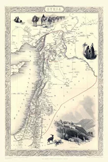
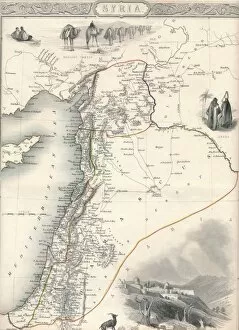
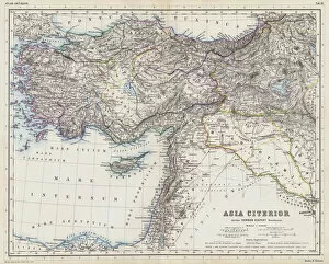
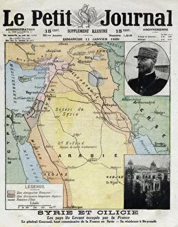
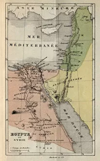
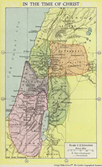
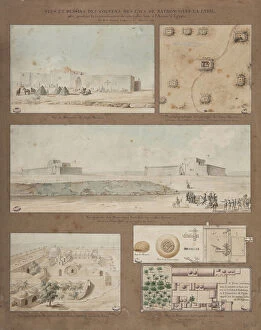
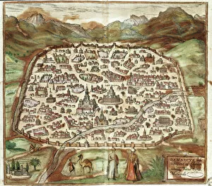
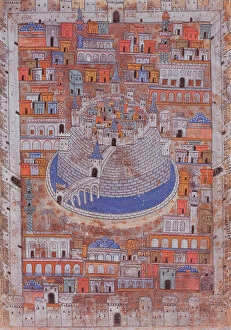
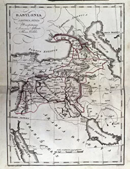
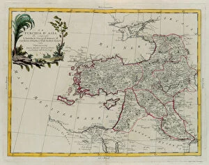
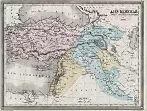
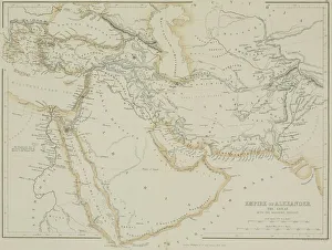
Syria is a country located in the Middle East, bordered by Turkey, Iraq, Jordan, Israel and Lebanon
136 items


All Professionally Made to Order for Quick Shipping
-
Maps Collection
Syria is a country located in the Middle East, bordered by Turkey, Iraq, Jordan, Israel and Lebanon, and is part of the larger region known as the Middle East or West Asia. Maps of Syria Asia provide an overview of this region and its surrounding countries. These maps show physical features such as mountains, rivers and deserts; political boundaries between countries; major cities; and other important landmarks. They also include information about population density, climate zones and natural resources. Maps of Syria Asia can be used to gain insight into the history and culture of this region as well as to plan trips or research projects related to it.
+
Our beautiful Wall Art and Photo Gifts include Framed Prints, Photo Prints, Poster Prints, Canvas Prints, Jigsaw Puzzles, Metal Prints and so much more
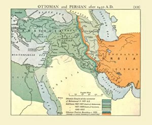
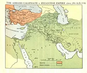
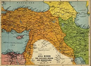
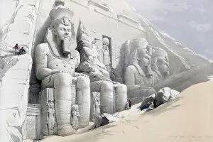
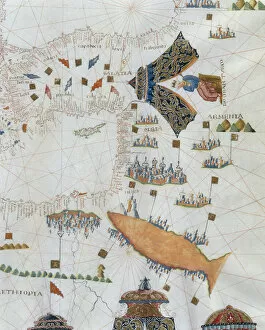
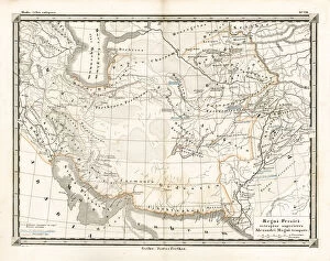
The Maps of Syria Asia collection from Media Storehouse is a stunning range of wall art and framed prints that showcases the geography and history of Syria, one of the oldest inhabited regions in the world. Our collection features a wide variety of maps, ranging from ancient depictions to modern-day satellite imagery, highlighting the country's rich cultural heritage and strategic location at the crossroads between Europe, Asia, and Africa. Each print is carefully crafted using high-quality materials to ensure long-lasting durability and vibrant colors. Whether you're looking for a unique piece to decorate your home or office or searching for an educational tool for students or historians, our collection has something for everyone. From detailed topographical maps to artistic renderings featuring intricate borders and illustrations, these prints offer a fascinating glimpse into Syria's complex past and present. With its diverse selection of styles and sizes available at affordable prices, the Maps of Syria Asia collection is sure to impress anyone with an interest in cartography or Middle Eastern history.
+
What are Maps of Syria Asia art prints?
Maps of Syria Asia art prints are high-quality reproductions of antique and contemporary maps depicting the region of Syria in Asia. These prints showcase detailed cartography, highlighting the topography, cities, towns, rivers, and other geographical features of this historically significant area. These art prints offer a unique way to explore the rich history and culture of Syria through its geography. They can be used as educational tools for students studying world history or geography or as decorative pieces for homes or offices. Maps of Syria Asia art prints come in various sizes and styles to suit different preferences. Some feature intricate illustrations while others have a more minimalist design. They are printed on premium quality paper using advanced printing techniques that ensure vibrant colors and sharp details. Whether you're looking to add some character to your living space or want to learn more about the fascinating country of Syria, Maps of Syria Asia art prints are an excellent choice that will provide both aesthetic appeal and educational value.
+
What Maps of Syria Asia art prints can I buy from Media Storehouse?
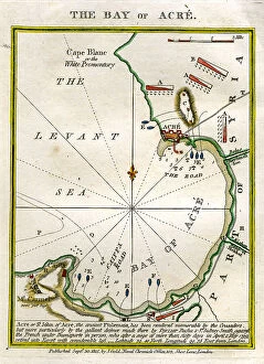
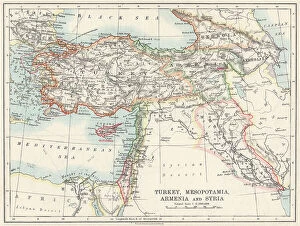
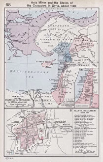
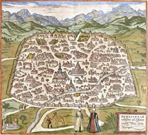
We offer a wide range of Maps of Syria Asia art prints that are perfect for anyone who is interested in geography, history or art. These maps showcase the intricate details and features of the region, including its cities, rivers, mountains and other landmarks. Some popular options include antique maps from the 19th century that depict Syria and neighboring countries such as Turkey, Lebanon and Iraq. These vintage pieces offer a unique glimpse into how cartographers viewed this part of the world during an era when travel was much more difficult than it is today. In addition to antique maps, Media Storehouse also has contemporary prints that feature modern-day borders and political boundaries. These pieces can be a great way to stay up-to-date on current events or simply add some color to your home or office decor. If you're looking for high-quality Maps of Syria Asia art prints that are both informative and visually stunning, we have plenty of options to choose from.
+
How do I buy Maps of Syria Asia art prints?
To buy Maps of Syria Asia art prints from Media Storehouse, you can browse our extensive collection of artwork online. Simply search for "Maps of Syria Asia" in the search bar on our website and select the print that catches your eye. Once you have found a piece that you like, add it to your cart and proceed to checkout. At checkout, fill out all necessary information such as billing and shipping address. You will also be prompted to choose a payment method which may include credit card or PayPal. Once your order is confirmed, Media Storehouse will process it and ship it directly to your chosen address. Your Maps of Syria Asia art print will arrive ready for framing or display however you choose. We offer high-quality prints with vibrant colors and sharp detail so that every aspect of the artwork is captured beautifully. With our easy-to-use website and secure checkout process, buying Maps of Syria Asia art prints has never been easier.
+
How much do Maps of Syria Asia art prints cost?
As We offer a wide range of Maps of Syria Asia art prints, the cost can vary depending on factors such as size and framing options. However, you can expect to find affordable prices for high-quality prints that are perfect for adding a touch of sophistication to any room. Whether you're looking for vintage maps or contemporary designs, there is something to suit every taste and budget. The Maps of Syria Asia art prints available at Media Storehouse are sourced from some of the world's most talented artists and photographers, ensuring that each print is unique and visually stunning. With so many options available, it's easy to find the perfect piece to complement your home decor or add character to your office space. So why not browse through our collection today and discover the beauty of Maps of Syria Asia art prints?
+
How will my Maps of Syria Asia art prints be delivered to me?
Your Maps of Syria Asia art prints will be delivered to you in a safe and secure manner. We take great care in packaging your order to ensure that it arrives at your doorstep undamaged. Our standard delivery method is through postal services, but we also offer express shipping options for those who need their orders sooner. We use high-quality materials for our packaging, including sturdy cardboard tubes or flat boxes with protective layers to prevent any bending or creasing during transit. Your print will be rolled carefully and placed inside the tube or box along with additional padding material as needed. Once your order has been dispatched, you will receive an email confirmation with tracking information so that you can monitor its progress until it reaches you. If there are any issues with the delivery of your Maps of Syria Asia art prints, please do not hesitate to contact us and we'll do everything possible to resolve the issue promptly.