Fraud Blocker Skip to main content

Home > Asia > Japan > Maps

Maps Collection (page 5)

Maps of Japan Asia are detailed maps that show the various physical features, cities, and other points of interest in Japan and surrounding countries

391 items

Background imageMaps Collection: 13849201

13849201

Background imageMaps Collection: 13834573

13834573

Background imageMaps Collection: 13834549

13834549

Background imageMaps Collection: 13833114

13833114

Background imageMaps Collection: 13829575

13829575

Background imageMaps Collection: 13828424

13828424

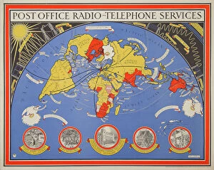
Background imageMaps Collection: Post Office Radio Telephone Services and Fisheries

Post Office Radio Telephone Services and Fisheries
A wonderful, original, poster map showing Post Office Radio Telephone Services commissioned by the General Post Office and designed by Leslie MacDonald Gill, 1935

Background imageMaps Collection: Map of the Roman Empire. The map is signed in the lower right corner by I. Laurus

Map of the Roman Empire. The map is signed in the lower right corner by I. Laurus
17th-century, antica, attraction, attractions, black, black-and-white, black-white, central italy, coastal city, coastal town, coastal village, contemporary, corners, depiction, depictions, deserted

Background imageMaps Collection: Old Antique map of Japan and Korean, detail of Tokyo bay, 1890s, Victorian 19th Century history

Old Antique map of Japan and Korean, detail of Tokyo bay, 1890s, Victorian 19th Century history

Background imageMaps Collection: Old chromolithograph map of Japan, island country in East Asia

Old chromolithograph map of Japan, island country in East Asia
Copyright has expired on this artwork. From my own archives, digitally restored

Background imageMaps Collection: Old chromolithograph map of China and Japan Islands

Old chromolithograph map of China and Japan Islands
Copyright has expired on this artwork. From my own archives, digitally restored

Background imageMaps Collection: Vintage map of Japan, 19th Century

Vintage map of Japan, 19th Century
Vintage illustration of a Vintage map of Japan, 19th Century

Background imageMaps Collection: Vintage map plan of Yedo (Tokyo), Japan, 1870s, 19th Century

Vintage map plan of Yedo (Tokyo), Japan, 1870s, 19th Century
Vintage illustration of a Vintage map plan of Yedo (Tokyo), Japan, 1870s, 19th Century

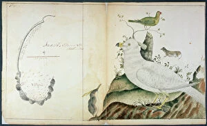
Background imageMaps Collection: Chart of Adventure Bay, Van Dieman's Land, c. 1773 (w/c on paper)

Chart of Adventure Bay, Van Dieman's Land, c. 1773 (w/c on paper)
RNM286357 Chart of Adventure Bay, Van Dieman's Land, c.1773 (w/c on paper) by Fannin, Peter (fl.1773); National Museum of the Royal Navy, Portsmouth, Hampshire

Background imageMaps Collection: Traditional Japanese theatre: an actor threatens an actress with a sword, 1900 (illustration)

Traditional Japanese theatre: an actor threatens an actress with a sword, 1900 (illustration)
7202903 Traditional Japanese theatre: an actor threatens an actress with a sword, 1900 (illustration) by Arai, Yoshimune (1873-1945); Private Collection; (add.info)

Background imageMaps Collection: Traditional Japanese theatre: three men-at-arms threaten a male and a female character

Traditional Japanese theatre: three men-at-arms threaten a male and a female character, 1900 (illustration)
7202904 Traditional Japanese theatre: three men-at-arms threaten a male and a female character, 1900 (illustration) by Arai

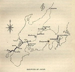
Background imageMaps Collection: Vintage illustration of Map showing early railways of Japan, 1870s, 1880s, 19th Century

Vintage illustration of Map showing early railways of Japan, 1870s, 1880s, 19th Century

Background imageMaps Collection: Palestine. Map

Palestine. Map
7269229 Palestine. Map by Faden, William (1750-1836); Private Collection; (add.info.: Palaestina quce et chanaan et terra Promissionis vel terra sancta)

Background imageMaps Collection: Warships 1886-1910 (litho)

Warships 1886-1910 (litho)
7184096 Warships 1886-1910 (litho) by McDowell, William John Patton (1889-1950); Private Collection; (add.info.: Warships 1886-1910)

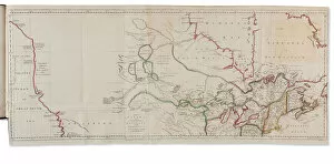
Background imageMaps Collection: Voyages from Asia to America, for Completing the Discoveries of the North West Coast of America

Voyages from Asia to America, for Completing the Discoveries of the North West Coast of America
3666907 Voyages from Asia to America, for Completing the Discoveries of the North West Coast of America, London: Thomas Jefferys, 1761 (hand-coloured engraving) by Muller

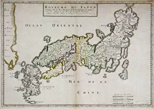
Background imageMaps Collection: Geographic map of Japan made by Father Philippe Briet, Jesuite and French scholar (1601-1668)

Geographic map of Japan made by Father Philippe Briet, Jesuite and French scholar (1601-1668). Paris, NL
JLJ4619590 Geographic map of Japan made by Father Philippe Briet, Jesuite and French scholar (1601-1668). Paris, NL by Briet, Philippe (1601-1668); Bibliotheque Nationale, Paris

Background imageMaps Collection: The Growth of European and Japanese Dominions in Asia since 1801 (colour litho)

The Growth of European and Japanese Dominions in Asia since 1801 (colour litho)
6016406 The Growth of European and Japanese Dominions in Asia since 1801 (colour litho) by Shepherd, William R. (1871-1934); Private Collection; (add.info)

Background imageMaps Collection: Map of Pacific ocean with a Whale between the American continent and Japan - 1588

Map of Pacific ocean with a Whale between the American continent and Japan - 1588
AIS5350357 Map of Pacific ocean with a Whale between the American continent and Japan - 1588 by Plantin, Christophe (1414 or 1420-1589); Biblioteca Universidad, Salamanca

Background imageMaps Collection: Cover of L Assiette au Beurre, number 183, Satirique en Colours, 1904_10_8

Cover of L Assiette au Beurre, number 183, Satirique en Colours, 1904_10_8
ICA4892937 Cover of L Assiette au Beurre, number 183, Satirique en Colours, 1904_10_8 by Camara, Leal de (1877-1948); (add.info.: Russia, Belgium, Japan)

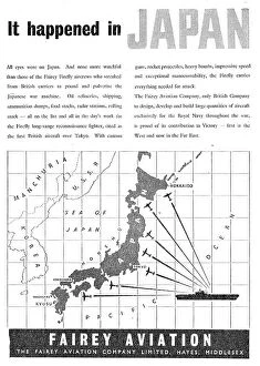
Background imageMaps Collection: British anti-tank gun confronting a Japanese medium tank, World War II (colour litho)

British anti-tank gun confronting a Japanese medium tank, World War II (colour litho)
7172724 British anti-tank gun confronting a Japanese medium tank, World War II (colour litho) by English School, (20th century); Private Collection; (add.info)

Background imageMaps Collection: Le Vocabulaire Illustre: Japonais; Japanese; Japoner (engraving)

Le Vocabulaire Illustre: Japonais; Japanese; Japoner (engraving)
7196432 Le Vocabulaire Illustre: Japonais; Japanese; Japoner (engraving) by European School, (19th century); Private Collection; (add.info.: Japonais; Japanese; Japoner)

Background imageMaps Collection: Traditional Japanese theater: the stage of Kaboukiza, Tokyos main theater

Traditional Japanese theater: the stage of Kaboukiza, Tokyos main theater, with its rotating platform
7202905 Traditional Japanese theater: the stage of Kaboukiza, Tokyos main theater, with its rotating platform, 1900 (illustration) by Arai

Background imageMaps Collection: Traditional Japanese theater: an actor performs makeup in his dressing room, 1900 (illustration)

Traditional Japanese theater: an actor performs makeup in his dressing room, 1900 (illustration)
7202902 Traditional Japanese theater: an actor performs makeup in his dressing room, 1900 (illustration) by Arai, Yoshimune (1873-1945); Private Collection; (add.info)

Background imageMaps Collection: The Japanese Empire, including Korea and Sakhalin (colour litho)

The Japanese Empire, including Korea and Sakhalin (colour litho)
7169503 The Japanese Empire, including Korea and Sakhalin (colour litho) by English School, (20th century); Private Collection; (add.info.: The Japanese Empire, including Korea and Sakhalin)

Background imageMaps Collection: Near Thursby, Yorkshire, 1895 (oil on canvas)

Near Thursby, Yorkshire, 1895 (oil on canvas)
6448766 Near Thursby, Yorkshire, 1895 (oil on canvas) by Glendening, Alfred, Jr. (1861-1907); 25.5x40.5 cm; Private Collection

Background imageMaps Collection: Surrender of Rangoon, Burma to the Japanese, World War II, 1942 (b / w photo)

Surrender of Rangoon, Burma to the Japanese, World War II, 1942 (b / w photo)
7173262 Surrender of Rangoon, Burma to the Japanese, World War II, 1942 (b/w photo) by Japanese Photographer (20th century); Private Collection; (add.info.: Surrender of Rangoon)

Background imageMaps Collection: Trade card for William Gulliford, japanner, Birmingham (engraving)

Trade card for William Gulliford, japanner, Birmingham (engraving)
7154052 Trade card for William Gulliford, japanner, Birmingham (engraving) by English School, (19th century); Private Collection; (add.info.: Trade card for William Gulliford, japanner)

Background imageMaps Collection: How to cook a German sausage (colour litho)

How to cook a German sausage (colour litho)
7151071 How to cook a German sausage (colour litho) by English School, (20th century); Private Collection; (add.info.: Comic postcard on a food related theme)

Background imageMaps Collection: The Japanese House and Wistaria Pergola, Bagshot Park (colour litho)

The Japanese House and Wistaria Pergola, Bagshot Park (colour litho)
7159991 The Japanese House and Wistaria Pergola, Bagshot Park (colour litho) by Ward, Cyril (1863-1935); Private Collection; (add.info.: The Japanese House and Wistaria Pergola, Bagshot Park)

Background imageMaps Collection: La fauconnerie au Japon (engraving)

La fauconnerie au Japon (engraving)
7200199 La fauconnerie au Japon (engraving) by French School, (19th century); Private Collection; (add.info.: La fauconnerie au Japon)

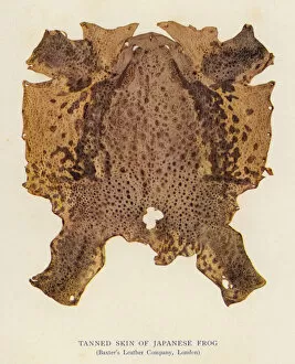
Background imageMaps Collection: Tanned Skin of Japanese Frog (colour litho)

Tanned Skin of Japanese Frog (colour litho)
7193655 Tanned Skin of Japanese Frog (colour litho) by English School, (20th century); Private Collection; (add.info.: Tanned Skin of Japanese Frog)

Background imageMaps Collection: Carte du monde bouddhiste - Aquarelle et encre de l ecole japonaise du debut du 18eme siecle

Carte du monde bouddhiste - Aquarelle et encre de l ecole japonaise du debut du 18eme siecle - Adelaide
FIA5397635 Carte du monde bouddhiste - Aquarelle et encre de l ecole japonaise du debut du 18eme siecle - Adelaide, Art Gallery of South Australia, Australie by Japanese School

Background imageMaps Collection: A. B. C. DES ENFANTS F G H I J, circa 1920 (illustration)

A. B. C. DES ENFANTS F G H I J, circa 1920 (illustration)
7206768 A.B.C. DES ENFANTS F G H I J, circa 1920 (illustration) by French School, (20th century); 32x17 cm; Private Collection; (add.info.: F G H I J: F: Fruit; G: Globe; H: Harp; I: Italian; J)

Background imageMaps Collection: Surrender of Singapore to the Japanese, 15 February 1942 (b / w photo)

Surrender of Singapore to the Japanese, 15 February 1942 (b / w photo)
7173259 Surrender of Singapore to the Japanese, 15 February 1942 (b/w photo) by Japanese Photographer (20th century); Private Collection; (add.info)

Background imageMaps Collection: Mada Primavesi, c. 1925 (pencil on simli japan paper)

Mada Primavesi, c. 1925 (pencil on simli japan paper)
6436331 Mada Primavesi, c.1925 (pencil on simli japan paper) by Klimt, Gustav (1862-1918); 55.2x36.8 cm; Private Collection

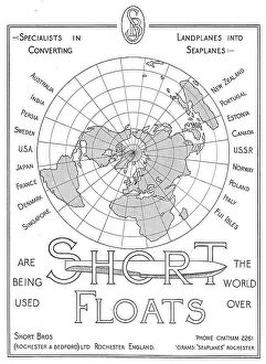
Background imageMaps Collection: Members of the League of Nations (colour litho)

Members of the League of Nations (colour litho)
7163177 Members of the League of Nations (colour litho) by English School, (20th century); Private Collection; (add.info.: Members of the League of Nations)

Background imageMaps Collection: Traditional Japanese Theater: Part of the Audience, 1900 (illustration)

Traditional Japanese Theater: Part of the Audience, 1900 (illustration)
7202901 Traditional Japanese Theater: Part of the Audience, 1900 (illustration) by Arai, Yoshimune (1873-1945); Private Collection; (add.info.: Traditional Japanese theater (kabuki)

Background imageMaps Collection: Asia At Night With Country Borders, True Colour Satellite Image

Asia At Night With Country Borders, True Colour Satellite Image. True colour satellite image of Asia at night with country borders

Background imageMaps Collection: The Famous Places on the Tokaido in One View (Tokaido meisho ichiran), Japan, 1818

The Famous Places on the Tokaido in One View (Tokaido meisho ichiran), Japan, 1818

Background imageMaps Collection: Map of the Choryang Waegwan and its surrounding area in Busan during the Joseon

Map of the Choryang Waegwan and its surrounding area in Busan during the Joseon Dynasty (Detail). Copy from a scroll of 18th cen, 19th century. Found in the Collection of the Busan Museum

Background imageMaps Collection: Physical map of asia

Physical map of asia - 1881

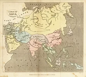
Background imageMaps Collection: Map of Asia, early 19th century

Map of Asia, early 19th century
6337920 Map of Asia, early 19th century by English School, (19th century); (add.info.: Map of Asia, early 19th century. Showing Asia Minor, Arabia, Persia, Siberia, Tartary, Thibet, Hindoostan)

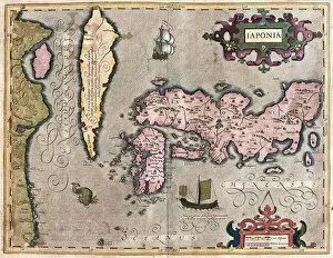
Background imageMaps Collection: Japan (engraving, 1596)

Japan (engraving, 1596)
LRI4718817 Japan (engraving, 1596) by Mercator, Gerardus (1512-94); Private Collection; (add.info.: Iaponia, 1633: Japan - in " Atlas Ssive Corsmographicae Meditationes" by Gerard Mercator)


All Professionally Made to Order for Quick Shipping


-

Maps Collection

Maps of Japan Asia are detailed maps that show the various physical features, cities, and other points of interest in Japan and surrounding countries. They provide an overview of the region's geography, as well as a look at its cultural and historical sites, and are be used to plan trips or to gain a better understanding of the area. They often include information on transportation networks, airports, major roads, national parks and other attractions. It also provide information on population density and climate conditions for each region. With such detailed maps available for Japan Asia, travelers can easily find their way around this fascinating part of the world.
+

Our beautiful Wall Art and Photo Gifts include Framed Prints, Photo Prints, Poster Prints, Canvas Prints, Jigsaw Puzzles, Metal Prints and so much more

The Maps of Japan Asia collection from Media Storehouse is a stunning compilation of vintage maps that showcase the rich history and geography of Japan and its neighboring countries in Asia. Our collection features beautifully detailed maps dating back to the 18th century, depicting various regions such as Hokkaido, Tokyo, Kyoto, Osaka, China, Korea, Taiwan and more. Each map has been carefully restored to retain its original charm while ensuring clarity and accuracy. The Maps of Japan Asia collection offers a wide range of options for wall art and framed prints that are perfect for home or office decor. These high-quality prints come in different sizes to suit any space. Whether you're an avid collector or simply appreciate the beauty of historical cartography, our collection is sure to impress. With its intricate details and vibrant colors, it's easy to see why these antique maps continue to captivate audiences today.
+

What are Maps of Japan Asia art prints?

Maps of Japan Asia art prints are high-quality reproductions of vintage and contemporary maps depicting the geography, topography, and landmarks of Japan and other Asian countries. These art prints showcase intricate details such as mountain ranges, rivers, cities, towns, temples, shrines, and cultural icons that represent the rich history and diversity of these regions. These maps are not only functional but also aesthetically pleasing pieces that can add a touch of sophistication to any room or office space. They come in various sizes and styles to suit different preferences and interior design themes. Whether you're a history buff or simply appreciate beautiful artwork with a cultural twist, Maps of Japan Asia art prints offer something for everyone. With their vivid colors and fine details captured through high-resolution printing technology on premium quality paper stock or canvas material - they make perfect gifts for anyone who loves travel or has an interest in Japanese culture.
+

What Maps of Japan Asia art prints can I buy from Media Storehouse?

We offer a wide range of Maps of Japan Asia art prints that are perfect for those who love to explore the beauty and culture of this region. These art prints showcase different maps of Japan, including antique maps from the 18th century, modern-day roadmaps, and detailed topographical maps. You can also find artistic renditions of famous landmarks in Japan such as Mount Fuji or Tokyo Tower. In addition to Japanese maps, Media Storehouse also has a collection of Asian map prints that include countries like China, India, Thailand and more. These artworks feature intricate details about each country's geography and history. All these Maps of Japan Asia art prints are available in various sizes and formats to suit your preferences. Whether you want a small print for your home office or a large canvas print for your living room wall, we have got you covered with their extensive selection.
+

How do I buy Maps of Japan Asia art prints?

To buy Maps of Japan Asia art prints from Media Storehouse, you can browse our extensive collection online. Simply search for "Maps of Japan Asia" in the search bar on our website and select the print that catches your eye. You can choose from a variety of sizes and framing options to suit your preferences. Once you have selected your desired print, add it to your cart and proceed to checkout. At this point, you will be prompted to enter your shipping and payment information. We offer secure payment options such as credit card or PayPal so that you can shop with peace of mind. Once your order is confirmed, they will process it promptly and ship it out to you as soon as possible. Buying Maps of Japan Asia art prints from Media Storehouse is a simple process that allows you to enjoy beautiful artwork in the comfort of your own home.
+

How much do Maps of Japan Asia art prints cost?

We offer a wide range of Maps of Japan Asia art prints at varying prices depending on the size and type of print. Our collection includes vintage maps, modern interpretations, and artistic renditions of the region. We pride ourselves on offering high-quality prints that are perfect for home or office decor. Our Maps of Japan Asia art prints come in various sizes ranging from small to large, allowing you to choose the best fit for your space. We also offer different types of paper finishes such as matte, gloss or satin which can affect pricing. We believe that everyone should have access to affordable art prints without compromising quality. Therefore, our prices are competitive and reflect our commitment to providing exceptional value for money. If you're looking for beautiful Maps of Japan Asia art prints that won't break the bank but still look stunning in any setting then Media Storehouse is the place to go.
+

How will my Maps of Japan Asia art prints be delivered to me?

We take great care in delivering your Maps of Japan Asia art prints to you. We use high-quality packaging materials to ensure that your artwork arrives safely and securely at your doorstep. Our standard delivery method is through a trusted courier service, which allows us to track the progress of your shipment and provide you with updates on its status. Once your order has been processed and shipped, you will receive an email notification containing a tracking number that you can use to monitor the progress of your delivery. Depending on where you are located, it may take several days for your package to arrive. We understand how important it is for our customers to receive their orders promptly and in good condition. That's why we work hard to ensure that every aspect of our shipping process meets the highest standards of quality and reliability.