
Maps Collection
Maps of Japan Asia are detailed maps that show the various physical features, cities, and other points of interest in Japan and surrounding countries
Choose a picture from our Maps Collection for your Wall Art and Photo Gifts
538 items


All Professionally Made to Order for Quick Shipping
-
Maps Collection
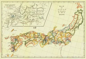
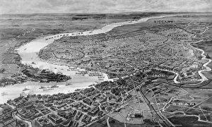
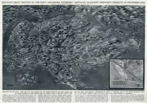
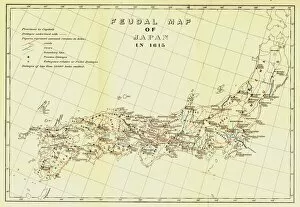
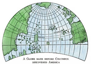
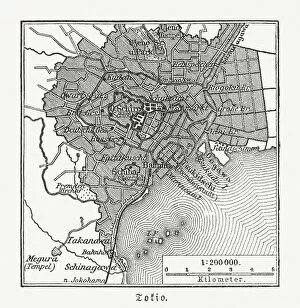
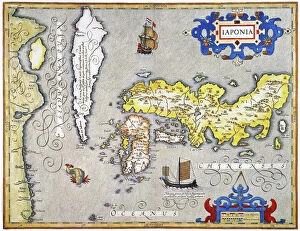
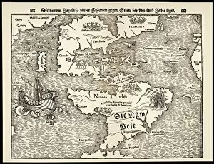
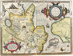
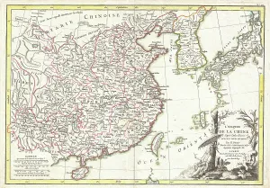
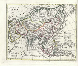
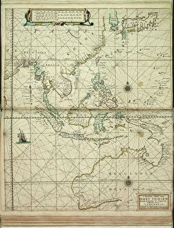
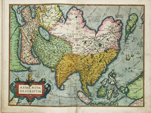
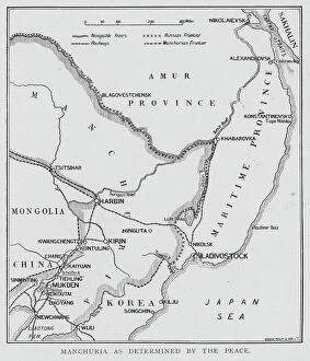
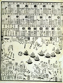
Maps of Japan Asia are detailed maps that show the various physical features, cities, and other points of interest in Japan and surrounding countries. They provide an overview of the region's geography, as well as a look at its cultural and historical sites, and are be used to plan trips or to gain a better understanding of the area. They often include information on transportation networks, airports, major roads, national parks and other attractions. It also provide information on population density and climate conditions for each region. With such detailed maps available for Japan Asia, travelers can easily find their way around this fascinating part of the world.
+
Our beautiful pictures are available as Framed Prints, Photos, Wall Art and Photo Gifts
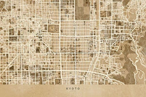
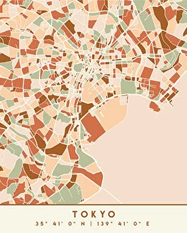
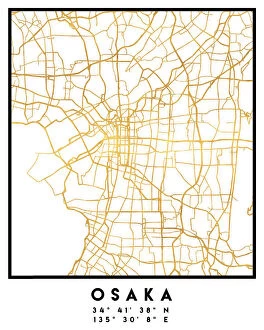
The Maps of Japan Asia collection from Media Storehouse is a stunning compilation of vintage maps that showcase the rich history and geography of Japan and its neighboring countries in Asia. Our collection features beautifully detailed maps dating back to the 18th century, depicting various regions such as Hokkaido, Tokyo, Kyoto, Osaka, China, Korea, Taiwan and more. Each map has been carefully restored to retain its original charm while ensuring clarity and accuracy. The Maps of Japan Asia collection offers a wide range of options for wall art and framed prints that are perfect for home or office decor. These high-quality prints come in different sizes to suit any space. Whether you're an avid collector or simply appreciate the beauty of historical cartography, our collection is sure to impress. With its intricate details and vibrant colors, it's easy to see why these antique maps continue to captivate audiences today.
+
What are Maps of Japan Asia art prints?
Maps of Japan Asia art prints are high-quality reproductions of vintage and contemporary maps depicting the geography, topography, and landmarks of Japan and other Asian countries. These art prints showcase intricate details such as mountain ranges, rivers, cities, towns, temples, shrines, and cultural icons that represent the rich history and diversity of these regions. These maps are not only functional but also aesthetically pleasing pieces that can add a touch of sophistication to any room or office space. They come in various sizes and styles to suit different preferences and interior design themes. Whether you're a history buff or simply appreciate beautiful artwork with a cultural twist, Maps of Japan Asia art prints offer something for everyone. With their vivid colors and fine details captured through high-resolution printing technology on premium quality paper stock or canvas material - they make perfect gifts for anyone who loves travel or has an interest in Japanese culture.
+
What Maps of Japan Asia art prints can I buy from Media Storehouse?
We offer a wide range of Maps of Japan Asia art prints that are perfect for those who love to explore the beauty and culture of this region. These art prints showcase different maps of Japan, including antique maps from the 18th century, modern-day roadmaps, and detailed topographical maps. You can also find artistic renditions of famous landmarks in Japan such as Mount Fuji or Tokyo Tower. In addition to Japanese maps, Media Storehouse also has a collection of Asian map prints that include countries like China, India, Thailand and more. These artworks feature intricate details about each country's geography and history. All these Maps of Japan Asia art prints are available in various sizes and formats to suit your preferences. Whether you want a small print for your home office or a large canvas print for your living room wall, we have got you covered with their extensive selection.
+
How do I buy Maps of Japan Asia art prints?
To buy Maps of Japan Asia art prints from Media Storehouse, you can browse our extensive collection online. Simply search for "Maps of Japan Asia" in the search bar on our website and select the print that catches your eye. You can choose from a variety of sizes and framing options to suit your preferences. Once you have selected your desired print, add it to your cart and proceed to checkout. At this point, you will be prompted to enter your shipping and payment information. We offer secure payment options such as credit card or PayPal so that you can shop with peace of mind. Once your order is confirmed, they will process it promptly and ship it out to you as soon as possible. Buying Maps of Japan Asia art prints from Media Storehouse is a simple process that allows you to enjoy beautiful artwork in the comfort of your own home.
+
How much do Maps of Japan Asia art prints cost?
We offer a wide range of Maps of Japan Asia art prints at varying prices depending on the size and type of print. Our collection includes vintage maps, modern interpretations, and artistic renditions of the region. We pride ourselves on offering high-quality prints that are perfect for home or office decor. Our Maps of Japan Asia art prints come in various sizes ranging from small to large, allowing you to choose the best fit for your space. We also offer different types of paper finishes such as matte, gloss or satin which can affect pricing. We believe that everyone should have access to affordable art prints without compromising quality. Therefore, our prices are competitive and reflect our commitment to providing exceptional value for money. If you're looking for beautiful Maps of Japan Asia art prints that won't break the bank but still look stunning in any setting then Media Storehouse is the place to go.
+
How will my Maps of Japan Asia art prints be delivered to me?
We take great care in delivering your Maps of Japan Asia art prints to you. We use high-quality packaging materials to ensure that your artwork arrives safely and securely at your doorstep. Our standard delivery method is through a trusted courier service, which allows us to track the progress of your shipment and provide you with updates on its status. Once your order has been processed and shipped, you will receive an email notification containing a tracking number that you can use to monitor the progress of your delivery. Depending on where you are located, it may take several days for your package to arrive. We understand how important it is for our customers to receive their orders promptly and in good condition. That's why we work hard to ensure that every aspect of our shipping process meets the highest standards of quality and reliability.