Antique Framed Print > Europe > Iceland > Paintings
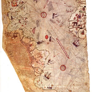
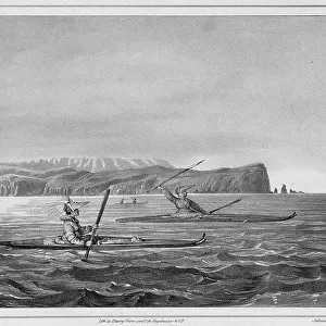
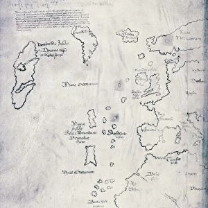
Antique Framed Print : Vinland Map, oldest map of Greenland and Northern America areas discovered by Norse, Vikings during their explorations, circa 1440


![]()
Framed Photos from Universal Images Group (UIG)
Vinland Map, oldest map of Greenland and Northern America areas discovered by Norse, Vikings during their explorations, circa 1440
Cartography, 15th century. Vinland Map (circa 1440). Oldest map of Greenland and Northern America areas discovered by Norse (Vikings) during their explorations
Universal Images Group (UIG) manages distribution for many leading specialist agencies worldwide
Media ID 9500143
© DEA / M. SEEMULLER
15th Century Coastline Greenland Handwriting Iceland Island Norse Sea Map Vikings Vinland
14"x12" (36x31cm) Antique Frame
Bevelled wood effect frame, card mounted, 10x8 archival quality photo print. Overall outside dimensions 14x12 inches (36x31cm). Environmentally and ozone friendly, the Polycore® moulding has the look of real wood, is durable and light and easy to hang. Biodegradable and made with non-chlorinated gases (no toxic fumes) it is efficient; producing 100 tons of polystyrene can save 300 tons of trees! Prints are glazed with lightweight, shatterproof, optical clarity acrylic (providing the same general protection from the environment as glass). The back is stapled hardboard with a sawtooth hanger attached. Note: To minimise original artwork cropping, for optimum layout, and to ensure print is secure, the visible print may be marginally smaller
Bevelled Wood Effect Framed and Mounted Prints - Professionally Made and Ready to Hang
Estimated Image Size (if not cropped) is 19cm x 24.4cm (7.5" x 9.6")
Estimated Product Size is 31.2cm x 36.3cm (12.3" x 14.3")
These are individually made so all sizes are approximate
Artwork printed orientated as per the preview above, with portrait (vertical) orientation to match the source image.
FEATURES IN THESE COLLECTIONS
> Europe
> Iceland
> Paintings
> Europe
> Iceland
> Related Images
> Maps and Charts
> Related Images
> North America
> Greenland
> Maps
> North America
> Greenland
> Related Images
> Popular Themes
> North Island
> Universal Images Group (UIG)
> Art
> Painting, Sculpture & Prints
> Cartography
EDITORS COMMENTS
This print showcases the Vinland Map, a remarkable artifact from the 15th century that sheds light on the Norse exploration of Greenland and Northern America. Created around 1440, this ancient map is considered to be the oldest representation of these regions discovered by Vikings during their expeditions. The artistry and precision displayed in this cartographic masterpiece reflect the expertise of early Norse navigators. The map's vertical orientation emphasizes its focus on island geography and topography, highlighting key locations such as Iceland, Greenland, and Vinland (the name given by Vikings to parts of North America). With no people depicted in the illustration, attention is drawn solely to the intricate coastline details and handwritten annotations that accompany them. This invaluable historical document not only provides insights into medieval cartography but also offers glimpses into Viking exploration strategies. Its discovery has greatly contributed to our understanding of early transatlantic voyages and cultural exchanges between Europe and North America. As an image captured by Universal Images Group (UIG), it serves as a testament to humanity's enduring curiosity about our past. While we cannot mention commercial use due to copyright restrictions, this photograph allows us to appreciate both the beauty of ancient craftsmanship and its significance in unraveling centuries-old mysteries.
MADE IN THE UK
Safe Shipping with 30 Day Money Back Guarantee
FREE PERSONALISATION*
We are proud to offer a range of customisation features including Personalised Captions, Color Filters and Picture Zoom Tools
SECURE PAYMENTS
We happily accept a wide range of payment options so you can pay for the things you need in the way that is most convenient for you
* Options may vary by product and licensing agreement. Zoomed Pictures can be adjusted in the Basket.