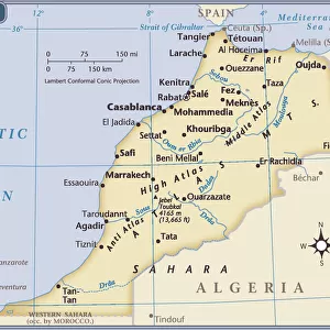
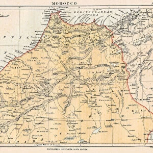
Antique Framed Print > Africa > Morocco > Maps
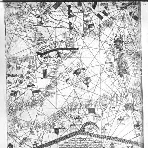
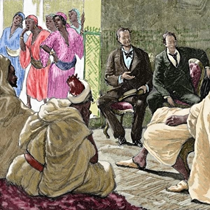
Antique Framed Print : Spain. War of Africa (1859-1860). Maps of Morocco
. Maps of Morocco")
. Maps of Morocco")


![]()
Framed Photos from Mary Evans Picture Library
Spain. War of Africa (1859-1860). Maps of Morocco
Mary Evans Picture Library makes available wonderful images created for people to enjoy over the centuries
Media ID 8277719
© Mary Evans Picture Library 2015 - https://copyrighthub.org/s0/hub1/creation/maryevans/MaryEvansPictureID/10684115
Cartographic Cartographies Cartography Donostia Garbage Maps Moroccan Moroccans Morocco Municipal Rubbish Telmo Trash Waste
21"x16" (54x41cm) Antique Frame
Bevelled wood effect frame, card mounted, 15x10 archival quality photo print. Overall outside dimensions 21x16 inches (54x41cm). Environmentally and ozone friendly, Polycore® moulding has the look of real wood, is durable and light and easy to hang. Biodegradable and made with non-chlorinated gases (no toxic fumes) it is efficient; producing 100 tons of polystyrene can save 300 tons of trees! Prints are glazed with lightweight, shatterproof, optical clarity acrylic (providing the same general protection from the environment as glass). The back is stapled hardboard with a sawtooth hanger attached. Note: To minimise original artwork cropping, for optimum layout, and to ensure print is secure, the visible print may be marginally smaller
Bevelled Wood Effect Framed and Mounted Prints - Professionally Made and Ready to Hang
Estimated Image Size (if not cropped) is 37.1cm x 22.8cm (14.6" x 9")
Estimated Product Size is 54cm x 41.4cm (21.3" x 16.3")
These are individually made so all sizes are approximate
Artwork printed orientated as per the preview above, with landscape (horizontal) orientation to match the source image.
FEATURES IN THESE COLLECTIONS
> Africa
> Morocco
> Related Images
> Africa
> Related Images
> Europe
> Spain
> Related Images
> Maps and Charts
> Related Images
> Maps and Charts
> Spain
EDITORS COMMENTS
This photograph print depicts a map of Morocco during the Spanish War of Africa (1859-1860), displayed in a museum in Donostia, Spain. The map, richly colored and adorned with intricate cartographic details, is a testament to the historical significance of this period in African and Spanish history. The focus of the image, however, is not solely on the map itself, but also on the surrounding context. Scattered around the map are various pieces of African rubbish and trash, adding an unexpected layer of contrast and complexity to the scene. The Moroccan cartographies, with their intricate patterns and vibrant colors, juxtaposed against the mundane and discarded waste, create a striking visual dialogue. The sanitation and waste management practices of the time are reflected in this image, offering a glimpse into the daily life of the people during this era. The map, with its detailed municipal divisions and annotations, highlights the Spanish influence and control over Moroccan territories during the war. The cartographic representation of the region is a powerful tool that reveals the political and strategic interests of the Spanish during this period. The photograph print, with its vivid colors and intriguing juxtaposition, invites viewers to explore the complex history of Spain's involvement in Africa and the role of cartography in shaping our understanding of the world.
MADE IN THE UK
Safe Shipping with 30 Day Money Back Guarantee
FREE PERSONALISATION*
We are proud to offer a range of customisation features including Personalised Captions, Color Filters and Picture Zoom Tools
SECURE PAYMENTS
We happily accept a wide range of payment options so you can pay for the things you need in the way that is most convenient for you
* Options may vary by product and licensing agreement. Zoomed Pictures can be adjusted in the Basket.