Antique Framed Print > Animals > Mammals > Muridae > Desert Mouse
Antique Framed Print : MAP / AFRICA / SAHARA 1719


![]()
Framed Photos from Mary Evans Picture Library
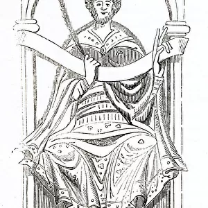
MAP / AFRICA / SAHARA 1719
Map of the Sahara Desert with Nubia, part of Egypt and part of Abyssinia Date: 1719
Mary Evans Picture Library makes available wonderful images created for people to enjoy over the centuries
Media ID 20153843
© Bubblepunk
1719 Abyssinia Desert Maps Nubia Sahara
21"x16" (54x41cm) Antique Frame
Bevelled wood effect frame, card mounted, 15x10 archival quality photo print. Overall outside dimensions 21x16 inches (54x41cm). Environmentally and ozone friendly, Polycore® moulding has the look of real wood, is durable and light and easy to hang. Biodegradable and made with non-chlorinated gases (no toxic fumes) it is efficient; producing 100 tons of polystyrene can save 300 tons of trees! Prints are glazed with lightweight, shatterproof, optical clarity acrylic (providing the same general protection from the environment as glass). The back is stapled hardboard with a sawtooth hanger attached. Note: To minimise original artwork cropping, for optimum layout, and to ensure print is secure, the visible print may be marginally smaller
Bevelled Wood Effect Framed and Mounted Prints - Professionally Made and Ready to Hang
Estimated Image Size (if not cropped) is 25.4cm x 37.1cm (10" x 14.6")
Estimated Product Size is 41.4cm x 54cm (16.3" x 21.3")
These are individually made so all sizes are approximate
Artwork printed orientated as per the preview above, with portrait (vertical) orientation to match the source image.
FEATURES IN THESE COLLECTIONS
> Africa
> Egypt
> Related Images
> Africa
> Related Images
> Animals
> Mammals
> Muridae
> Desert Mouse
> Maps and Charts
> Related Images
> Mary Evans Prints Online
> Egypt
> Mary Evans Prints Online
> New Images July 2020
EDITORS COMMENTS
This intriguing map print, dated 1719, offers a fascinating glimpse into the geographical knowledge of the Sahara Desert during the early modern period. Titled "Africa," the map primarily focuses on the central Sahara region, highlighting various territories and features that were known at the time. The map includes the expansive Sahara Desert, stretching from the Atlantic Ocean in the west to the Red Sea in the east. The desert is depicted in browns and beiges, contrasting sharply with the greens and blues representing the Nile River and its tributaries. The map also shows the northernmost reaches of the desert, where the Sahara transitions into the Mediterranean climate of Egypt. Nubia, an ancient African civilization located along the Nile River, is depicted in the eastern part of the map. The region is shown as a series of distinct territories, each with its name inscribed in Latin script. To the north of Nubia lies Egypt, represented in greater detail, with the Nile River winding through the fertile valley and the major cities of Alexandria, Cairo, and Memphis clearly marked. In the easternmost part of the map, the land of Abyssinia, or modern-day Ethiopia, is shown as a large, mountainous region. The map includes several notable features, such as the Blue Nile and the Tana River, which were essential sources of water for the ancient civilizations in the region. This map, produced in 1719, offers a valuable window into the geographical knowledge of the Sahara Desert and its surrounding regions during the early modern period. Its intricate details and accurate representation of known territories make it an essential resource for scholars and historians studying the history of Africa during this time.
MADE IN THE UK
Safe Shipping with 30 Day Money Back Guarantee
FREE PERSONALISATION*
We are proud to offer a range of customisation features including Personalised Captions, Color Filters and Picture Zoom Tools
SECURE PAYMENTS
We happily accept a wide range of payment options so you can pay for the things you need in the way that is most convenient for you
* Options may vary by product and licensing agreement. Zoomed Pictures can be adjusted in the Basket.