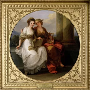
Antique Framed Print : Map of the cities of North Africa. 16th century


![]()
Framed Photos from Mary Evans Picture Library
Map of the cities of North Africa. 16th century
Mary Evans Picture Library makes available wonderful images created for people to enjoy over the centuries
Media ID 14337079
© Thaliastock / Mary Evans
1543 Cartography Isles Mapping Mediterranean
14"x12" (36x31cm) Antique Frame
Bevelled wood effect frame, card mounted, 10x8 archival quality photo print. Overall outside dimensions 14x12 inches (36x31cm). Environmentally and ozone friendly, the Polycore® moulding has the look of real wood, is durable and light and easy to hang. Biodegradable and made with non-chlorinated gases (no toxic fumes) it is efficient; producing 100 tons of polystyrene can save 300 tons of trees! Prints are glazed with lightweight, shatterproof, optical clarity acrylic (providing the same general protection from the environment as glass). The back is stapled hardboard with a sawtooth hanger attached. Note: To minimise original artwork cropping, for optimum layout, and to ensure print is secure, the visible print may be marginally smaller
Bevelled Wood Effect Framed and Mounted Prints - Professionally Made and Ready to Hang
Estimated Image Size (if not cropped) is 24.4cm x 18.4cm (9.6" x 7.2")
Estimated Product Size is 36.3cm x 31.2cm (14.3" x 12.3")
These are individually made so all sizes are approximate
Artwork printed orientated as per the preview above, with landscape (horizontal) orientation to match the source image.
EDITORS COMMENTS
1. Title: "Exploring the Ancient Cities of North Africa: A Glimpse into the 16th Century" This print showcases an intricately detailed map of the cities of North Africa during the 16th century. Dating back to 1543, this ancient map offers a fascinating glimpse into the history of cartography and the European exploration of the Mediterranean world. The map, created during the height of the Renaissance and the Age of Discovery, reveals the extensive knowledge Europeans had gained of the North African coastline by this time. The map's creator, unknown, meticulously depicted the major cities and settlements along the coasts of modern-day Morocco, Algeria, Tunisia, Libya, and Egypt. The map's rich details reveal the European fascination with the exotic and the unknown. It features not only the cities and their fortifications but also the surrounding natural features, such as rivers, mountains, and islands. The British Isles, including Great Britain and Ireland, are also depicted in the upper right corner, emphasizing the interconnectedness of the Mediterranean and European worlds during this period. The map's intricate engraving showcases the advanced cartographic techniques of the time, with precise lines and clear labels. The map's historical significance lies in its ability to provide valuable insights into the geographical knowledge of the 16th century and the European fascination with the ancient cities of North Africa. This map is a testament to the rich history of cartography and the European exploration of the Mediterranean world during the 16th century. It offers a unique perspective on the historical connections between Europe and North Africa and serves as a reminder of the enduring fascination with the ancient world that continues to captivate us today.
MADE IN THE UK
Safe Shipping with 30 Day Money Back Guarantee
FREE PERSONALISATION*
We are proud to offer a range of customisation features including Personalised Captions, Color Filters and Picture Zoom Tools
SECURE PAYMENTS
We happily accept a wide range of payment options so you can pay for the things you need in the way that is most convenient for you
* Options may vary by product and licensing agreement. Zoomed Pictures can be adjusted in the Basket.