Antique Framed Print > Granger Art on Demand > Maps
Antique Framed Print : MAP: USA, 1783. The United States according to the definitive treaty of peace


![]()
Framed Photos from Granger
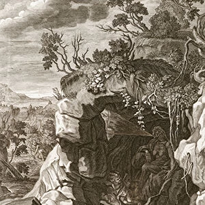
MAP: USA, 1783. The United States according to the definitive treaty of peace
MAP: USA, 1783.
The United States according to the definitive treaty of peace signed at Paris Sept. 3d. 1783. Map by William McMurray, 1784
Granger holds millions of images spanning more than 25,000 years of world history, from before the Stone Age to the dawn of the Space Age
Media ID 12321392
13 Colonies 1783 1784 American Revolution Treaty Of Paris United States William
14"x12" (36x31cm) Antique Frame
Bevelled wood effect frame, card mounted, 10x8 archival quality photo print. Overall outside dimensions 14x12 inches (36x31cm). Environmentally and ozone friendly, the Polycore® moulding has the look of real wood, is durable and light and easy to hang. Biodegradable and made with non-chlorinated gases (no toxic fumes) it is efficient; producing 100 tons of polystyrene can save 300 tons of trees! Prints are glazed with lightweight, shatterproof, optical clarity acrylic (providing the same general protection from the environment as glass). The back is stapled hardboard with a sawtooth hanger attached. Note: To minimise original artwork cropping, for optimum layout, and to ensure print is secure, the visible print may be marginally smaller
Bevelled Wood Effect Framed and Mounted Prints - Professionally Made and Ready to Hang
Estimated Image Size (if not cropped) is 24.4cm x 17.3cm (9.6" x 6.8")
Estimated Product Size is 36.3cm x 31.2cm (14.3" x 12.3")
These are individually made so all sizes are approximate
Artwork printed orientated as per the preview above, with landscape (horizontal) orientation to match the source image.
EDITORS COMMENTS
This print showcases a historical map of the United States in 1783, following the signing of the definitive treaty of peace at Paris on September 3rd. Created by William McMurray in 1784, this engraving offers a glimpse into the early days of America after gaining independence from British rule during the American Revolution. The sepia-toned image beautifully captures the intricate details and boundaries of the thirteen colonies that formed the United States at that time. It serves as a visual representation of an important milestone in American history - when a new nation was born out of struggle and determination. Through this map, viewers can trace how far America has come since its humble beginnings. It symbolizes not only territorial expansion but also signifies unity among states that were once divided under British control. The lines drawn on this historic document represent more than just geographical borders; they embody freedom, resilience, and hope for a better future. As we gaze upon this remarkable piece, we are reminded of our shared heritage and collective journey towards progress. This photograph is not merely an artistic depiction but rather a testament to our nation's rich history and enduring spirit.
MADE IN THE UK
Safe Shipping with 30 Day Money Back Guarantee
FREE PERSONALISATION*
We are proud to offer a range of customisation features including Personalised Captions, Color Filters and Picture Zoom Tools
SECURE PAYMENTS
We happily accept a wide range of payment options so you can pay for the things you need in the way that is most convenient for you
* Options may vary by product and licensing agreement. Zoomed Pictures can be adjusted in the Basket.