Antique Framed Print > Europe > United Kingdom > England > Maps
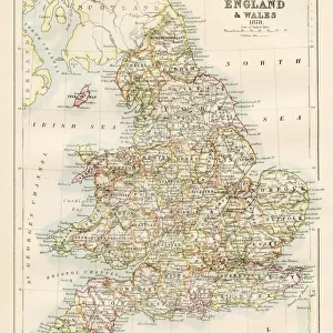
Antique Framed Print : Map of England, Britannia Antiqua, from The Atlas of Ancient Geography


![]()
Framed Photos from Fine Art Finder
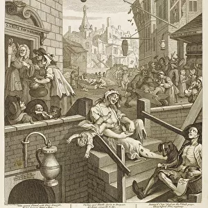
Map of England, Britannia Antiqua, from The Atlas of Ancient Geography
KW288091 Map of England, Britannia Antiqua, from The Atlas of Ancient Geography, by Samuel Butler, published in London, c.1829 (colour litho) by English School, (19th century); Private Collection; Ken Welsh; English, out of copyright
Media ID 12791699
© www.bridgemanimages.com
14"x12" (36x31cm) Antique Frame
Bevelled wood effect frame, card mounted, 10x8 archival quality photo print. Overall outside dimensions 14x12 inches (36x31cm). Environmentally and ozone friendly, the Polycore® moulding has the look of real wood, is durable and light and easy to hang. Biodegradable and made with non-chlorinated gases (no toxic fumes) it is efficient; producing 100 tons of polystyrene can save 300 tons of trees! Prints are glazed with lightweight, shatterproof, optical clarity acrylic (providing the same general protection from the environment as glass). The back is stapled hardboard with a sawtooth hanger attached. Note: To minimise original artwork cropping, for optimum layout, and to ensure print is secure, the visible print may be marginally smaller
Bevelled Wood Effect Framed and Mounted Prints - Professionally Made and Ready to Hang
Estimated Image Size (if not cropped) is 18.9cm x 24.4cm (7.4" x 9.6")
Estimated Product Size is 31.2cm x 36.3cm (12.3" x 14.3")
These are individually made so all sizes are approximate
Artwork printed orientated as per the preview above, with portrait (vertical) orientation to match the source image.
FEATURES IN THESE COLLECTIONS
> Europe
> Italy
> Lazio
> Rome
> Europe
> United Kingdom
> England
> London
> Related Images
> Europe
> United Kingdom
> England
> Maps
> Europe
> United Kingdom
> England
> Posters
> Europe
> United Kingdom
> England
> Related Images
> Maps and Charts
> Early Maps
> Maps and Charts
> Related Images
> Fine Art Finder
> Maps (celestial & Terrestrial)
> Fine Art Finder
> Schools
> English School
EDITORS COMMENTS
This print showcases a remarkable piece of history, the "Map of England, Britannia Antiqua" from The Atlas of Ancient Geography by Samuel Butler. Published in London around 1829, this exquisite color lithograph takes us on a journey back in time to explore the ancient Roman province of Britannia. The map's intricate details and vibrant colors transport us to an era when Latin inscriptions adorned the land. It offers a fascinating glimpse into the cartography and geography of ancient Rome, shedding light on their understanding of the British Isles during that period. With its rich historical significance, this print serves as a window into our past. It invites us to delve deeper into the cultural heritage and legacy left behind by our ancestors. As we study each contour and inscription meticulously engraved upon it, we can't help but marvel at how far we have come since then. Displayed within a private collection, this masterpiece captures both artistry and scholarly knowledge. Its presence is a testament to our enduring fascination with maps as tools for exploration and discovery. Whether you are an enthusiast of ancient civilizations or simply appreciate fine art, this image transports you through time while igniting your curiosity about Britain's past. Let yourself be captivated by its beauty and immerse yourself in the wonders it holds within its borders – both geographical and historical alike.
MADE IN THE UK
Safe Shipping with 30 Day Money Back Guarantee
FREE PERSONALISATION*
We are proud to offer a range of customisation features including Personalised Captions, Color Filters and Picture Zoom Tools
SECURE PAYMENTS
We happily accept a wide range of payment options so you can pay for the things you need in the way that is most convenient for you
* Options may vary by product and licensing agreement. Zoomed Pictures can be adjusted in the Basket.