Fraud Blocker Skip to main content

Home > Africa > Sudan > Maps

Maps Collection (page 3)

Sudan is a country located in the northeast corner of Africa, and is bordered by Egypt to the north, Libya to the northwest, Chad to the west

160 items

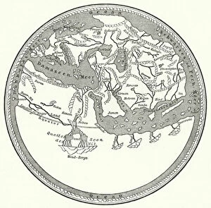
Background imageMaps Collection: World map of the Arab geographer and cartographer Muhammad al-Idrisi, 1150 (engraving)

World map of the Arab geographer and cartographer Muhammad al-Idrisi, 1150 (engraving)
3647375 World map of the Arab geographer and cartographer Muhammad al-Idrisi, 1150 (engraving) by German School, (19th century); Private Collection; (add.info)

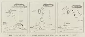
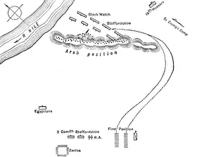
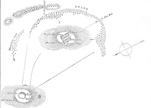
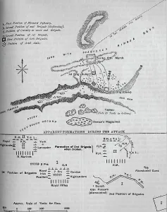
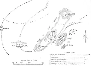
Background imageMaps Collection: The Battle of Omdurman, Plans showing the Positions of the two Armies (engraving)

The Battle of Omdurman, Plans showing the Positions of the two Armies (engraving)
1063779 The Battle of Omdurman, Plans showing the Positions of the two Armies (engraving) by English School, (19th century); Private Collection; (add.info.: The Battle of Omdurman)

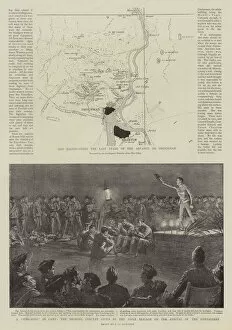
Background imageMaps Collection: The Advance on Omdurman (litho)

The Advance on Omdurman (litho)
1063724 The Advance on Omdurman (litho) by English School, (19th century); Private Collection; (add.info.: The Advance on Omdurman)

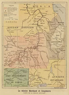
Background imageMaps Collection: Map of the region of Africa explored by the Marchand Expedition (colour litho)

Map of the region of Africa explored by the Marchand Expedition (colour litho)
2818941 Map of the region of Africa explored by the Marchand Expedition (colour litho) by French School, (19th century); Private Collection; (add.info)

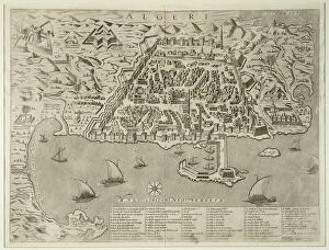
Background imageMaps Collection: View of Algiers (Algerii), Algerie (etching, 1572-1617)

View of Algiers (Algerii), Algerie (etching, 1572-1617)
LRI4707761 View of Algiers (Algerii), Algerie (etching, 1572-1617) by Hogenberg, Franz (1540-c.1590); Private Collection; (add.info.: Vue d Algiers (Algerii)

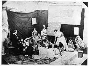
Background imageMaps Collection: School for young girls taught by Madame Luce, Algiers, 1856 (b / w photo)

School for young girls taught by Madame Luce, Algiers, 1856 (b / w photo)
CHT438858 School for young girls taught by Madame Luce, Algiers, 1856 (b/w photo) by Moulin, Jacques Antoine (c.1800-75); Private Collection; eArchives Charmet; French, out of copyright

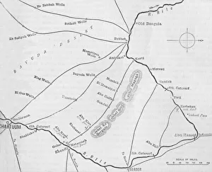
Background imageMaps Collection: Map of the Nile Region, to illustrate the Advance on Dongola (engraving)

Map of the Nile Region, to illustrate the Advance on Dongola (engraving)
1605190 Map of the Nile Region, to illustrate the Advance on Dongola (engraving) by English School, (19th century); Private Collection; (add.info.: Map of the Nile Region)

Background imageMaps Collection: French Colonization of Africa (engraving)

French Colonization of Africa (engraving)
1586925 French Colonization of Africa (engraving) by English School, (19th century); Private Collection; (add.info.: French Colonization of Africa)

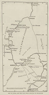
Background imageMaps Collection: Map of Nubia and the Nile from Assouan to Khartoum (engraving)

Map of Nubia and the Nile from Assouan to Khartoum (engraving)
1622748 Map of Nubia and the Nile from Assouan to Khartoum (engraving) by English School, (19th century); Private Collection; (add.info.: Map of Nubia and the Nile from Assouan to Khartoum)

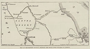
Background imageMaps Collection: Map of the Eastern Soudan, showing the Route from Souakim to Berber (engraving)

Map of the Eastern Soudan, showing the Route from Souakim to Berber (engraving)
1590963 Map of the Eastern Soudan, showing the Route from Souakim to Berber (engraving) by English School, (19th century); Private Collection; (add.info.: Map of the Eastern Soudan)

Background imageMaps Collection: The Nile Expedition, Lord Wolseleys Intended Route across the Desert from Korti to Shendy

The Nile Expedition, Lord Wolseleys Intended Route across the Desert from Korti to Shendy (engraving)
1590907 The Nile Expedition, Lord Wolseleys Intended Route across the Desert from Korti to Shendy (engraving) by English School, (19th century); Private Collection; (add.info.: The Nile Expedition)

Background imageMaps Collection: Carte arabe a l usage des Egyptiens (engraving)

Carte arabe a l usage des Egyptiens (engraving)
3644426 Carte arabe a l usage des Egyptiens (engraving) by French School, (19th century); Private Collection; (add.info.: Carte arabe a l usage des Egyptiens)

Background imageMaps Collection: Port and Town of Algiers, c. 1572 (engraving)

Port and Town of Algiers, c. 1572 (engraving)
STC192799 Port and Town of Algiers, c.1572 (engraving) by Italian School, (16th century); Private Collection; (add.info.: based on 1572 map by Braun and Hogenburg;)

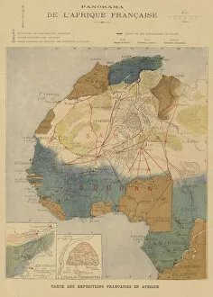
Background imageMaps Collection: French Africa (colour litho)

French Africa (colour litho)
2818487 French Africa (colour litho) by French School, (19th century); Private Collection; (add.info.: French Africa. Map showing the routes of expeditions)

Background imageMaps Collection: Conquete de l Algerie: 'Portrait en pied de Victor Guy, Baron Duperre

Conquete de l Algerie: "Portrait en pied de Victor Guy, Baron Duperre
JLJ4584902 Conquete de l Algerie: " Portrait en pied de Victor Guy, Baron Duperre, admiral and minister of the navy from 1834 to 1843 (1775-1846)

Background imageMaps Collection: Map of North Africa (Mauritania, Morocco, Algeria, Tunisia, Libya) and Europe (Spain

Map of North Africa (Mauritania, Morocco, Algeria, Tunisia, Libya) and Europe (Spain
LRI4706827 Map of North Africa (Mauritania, Morocco, Algeria, Tunisia, Libya) and Europe (Spain, Portugal, France, Italy, Greece with Balearic Islands, Sardinia, Corsica and Sicily) (etching)

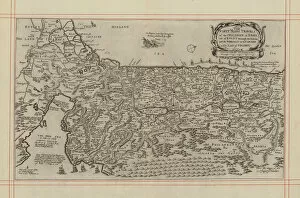
Background imageMaps Collection: Map showing the forty year journey of the Children of Israel out of Egypt to the Promised Land

Map showing the forty year journey of the Children of Israel out of Egypt to the Promised Land (engraving)
6002057 Map showing the forty year journey of the Children of Israel out of Egypt to the Promised Land (engraving) by English School

Background imageMaps Collection: Map of French expeditions in Africa, illustration from 'Le Petit Journal'

Map of French expeditions in Africa, illustration from "Le Petit Journal"
XEE4158968 Map of French expeditions in Africa, illustration from " Le Petit Journal" of March 5, 1894 (engraving) by French School

Background imageMaps Collection: Cartegena, from Drakes West Indian Voyage 1585 - 86, pub

Cartegena, from Drakes West Indian Voyage 1585 - 86, pub
2909734 Cartegena, from Drakes West Indian Voyage 1585 - 86, pub. 1589 (hand coloured engraving) by Boazio, Baptista (fl.1588-1606); Private Collection; (add.info)

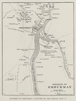
Background imageMaps Collection: Environs of Omdurman, captured by the Sirdar, 3 September (engraving)

Environs of Omdurman, captured by the Sirdar, 3 September (engraving)
1606467 Environs of Omdurman, captured by the Sirdar, 3 September (engraving) by English School, (19th century); Private Collection; (add.info.: Environs of Omdurman, captured by the Sirdar)

Background imageMaps Collection: Birds Eye View of the Soudan and Surrounding Countries (chromolitho)

Birds Eye View of the Soudan and Surrounding Countries (chromolitho)
1623054 Birds Eye View of the Soudan and Surrounding Countries (chromolitho) by English School, (19th century); Private Collection; (add.info.: Birds Eye View of the Soudan and Surrounding Countries)

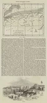
Background imageMaps Collection: Algeria in Africa and the Province of Oran, France. Series on the French Departments
Algeria in Africa and the Province of Oran, France. Series on the French Departments
XEE4193078 Algeria in Africa and the Province of Oran, France. Series on the French Departments. Import of Figs, Cotton, Tobacco, Agathe and Lead

Background imageMaps Collection: Map of Egypt, Nubia (Sudan) and Abyssinia (Ethiopia) (etching, 1730)

Map of Egypt, Nubia (Sudan) and Abyssinia (Ethiopia) (etching, 1730)
LRI4706896 Map of Egypt, Nubia (Sudan) and Abyssinia (Ethiopia) (etching, 1730) by Delisle, Guillaume (1675-1726); Private Collection; (add.info.: Map of Egypt)

Background imageMaps Collection: Map of Algiers - Algeria (engraving, 16th century)

Map of Algiers - Algeria (engraving, 16th century)
LRI4646859 Map of Algiers - Algeria (engraving, 16th century) by Hogenberg, Franz (1540-c.1590); Private Collection; (add.info)

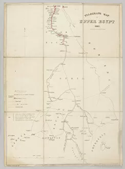
Background imageMaps Collection: Telegraph map of Upper Egypt 1882 (litho)

Telegraph map of Upper Egypt 1882 (litho)
2973889 Telegraph map of Upper Egypt 1882 (litho) by English School, (19th century); National Army Museum, London; (add.info.: Telegraph map of Upper Egypt 1882, compiled by the Intelligence Branch)

Background imageMaps Collection: Map of Algiers, from Civitates Orbis Terrarum by Georg Braun (1541-1622

Map of Algiers, from Civitates Orbis Terrarum by Georg Braun (1541-1622
STC121077 Map of Algiers, from Civitates Orbis Terrarum by Georg Braun (1541-1622) and Frans Hogenberg (1535-90), c.1572 (coloured engraving) by Hoefnagel

Background imageMaps Collection: Portrait of the Comte de Bourmont (1773-1846), Commander-in-Chief of the Africa

Portrait of the Comte de Bourmont (1773-1846), Commander-in-Chief of the Africa
STC192793 Portrait of the Comte de Bourmont (1773-1846), Commander-in-Chief of the Africa Expedition, from a volume commemorating the French Expeditionary Force which captured Algiers in 1830 (litho)

Background imageMaps Collection: The Great Bend of the Nile, with the Desert between Korti (Lord Wolseleys Head-Quarters)

The Great Bend of the Nile, with the Desert between Korti (Lord Wolseleys Head-Quarters)
1590939 The Great Bend of the Nile, with the Desert between Korti (Lord Wolseleys Head-Quarters) and Sir Herbert Stewarts Position above Metammeh (engraving) by English School

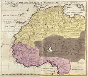
Background imageMaps Collection: Map of Barbaria (Morocco, Algeria, Tunisia, Libya), Nigritude (Mali, Burkina Faso

Map of Barbaria (Morocco, Algeria, Tunisia, Libya), Nigritude (Mali, Burkina Faso
LRI4706870 Map of Barbaria (Morocco, Algeria, Tunisia, Libya), Nigritude (Mali, Burkina Faso, Niger) and Guinee (Senegal, Guinea, Sierra Leone, Liberia, Ivory Coast, Ghana, Togo, Benin)

Background imageMaps Collection: The Evacuation of Fashoda, Sketch Map showing the Positions occupied by the British

The Evacuation of Fashoda, Sketch Map showing the Positions occupied by the British and French Troops (engraving)
1064145 The Evacuation of Fashoda, Sketch Map showing the Positions occupied by the British and French Troops (engraving) by English School

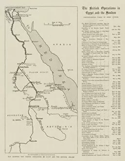
Background imageMaps Collection: Map showing the British Operations in Egypt and the Soudan, 1882-1898 (engraving)

Map showing the British Operations in Egypt and the Soudan, 1882-1898 (engraving)
1063822 Map showing the British Operations in Egypt and the Soudan, 1882-1898 (engraving) by English School, (19th century); Private Collection; (add.info)

Background imageMaps Collection: The French on the Upper Nile (engraving)

The French on the Upper Nile (engraving)
1063749 The French on the Upper Nile (engraving) by English School, (19th century); Private Collection; (add.info.: The French on the Upper Nile)

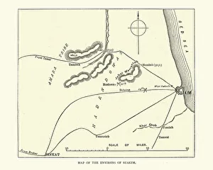
Background imageMaps Collection: Map of the environs of Suakin, Sudan, Mahdist War, 19th Century

Map of the environs of Suakin, Sudan, Mahdist War, 19th Century
Vintage illustration of Map of the environs of Suakin, Sudan, 19th Century

Background imageMaps Collection: Map of the area arounf the Battle of Abu Klea, 1885

Map of the area arounf the Battle of Abu Klea, 1885
Vintage illustration of Map of the area arounf the Battle of Abu Klea, 1885. The Battle of Abu Klea, or the Battle of Abu Tulayh took place between the dates of 16 and 18 January 1885, at Abu Klea

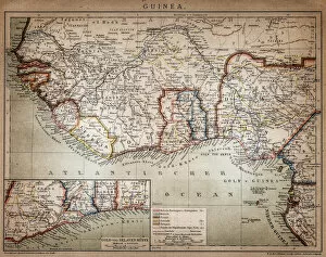
Background imageMaps Collection: Map of Guinea

Map of Guinea

Background imageMaps Collection: Map of Africa illustrating travels of explorers

Map of Africa illustrating travels of explorers
A map of Africa which illustrates the travels of the explorers Livingstone, Stanley and Cameron. Date: 19th Century

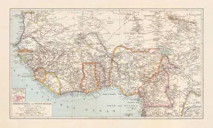
Background imageMaps Collection: Historical map of Upper-, Lower-Guinea and West-Sudan, lithograph, published 1897

Historical map of Upper-, Lower-Guinea and West-Sudan, lithograph, published 1897
Historical map of Upper-, Lower-Guinea and West Suadn, West Africa. Lithograph, published in 1897

Background imageMaps Collection: Map of the Environs of Suakim, c1885

Map of the Environs of Suakim, c1885. Episode of the Mahdist War (1881-1899). From British Battles on Land and Sea, Vol. IV, by James Grant. [Cassell Petter & Galpin, London, Paris & Melbourne, c1880]

Background imageMaps Collection: Plan of the Battle of Hasheen, (March 20, 1885), c1885

Plan of the Battle of Hasheen, (March 20, 1885), c1885. Episode of the Mahdist War (1881-1899). From British Battles on Land and Sea, Vol. IV, by James Grant

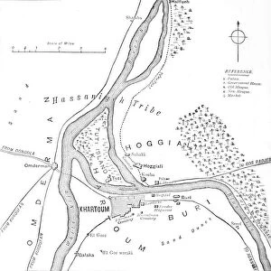
Background imageMaps Collection: Map of Khartoum and Vicinity, c1885

Map of Khartoum and Vicinity, c1885. Episode of the Mahdist War, (1881-1899). From British Battles on Land and Sea, Vol. IV, by James Grant. [Cassell Petter & Galpin, London, Paris & Melbourne, c1880]

Background imageMaps Collection: Plan of the Battle of Kirbekian, (February 10, 1885), c1885

Plan of the Battle of Kirbekian, (February 10, 1885), c1885. Episode of the Mahdist War (1881-1899). From British Battles on Land and Sea, Vol. IV, by James Grant

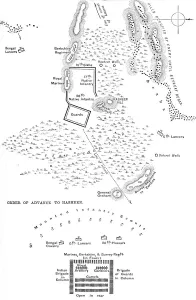
Background imageMaps Collection: Plan of the Battle of Abu Kru, (January 19, 1885), c1885

Plan of the Battle of Abu Kru, (January 19, 1885), c1885. Episode of the Mahdist War (1881-1899). From British Battles on Land and Sea, Vol. IV, by James Grant

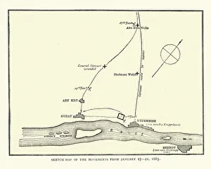
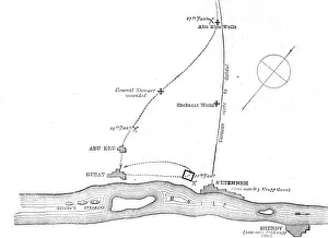
Background imageMaps Collection: Sketch-Map of the Movements from January 17-21, 1885, c1885

Sketch-Map of the Movements from January 17-21, 1885, c1885. Episode of the Mahdist War (1881-1899). From British Battles on Land and Sea, Vol. IV, by James Grant

Background imageMaps Collection: Plan of the Theatre of War in the Second Soudan Campaign, c1881-85

Plan of the Theatre of War in the Second Soudan Campaign, c1881-85. Episode of the Mahdist War (1881-1899). From British Battles on Land and Sea, Vol. IV, by James Grant

Background imageMaps Collection: Plan of the Battle of Tamai, (March 13, 1884), c1881-85

Plan of the Battle of Tamai, (March 13, 1884), c1881-85. Episode of the Mahdist War (1881-1899). From British Battles on Land and Sea, Vol. IV, by James Grant

Background imageMaps Collection: Plan of the Battle of El Teb, (February 29, 1884), c1881-85

Plan of the Battle of El Teb, (February 29, 1884), c1881-85. Episode of the Mahdist War (1881-1899). From British Battles on Land and Sea, Vol. IV, by James Grant

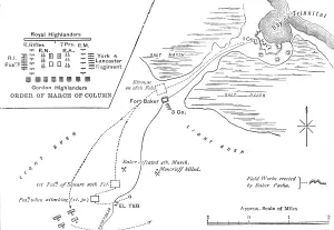
Background imageMaps Collection: Map of the March to El Teb, (February 28-29, 1884), c1881-85

Map of the March to El Teb, (February 28-29, 1884), c1881-85
Map of the March to El Teb, (February 28-29, 1884), c1880. Episode of the Mahdist War, (1881-1899). From British Battles on Land and Sea, Vol. IV, by James Grant

Background imageMaps Collection: Admiral Sir W. Hewlett, c1881-85

Admiral Sir W. Hewlett, c1881-85
Admiral Sir W. Hewlett, c1880. Sir William Nathan Wrighte Hewett, (1834-1888), Royal Navy officer. From British Battles on Land and Sea, Vol. IV, by James Grant


All Professionally Made to Order for Quick Shipping


-

Maps Collection

Sudan is a country located in the northeast corner of Africa, and is bordered by Egypt to the north, Libya to the northwest, Chad to the west, Central African Republic to the southwest, South Sudan to the south and Ethiopia and Eritrea to the east. Maps of Sudan provide an overview of its physical features such as mountains, rivers and deserts as well as its political divisions. They also show major cities such as Khartoum (the capital), Port Sudan (the largest port) and Omdurman (the second-largest city). Maps of Sudan can be used for navigation purposes or just for reference when studying this fascinating country and are useful for understanding how climate change has affected this region over time.
+

Our beautiful pictures are available as Framed Prints, Photos, Wall Art and Photo Gifts

The Maps of Sudan Africa collection from Media Storehouse offers a unique and fascinating glimpse into the history and geography of Sudan. Our collection features a wide range of maps, including antique maps dating back to the 19th century as well as more modern topographical maps. These maps showcase the diverse terrain of Sudan, from its vast deserts to its lush river valleys. They also provide insight into the country's rich cultural heritage, with detailed depictions of ancient cities and landmarks. Whether you're a history buff or simply looking for an eye-catching piece of wall art, our collection has something for everyone. Each map is expertly reproduced using high-quality printing techniques and can be ordered in a variety of sizes and framing options to suit your needs. With their intricate details and stunning visuals, these maps are sure to spark conversation and inspire curiosity about one of Africa's most fascinating countries.
+

What are Maps of Sudan Africa art prints?

Maps of Sudan Africa art prints are high-quality reproductions of maps depicting the country of Sudan and its surrounding areas. These prints showcase intricate details such as topography, political boundaries, major cities, and bodies of water. They are a great way to add a touch of sophistication and elegance to any space while also serving as educational tools. These art prints come in various sizes and can be framed or mounted for display purposes. They are printed on premium quality paper using state-of-the-art printing technology that ensures vibrant colors and sharp details that will last for years without fading. Whether you're an avid traveler or simply interested in geography, Maps of Sudan Africa art prints make excellent additions to your home decor collection. We offer a unique perspective on the world around us while also providing valuable information about one specific region.
+

What Maps of Sudan Africa art prints can I buy from Media Storehouse?

We offer a wide range of Maps of Sudan Africa art prints that are perfect for anyone looking to add some African flair to their home or office. These maps showcase the diverse geography and topography of Sudan, including its deserts, mountains, rivers, and lakes. You can choose from a variety of styles and designs, including vintage maps with intricate details or modern interpretations with bold colors. Some popular options include antique maps dating back to the 19th century that show the country's historical boundaries and colonial influences. Other contemporary prints feature satellite imagery that highlights Sudan's natural resources such as oil fields and agricultural lands. Whether you're an avid traveler or simply appreciate beautiful artwork, we have something for everyone. Their high-quality prints are available in various sizes and materials so you can find the perfect fit for your space.
+

How do I buy Maps of Sudan Africa art prints?

To buy Maps of Sudan Africa art prints from Media Storehouse, you can browse our extensive collection of maps and select the one that best suits your needs. Once you have found the map that you want to purchase, simply add it to your cart and proceed to checkout. During the checkout process, you will be prompted to enter your shipping information and payment details. We offer a range of payment options including credit card, PayPal and bank transfer. Once your order has been processed, they will print the map on high-quality paper using state-of-the-art printing technology. Maps of Sudan Africa art prints are perfect for anyone who loves geography or wants to decorate their home or office with unique artwork. They make great gifts for friends and family members who are interested in travel or history as well. With our easy-to-use website and fast shipping times, buying maps has never been easier.
+

How much do Maps of Sudan Africa art prints cost?

We offer a wide range of Maps of Sudan Africa art prints at varying prices. Our collection includes vintage and contemporary maps that showcase the country's diverse landscapes, cities, and regions. The cost of these prints depends on several factors such as the size, quality, and framing options selected by our customers. We understand that every customer has unique preferences when it comes to purchasing art prints. That is why we provide an extensive selection of Maps of Sudan Africa art prints to cater to different tastes and budgets. Whether you are looking for a small print or a large canvas print, we have something for everyone. Our Maps of Sudan Africa art prints are perfect for home decor or office spaces. They make great gifts for friends or family members who love travel or geography-related artwork. We take pride in offering high-quality products at affordable prices without compromising on quality or service standards.
+

How will my Maps of Sudan Africa art prints be delivered to me?

We offer a range of delivery options for our Maps of Sudan Africa art prints. We understand the importance of ensuring that your order is delivered to you in perfect condition and in a timely manner. Our standard delivery option usually takes between 3-5 working days from the date of dispatch, while our express delivery option guarantees next day delivery within the UK. All our art prints are carefully packaged using high-quality materials to ensure they arrive at your doorstep undamaged. We use sturdy cardboard tubes or flat packaging depending on the size and type of print you have ordered. We also offer international shipping for customers outside the UK, with varying delivery times depending on your location. Rest assured that we will do everything possible to get your Maps of Sudan Africa art prints delivered to you as quickly and safely as possible.