Fraud Blocker Skip to main content

Home > Africa > South Africa > Maps

Maps Collection

South Africa is a large and diverse country, with many different landscapes

Choose a picture from our Maps Collection for your Wall Art and Photo Gifts

399 items

Background imageMaps Collection: Continental drift after 250 million years

Continental drift after 250 million years, showing the supercontinent of Pangea Ultima, which was named for the ancient supercontinent of Pangea

Background imageMaps Collection: Plan of the Marches near Isandhlwana between Jan. 12th and 22nd, 1879, c1880

Plan of the Marches near Isandhlwana between Jan. 12th and 22nd, 1879, c1880. From British Battles on Land and Sea, Vol. IV, by James Grant. [Cassell Petter & Galpin, London, Paris & Melbourne, c1880]

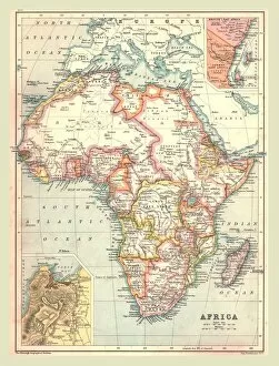
Background imageMaps Collection: Map of Africa, 1902. Creator: Unknown

Map of Africa, 1902. Creator: Unknown
Map of Africa, 1902. Showing colonial possessions including French West Africa and German South West Africa, with insets of Table Bay in South Africa, and British and German East Africa

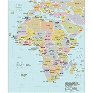
Background imageMaps Collection: Political Map of Africa

Political Map of Africa
Vector Illustration of the policital map of Africa Reference map as created by the US Central Intelligence Agency

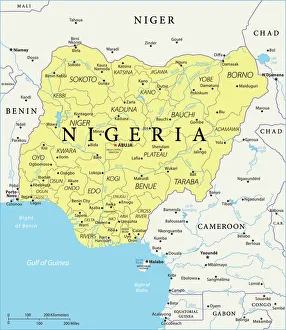
Background imageMaps Collection: Map of Nigeria

Map of Nigeria
Nigeria is a country on the coast of West Africa, bordered in south by the Bight of Benin and the Bight of Biafra (Bight of Bonny), both part of the Gulf of Guinea, by Niger in north, Benin in west

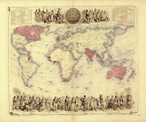
Background imageMaps Collection: British Empire world map, 19th century

British Empire world map, 19th century
British Empire world map. This world map shows the 19th-century British Empire (pink) and its indigenous peoples. Five illustrations (clockwise from upper left) show the people of Australia

Background imageMaps Collection: 17th century world map

17th century world map
World map, published around 1664 in Amsterdam, the Netherlands, by Dutch mapmaker Joan Blaeu (c.1599- 1673). The Latin title is Nova et Accuratissima Totius Terrarum Orbis Tabula

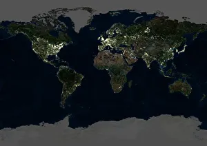
Background imageMaps Collection: Whole Earth at night, satellite image

Whole Earth at night, satellite image
Whole Earth map at night, satellite image. Here, Africa is seen at centre. City lights (yellow) of increasing intensity show areas of increasing population

Background imageMaps Collection: Oronce Fines world map, 1531

Oronce Fines world map, 1531
Oronce Fines world map. Map of the worlds northern and southern hemispheres by the French mathematician and cartographer Oronce Fine (1494-1555)

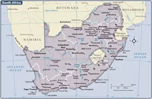
Background imageMaps Collection: South Africa country map

South Africa country map
2011 edition

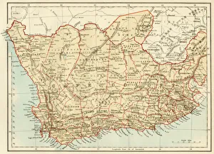
Background imageMaps Collection: Map of Cape Colony, South Africa

Map of Cape Colony, South Africa
South Africa when a British colony, 1870s. Printed color lithograph of a 19th-century illustration

Background imageMaps Collection: Map /s Africa / Boer C1898

Map /s Africa / Boer C1898
SOUTH AFRICA on the eve of the Boer War

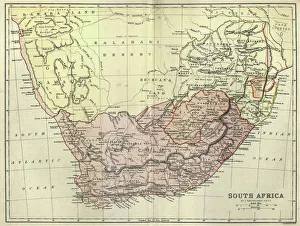
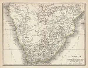
Background imageMaps Collection: Antique map of South Africa, 1884, 19th Century

Antique map of South Africa, 1884, 19th Century
Vintage engraving of Antique map of South Africa, 1884, 19th Century

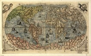
Background imageMaps Collection: 16th century world map

16th century world map
World map, published around 1565 in Venice, Italy, by Italian mapmaker Ferando Bertelli. The title of the map: Universale Descrittione di Tutta la Terra Conosciuta Fin Qui

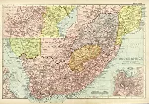
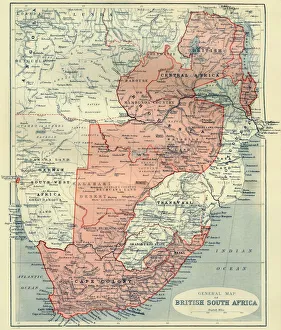
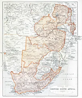
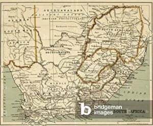
Background imageMaps Collection: General Map of British South Africa, 1900. Creator: Unknown

General Map of British South Africa, 1900. Creator: Unknown
General Map of British South Africa, 1900. From " South Africa and the Transvaal War, Vol. I", by Louis Creswicke. [T. C. & E. C. Jack, Edinburgh, 1900]

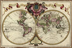
Background imageMaps Collection: Map of the world, 1720

Map of the world, 1720
(Original Caption) 18th century map of the world. Published in Paris in 1720, this French map shows the known world, including the new lands that had been discovered in the preceding centuries by

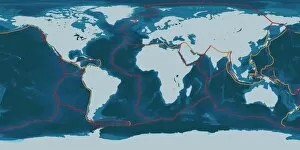
Background imageMaps Collection: Earths tectonic plates

Earths tectonic plates. Global map showing the boundaries of the tectonic plates that make up the Earths crust. The eight major plates are the: African Plate, Antarctic Plate, Indian Plate

Background imageMaps Collection: Continental drift, 100 million years ago

Continental drift, 100 million years ago. Map of the Earth showing the continents some 100 million years after the start of the break-up of the ancient supercontinent of Pangea

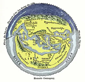
Background imageMaps Collection: Homeric cosmogony

Homeric cosmogony. Map of the Earth based on the myths and knowledge of the Ancient Greeks at the time of Homer (1st or 2nd millennium BC)

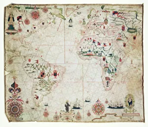
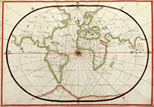
Background imageMaps Collection: 17th Century nautical map of the Atlantic

17th Century nautical map of the Atlantic Ocean. Historical portolan chart showing the Atlantic Ocean and adjacent continents

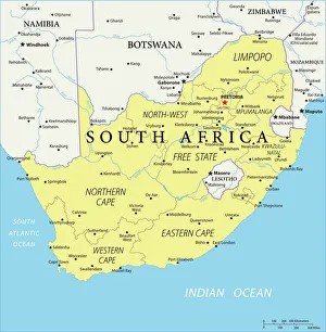
Background imageMaps Collection: Reference Map of Map of South Africa

Reference Map of Map of South Africa
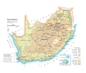
South Africa is located in southern Africa. South Africa is bordered by the Atlantic Ocean and the Indian Ocean, Lesotho and eSwatini (formerly Swaziland) in the eastern portion of South Africa

Background imageMaps Collection: Map of South Africa

Map of South Africa

Background imageMaps Collection: South Africa Vector Map

South Africa Vector Map
+++

Background imageMaps Collection: Plan of the Defence of Rorkes Drift (litho)

Plan of the Defence of Rorkes Drift (litho)
STC373386 Plan of the Defence of Rorkes Drift (litho) by English School, (19th century); Private Collection; (add.info.: Battle of Rorkes Drift, 22-23 January 1879)

Background imageMaps Collection: Map of South Africa 1900

Map of South Africa 1900
Meyers hand-Atlas Leipzig und Wien Verlag des Bibliographischen Instituts 1900

Background imageMaps Collection: World map by Mathieu Albert Lotter, Augsburg, 1778

World map by Mathieu Albert Lotter, Augsburg, 1778
World map from 1778. Original hand-colored copper engraving by Matthieu Albert Lotter (1741 - 1810, Augsburg) with route of James Cooks First Circumnavigation (1770), through Tahiti

Background imageMaps Collection: Map of the world, 1590

Map of the world, 1590
16th century map of the world. Published around 1590, this map shows the known world, including the new lands being discovered by Europeans exploring across the Atlantic

Background imageMaps Collection: Plan of the Defences at Rorkes Drift, (Jan. 22, 1879), c1880

Plan of the Defences at Rorkes Drift, (Jan. 22, 1879), c1880
Plan of the Defences at Rorkes Drift (Jan. 22, 1879), c1880. Episode of the Anglo-Zulu Wars (1879-1896). From British Battles on Land and Sea, Vol. IV, by James Grant

Background imageMaps Collection: Ancient map of South Africa, lithograph, published in 1876

Ancient map of South Africa, lithograph, published in 1876
Ancient map of South Africa. Lithograph, published in 1876

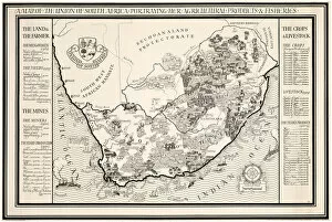
Background imageMaps Collection: A Map of the Union of South Africa, 1931 (colour litho)

A Map of the Union of South Africa, 1931 (colour litho)
1198400 A Map of the Union of South Africa, 1931 (colour litho) by Gill, Leslie MacDonald (Max) (1884-1947); 102x153 cm; Private Collection; (add.info.: Gill)

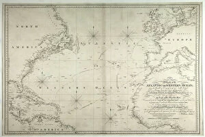
Background imageMaps Collection: A Chart of the Atlantic or Western Ocean, showing the track of Nelsons fleet

A Chart of the Atlantic or Western Ocean, showing the track of Nelsons fleet
3244750 A Chart of the Atlantic or Western Ocean, showing the track of Nelsons fleet, 12th May-15th August 1805, 1807 (engraving) by Faden, William (1750-1836); National Museum of the Royal Navy

Background imageMaps Collection: Plan of the Battle of Isandhlwana, (Jan. 22, 1879), c1880

Plan of the Battle of Isandhlwana, (Jan. 22, 1879), c1880. From British Battles on Land and Sea, Vol. IV, by James Grant. [Cassell Petter & Galpin, London, Paris & Melbourne, c1880]

Background imageMaps Collection: Wylds Military Sketch of Zululand, 1879 (colour engraving)

Wylds Military Sketch of Zululand, 1879 (colour engraving)
XCF282014 Wylds Military Sketch of Zululand, 1879 (colour engraving) by Wyld, James the Elder (1790-1836); British Museum, London, UK; (add.info.: the Transvaal and adjoining territories; ); British

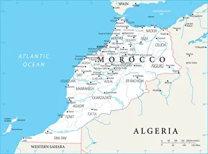
Background imageMaps Collection: Reference Map of Morocco

Reference Map of Morocco
Morocco is a country in the western Maghreb region of North Africa. Morocco is bordered by the Atlantic Ocean in west, by the Mediterranean Sea in north

Background imageMaps Collection: General Map Of British South Africa. From The Book South Africa And The Transvaal War

General Map Of British South Africa. From The Book South Africa And The Transvaal War, Volume 1 By Louis Creswicke, Published 1900

Background imageMaps Collection: Map of Morocco

Map of Morocco
Morocco is a country in the western Maghreb region of North Africa. Morocco is bordered by the Atlantic Ocean in west, by the Mediterranean Sea in north

Background imageMaps Collection: Europae, 1570 (copperplate engraving on paper)

Europae, 1570 (copperplate engraving on paper)
7340122 Europae, 1570 (copperplate engraving on paper) by Ortelius, Abraham (1527-98); 42x53 cm; National Maritime Museum, London

Background imageMaps Collection: A map of the city and port of Tripoli in Barbary, 1675 (coloured engraving)

A map of the city and port of Tripoli in Barbary, 1675 (coloured engraving)
7340047 A map of the city and port of Tripoli in Barbary, 1675 (coloured engraving) by Seller, John (1632-97); 42x53 cm; National Maritime Museum, London

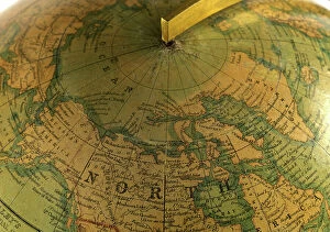
Background imageMaps Collection: A crop image of Malby's globe covering the areas explored before Franklin's 1845 'Erebus'

A crop image of Malby's globe covering the areas explored before Franklin's 1845 'Erebus'
7295646 A crop image of Malby's globe covering the areas explored before Franklin's 1845 'Erebus' and 'Terror' expedition., 1845 (cardboard, plaster, paper, varnish, brass, wood, hand-coloured)

Background imageMaps Collection: Chart of the Southern Hemisphere showing pre-Cook journeys and discoveries, 1777 (engraving)

Chart of the Southern Hemisphere showing pre-Cook journeys and discoveries, 1777 (engraving)
7295408 Chart of the Southern Hemisphere showing pre-Cook journeys and discoveries, 1777 (engraving) by Cook, James (1728-79); 56x54 cm; National Maritime Museum, London

Background imageMaps Collection: Map of the southwest of Africa, 18th century, 1754 (coloured engraving)

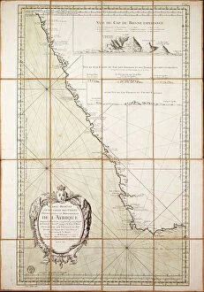
Map of the southwest of Africa, 18th century, 1754 (coloured engraving)
7339407 Map of the southwest of Africa, 18th century, 1754 (coloured engraving) by French School, (18th century); 95x66 cm; National Maritime Museum, London

Background imageMaps Collection: Geography map: representation of the Atlantic Ocean (or North Sea) with the coasts of the Americas

Geography map: representation of the Atlantic Ocean (or North Sea) with the coasts of the Americas
VEN5030386 Geography map: representation of the Atlantic Ocean (or North Sea) with the coasts of the Americas (South and United States), the Caribbean Sea and the Caribbean

Background imageMaps Collection: World map of Claudius Ptolemaeus (Claude Ptolemee, 90-168 ap JC)

World map of Claudius Ptolemaeus (Claude Ptolemee, 90-168 ap JC), Greek astronomer and astrologer (in red)
NWI4852574 World map of Claudius Ptolemaeus (Claude Ptolemee, 90-168 ap JC), Greek astronomer and astrologer (in red), contrasted with the real positions of cities and countries (in black)

Background imageMaps Collection: French map of the Transvaal at the outbreak of the Boer War in South Africa, 1899

French map of the Transvaal at the outbreak of the Boer War in South Africa, 1899
3479681 French map of the Transvaal at the outbreak of the Boer War in South Africa, 1899; Universal History Archive/UIG

Background imageMaps Collection: Map of Ladysmith, c.1900 (engraving)

Map of Ladysmith, c.1900 (engraving)
533405 Map of Ladysmith, c.1900 (engraving); (add.info.: Map of Ladysmith, South Africa, circa 1902, from the 10th edition of Encyclopaedia Britannica.); Encyclopaedia Britannica/UIG

Background imageMaps Collection: Map of Johannesburg, c.1900 (engraving)

Map of Johannesburg, c.1900 (engraving)
533402 Map of Johannesburg, c.1900 (engraving); (add.info.: Map of Johannesburg, South Africa, circa 1902, from the 10th edition of Encyclopaedia Britannica.); Encyclopaedia Britannica/UIG

Background imageMaps Collection: South Africa

South Africa
2902104 South Africa; (add.info.: South Africa, 1899.); Buyenlarge Archive/UIG

Background imageMaps Collection: Chart of the Atlantic Ocean, with the British, French & Spanish settlements in North America

Chart of the Atlantic Ocean, with the British, French & Spanish settlements in North America and the West Indies
7295390 Chart of the Atlantic Ocean, with the British, French & Spanish settlements in North America and the West Indies, 1753 (engraving) by Jefferys


All Professionally Made to Order for Quick Shipping


-

Maps Collection

South Africa is a large and diverse country, with many different landscapes. Maps of South Africa are essential for navigating the country and understanding its geography. Maps of South Africa typically include physical features such as rivers, mountains, deserts, and coastlines. They also show major cities and towns, roads, railways, airports, national parks and other points of interest, and are be used to plan trips or explore new areas in the country and can also help visitors find their way around unfamiliar places or get an overview of the entire region at once. With so much to see in South Africa, they can an invaluable tool for discovering all it has to offer.
+

Our beautiful pictures are available as Framed Prints, Photos, Wall Art and Photo Gifts

The Maps of South Africa collection from Media Storehouse is a stunning assortment of wall art and framed prints that showcase the diverse geography, history, and culture of South Africa. Our collection features an array of maps dating back to the 17th century, including antique maps depicting the Cape Colony and Natal region. Our collection also includes contemporary topographical maps that highlight the country's natural wonders such as Kruger National Park and Table Mountain. Each print in our collection is carefully crafted using high-quality materials to ensure longevity and durability. These prints are perfect for adding a touch of elegance to any room or office space while providing a glimpse into South Africa's rich history. Whether you're looking for a unique gift or simply want to add some character to your home decor, the Maps of South Africa collection from Media Storehouse offers something for everyone. With its beautiful designs and exceptional quality, our collection is sure to impress anyone who appreciates fine artistry.
+

What are Maps of South Africa Africa art prints?

Maps of South Africa art prints are beautiful and informative pieces of artwork that showcase the geography, topography, and landmarks of South Africa. These maps can be used for educational purposes or as decorative pieces in homes, offices, or public spaces. They come in a variety of styles and sizes to suit different tastes and preferences. Some Maps of South Africa art prints feature detailed illustrations that highlight the country's diverse flora and fauna, while others focus on its major cities, highways, and tourist attractions. Some also include historical information about the country's past struggles with apartheid. These art prints are created using high-quality printing techniques that ensure their longevity and vibrancy over time. They make great gifts for anyone who loves travel or has an interest in African culture. Whether you're looking to decorate your home or office space with a unique piece of artwork or want to give a thoughtful gift to someone special, Maps of South Africa art prints are an excellent choice.
+

What Maps of South Africa Africa art prints can I buy from Media Storehouse?

We offer a wide range of South Africa art prints that showcase the beauty and diversity of this stunning country. From detailed maps highlighting its various regions, cities and landmarks to breathtaking landscape photographs capturing its natural wonders, there is something for everyone. You can choose from vintage-style maps that evoke a sense of nostalgia or contemporary designs that reflect modern-day South Africa. Some popular options include maps featuring Cape Town, Johannesburg, Durban and Pretoria as well as prints showcasing iconic attractions such as Table Mountain, Kruger National Park and the Garden Route. Whether you are looking to decorate your home or office with unique wall art or searching for a special gift for someone who loves South Africa, we have an extensive collection of high-quality prints available in different sizes and formats to suit your needs.
+

How do I buy Maps of South Africa Africa art prints?

To buy maps of South Africa and African art prints from Media Storehouse, you can browse our extensive collection online. We offer a wide range of options to choose from, including vintage maps, contemporary designs, and artwork inspired by the natural beauty of Africa. Once you have found the print that you like, simply add it to your cart and proceed to checkout. You will need to provide your shipping information and payment details at this stage. We offer high-quality prints on a variety of materials such as canvas or paper. You can also select different sizes depending on your preferences. If you are looking for something specific but cannot find it in their collection, they may be able to source it for you through their network of photographers and artists. Buying maps of South Africa and African art prints from Media Storehouse is easy and convenient with plenty of options available to suit all tastes.
+

How much do Maps of South Africa Africa art prints cost?

We offer a wide range of Maps of South Africa art prints that vary in price depending on the size and type of print. Our collection includes vintage maps, modern designs, and detailed topographical maps. We understand that our customers have different preferences when it comes to artwork, which is why we provide various options to choose from. Our Maps of South Africa art prints are available in different sizes ranging from small to large formats. Additionally, you can select your preferred print type such as canvas or framed prints. Each option has its unique features and benefits. We take pride in providing high-quality products at affordable prices without compromising on quality. Our team ensures that every order is carefully packaged for safe delivery to your doorstep. The cost of our Maps of South Africa art prints varies based on several factors such as size and print type but rest assured that we offer competitive pricing for all our products.
+

How will my Maps of South Africa Africa art prints be delivered to me?

We take great care in ensuring that your Maps of South Africa art prints are delivered to you safely and securely. We use high-quality packaging materials to protect your artwork during transit, including sturdy cardboard tubes for rolled prints and flat boxes for framed prints. All our deliveries are fulfilled by trusted courier partners who provide a reliable service across the globe. You will receive a tracking number once your order has been dispatched so that you can monitor its progress and ensure someone is available to sign for it upon delivery. We understand how important it is for your artwork to arrive in perfect condition, which is why we offer a no-quibble guarantee on all our products. If there are any issues with your order, please don't hesitate to get in touch with us and we'll do everything we can to put things right.