
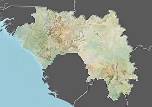
Maps Collection
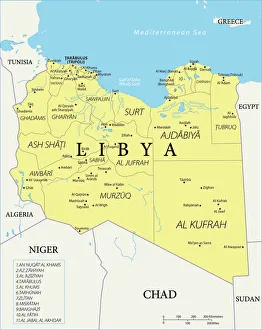
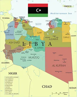
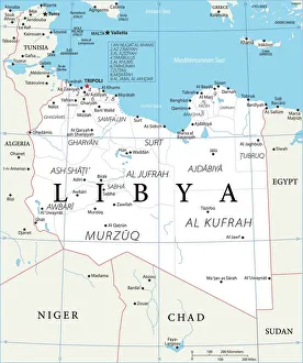
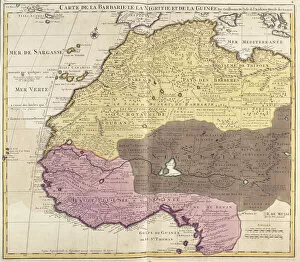
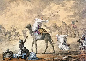
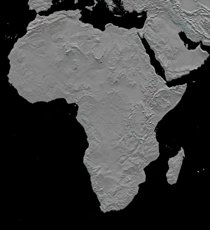
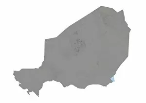
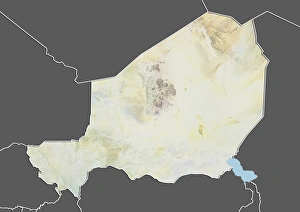
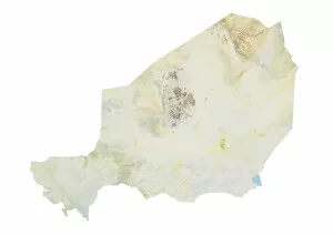
Niger is a landlocked country in West Africa, and is bordered by Algeria, Benin, Burkina Faso, Chad, Libya, Mali and Nigeria
Choose a picture from our Maps Collection for your Wall Art and Photo Gifts
34 items


All Professionally Made to Order for Quick Shipping
-
Maps Collection
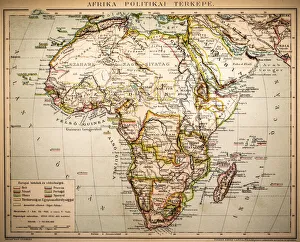
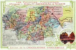
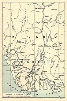
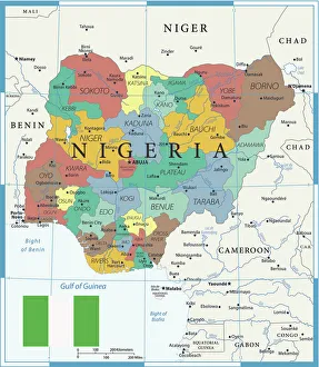
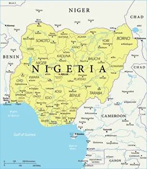
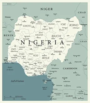
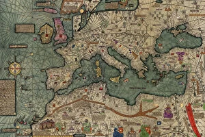
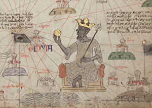
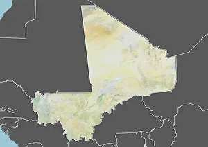
Niger is a landlocked country in West Africa, and is bordered by Algeria, Benin, Burkina Faso, Chad, Libya, Mali and Nigeria. Niger has an area of 1.267 million square kilometers and is the largest nation in West Africa. The terrain of Niger varies from desert to savanna plains to highlands in the north and northeast regions. The capital city of Niamey lies on the banks of the Niger River which runs through much of the country's length from east to west. Maps of Niger show its diverse geography including mountains, valleys and rivers as well as cities such as Niamey, Zinder and Agadez which are important economic centers for trade with neighboring countries. It also highlight major roadways connecting these cities with each other as well as with other parts of Africa such as Nigeria or Algeria. Additionally they show where natural resources such as oil can be found in this vast African nation that continues to develop its infrastructure despite many challenges it faces today.
+
Our beautiful pictures are available as Framed Prints, Photos, Wall Art and Photo Gifts
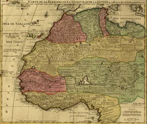
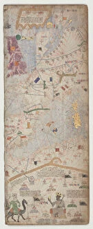
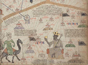
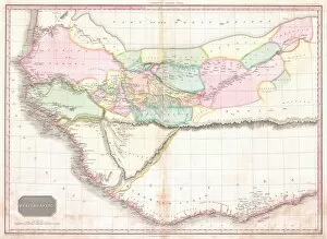
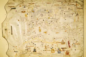
The Maps of Niger Africa collection is a stunning compilation of vintage and contemporary maps that depict the geography, topography, and political boundaries of Niger. Our collection features a wide range of maps dating back to the 18th century, including hand-drawn sketches, lithographs, and modern digital prints. These maps showcase the rich history and cultural heritage of Niger while providing valuable insights into its economic development and geopolitical landscape. From detailed city plans to regional overviews, each map in our collection tells a unique story about Niger's past and present. Some highlight key landmarks such as rivers, mountains or deserts; others show trade routes or ethnic groups' territories. All are beautifully crafted with intricate details that make them perfect for display in any home or office setting. Whether you're an avid collector or simply looking for a unique piece of wall art that celebrates African culture and history, the Maps of Niger Africa collection from Media Storehouse offers something for everyone.
+
What are Maps of Niger Africa art prints?
Maps of Niger Africa art prints are a collection of high-quality, visually stunning maps that showcase the geography and topography of Niger in West Africa. These prints are designed to be both informative and decorative, making them perfect for display in homes, offices or educational institutions. Each map is carefully crafted using the latest cartographic techniques and features detailed information about the country's cities, towns, rivers, lakes and other landmarks. The prints come in a variety of sizes to suit different spaces and can be customized with framing options to match your decor. Whether you're interested in exploring Niger's rich cultural heritage or simply want to add some color and style to your walls, Maps of Niger Africa art prints offer an excellent way to do so. With their vibrant colors and intricate details, these maps are sure to capture the imagination of anyone who sees them.
+
What Maps of Niger Africa art prints can I buy from Media Storehouse?
We offer a wide range of Maps of Niger Africa art prints that you can buy. These maps showcase the geography, topography, and political boundaries of Niger in great detail. You can choose from different styles and designs to suit your preferences or decor needs. Some of the popular options include antique maps, satellite imagery, and modern cartographic representations. These Maps of Niger Africa art prints are available in various sizes and formats such as framed prints, canvas prints, posters, and photographic prints. They are printed using high-quality materials to ensure longevity and durability. Whether you're looking for a unique gift or want to add some African flair to your home or office space, we have got you covered with our extensive collection of Maps of Niger Africa art prints. With so many options available at affordable prices, it's easy to find something that fits your style and budget.
+
How do I buy Maps of Niger Africa art prints?
To purchase Maps of Niger Africa art prints from Media Storehouse, you can browse our extensive collection online. Simply search for "Maps of Niger Africa" in the search bar on our website and select the print that best suits your needs. Once you have found the desired print, add it to your cart and proceed to checkout. During checkout, you will be prompted to enter your shipping information and payment details. We offer a variety of sizes and framing options for their prints, so be sure to choose the one that fits your space and style preferences. We also offer high-quality printing services using state-of-the-art technology to ensure that each print is crisp and vibrant. Whether you are looking for a unique piece of wall art or a thoughtful gift for someone special, Maps of Niger Africa art prints from Media Storehouse are an excellent choice.
+
How much do Maps of Niger Africa art prints cost?
We offer a wide range of Maps of Niger Africa art prints at varying prices. The cost of these prints depends on several factors such as the size, quality, and type of print you choose. We have various options available including canvas prints, framed prints, photographic prints, and poster prints. Our Maps of Niger Africa art prints are created using high-quality materials to ensure that they last for years without fading or losing their vibrancy. They are perfect for adding a touch of African culture to your home or office décor. We take pride in offering affordable yet high-quality art prints that suit every budget. Our pricing is competitive and reflects the value we place on providing our customers with exceptional products. Whether you're looking for a small poster print or a large canvas print, we have something to suit your needs and budget. Browse through our collection today to find the perfect Maps of Niger Africa art print for your space.
+
How will my Maps of Niger Africa art prints be delivered to me?
We take great care in ensuring that your Maps of Niger Africa art prints are delivered to you safely and securely. We use high-quality packaging materials to protect your artwork during transit and ensure it arrives in pristine condition. Your art prints will be carefully rolled and placed inside a sturdy cardboard tube for shipping. This method ensures that the print remains flat and avoids any creases or damage during transportation. We work with trusted delivery partners who offer reliable services to ensure your order is delivered promptly. You can track your shipment online using the tracking number provided once your order has been dispatched. We pride ourselves on providing excellent customer service, so if you have any questions or concerns about the delivery of your Maps of Niger Africa art prints, please do not hesitate to contact us.