Fraud Blocker Skip to main content

Acrylic Blox > Asia > Indonesia > Maps

Maps Acrylic Blox Collection

Discover the rich cultural tapestry of Indonesia with our Maps of Indonesia, Asia collection from Media Storehouse. These intricately designed maps showcase the diverse regions and islands of this vibrant country, bringing a touch of Asian beauty to your home or office. Each map is meticulously crafted with attention to detail, making it a stunning addition to any space. Explore the wonders of Indonesia with our Maps of Indonesia, Asia collection - a perfect blend of art and geography.
Maps of Indonesia Asia are a type of map that shows the physical features and political boundaries of the Indonesian archipelago

Choose a picture from our Maps Acrylic Blox Collection for your Wall Art and Photo Gifts

101 Acrylic Bloxs

Background imageMaps Acrylic Blox Collection: GPAC2A-00018

GPAC2A-00018
Map of the Pacific island groups, 1800s. Hand-colored woodcut of a 19th-century illustration

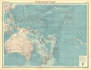
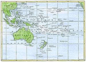
Background imageMaps Acrylic Blox Collection: Map of the South Pacific Ocean

Map of the South Pacific Ocean. Map showing the Philippines, Indonesia, Papua New Guinea, Australia and New Zealand, and Pacific islands. Plate 102 from The Times Atlas

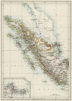
Background imageMaps Acrylic Blox Collection: Sumatra, 1800s

Sumatra, 1800s
Map of Sumatra, 1870s. Color lithograph of a 19th-century illustration

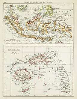
Background imageMaps Acrylic Blox Collection: Map of Fiji Sumatra Borneo 1897

Map of Fiji Sumatra Borneo 1897
Map of Fiji, Borneo, Sumatra, java

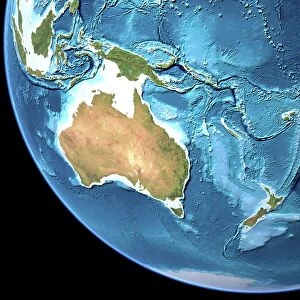
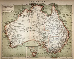
Background imageMaps Acrylic Blox Collection: Australia, topographic map

Australia, topographic map. Highlands and lowlands of the continents are shown as ridges and flat areas. Southeast Asia (top left), New Zealand (lower right) and Antarctica (bottom right)

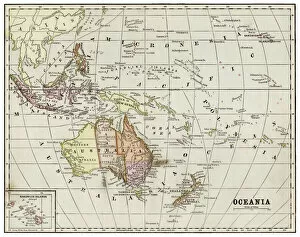
Background imageMaps Acrylic Blox Collection: Map of Oceania 1877

Map of Oceania 1877
Warrens Common School Geography 1877

Background imageMaps Acrylic Blox Collection: Oceania map 1889

Oceania map 1889
Indiana Educational Series The Complete Geography - Indianapolis 1889

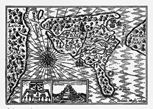
Background imageMaps Acrylic Blox Collection: Historical Map of Dutch Navigators Island of Bali Illustration

Historical Map of Dutch Navigators Island of Bali Illustration
Very Rare, Beautifully Illustrated Antique Engraved Victorian Illustration of Historical Map of Dutch Navigators on the Island of Bali. Copyright has expired on this artwork. Digitally restored

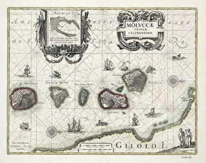
Background imageMaps Acrylic Blox Collection: Chart of the Moluccas, Indonesia, 1640 (coloured engraving)

Chart of the Moluccas, Indonesia, 1640 (coloured engraving)
7339459 Chart of the Moluccas, Indonesia, 1640 (coloured engraving) by Blaeu, Willem (1571-1638); 55x65 cm; National Maritime Museum, London

Background imageMaps Acrylic Blox Collection: Navigation through the Straits of Sunda to Batavia, 1803 (engraving)

Navigation through the Straits of Sunda to Batavia, 1803 (engraving)
7339420 Navigation through the Straits of Sunda to Batavia, 1803 (engraving) by Heather, William (19th century); 64.5x93.5 cm; National Maritime Museum, London

Background imageMaps Acrylic Blox Collection: Padang - the chief settlement of the Dutch Company on the west coast of Sumatra, 1782 (engraving)

Padang - the chief settlement of the Dutch Company on the west coast of Sumatra, 1782 (engraving)
7339395 Padang - the chief settlement of the Dutch Company on the west coast of Sumatra, 1782 (engraving) by Dalrymple, Alexander (18th-19th century); 30.5x31 cm; National Maritime Museum, London

Background imageMaps Acrylic Blox Collection: Map of Java (Indonesia), ca. 1870 - Map of Java, 1870s - Color lithograph

Map of Java (Indonesia), ca. 1870 - Map of Java, 1870s - Color lithograph
NWI4879576 Map of Java (Indonesia), ca. 1870 - Map of Java, 1870s - Color lithograph; (add.info.: Map of Java (Indonesia), ca

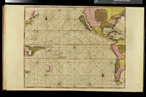
Background imageMaps Acrylic Blox Collection: Geography map: representation of the Pacific Ocean (or South Sea)

Geography map: representation of the Pacific Ocean (or South Sea) with the Americas (South and United States)
VEN5031134 Geography map: representation of the Pacific Ocean (or South Sea) with the Americas (South and United States), as well as New Zealand, Indonesia and Japan

Background imageMaps Acrylic Blox Collection: Map of Bali (Indonesia), around 1870 - Lithography 19th century (Map of Bali)

Map of Bali (Indonesia), around 1870 - Lithography 19th century (Map of Bali)
NWI4879616 Map of Bali (Indonesia), around 1870 - Lithography 19th century (Map of Bali, 1870s - Color lithograph of a 19th-century illustration); (add.info.: Map of Bali (Indonesia)

Background imageMaps Acrylic Blox Collection: Geographic map of the volcano of Krakatoa and the surrounding islands

Geographic map of the volcano of Krakatoa and the surrounding islands (Lang and Verlaten island present-day Sertung)
NWI4879073 Geographic map of the volcano of Krakatoa and the surrounding islands (Lang and Verlaten island present-day Sertung) before the eruption of the volcano in 1883

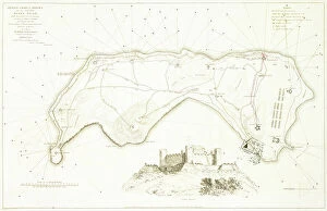
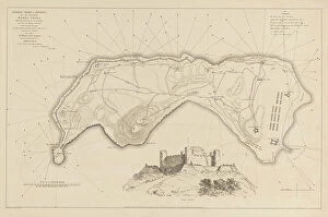
Background imageMaps Acrylic Blox Collection: General chart of defence for the Island Banda Neira, early 19th century (coloured etching)

General chart of defence for the Island Banda Neira, early 19th century (coloured etching)
7341899 General chart of defence for the Island Banda Neira, early 19th century (coloured etching) by Daniell, William (1769-1837); 43.4x58 cm; National Maritime Museum, London

Background imageMaps Acrylic Blox Collection: Geographic map of the Sumatra, years 1870. 19th century colour engraving

Geographic map of the Sumatra, years 1870. 19th century colour engraving
NWI4879416 Geographic map of the Sumatra, years 1870. 19th century colour engraving.; (add.info.: Geographic map of the Sumatra, years 1870)

Background imageMaps Acrylic Blox Collection: Volcano of Krakatoa and neighboring islands (Lang and Verlaten now Sertung)

Volcano of Krakatoa and neighboring islands (Lang and Verlaten now Sertung) after the volcanic eruption in 1883
NWI4879090 Volcano of Krakatoa and neighboring islands (Lang and Verlaten now Sertung) after the volcanic eruption in 1883

Background imageMaps Acrylic Blox Collection: Geographic map of the islands of the Pacific Ocean in Oceania, 19th century

Geographic map of the islands of the Pacific Ocean in Oceania, 19th century
NWI4879032 Geographic map of the islands of the Pacific Ocean in Oceania, 19th century. Polynesia, Micronesia, New Zealand, Australia, New Guinee, Philippines, Java, Borneo, Malaysia, Indonesia

Background imageMaps Acrylic Blox Collection: Bay of Bengal from Ceylon to Malacca, 1758 (coloured engraving)

Bay of Bengal from Ceylon to Malacca, 1758 (coloured engraving)
7339374 Bay of Bengal from Ceylon to Malacca, 1758 (coloured engraving) by Herbert, William (fl.c.1758); 65x95 cm; National Maritime Museum, London

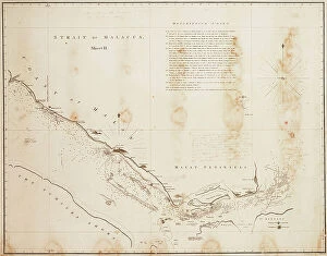
Background imageMaps Acrylic Blox Collection: Strait of Malacca, 1806 (engraving)

Strait of Malacca, 1806 (engraving)
7339409 Strait of Malacca, 1806 (engraving) by Horsburgh, James (19th century); 64x80 cm; National Maritime Museum, London, UK; (add.info.: Creator: Horsburgh, James; Horsburgh, James Walker, J)

Background imageMaps Acrylic Blox Collection: Map of the Molucca Islands (modern Indonesia), c.1707 (coloured engraving)

Map of the Molucca Islands (modern Indonesia), c.1707 (coloured engraving)
7339398 Map of the Molucca Islands (modern Indonesia), c.1707 (coloured engraving) by Aa, Pieter Van der (1659-1733); 27x16 cm; National Maritime Museum, London

Background imageMaps Acrylic Blox Collection: Plan of Fort Victoria, Ambon, 1718. Creator: Anon

Plan of Fort Victoria, Ambon, 1718. Creator: Anon
Plan of Fort Victoria, Ambon, 1718. Scale of 30 Rijnlandse rods, with a compass rose underneath

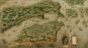
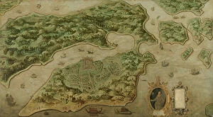
Background imageMaps Acrylic Blox Collection: View of Ambon, c.1617. Creator: Anon

View of Ambon, c.1617. Creator: Anon
View of Ambon, c.1617. Other Title(s): Bird's-eye View of Ambon, with a Portrait of Frederik Houtman (1571-1627) in a Cartouche

Background imageMaps Acrylic Blox Collection: Conquest of Banda by the English on August 9, 1810, (1811). Creator: M. Graham

Conquest of Banda by the English on August 9, 1810, (1811). Creator: M. Graham
Conquest of Banda by the English on August 9, 1810, (1811). lllustrative account of Captain Cole's splendid achievement in the capture of the island of Banda

Background imageMaps Acrylic Blox Collection: Black Maps Earth Tones 07

Black Maps Earth Tones 07
Emiliano Deificus

Background imageMaps Acrylic Blox Collection: 1 Maps 2 31

1 Maps 2 31
Emiliano Deificus

Background imageMaps Acrylic Blox Collection: 1 Maps 26

1 Maps 26
Emiliano Deificus

Background imageMaps Acrylic Blox Collection: City Love Maps 07

City Love Maps 07
Emiliano Deificus

Background imageMaps Acrylic Blox Collection: City Heart Maps 07

City Heart Maps 07
Emiliano Deificus

Background imageMaps Acrylic Blox Collection: Black Maps 07

Black Maps 07
Emiliano Deificus

Background imageMaps Acrylic Blox Collection: City Heart Maps 07

City Heart Maps 07
Emiliano Deificus

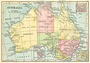
Background imageMaps Acrylic Blox Collection: Map of Australia 1895

Map of Australia 1895
The Rand-McNally Grammar School Geography 1895 - Chicago & New York

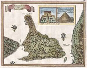
Background imageMaps Acrylic Blox Collection: 1760 Bellin Map Of Bali Indonesia Topography

1760 Bellin Map Of Bali Indonesia Topography
1760, Bellin Map of Bali, Indonesia

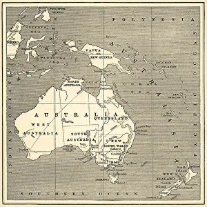
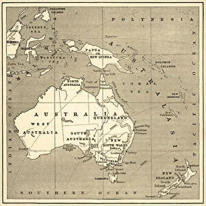
Background imageMaps Acrylic Blox Collection: Map of Australasia (1898 engraving)

Map of Australasia (1898 engraving)
Old map of Australasia from 1898

Background imageMaps Acrylic Blox Collection: Map of Australasia (1882 engraving)

Map of Australasia (1882 engraving)
Old map of Australasia from Royal Geographical Readers no. 5 of Asia, Africa, America and Oceania, publ. T Nelson & Sons, London in 1883

Background imageMaps Acrylic Blox Collection: antique, archival, border, burma, cambodia, cartography, country, document, geography

antique, archival, border, burma, cambodia, cartography, country, document, geography, historic, historical, india orientalis, indian ocean, indonesia, islands, latitude, legend, longitude, malaysia

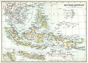
Background imageMaps Acrylic Blox Collection: Antique map of East Indian Archipelago

Antique map of East Indian Archipelago, including, the Phillippines, Papua New Guinea, Borneo and Java from 1891. With Detail of Batavia (Jakarta)

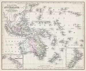
Background imageMaps Acrylic Blox Collection: Map of Australia and Polynesia 1877

Map of Australia and Polynesia 1877
Warrens Common School Geography 1877

Background imageMaps Acrylic Blox Collection: Map of southeast Asia's Malay Archipelago 1896

Map of southeast Asia's Malay Archipelago 1896
Andres Allgemeiner Handatlas - Bielefeld und Leipzig 1896

Background imageMaps Acrylic Blox Collection: Australia map 1875

Australia map 1875
The Independent Course Comprehensive Geography by James Monteith, A.S. Barnes & Co, New York & Chicago 1875

Background imageMaps Acrylic Blox Collection: Indonesia Jungle Paradise No2

Indonesia Jungle Paradise No2
Andrea Haase

Background imageMaps Acrylic Blox Collection: Indonesia Jungle Paradise No4

Indonesia Jungle Paradise No4
Andrea Haase

Background imageMaps Acrylic Blox Collection: Indonesia Jungle Paradise No1

Indonesia Jungle Paradise No1
Andrea Haase

Background imageMaps Acrylic Blox Collection: Indonesia Jungle Paradise No3

Indonesia Jungle Paradise No3
Andrea Haase

Background imageMaps Acrylic Blox Collection: View of Ambon, c. 1617 (oil on canvas)

View of Ambon, c. 1617 (oil on canvas)
7415456 View of Ambon, c.1617 (oil on canvas) by Anonymous; 148.8 -- 268.2 cm; Rijksprentenkabinet, Amsterdam, The Netherlands; (add.info)

Background imageMaps Acrylic Blox Collection: Map of Australasia (1898 engraving)

Map of Australasia (1898 engraving)
Old map of Australasia from 1898

Background imageMaps Acrylic Blox Collection: Map of Australasia (1882 engraving)

Map of Australasia (1882 engraving)
Old map of Australasia from "Royal Geographical Readers no. 5" of Asia, Africa, America and Oceania, publ. T Nelson & Sons, London in 1883


All Professionally Made to Order for Quick Shipping


-

Maps Acrylic Blox Collection

Maps of Indonesia Asia are a type of map that shows the physical features and political boundaries of the Indonesian archipelago. They include all 17,000 islands that make up the country, as well as its surrounding waters. They also show major cities, rivers and lakes, mountains and other geographical features and can be used to plan trips or to gain an understanding of the country’s geography. Maps of Indonesia Asia are available in both digital and print formats from various sources such as bookstores, libraries and online retailers. They are be used for educational purposes or for navigation while traveling in Indonesia.
+

Our beautiful pictures are available as Framed Prints, Photos, Wall Art and Photo Gifts

The Maps of Indonesia Asia collection from Media Storehouse offers a stunning array of wall art and framed prints that showcase the beauty and diversity of this fascinating region. Featuring maps dating back to the 16th century, these pieces offer a unique glimpse into the history and culture of Indonesia, as well as its place in the wider Asian continent. From intricate depictions of trade routes and shipping lanes to detailed topographical maps highlighting mountain ranges, rivers, and coastlines, our collection offers something for everyone interested in geography or world history. Whether you're looking for a conversation piece for your living room or office space or simply want to add some visual interest to your home decor, these prints are sure to impress. With high-quality printing techniques that bring out every detail in vivid color and clarity, these pieces are perfect for anyone who wants to explore the rich tapestry of Indonesian culture through beautiful artwork. So why wait? Browse our selection today and discover all that this amazing collection has to offer.
+

What are Maps of Indonesia Asia art prints?

Maps of Indonesia Asia art prints are a collection of beautifully designed and detailed maps depicting the geography, topography, and landmarks of Indonesia. These art prints showcase the country's diverse landscapes, including its mountains, forests, beaches, rivers, and cities. They also feature important cultural sites such as temples and historical monuments. These maps are not only aesthetically pleasing but also informative. They provide valuable information about the country's history, culture, and natural resources. Whether you're an avid traveler or simply interested in learning more about Indonesia's rich heritage and geography, these art prints make for a great addition to any home or office space. Maps of Indonesia Asia art prints come in various sizes and styles to suit different preferences. They can be framed or hung on their own as wall decor pieces. With their intricate details and vibrant colors, they add character to any room while educating viewers about one of Southeast Asia's most fascinating countries.
+

What Maps of Indonesia Asia art prints can I buy from Media Storehouse?

We offer a wide range of Maps of Indonesia Asia art prints that are perfect for both home and office decor. These maps showcase the beautiful landscapes, cities, and regions of Indonesia in stunning detail. You can choose from different styles such as vintage, modern or satellite imagery to suit your taste. Some popular options include detailed topographic maps that highlight the country's mountain ranges, rivers, and coastlines. There are also political maps that show the administrative divisions of Indonesia along with major cities and towns. In addition to these standard map prints, Media Storehouse also offers customized options where you can add your own text or images to create a unique piece of artwork. Whether you're looking for a gift for someone who loves geography or simply want to add some color to your walls, there is something for everyone in their collection.
+

How do I buy Maps of Indonesia Asia art prints?

To buy Maps of Indonesia Asia art prints from Media Storehouse, you can start by browsing through their vast collection of artwork online. Once you have found the print that you like, simply add it to your cart and proceed to checkout. You will be prompted to enter your shipping and payment details before finalizing your purchase. We offer a variety of sizes for their art prints, so make sure to choose the one that best fits your needs. We also offer framing options if you want a ready-to-hang piece. If you have any questions or concerns about purchasing from Media Storehouse, they have a customer service team available to assist you via email or phone. Buying Maps of Indonesia Asia art prints from Media Storehouse is an easy and convenient process that allows you to bring beautiful artwork into your home or office space.
+

How much do Maps of Indonesia Asia art prints cost?

We offer a wide range of Maps of Indonesia Asia art prints that vary in price depending on the size and type of print. Our collection includes vintage maps, contemporary designs, and artistic interpretations of the region. We strive to provide high-quality prints at affordable prices so that everyone can enjoy beautiful artwork in their homes or offices. Our selection is perfect for those who love travel, history, or simply appreciate stunning visuals. Whether you are looking for a small print to add to your gallery wall or a large statement piece for your living room, we have something for everyone. We take pride in offering unique and diverse artwork from talented artists around the world. Please visit our website to browse our full collection and find the perfect Maps of Indonesia Asia art print for you.
+

How will my Maps of Indonesia Asia art prints be delivered to me?

We take great care in delivering your Maps of Indonesia Asia art prints to you. We use high-quality packaging materials to ensure that your artwork arrives safely and undamaged. Depending on the size and quantity of your order, we may ship it using a courier service or standard postal delivery. Our team will carefully pack your artwork into a sturdy cardboard tube or flat package, depending on the type of print you have ordered. Each package is labelled with clear instructions for handling and opening. We also provide tracking information so that you can keep an eye on the progress of your delivery. If there are any issues with shipping or if you have any questions about delivery times, our customer service team is always available to assist you. We strive to make sure that receiving your Maps of Indonesia Asia art prints from Media Storehouse is a hassle-free experience.