Home > Asia > China > Maps
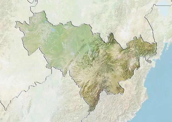
Province of Jilin, China, Relief Map
![]()

Wall Art and Photo Gifts from Universal Images Group (UIG)
Province of Jilin, China, Relief Map
Relief map of the province of Jilin, China. This image was compiled from data acquired by LANDSAT 5 & 7 satellites combined with elevation data
Universal Images Group (UIG) manages distribution for many leading specialist agencies worldwide
Media ID 9613281
© Planet Observer/UIG
China Province Relief Map Jilin Satellite View
FEATURES IN THESE COLLECTIONS
> Aerial Photography
> Related Images
> Universal Images Group (UIG)
> Universal Images Group
> Satellite and Aerial
> Planet Observer 4
EDITORS COMMENTS
This print showcases the stunning relief map of the Province of Jilin, China. Created through a meticulous compilation of data acquired by LANDSAT 5 & 7 satellites combined with elevation data, this image offers an extraordinary glimpse into the topography and physical geography of this region. Stretching horizontally across the frame, every intricate detail is vividly displayed in a colorful cartographic representation. The absence of people allows us to fully appreciate the natural beauty and complexity that lies within this province. The vastness of Jilin's landscape unfolds before our eyes as we explore its mountains, valleys, rivers, and plains. From towering peaks to meandering waterways, each feature tells a unique story about the land's formation and evolution over time. As we immerse ourselves in this satellite view photograph, it becomes evident that Jilin possesses an awe-inspiring blend of geographical elements. Its diverse terrain not only contributes to its breathtaking aesthetics but also plays a crucial role in shaping local ecosystems and human activities. Whether you are an avid cartography enthusiast or simply intrigued by Asia's remarkable landscapes, this print from Universal Images Group (UIG) will transport you on a visual journey like no other. It serves as a testament to humanity's ability to capture nature's wonders from above while reminding us how interconnected we are with our planet’s magnificent tapestry.
MADE IN THE UK
Safe Shipping with 30 Day Money Back Guarantee
FREE PERSONALISATION*
We are proud to offer a range of customisation features including Personalised Captions, Color Filters and Picture Zoom Tools
SECURE PAYMENTS
We happily accept a wide range of payment options so you can pay for the things you need in the way that is most convenient for you
* Options may vary by product and licensing agreement. Zoomed Pictures can be adjusted in the Basket.


