Home > Europe > United Kingdom > England > Norfolk > Fersfield
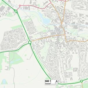
Ordnance Survey Map, Attercliffe area, Sheffield, 1889 (Yorkshire sheet 294. 8. 4)
![]()

Wall Art and Photo Gifts from Sheffield City Archives
Ordnance Survey Map, Attercliffe area, Sheffield, 1889 (Yorkshire sheet 294. 8. 4)
This map features:
Top left: [Charles Cammell and Co. Ltd. steel manufacturers], Cyclops Works (steel and iron), Sutherland Street / Saville Street East; [Spear and Jackson, Aetna Works], Etna Works (iron), Savile Street East; Savile Street; tramway; Greystock Street; Corby Street; [E. Cooper and Sons, axle manufacturers], Sutherland Works (steel and iron) [Savile Street East]; Sutherland Street[ W. S. Flowerday and Sons, timber and slate merchants], Midland Sawing and Turning Mills on Savile Street; Midland Railway Goods Line; Cricket Ball Inn; George Inn; Norfolk Inn.
Top right: Greystock Street; Corby Street; Midland Railway; viaduct; Fersfield Street; Windsor Street; Princess Street; Lovell Street; [? John Robinson, general iron funder], Royd's foundry (iron); Royd's Mill Street; Royd's Mills (smelting) [Sheffield Smelting Company, Royds Mill]; Blackmore Street; Beaconsfield Club; Methodist Chapel (Primitive) (disused) on Corby Street; [Thomas Firth and Sons Ltd. steel manufacturers], Norfolk Steel and Iron Works [Savile Street East].
Bottom left: Savile Street; tramway; Greystock Street; Corby Street; Sutherland Street; viaduct; Midland Railway; Attercliffe Road; [J. Shipman and Co. steel and wire manufacturers], Burton Weir Wire and Cold Rolling Mills; River Don; Local Terrace; Norfolk Terrace; Bay Horse Public House; M. Hunter and Son, Cutlery Manufacturers], Talbot Works (cutlery) on Savile Street; Mission Room on Greystock Street; Albert Inn; Leveson Street; Norfolk Bridge; weir; sluice; [W. T. Beesley and Co. Ltd. hot and cold steel wire manufacturers], Universal Steel Works and Rolling Mills on Attercliffe Road and Effingham Street; Burton Terrace; Princess Street; Mill Race [a channel carrying water to drive a mill wheel];
Bottom right:Midland Railway; Attercliffe Road; tramway; Burton Weir Wire and Cold Rolling Mills; Princess Street; Lovell Street; Royd's Mill Street; [Winder Brothers Ltd. engineers and ironfounders], Royd's Works (steel and iron) on Attercliffe Road and Warren Street; Star Steel Works; Norfolk Arms Public House; Mill Race [a channel carrying water to drive a mill wheel]; Warren Street; Worrall, Hallam and co, cast steel etc manufacturers], Needle Works on Attercliffe Road; [Joseph Jackman and Co Ltd.], Persberg Steel Works on Attercliffe Road; Salmon Pastures Yard (Coal and Coke Depot); Scotia Works (steel and tools) [Thomas Jowitt and Sons, steel manufacturers, Scotia Works, Warren Street]; Norfolk Bridge Forge and Rolling Mills.
Surveyed 1889. First edition 1890.
Dimensions 77 x 102 cm.
Scale 10.56 feet : 1 mile [1:500].
From an original at Sheffield Libraries: q00076
Sheffield City Archives and Local Studies Library has an unrivalled collection of images of Sheffield, England
Media ID 32416599
© Sheffield City Council - All Rights Reserved
Attercliffe Old Map Ordnance Survey Os Map Sheffield
FEATURES IN THESE COLLECTIONS
> Animals
> Farm
> Horses
> Related Images
> Animals
> Fishes
> S
> Salmon
> Animals
> Insects
> Crickets
> House Cricket
> Animals
> Mammals
> Horse
> Related Images
> Europe
> United Kingdom
> England
> Norfolk
> Fersfield
> Europe
> United Kingdom
> England
> Norfolk
> Mill Street
> Europe
> United Kingdom
> England
> Yorkshire
> Attercliffe
> Europe
> United Kingdom
> England
> Yorkshire
> Sheffield
> Europe
> United Kingdom
> England
> Yorkshire
> Street
> Europe
> United Kingdom
> Scotland
> Sutherland
> Sheffield City Archives
> Maps and Plans
> Sheffield OS maps
EDITORS COMMENTS
This print showcases an Ordnance Survey Map of the Attercliffe area in Sheffield, dating back to 1889. The map, known as Yorkshire sheet 294.8.4, provides a fascinating glimpse into the industrial landscape of the time. In the top left corner, we can spot prominent steel manufacturers such as Charles Cammell and Co. Ltd. , Spear and Jackson at Aetna Works, and E. Cooper and Sons at Sutherland Works. Tramways traverse through Savile Street East while nearby establishments like W. S. Flowerday and Sons' timber mills add to the bustling atmosphere. Moving to the top right section of the map reveals Greystock Street, Corby Street, and notable landmarks like Royd's foundry and Royd's Mill belonging to Sheffield Smelting Company. Norfolk Steel and Iron Works operated by Thomas Firth & Sons also make their mark on this part of town. The bottom left portion highlights key features such as Burton Weir Wire and Cold Rolling Mills owned by J. Shipman & Co. , Talbot Works for cutlery manufacturing by M. Hunter & Son, Universal Steel Works on Attercliffe Road run by W. T. Beesley & Co. , among others. Lastly, in the bottom right quadrant lies Warren Street with its ironworks including Royd's Works managed by Winder Brothers Ltd. , Needle Works operated by Worrall Hallam & Co. , Persberg Steel Works owned by Joseph Jackman & Co. , Scotia Works under Thomas Jowitt & Sons' guidance, along with Norfolk Bridge Forge and Rolling Mills completing this vibrant industrial scene. Surveyed in 1889 with its first edition released in 1890; this remarkable map measures 77 x 102 cm featuring a scale ratio of 10.56 feet:1 mile (1:500). This particular print is sourced from Sheffield Libraries' original collection (q00076) held at Sheffield City Archives.
MADE IN THE UK
Safe Shipping with 30 Day Money Back Guarantee
FREE PERSONALISATION*
We are proud to offer a range of customisation features including Personalised Captions, Color Filters and Picture Zoom Tools
SECURE PAYMENTS
We happily accept a wide range of payment options so you can pay for the things you need in the way that is most convenient for you
* Options may vary by product and licensing agreement. Zoomed Pictures can be adjusted in the Basket.


![Plan of Owlerton Hall estate, Sheffield [1825]](/sq/716/plan-owlerton-hall-estate-sheffield-1825-21076344.jpg.webp)


