Home > Arts > Artists > B > Emanuel Bowen
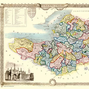
County Map of Somersetshire, c. 1777

![]()
Wall Art and Photo Gifts from Sheffield City Archives
County Map of Somersetshire, c. 1777
From The Large English Atlas: or, a new set of map of all the counties of England and Wales drawn from the several surveys which have been hitherto been published. With three general maps of England, Scotland and Ireland, from the latest and best authorities, by Emanuel Bowen, Thomas Kitchin and others. London, printed and sold by T. Bowles, [c.1777]
Original at Sheffield Libraries: 912 STF
Sheffield City Archives and Local Studies Library has an unrivalled collection of images of Sheffield, England
Media ID 25501497
© Sheffield City Council - All Rights Reserved
Antique Map Bowens Map County Map Emanuel Bowen Old Map Street Thomas Kitchin Bridgwater Burnham On Sea Chard Clevedon Frome Glastonbury Highbridge Keynsham Minehead Portishead Shepton Mallet Somerset Wells Weston Super Mare Yeovil
FEATURES IN THESE COLLECTIONS
> Arts
> Artists
> B
> Emanuel Bowen
> Arts
> Artists
> K
> Thomas Kitchin
> Europe
> Republic of Ireland
> Maps
> Europe
> United Kingdom
> England
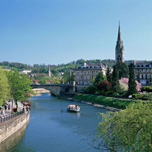
> Bath
> Europe
> United Kingdom
> England
> London
> Related Images
> Europe
> United Kingdom
> England
> Maps
> Europe
> United Kingdom
> England
> Sheffield
> Europe
> United Kingdom
> England
> Somerset
> Bath
> Europe
> United Kingdom
> England
> Somerset
> Bridgwater
> Europe
> United Kingdom
> England
> Somerset
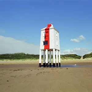
> Burnham-on-Sea
> Sheffield City Archives
> Maps and Plans
> Bowen's County Maps, c. 1777
EDITORS COMMENTS
This print showcases a remarkable piece of history - the County Map of Somersetshire, dating back to approximately 1777. A true treasure from The Large English Atlas, this antique map offers an intriguing glimpse into the past. Created by renowned cartographers Emanuel Bowen and Thomas Kitchin, alongside other esteemed authorities of their time, this map is a testament to their expertise. The intricate details on this map transport us to the charming towns and cities that make up Somersetshire. From bustling Bath and picturesque Weston-super-Mare to historic Yeovil and enchanting Glastonbury, each location is meticulously depicted with precision and artistry. This county map also highlights notable landmarks such as Bridgwater's iconic bridge, Portishead's coastal beauty, Burnham-on-Sea's sandy shores, and Wells' majestic cathedral. As we explore further into this print, lesser-known gems like Raunton, Frome, Highbridge, Clevedon, Nailsea reveal themselves in all their historical glory. Even smaller towns like Keynsham or Midsomer Norton are given due attention on this comprehensive map. Preserved at Sheffield Libraries within the Sheffield City Archives collection (912 STF), this original artifact serves as a valuable resource for researchers and enthusiasts alike. Its rich hues and delicate lines evoke a sense of nostalgia while reminding us of the enduring importance of cartography throughout history
MADE IN THE UK
Safe Shipping with 30 Day Money Back Guarantee
FREE PERSONALISATION*
We are proud to offer a range of customisation features including Personalised Captions, Color Filters and Picture Zoom Tools
SECURE PAYMENTS
We happily accept a wide range of payment options so you can pay for the things you need in the way that is most convenient for you
* Options may vary by product and licensing agreement. Zoomed Pictures can be adjusted in the Basket.