Home > Europe > United Kingdom > England > London > Towns > Downham
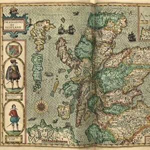
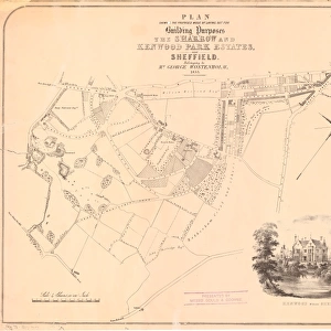
County Map of Norfolk, c. 1777

![]()
Wall Art and Photo Gifts from Sheffield City Archives
County Map of Norfolk, c. 1777
From The Large English Atlas: or, a new set of map of all the counties of England and Wales drawn from the several surveys which have been hitherto been published. With three general maps of England, Scotland and Ireland, from the latest and best authorities, by Emanuel Bowen, Thomas Kitchin and others. London, printed and sold by T. Bowles, [c.1777]
Original at Sheffield Libraries: 912 STF
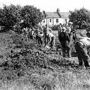
Sheffield City Archives and Local Studies Library has an unrivalled collection of images of Sheffield, England
Media ID 25501445
© Sheffield City Council - All Rights Reserved
Antique Map Bowens Map County Map Emanuel Bowen Norfolk Old Map Thomas Kitchin Attleborough Caister Cromer Dereham Diss Gorleston On Sea Great Yarmouth Hunstanton Kings Lynn Sherringham Thetford Watton Wymondham
FEATURES IN THESE COLLECTIONS
> Arts
> Artists
> B
> Emanuel Bowen
> Arts
> Artists
> K
> Thomas Kitchin
> Europe
> Republic of Ireland
> Maps
> Europe
> United Kingdom
> England
> London
> Towns
> Downham
> Europe
> United Kingdom
> England
> Maps
> Europe
> United Kingdom
> England
> Norfolk
> Attleborough
> Europe
> United Kingdom
> England
> Norfolk
> Cromer
> Europe
> United Kingdom
> England
> Norfolk
> Dereham
> Europe
> United Kingdom
> England
> Norfolk
> Diss
> Europe
> United Kingdom
> England
> Norfolk
> Downham Market
> Sheffield City Archives
> Maps and Plans
> Bowen's County Maps, c. 1777
EDITORS COMMENTS
This antique print showcases the County Map of Norfolk, dating back to approximately 1777. Taken from "The Large English Atlas: or, a new set of map of all the counties of England and Wales" this historical piece was meticulously drawn by renowned cartographers Emanuel Bowen, Thomas Kitchin, and others. The map provides an intriguing glimpse into the past with its intricate details and accurate representation. Norfolk's prominent towns such as King's Lynn, Great Yarmouth, Thetford, Gorleston on Sea, Dereham, Taverham, Wymondham are highlighted along with other significant locations like North Walsham, Downham Market, Attleborough, Diss. Caister-on-Sea Hunstanton Watton Fakenham Cromer Sheringham. Preserved at Sheffield Libraries within their esteemed collection (912 STF), this original artifact offers a window into Norfolk's rich history and geographical landscape during that era. Its aged appearance adds charm to any space it graces while captivating viewers with its timeless allure. As we admire this bowens map masterpiece today let us appreciate the dedication put forth by these skilled cartographers in creating an accurate depiction of Norfolk centuries ago. This remarkable piece serves as a testament to their expertise and commitment to preserving our understanding of geography throughout time.
MADE IN THE UK
Safe Shipping with 30 Day Money Back Guarantee
FREE PERSONALISATION*
We are proud to offer a range of customisation features including Personalised Captions, Color Filters and Picture Zoom Tools
SECURE PAYMENTS
We happily accept a wide range of payment options so you can pay for the things you need in the way that is most convenient for you
* Options may vary by product and licensing agreement. Zoomed Pictures can be adjusted in the Basket.